
Zone 3
Southwest (Texas, New Mexico, Arizona)
Arizona

Florida Canyon Trail
8.8 miles out & back; 3,466ft. elevation gain; Moderately Strenuous
Views; canyon; forest; mountains; Coronado National Forest
New Mexico

Chamisa Trail Loop
9.9 mile lollipop loop; 1,908ft. elevation gain; Moderate
Forest; views; Hyde Memorial State Park
Texas

Walnut Creek Loop
1.3 mile loop; 62ft. elevation gain; Easy
Forest; views; creek; Round Rock
Zone 4
Rocky Mountain States (Montana, Idaho, Wyoming, Colorado)
Idaho

Proctor Mountain Loop
4.5 mile loop; 1,601ft. elevation gain; Moderate
Views; forest; historical interest; Ketchum
Proctor Mountain Loop Trail Guide
Montana

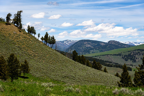
Cliff Lake & Saint Paul Peak
3.8 miles out & back; 1,831ft. elevation gain; Moderately Strenuous
Views; lake; forest; wildflowers; Cabinet Mountains Wilderness
Cliff Lake & Saint Paul Peak Route Guide
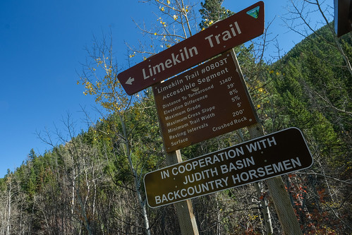
Limekiln Loop
6.4 mile loop; 1,300ft. elevation gain; Moderately Strenuous
Views; forest; mountains; wildlife; Lewistown
Wyoming
Lost Lake
10.7 miles out & back; 1,352ft. elevation gain; Moderate
Lake; waterfalls; forest; views; Red Lodge

Bonneville Pass
3.6-5.4 miles out & back; 687ft. elevation change; Moderate
Views; meadows; wildflowers; mountains; forest; waterfall; Togwotee Pass
Colorado

Mount of the Holy Cross
10.4 miles out & back; 5,312ft. elevation gain; Extremely Strenuous
Views; mountains; forest; White River National Forest
Mount of the Holy Cross Trail Guide

Amphitheatre Peak
10 miles out & back; 1,570ft. elevation change; Strenuous
Views; forest; wildflowers; waterfall; meadows; Flat Tops Wilderness