
I’m back!! I know I’ve taken off quite a few weeks on the blog, but I’ll be back to regular posting soon. For now, here’s what I’ve been up to for the last five or so weeks as my van took me nearly 11,000 miles across the US and my feet took me 200 miles up and down 51,500ft. of elevation gain (those were some steep trails). Or really, here’s the first installment: I simply hiked too many trails to want to put them all in a single post (you’d be scrolling forever!)
We started our adventures by driving the road through the Snowy Range of Wyoming so that we could take a dip in Hobo Pool in Saratoga Springs, WY (the thought of passing up a free shower after a very hot and sticky drive across the country was too much to resist!). Since we were driving through, it only made sense to have lunch at the very snowy (and very beautiful) Lake Marie.
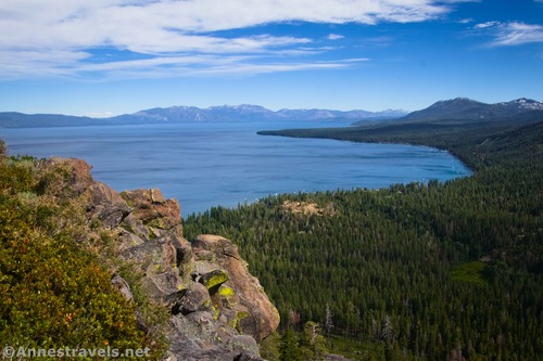
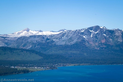
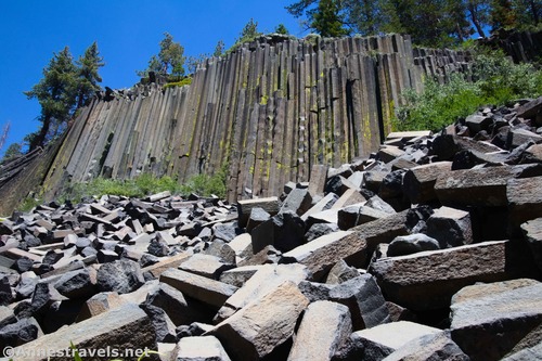
Then we continued on our way to Lake Tahoe. I’ve heard a lot of good things about the area, especially its trails and views. Interestingly, I found it to be very, very similar to the Adirondack Mountains in New York (maybe around Lake George) – similar views, similar architecture (tons of tourist cabins), and similar trash everywhere. The trails, however, were in much better condition than the routes I’m used to in the Adirondacks. We started out by following the almost unknown hike up to the Basalt Overlook.
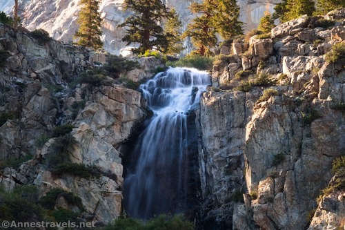
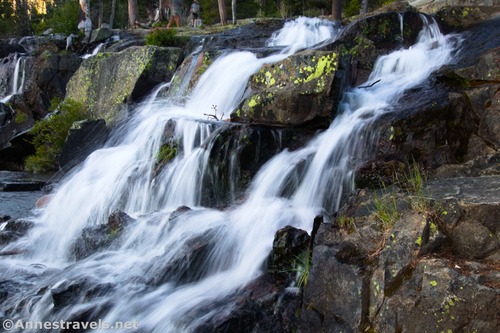
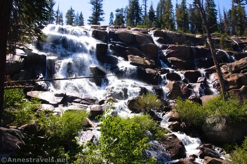
We stopped at Eagle Falls on our way out to camp for the night and scrambled around to see the upper part of the falls.
We weren’t able to ascend the road to my next planned hike, so we headed over to the Castle Rock Overlook just into Nevada (a road in the nearby town is the state line; there is literally a huge casino on that street corner so you barely have to leave California to gamble). Birds were nesting on the rock, so we couldn’t climb to the top, but the views were pretty good from partway up.
Eagle Falls had been so interesting the night before that we decided to drive back there and descend to lake level. It was busy but a really great hike!
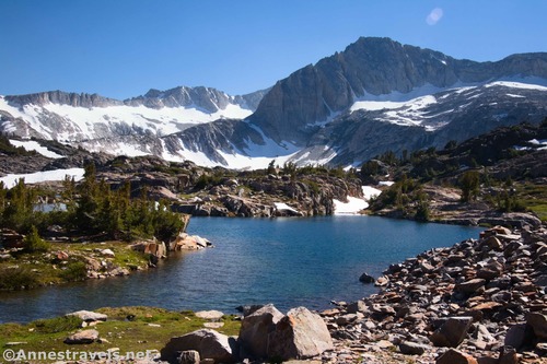
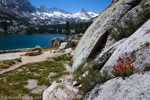
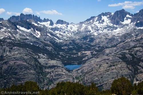
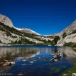
Our real goal in visiting California was to go to the High Sierras. Back in 2017, I’d planned a trip to the area, but 200% snowpack had pretty much foiled those plans. This year, we came back to do all of those lovely hikes we’d missed seven years earlier! Near the top of my “must do” list were the 20 Lakes Basin from Saddlebag Lake. The trail was still very snowy (we lost it multiple times), but oh, what a beautiful hike.
The next day, we needed to drive south, and I wanted a bit of a rest day (none of us were in perfect shape, and the elevation was real). So we parked near Lake Sabrina and hiked up to Blue Lake on the recommendation of a friend.
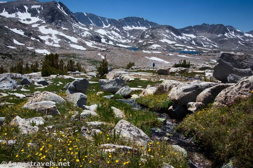
The same friend raved over the views in nearby Humphreys Basin. We didn’t quite make it to the basin, but we did hike up to Piute Pass and then did some off-trail hiking up both sides of the pass. It was incredible; the kinds of views you just can’t make up!
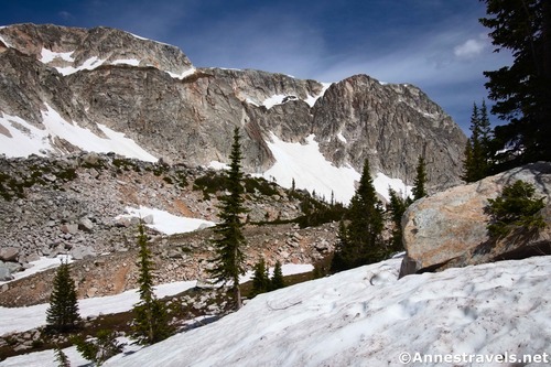
Kearsarge Pass had been high on my list in 2017, so we drove up Onion Valley (on the road that was supposed to go all of the way over the mountains, emerging in Kings Canyon National Park – it was even designed and planned, but the road was never finished). By the time we got to the trailhead (the end of the road), it was getting on in the day, so we figured a 5 miles RT to the Golden Trout Lakes would be a great afternoon outing. No one mentioned that it was 2.5 miles straight up the mountainside! I highly recommend the hike for beauty, but you’d better be chafing for an adventure… we even lost the trail a few times (and not entirely due to a few late-melting snowfields).
Kearsarge Pass, itself, didn’t disappoint. In fact, it topped several of my group members’ lists of their favorite hikes in the Sierras. Pinnacles, lakes, top-of-the-world views, lots of thru-hikers resupplying… gorgeous and fun!
Many, many years ago, we picked up a book on the national parks at a garage sale. This was before we’d been to almost any national parks (none of us had been west of the Mississippi River at that point, nor did we expect to do it in the near future… well, that changed!). In the back, the book had small blurbs about various national monuments, including Devils Postpile. Remembering that little blurb, we got up early to try and circumvent some of the crowds and went above the Postpile, down to Rainbow Falls, down to the Lower Falls, and finally back along the bottom of the Postpile.
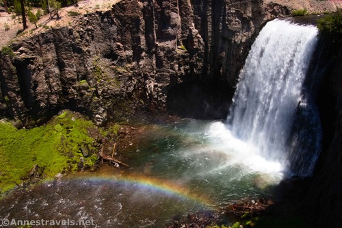
Overall, we weren’t overly impressed, in part because of the scenery, but the real kicker was the heat and the crowds. If you don’t get in before 7am, you have to take a very expensive shuttle bus – but that didn’t seem to stop many people. We must have seen at least a hundred other visitors before we went off the beaten path and over to Minaret Falls.
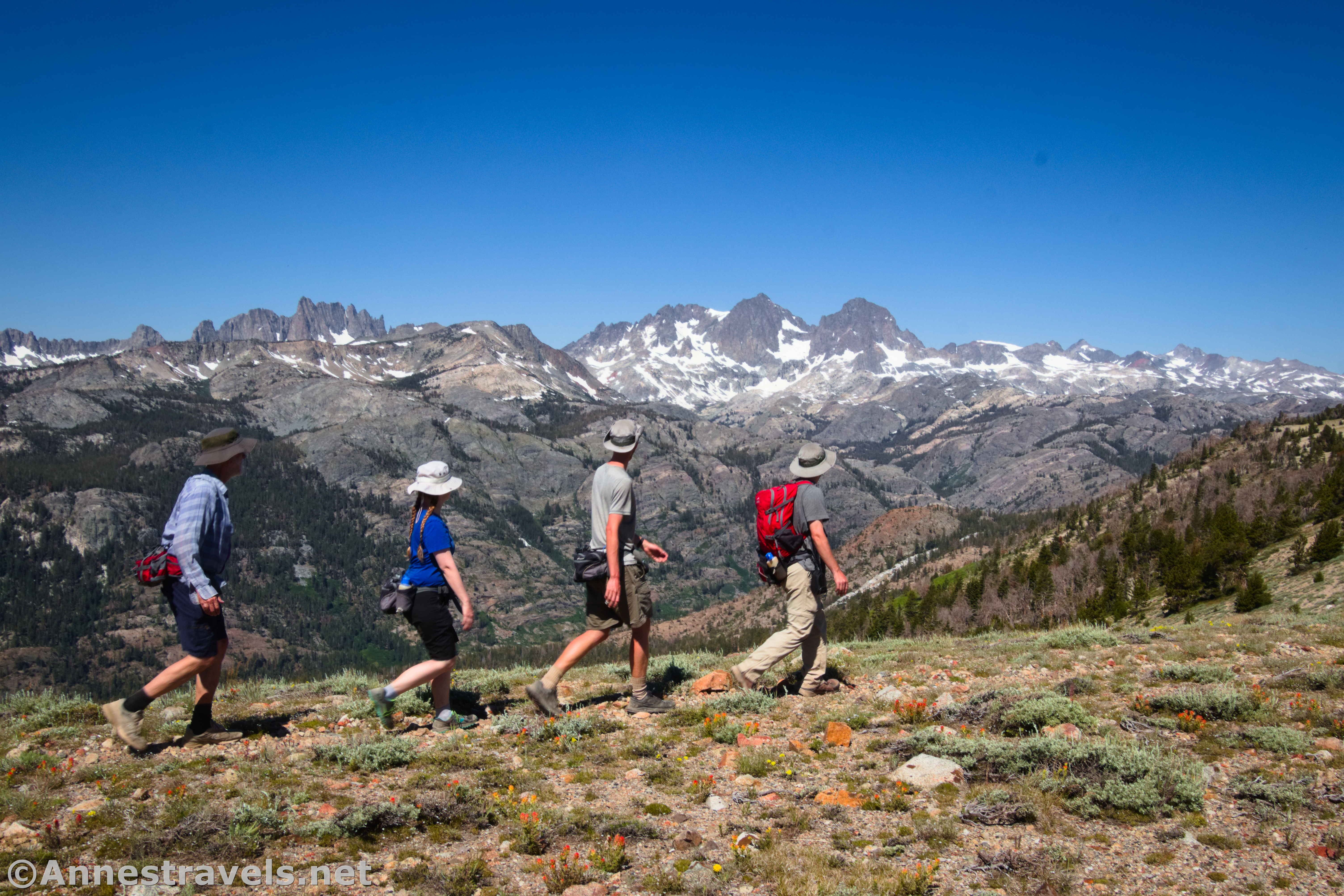
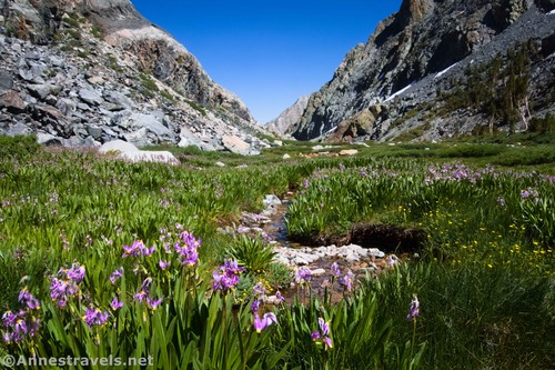
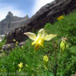
I’d tried to hike San Joaquin Mountain back in 2017, but the road up to Minaret Summit was closed (we’re talking a huge pile of snow in the middle of the road to make absolutely certain no one could get up there). So I’d ended up at Duck Pass instead. However, the mountain was worth the wait. Mile upon mile of ridgetop hiking (mind you, I didn’t say it was easy!) and spectacular mountain vistas – not to mention alpine meadows full of wildflowers – left us in awe!
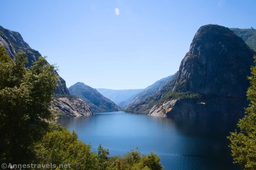
Our last hike in the High Sierra was along the Hetch Hetchy Reservoir in Yosemite National Park to Wapama Falls. I’ve heard quite a bit about the trail, but it never seemed worth the extra drive on tiny mountain roads. This time, it was a hike exactly where we needed one. The day was very hot (they said it should be around 100F), and the mountains were a little hazy, but it’s a beautiful area. I might even go back in cooler weather.
We headed up driving north after that, but I think this is long enough for the moment. Be on the lookout for Part 2!
Today’s Featured Product!
With many peaks, trails, and scrambles in the High Sierra, this is a great book for those who want to go beyond the traditional touristy hikes. You’ll need to be good at scrambling for some of the routes, but you’re guaranteed some fantastic scenery. Buy your copy here!


Pingback: 118 Miles on the Pacific Coast, Mount Hood, and Mount Rainier! – Anne's Travels