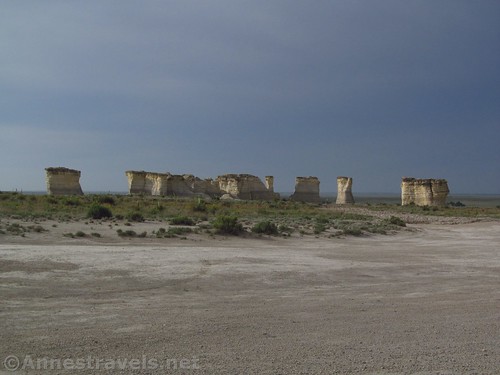
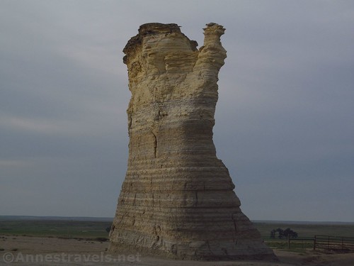
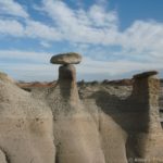
It’s not well known, it’s not well-signed, and it’s down a dirt road in rural Kansas. Still, Monument Rocks National Natural Landmark is well worth the visit if you’re travel down I-70 through western Kansas. The “Chalk Pyramids”, as they’re also known, are chalk rock formations that stand up out of the prairie. They contain plenty of fossils, not to mention a few fun formations and a couple of windows or arches. You won’t spend a lot of time visiting Monument Rocks, but it’s worth the side-trek as a diversion.
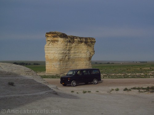
To be fair, there is now a sign on the highway (that wasn’t there when we first visited in 2006 or 2007). But once you’re off the highway, you’ll need to have good directions or a GPS (if you’re using the latter, you’d also better have some good common sense in case the GPS tells you to drive down a cattle trail) to get to the rocks. In dry weather, you won’t need high clearance or 4×4 (I think I saw a Honda Accord drive through), but in wet weather, you’d be better off just staying away.
We most recently visited on a very quiet, misty morning in late May. Driving from the highway to Monument Rocks, I was enthralled by the mist hanging over the grassy plains and a few small chalk bluffs. We parked by the formations and hopped out to see what there was to see.
It was so deathly quiet, except for a few birds. Nothing moved or even sounded like it was breathing. We wandered around the formations on the east side of the road, talking in whispers. It seemed too strange to talk out loud.
The formations are awash with fossils. However, you can’t take any with you; this is private property, so use extreme respect for the area. You’re also not supposed to climb on the formations, but there’s nothing keeping you from walking all around the outsides of the Chalk Pyramids. A few of the formations have grass sticking up out of the tops, like shocks of hair out of a head, and swallows have built their nests under the hard rocks that stick out of the chalk.
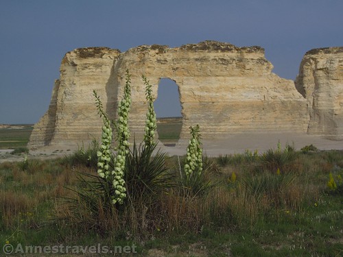
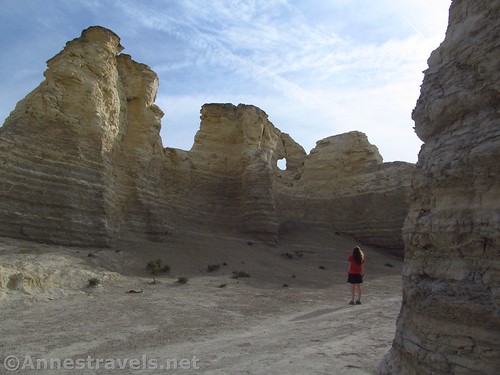
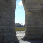
We went back up the road to where the formations are on the west side of the road. A road does lead to these formations, but I wouldn’t try it without 4×4. (We more or less parked right next to the main road next to the easterly formations.) The formations to the west are the best, and definitely the coolest. The best part is an arch known as “The Keyhole”.
So they say, the Keyhole was made when some board cowboys shot at the formation – and the bullet went right through. From there wind and weather took over and today we have quite a massive hole. I’d say the hole has grown since I last visited the Monument Rocks, but it’s hard to say for sure.
There is also another small arch in this formation. A few strange spires make it worth walking all the way around this formation.
We spotted a few small wildflowers in the meadows around the Chalk Pyramids.
Overall, I’d say we spent 30-60 minutes wandering around. But then again, we tend to take our time over things like this. Three other vehicles came by while we were there and none of them stayed half as long as we did. You may or may not have the place to yourself, but whether you do or not, Monument Rocks is definitely worth visiting!
Round Trip Trail Length: Varies. I’d guess I walked about a mile or so, maybe a little more since I went back and forth a couple of times.
Elevation Gain: Negligible. The area is very flat around the formations and doesn’t have too much in the way of obstacles.
Facilities: None
Fees: None
Area notes: No climbing the formations (a new-ish rule; we climbed to the top in 2006 an no signs forbid it then!), no collecting fossils, no camping, no littering, and no campfires. Don’t try visiting in wet weather; the roads are not made for that. Your car will probably be very dusty after all the dirt roads and chalk dust!
Trail 


Road 


Signs 


Scenery 


Interest 


Fun Factor 


Ease of access / walking 


Would I go 100 miles out of my way for this? 


Overall Rating: 


GPS Coordinates for Monument Rocks
East Formations: 38.7933333°, -100.7630500° (N38° 47.600′ W100° 45.783′ / 38°47’36.0000″, -100°45’46.9800″) (2,648ft.)
Keyhole/West Formations: 38.7953333°, -100.7644667° (N38° 47.720′ W100° 45.868′ / 38°47’43.2000″, -100°45’52.0800″) (2,659ft.)
Getting to Monument Rocks
From the west, take Exit 70 off of I-70E toward Oakley. At the bottom of the ramp, turn right on to US-83S. Drive 4.8 miles, then turn left onto US-40E for one mile. Turn right onto US-83S for exactly 20 miles. Turn left onto Jayhawk (the junction is not signed for Monument Rocks); the road becomes dirt. Stay on the main road 5.5 miles to Monument Rocks.
From the East, take Exit 93 from I-70W toward Grainfield. At the bottom of the exit ramp, turn left onto KS-23 and drive 14.7 miles. Turn right onto Gove W (the road will be dirt) for 4.9 miles before turning left on Gove 34 for 2.0 miles. Turn right onto Gove M for 6.0 miles, then left onto County Road 22 for 1.0 mile, then right on Gove L for 2.9 miles, then left to stay on Gove L for another 1.1 miles. Turn left on Gove 14 for 5.6 miles to Monument Rocks. (You could also continue on I-70 to Exit 70 and follow the directions as if coming from the west if these directions sound too confusing!)
Zoom map out to browse nearby hikes & places of interest
This Week’s Featured Product!
Looking for more off-the-beaten-path Kansas attractions? How about some quirky sites, some odd locations, and some of the places only the locals know about? This book might let you in on some of these things, plus a whole lot more that Kansas has to offer.







Pingback: Break up a Trip Across Kansas at Monument Rocks!
Pingback: The Time In Between - Anne's Travels
Pingback: 17 Arches Across the West (you probably haven’t heard of) - Anne's Travels
Pingback: Sneak Peak: Southwestern Variety at its Finest - Anne's Travels