I took a little bike ride. Usually, I’d ride trails and keep my road-riding to a minimum, but it had rained the week before and the trails were very soggy. We ended up taking back roads for a very nice, rustic ride between Bear Creek Harbor (east of Webster) and B. Forman Park (east of Pultneyville).
Quick Stats
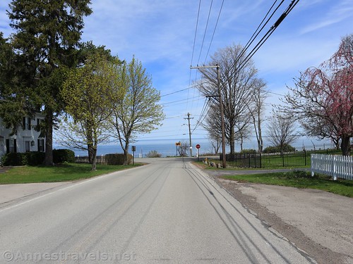
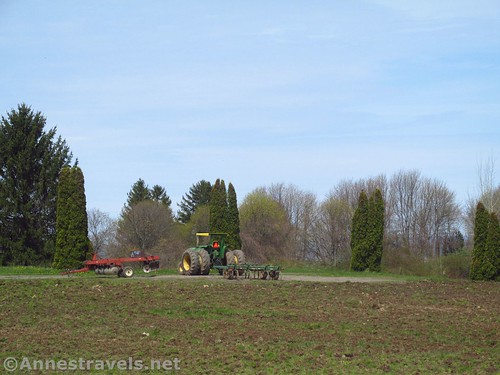
The shortest method would have been to bike down Lake Road, but I didn’t want to do that (too much traffic without enough shoulder), so we took the small roads. The scenery was a lot of apple orchards and vineyards, with some forest, fields, and country neighborhoods. All in all, very nice for being next to a road!
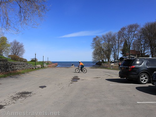
Bear Creek Harbor is mostly just a boat launch for the Town of Ontario Residents (permit required whether or not you’re a resident of Ontario). There is also a memorial garden to the veterans from the Town of Ontario who have died. This time of year, the daffodils were glorious, and the views from the end of the grassy garden were pretty good too.
We headed east on Lake Road and took a quick right onto Furnace Road. We passed a vineyard, then turned left on Putnam Road. This is a neighborhood; there were quite a few families doing yard work (most of whom seemed to be enjoying themselves). Putnam Road T’s into Fisher Road, so we turned left and took an almost immediate right onto Shepherd Road.
One of the nice things about Shepherd Road is that it’s very much in the country. There are apple orchards galore, old barns, farm houses, and more. Unfortunately, the trees weren’t blossoming yet (actually might be a good thing if we get the snow they’re predicting for this week).
Shepherd Road eventually T’s into Salmon Creek Road. We turned left for almost a mile, where Salmon Creek Road T’s into Hamilton Street. If you want to cut almost two miles (one way) off your ride, and you don’t mind a bit of traffic, turn left here up to Lake Road. Once at Lake Road, turn right and you can ride through charming downtown Pultneyville (if historic towns are your thing, you’ll love it).
We weren’t feeling quite that brave, so we turned right and continued south when Hamilton Street merges into Lake Avenue. We should have then taken a left onto New Road, but I became confused and we continued down to Jersey Road. Whichever you prefer, when you get to Bear Swamp Road, turn left and head back north to where it T’s into Lake Road and turn left.
You’ve overshot B. Forman Park at this point, but not by a lot. A quarter mile will bring you to the entrance, on your right (the north side of Lake Road).
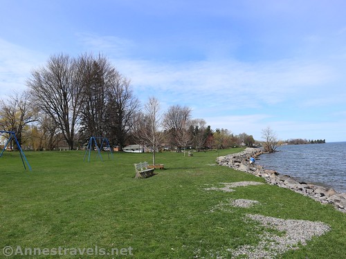
B. Forman Park was a long-standing fun place to visit when I was young, so I might have a little more fondness for it than many people. Even so, it’s a very beautiful place to enjoy Lake Ontario. There are small copses of trees, several picnic shelters, a large playground (the dangerous – but super fun – tall slides were removed a few years ago), and Mr. Forman’s house that has been turned into a lodge for parties. (Interestingly, the house was a northern terminus for the Underground Railroad before the American Civil War.)
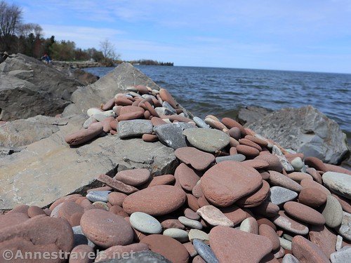
Better yet is the acres of green grass where you can plop down for a picnic or just to enjoy the views over Lake Ontario. We kept our distance from all of the other people using the park (we by far were not the only people there) and found ourselves a nice little spot of green grass to park our bicycles. Signs ask people to stay off the beach (I missed the meaning of the sign and did it anyway – oops!) but they’ve cut down all the vegetation along the edge of the beach and put in large rocks to keep the coastline in place. Lakestones have washed up on top of the rocks, so while there may not be as many as there used to be (I remember when there were millions upon millions!) the beach is still pretty.
We returned through Pultneyville and rode back to Bear Creek Harbor. Overall it was a great day in the sunshine (even if I did forget sunscreen – yikes!) and a pretty good route, all things considered.
If you want to see a map of my ride (using New Road) on Google Maps, click here: https://goo.gl/maps/5voniyT2Vpu8xPXo6
Round Trip Length: 7.0 or 8.9 mile shuttle, 14.0 mile or 17.8 mile out & back; or 15.9 mile lollipop loop
Elevation gain: About 275ft. (253ft. to 348ft.)
Facilities: There were none at Bear Harbor; B. Forman Park usually has restrooms that always seem to be locked when I visit. There are a few small restaurants in Pultneyville.
Fees: None for parking
Ride Notes: Some of the roads have better shoulders than others. Most are fairly quiet though I saw vehicles on almost every single one. No swimming, fishing, or alcohol is allowed at B. Forman Park.
Roads 


Parking 


Signs 


Scenery 


Would I go 100 miles out of my way for this? 


Overall Rating: 


GPS Coordinates
Bear Creek Harbor Parking: 43.276604, -77.275566 (43°16.59624′, -077°16.53396′ / 43°16’35.7744″, -077°16’32.0376″)
B. Forman Park: 43.281096, -77.168738 (43°16.86576′, -077°10.12428′ / 43°16’51.9456″, -077°10’07.4568″)
Getting to Bear Creek Harbor & B. Forman Park
Bear Creek Harbor is located on the north side of Lake Road 1.8 miles east of Webster Road, 5.1 miles east of County Line Road, 1.6 miles east of Ontario Center Road, 2.3 miles west of Stoney Lonesome Road, 4.7 miles west of Pultneyville, and 5.5 miles west of B. Forman Park. The parking area is on the east side of Bear Creek across the road from the water treatment plant.
B. Forman Park is located on the north side of Lake Road 0.8 miles east of Pultneyville, 1.4 miles west of Townline Road, 5.7 miles west of Maple Ave, and 9.6 miles west of Sodus Point.
For a map of my ride, click here: https://goo.gl/maps/5voniyT2Vpu8xPXo6
Zoom map out to browse nearby hikes & places of interest
This Week’s Featured Product!
Take your bike for a ride – even take the family if you want – on these great bike rides around Rochester, New York.








I seen information you supplied about where you can drive with an out of state permit . it was very helpful . thank you