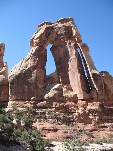
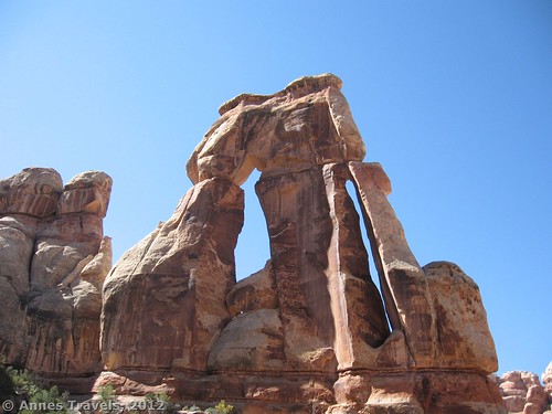
I’ve never seen an arch quite like Druid Arch. It’s free standing, has two large openings, and is somewhat reminiscent of Delicate Arch in shape. It’s really cool, and if it was only a mile from a trailhead, I’d highly recommend that you visit it. However, the drawback of the arch is that to get to it you’ve got to hike 5.1 miles, and then another 5.1 miles to get back. We actually did a loop, which totaled 14 miles, the longest hike we’d done to date. So, to get to the arch isn’t a stroll in the park. You’re hiking up a very nice, but also very sandy, canyon, so hiking is somewhat more difficult than on most hikes in that area. But, you get to see the arch, as well as some Chesler Park-like hoodoos along way. The bottom line: If you’re looking for a unique hike that’s probably harder than it deserves to be, or you are in love with unique arches, this is the hike for you. Read on.
The trailhead is the same as for Chesler Park and Elephant Canyon in the Needles District of Canyonlands National Park. From US 191, turn onto Utah Hwy 211. This turn is 40 miles (60 km) south of Moab and 14 miles (22 km) north of Monticello; it is very well-marked, but easy to miss after driving a very long way from Moab with nothing but Hole in the Rock along the way! From US 191, it’s about 34 miles to the visitor center and entrance station. Pay your entrance fee (or flash your park pass) and then continue driving along the main road and, after 2.8 miles (4.5 km), turn left towards Squaw Flat Campground. Keep right 0.2 miles (0.3 km) later, when the left fork enters the campground. Bear right again a very short time later. (If you come to the end of the road within the next mile/kilometer, you’ll know you went the wrong way). From here, the road is not exactly paved, although it is still in good condition and should be accessible by 2 wheel drive vehicles. Check at the visitor center for updated road information. About 3 miles (4.8 km) from where you didn’t go to the Squaw Flat Campground, you will come to a medium-sized dirt parking area. The road continues, but it’s only for serious 4 wheel drive vehicles (no ATVs allowed). I watched a few jeeps trying to ascend the hill the road climbs right next to the parking area, and it’s nothing I’d want to try!
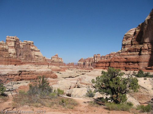
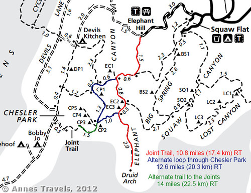
The trail begins at the end of the parking lot, well to the left of the 4×4 road. This is actually the Elephant Canyon Trail; you’ll need to take this trail for a while before turning down the canyon towards Druid Arch. The first 1.5 miles (2.4 km) are very pretty, with rock hoodoos all around you in white and red, as well as other formations (which I guess look like elephants). After 1.5 miles (2.4 km), you will suddenly drop down into a wash. Here, you want to turn right and hike for 0.6 miles (1 km). All the junctions are fairly well-signed, if you can find the signs. At several places we found wooden signs that seemed a bit rickety and blended in well with the landscape. Still, they are signs and they will direct you in the right way if you can see them (often they’re located on the opposite side of the wash). After the 0.6 miles (1 km), the trail will drop into another wash. Turn left to hike up the wash towards Druid Arch. From here to about 0.25 miles (0.4 km) before the arch, you will be slogging through deep sand and loose rock on the bottom of the wash. (This would not be a good hike to do right after a rainstorm!)
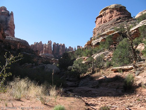
After hiking up this wash (Elephant Canyon, as it’s called) for 0.8 miles (1.3 km), you’ll come to a trail junction. Keep right for another 0.5 miles (0.8 km) to another junction; this time, keep left. If you want to visit Chesler Park on the way back (or just avoid all the sand you’ve already walked through) you can take this trail as an alternate loop through Chesler Park. But for now, stay left and continue to hike. It’s about 2 miles (3.2 km) from here to Durid Arch. The last 0.25 miles (0.4 km) or so is a scramble up a dry (hopefully!) waterfall. We found many puddles along the way, and even scrambled over some to stay on the ‘trail’. There is also one ladder (very fun!). The views in the canyon are ok, but not great. It’s pretty enough, but not worth the hike through the sand.
And then, at long last, Druid Arch comes into view. The pictures don’t do it justice; it’s much more magnificent in person than in the pictures. The biggest problem is that it can be difficult to get a good view of it, because there are many bushes, rocks, etc. in the way. So I read, the arch got its name from the fact that the rocks looked to early explorers like Stonehenge—thus “Druid” arch. We enjoyed lunch in the shade of some trees, took lots of pictures, and then headed back. I hear that the picture taking is best in the morning. By early afternoon, it was beginning to be shaded on the front side. If you decided to camp in the area (there is one or two backcountry campsites, which you’d have to get a permit to use) you could explore the area more fully. However, it was a hot day and none of us felt much like exploring after slogging up the canyon. Looking back down the canyon is also very nice—it’s incredible to think that you just walked through that!
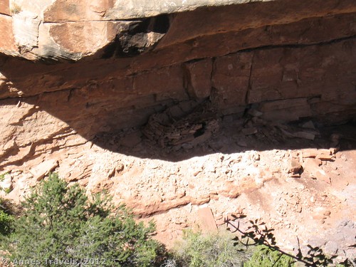
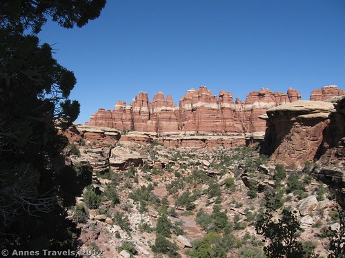
Return by the way you came. Or, if you’re like us and have no desire to go back through all that sand and don’t mind a slightly longer hike, turn left 2 miles (3.2 miles) from the arch on a trail with a sign that says that Chesler Park is in 1 mile (1.6 km). Actually, I’d recommend this route even if the sand isn’t an issue to you. The views along it are very nice, and you get to see Chesler Park (my favorite place in the Needles District) too. As you’re heading up the trail, keep a sharp eye on the cliff wall to your right. We saw an old ruin that looked like it could have been made by Indians. Also, keep looking back—the views are very, very nice.
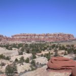
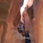
After 1 mile (1.6 km), you will come to the Chesler Park Trail. If you just want to get back to your vehicle, turn right. However, if you want to see the Park, turn left. About 0.7 miles (1.1 km) later, you’ll come to The Joints Trail. Just before you come to this intersection are some of the very best views of Chesler Park. We’d been to Chesler Park the year before, so the reason we did it was because our children love slot canyons. We wanted to let them enjoy themselves before heading back to the parking area—especially the smallest ones were ready to play a bit before hiking some more. So, that’s another good reason to go this way. (For more on Chelser Park and The Joints, please see this post: https://www.annestravels.net/chesler-park-to-viewpoint/ and https://www.annestravels.net/the-joint-trail/. The first picture was taken near The Joint.)
When you’ve enjoyed the view (or The Joint, or both), turn around and head back around the edge of Chesler Park. You’re walking through a desert meadow, full of grass and small bushes, but it’s very, very nice with the hoodoos sticking up above everything. When you come to the sign that indicates the way you came from Druid Arch, keep going straight (left). After 1.3 miles (2 km), turn right down the wash, then 0.2 miles (0.3 km) later, keep going straight (right). Another 0.6 miles (1 km) later, keep going straight for 0.6 (1 km) more miles. Then turn left on the trail that will take you back to the Elephant Hill Parking Area, 1.5 miles (2.4 km) away. If you do the entire hike, you’ll have gone a total of 14 miles (22.5 km), the most we’d ever done to date!
Druid Arch probably isn’t worth the hike, but you’ll definitely see some nice scenery if you go. So, if you’ve done most of the other hikes in the Needles District or like very long hikes through the sand, enjoy yourself and appreciate all the colorful rocks and arch around you!
Round Trip Trail Length: 10.2-14 miles (17.4-22.5 kilometers)
Facilities: Picnic Tables at the trailhead
Fees: $10 fee to enter Canyonlands National Park, good 7 days at any Canyonlands National Park entrance (Island in the Sky, Needles, and the Maze districts). America the Beautiful (Interagency), Military, Senior (Golden Age), Access (Golden Access), and Volunteer Passes and Local Passports are also accepted.
Trail 


Road 


Signs 


Scenery 


Would I go 100 miles out of my way for this? 


Overall Rating: 


This Week’s Featured Product!
Looking for even more hikes in Canyonlands? This book covers both Arches National Park and Canyonlands National Park, and includes an extensive section on the Needles District.


I was recommended this blog through my cousin. You are wonderful! Thank you!
Hey there! I’ve been following your site for a long time now and finally got the courage to go ahead and give you a shout out from Huffman Texas! Just wanted to say keep up the fantastic work!
Fantastic guide – thanks. We’ve been looking to hike to Druid Arch and Angel Arch nearby, but have always been put off by the disstance and lack of real-life guidance. Tell me, have you bagged Angel Arch (aka Poodle Arch) often photographed by The Molar? Happy for some hiking tips there too!
Kind regards
Nigel,
I’ve never hiked Angel Arch, though it looks like an incredible arch (if a bit long for me to tackle!) These links might be helpful: http://www.rainer-grosskopf.de/travelogues/blog/angel-arch-en.html and http://www.backpackinglight.com/cgi-bin/backpackinglight/forums/thread_display.html?forum_thread_id=19890
Happy Hiking!
Anne
Pingback: 12 Trails that Require Hands & Knees, River Crossings, and Other Adventures
Pingback: 15 of the Best Day Hikes in Southern Utah - Anne's Travels
Pingback: Top 10 Pages on Anne’s Travels in 2014 - Anne's Travels
Pingback: Epic Hiking Fail to Epic Hiking Success - Anne's Travels
Pingback: Epic Day Hiking Road Trip to Southern Utah - Anne's Travels
Pingback: The Glory of the Lord Covers the Earth - Anne's Travels