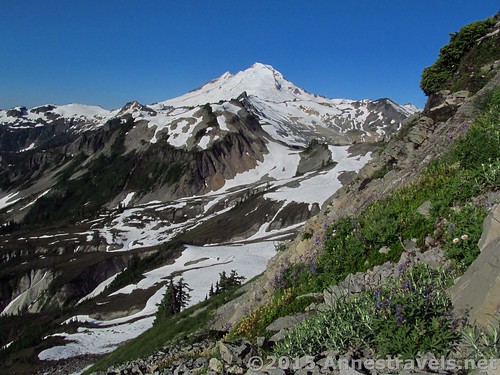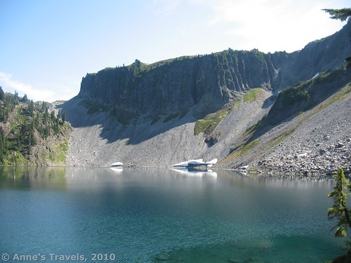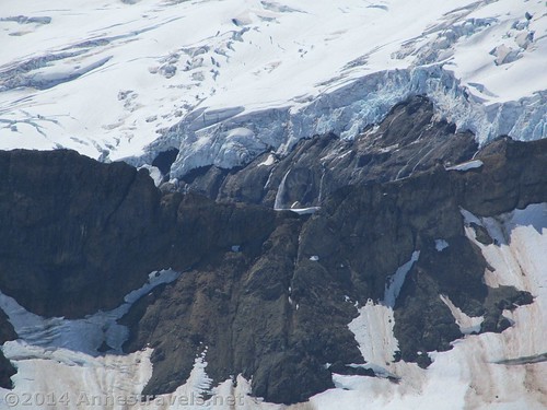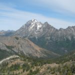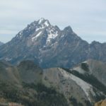
North Cascades National Park and vicinity ranks as one of my all-time favorite national parks in terms of spectacular beauty. Those sheer-faced peaks still speckled with snow well into the summer, the rich green pine forests, and the wildflowers in the summer months make my view-junkie heart swell every time.

So here I’ve compiled a hiking itinerary for adventuring in the North Cascades National Park Complex, with 3 day, 5 day, 7 day, and 12 day itineraries! I’ve included three different hiking options at three different hiking difficulties for each day (Easier, More Moderate, and Adventurous – which is another way of saying Moderate to Strenuous, Strenuous to Very Strenuous, and Very Strenuous But It’s Worth It).
3 Day Hiking Itinerary in North Cascades National Park
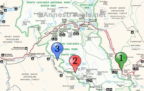
Day 1: Rainy Lake, Maple Pass, & Lake Ann

Easier: Hike to the lovely Rainy Lake (2.0 miles out & back) and Lake Ann (3.4 miles out & back) in a rocky cirque.
More Moderate: Hike the spectacular Maple Pass Loop (7.2 mile loop) to views of mountains and lakes.

Adventurous: Take the Maple Pass Loop (7.2 mile loop) for spectacular views. Include the spurs to Rainy Lake (1.0 mile spur) and Lake Ann (1.0 mile spur) for even more views.
Total Hiking for Day 1: 5.4, 7.2 or 9.2 miles
Camping/Lodging: Camp or lodge in or near Marblemount, WA.
Day 2: Cascade Pass, Horseshoe Basin, Doubtful Lake, & Sahale Arm
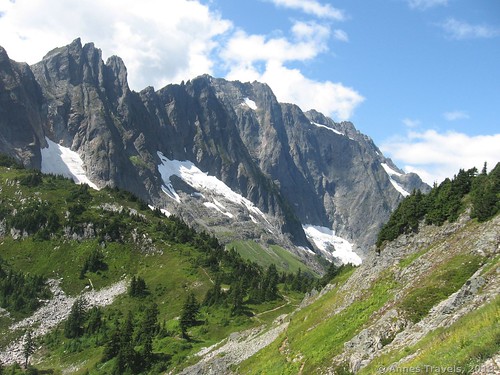
Easier: Hike up to Cascade Pass (8.0 miles out & back) for fantastic views of nearby mountains
More Moderate: Hike up to Cascade Pass (8.0 miles out & back) and turn left up Sahale Arm to the Doubtful Lake Junction (0.9 miles beyond the pass) for out-of-this-world spectacular views of nearby mountains and Doubtful Lake. You can continue down to Doubtful Lake (1.0 mile RT spur) if desired.
Adventurous: Your Choice: Hike up Sahale Arm to the Glacier Camp (13.4 miles out & back) for simply jaw-dropping views over mountains, valleys, and lakes. Or continue over Cascade Pass into Pelton Basin and then turn on the spur into Horseshoe Basin (16.8 miles out & back).
Total Miles for Day 2: 8.0, 9.8/10.8, or 13.4/16.8 miles
Camping/Lodging: Keep your site or room in Marblemount for a second night.
Day 3: Hidden Lake: The Pass, The Lake, The Lookout
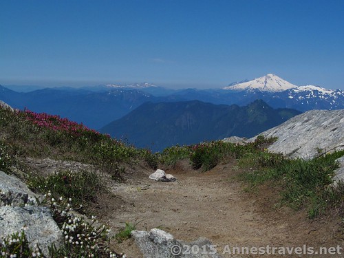
Easier: Hike up to Hidden Lake Pass (8.6 miles) for truly spectacular views of the Cascades and Mt. Baker.
More Moderate: Hike up to Hidden Lake Pass (8.6 miles) and then continue the scramble up to the Hidden Lake Lookout (0.9 miles total scramble spur) for even better views over the surrounding mountains.
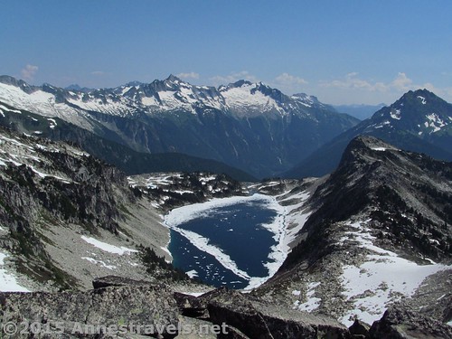
Adventurous: After hiking up to the Hidden lake Lookout (9.3 miles out & back), scramble down to Hidden Lake (1.0 mile RT spur). There is no trail, so watch your step carefully.
Total Miles for Day 3: 8.6, 9.3, or 10.3 miles
5 Day Hiking Itinerary for North Cascades National Park Complex
Days 1, 2, & 3: Repeat 3 Day Itinerary
For days 1, 2, and 3 use the 3 Day Itinerary (Rainy Lake/Lake Ann/Maple Pass Loop; Cascade Pass/Sahale Arm area; Hidden Lake area).
Day 3 Camping: You can camp another night in Marblemount, but depending on current energy levels, I would recommend camping or lodging further west – for example, in Sedro-Woolley.
Day 4: Rest/Travel Day + Artist Point & Table Mountain
Drive up to the Mount Baker Highway (about 3 hours from Marblemount). Stop in Glacier to snag a campsite, get a room if you don’t have reservations, and/or get your national forest pass at the ranger station. Be absolutely certain to get your pass – there are no self-serve stations beyond the ranger station and the rangers do check to make sure you’ve paid.
Drive to the very end of the Mount Baker Highway up at Artist Point.
Easy: Hike the Artist Ridge Trail out to Huntoon Point (1.5 miles out & back) for fabulous views of Mount Shuksan (views are better in the afternoon).
Moderate: Hike up Table Mountain (3.0 miles out & back). Views are fantastic over Mt. Baker (better in the morning) and Mt. Shucksan (better in the afternoon) as well as nearby valleys and mountains – all the way into Canada!
Slightly Adventurous: Hike up Table Mountain (3.0 miles out & back), then hike out the Artist Ridge Trail to Huntoon Point (1.5 miles out & back).

No matter which option you take, stop on your way back down the highway at Picture Lake (0.3 mile semi-loop). The views of Mt. Shuksan reflected in the lake are puzzle-worthy!
Total Miles for Day 4: 1.5, 3.0, or 4.5 miles
Camping/Lodging: Stay in or near Glacier, Washington – most accommodations and campgrounds are slightly rustic.
Day 5: Ptarmigan Ridge or Skyline Divide
Easier: Hike the Skyline Divide Trail to the top of the divide (4.2 miles out & back) for views of Mt. Baker and the Canadian Cascades. You can continue along the ridge in either direction for even more views.
More Moderate: Hike the Skyline Divide Trail and turn right along the ridgeline for a ridgewalk with constant views of Mt. Baker, Mt. Shuksan, and other valleys and peaks (4.2-10+ miles).
Adventurous: Take the Ptarmigan Ridge Trail (about 9.5 miles out & back) to the Coleman Camp (or beyond). For views, this trail can’t be beat (about as close as you can hike to Mt. Baker, Mt. Shuksan, etc., from a trail on the Mt. Baker Highway), but you’ll pay for those views with permanent snowfields, trails on near-sheer scree slopes, and a vague end-point.
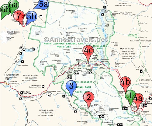
7 Day Hiking Itinerary for North Cascades National Park Complex
Day 1, Day 2, & Day 3: See 3 Day Itinerary
For days 1, 2, and 3, use the 3 Day Itinerary (Rainy Lake/Lake Ann/Maple Pass Loop; Cascade Pass/Sahale Arm area; Hidden Lake area).
Day 3 Camping/Lodging: You can continue to stay in Marblemount, or better yet, camp or lodge in Diablo or Newhalem.
Day 4: Sourdough Mountain, Easy Pass, or Blue Lake

Easier: Hike to Blue Lake (5.3 miles out & back) for en route views of a number of mountains and a crystal-clear lake.

More Moderate: Check out the trail up to Easy Pass (7.7 miles out & back). Views are stunning of the surrounding valleys and peaks.

Adventurous: Take the extremely steep hike up Sourdough Mountain (9.1 miles out & back) to simply spectacular views of Ross Lake and nearby mountains – not to mention a fire lookout.
Total Miles Day 4: 5.3, 7.7, or 9.1 miles
Day 4 Camping: You can camp another night in Marblemount, Diablo, or Newhalem, but depending on current energy levels, I would recommend camping or lodging further west – for example, in Sedro-Woolley.
Day 5: Travel Day/Winchester Fire Lookout or Lake Ann
Drive up to the Mount Baker Highway (about 3 hours from Marblemount). Stop in Glacier on the way to snag a campsite, get a room if you don’t have reservations, and/or get your national forest pass at the ranger station. Be absolutely certain to get your pass – there are no self-serve stations beyond the ranger station and the rangers do check to make sure you’ve paid.
Easier/More Moderate: Drive up to the Twin Lakes Trailhead and hike up the steep trail to the Winchester Fire Lookout (3.5 miles out & back). Views are beautiful to Mt. Baker and over surrounding peaks.
Adventurous: If the road is too rough for your vehicle (it’s unlikely cars can make it to the trailhead; check at the ranger station for current conditions), hike to Lake Ann (8.8 miles out & back) for views of Mt. Shuksan (not the same Lake Ann as near the Maple Pass Loop). If the hike is too long, even a short hike on the trail is beautiful.
Camping/Lodging: Stay in or near Glacier, Washington – most accommodations and campgrounds are slightly rustic.
Day 6: Skyline Divide or Heliotrope Divide
Easier: Hike the Skyline Divide Trail to the top of the divide (4.2 miles out & back) for views of Mt. Baker and the Canadian Cascades. You can continue along the ridge in either direction for even more views.
More Moderate: Hike the Skyline Divide Trail and turn right along the ridgeline for a ridgewalk with constant views of Mt. Baker, Mt. Shuksan, and other valleys and peaks (4.2-10+ miles).
Adventurous: If you want a little more adventure, hike the Heliotrope Divide Trail (6.5 miles out & back). Multiple river crossings (usually no more than knee-deep; most can be rock-hopped) and the end of the trail being multiple social trails makes this a little more difficult than other hikes. Hikers are rewarded with views directly up the Coleman Glacier to the cone of Mt. Baker.
Total Miles for Day 6: 4.2, 4.2/10+, or 6.5 miles
Camping/Lodging: Stay in Glacier or vicinity.
Day 7: Ptarmigan Ridge, Table Mountain, or Artist Ridge
Easier: Hike up Table Mountain (3.0 miles out & back). Views are fantastic over Mt. Baker (better in the morning) and Mt. Shuksan (better in the afternoon) as well as nearby valleys and mountains – all the way into Canada! After returning the parking area, hike the Artist Ridge Trail out to Huntoon Point (1.5 miles out & back) for fabulous views of Mount Shuksan (views are better in the afternoon).
More Moderate: Start out taking the very scenic Chain of Lakes Trail along the base of Table Mountain with views over Mt. Baker and then down to several alpine lakes. Return via the Wild Goose Trail for a total mileage of 6.7 miles.
Adventurous: Take the Ptarmigan Ridge Trail (about 9.5 miles out & back) to the Coleman Camp (or beyond). For views, this trail can’t be beat (about as close as you can hike to Mt. Baker, Mt. Shuksan, etc. on a trail from the Mount Baker Highway), but you’ll pay for those views with permanent snowfields, trails on near-sheer scree slopes, and a vague end-point.

On your way back down the Mt. Baker Highway, be sure to stop at Picture Lake (0.3 mile semi-loop). The views of Mt. Shuksan reflected in the lake are puzzle-worthy!
A few notes:
No entry fee is required for North Cascades National Park. However, many trailheads are located in the nearby national forest, where a $5/day fee is required (national park passes are accepted). The Mount Baker Highway requires the $5 fee for every single day that you are recreating on the highway, even if you arrive in the evening. A self-service fee station is available at the ranger station in Glacier; there are no other fee stations along the highway.
Most of these hikes aren’t accessible until mid-July; some trailheads may be inaccessible into August depending on the year, snow levels, snowmelt, and plowing schedules. So the best time for a road trip to North Cascades is August-September, with the second half of July and the first half of October being possibilities depending on snowfall and the progress of clearing the road.
The Mt. Baker Highway is technically in the Mount Baker-Snoqualmie National Forest, but NPS workers shamelessly claim the views along the highway as their own. And since it’s one of the most beautiful, peaceful places I’ve ever hiked, I’ve included a few of its vistas on the 5 day and 7 day itineraries.
I’m assuming you’re in pretty good physical shape. Hiking up mountains in the North Cascades is no picnic!
As with any mountain state, the weather can be iffy. Rain in the North Cascades is very normal – but summers often are sunny and pleasant.
I’m not including travel time to the North Cascades or back to your starting point – the days only include travel time between trailheads within the itineraries.
Because the lower slopes of the Cascades are so much lower than the lower slopes of the Rockies, it’s highly unlikely that you’ll need to acclimate the way you would need to in, say, Rocky Mountain National Park. But on higher peaks you may still feel the altitude.
What stunning hikes in North Cascades National Park did I miss? Let me know in the comments below!
This Week’s Featured Product!
With nearly 90 trails in this book, you’ll have plenty to choose from in the North Cascades Complex area. The section on North Cascades rates the hikes by views, so you’ll be sure to get the best of the best hikes.

