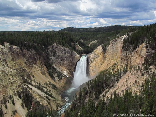
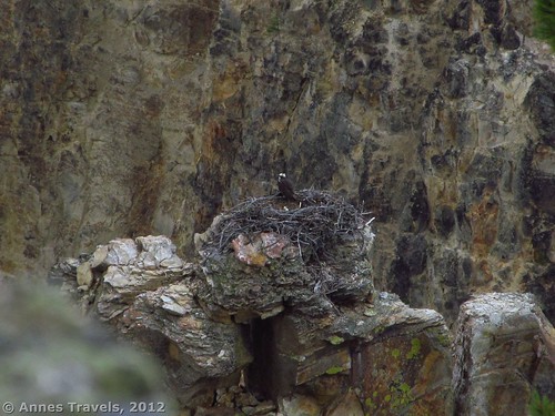
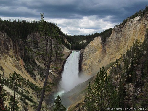
Usually, the park maps and brochures at a given national park are really good. Most of the time you can just use the map to get around the park, from hiking to camping to deciding where to watch wildlife. This is even true of Yellowstone National Park. However, what the map—and the Yellowstone NP website—fail to show is the trail to one of the best views of the Lower Falls on the north rim of Grand Canyon of the Yellowstone. Though it’s steep and has plenty of stairs, I highly recommend Red Rock Point to those visiting the region—you’ll get a great view of the Grand Canyon of the Yellowstone, as well as the Falls and surrounding area. We even got to see a osprey’s nest and some hail, but hopefully you won’t see the latter. The real trick is to find a parking spot during the summer—the North Rim Drive can be really crowded! (But the good news is that the crowd thins a bit once you’re on the trail!)
To get to the parking area, from Canyon Village, drive a short way south toward Fishing Bridge—the road is well-marked. You will want to turn left on the North Rim Drive, a one-way road (south to north) that will eventually take you back to Canyon Village. If you get to the South Rim Drive, you’ve gone too far; turn around and go back up to the North Rim Drive. You also don’t want the first parking area, which is for the Brink of the Falls Trail—I’m sure this is nice, but it’s not where you want to be right now. We actually ended up parking here and then walking the Rim Trail along the road down to your destination—Lookout Point. Park your vehicle in the parking area, and then head over to the paved trail that leads out to Lookout Point. I highly recommend that you visit the point either before or after doing the trail. A map of the area can be found at http://www.nps.gov/features/yell/interactivemap/canyon.htm
The wide, paved path leads up a small hill between rock walls. I recommend you go here first. There’s a nice viewing platform, and it’s one of the nicest views of the Lower Falls I’ve seen on the North Rim (you’ll soon be hiking to the other nicest view). You also get a great view of the Grand Canyon of the Yellowstone. Actually, on your left as you’re walking up towards the hilltop, if you look along the side of the canyon you may be able to spot an osprey nest. Further up (supposedly) you can see two—I never located the second nest. In July, the parents were still at the next. The same parents come back year after year. Another visitor told us that the same nest had been there for over a hundred years—the parents and then their descendants keep coming back to it, year after year. Wow!
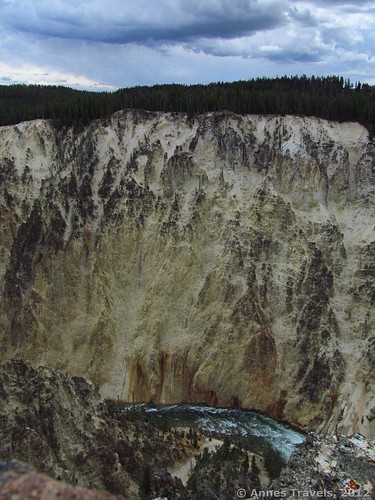
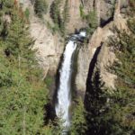
After you’ve enjoyed the view (and maybe snapped a few pictures), go back towards the parking area. Before you reach the Rim Trail, you’ll see a real trail (it’s “paved”) descending steeply—a sign points towards Lookout Point and Red Rock Point; follow the arrow for Red Rock Point. This trail is about ¼ mile one way, but it’s steep! The trail almost immediately begins to switchback down the steep side of the canyon. It’s very doable, just watch your footing. The trail is in very good condition; stairs have been installed where needed. As you reach Red Rock Point, the park service has installed a boardwalk with plenty of stairs. You’re getting close! The trail doesn’t have much of a view, but keep going. Eventually, you’ll get to the bottom of the trail. This is not the bottom of the gorge; you’re still a long way up the canyon side. However, you do get a more head-on view of Lower Yellowstone Falls. You can also see the Grand Canyon of the Yellowstone, which is nice. The day I visited, it was very cloudy, but the rain and clouds made for some really cool pictures.
Return by the way you came. This is a very nice little side trip in Yellowstone, away from some of the better-known attractions. Not something you’ll spend all day doing, but it’s fun!
Round Trip Trail Length: ½ mile; more if you hike the rim trail, too
Facilities: None at the Lookout Point parking area
Fees: $25 to enter Yellowstone National Park, good 7 days to enter Yellowstone and Grand Teton National Parks. America the Beautiful (Interagency), Senior (Golden Age), Access (Golden Access), Volunteer, Military, and Yellowstone Annual Passes also accepted. Educational institutions may be able to get a fee waiver: http://www.nps.gov/yell/planyourvisit/upload/fee_waiver_7-10.pdf
Trail 


Road 


Signs 


Scenery 


Would I go 100 miles out of my way for this? 


Overall Rating: 


This Week’s Featured Product!
Looking for even more waterfalls in Yellowstone? This book will tell you how to get to more than 200 waterfalls in Yellowstone National Park, many of which hadn’t even been discovered by park officials until the authors wrote about them. Detailed topo maps and stories behind the discovery of the waterfalls (including the ones that were discovered hundreds of years ago) keep the book interesting and help users find these beautiful new—and old—waterfalls.

A very impressive article. Well prepared. Very motivating!!
I have been exploring for a little bit for any high quality articles or weblog posts in this kind. Exploring in Yahoo I ultimately stumbled upon this website. Reading this info So i’m happy to exhibit that I have an incredibly excellent uncanny feeling I found out exactly what I needed. I so much unquestionably will make sure to don’t disregard this web site and give it a look on a continuing basis.
Lovely message you wrote. It was educating.
Pingback: 15 Must Do Waterfall Hikes Across the US - Anne's Travels
Pingback: 11 Amazing Trails of the West that are 1 Mile (or Less) in Length
Pingback: The Glory of the Lord Covers the Earth - Anne's Travels