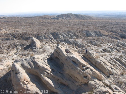
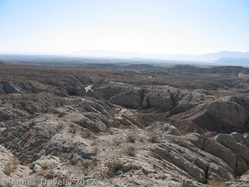
Anza-Borrego Desert State Park has many things that most places don’t, but Truckhaven Rocks sticks out in my mind. Why? Maybe it’s the desolate scenery. Or the eerie silence. Or the fact that it’s usually deserted. Or the lack of trail. Whatever the reason, it’s a really cool place to stop if you’re in Anza-Borrego or entering the park from the east along County Hwy S-22. I’ve visited a couple of times; it’s a great place to let the children run, to let yourself wander for hours, study Southern California geology, or to simply lose yourself among the rocks, which are really high monoliths that can be fairly easily ascended for beautiful views of the surrounding area. Be sure to bring a compass or GPS, though, or else you might not find your way back if you’ve walked too far into the rocks!
Truckhaven Rocks GPS Coordinates: About 33.290055 N, -116.141177 W (33*17’24.198”)
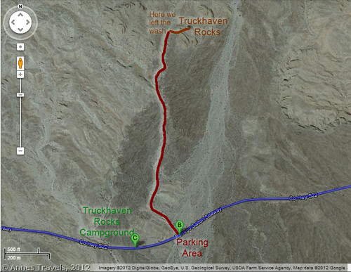
Truckhaven Rocks Parking Area GPS Coordinates: 33.282065 N, -116.141123 W (-116*8’28.2366”)
Getting to Truckhaven Rocks
The gravel pullout (wide shoulder) that serves as the parking area is along S-22 at milepost 35.5, just on the east side of a culvert that goes under the road. This pullout is located about 16 miles (25.7 km) east of the Borrego Springs and about 11 miles (17.7 km) west of Salton City (for all you engineers, according to Google Maps it’s exactly 10.9 miles (17.3 km) from CA-86 in Salton City to the parking area, and exactly 16.4 miles (26.4 km) from the traffic circle in Borrego Springs). There is no sign marking the pullout, so remember milepost 35.5. If you’re coming from the west (Borrego Springs), you’ll pass the Truckhaven Rocks Campground just before coming to the pullout.
From the pullout, scramble down the sandy bank into the wash. Head up the wash (north; away from the road) for about a half a mile (0.8 km), and you’ll come to the rocks. The wash is a little sandy/rocky in places, and you may have to scramble up small (2-ft.) dryfalls in a few places. If you’re half-good at walking cross-country, though, you shouldn’t have much difficulty. Actually, if you like geology, this might be a fun place to hang out. There are many different kinds of rocks here; it’s a study just to look at your feet while walking up the wash. On either side of the wash are dry desert bushes and ocotillo plants. Two things to remember in the wash: 1) keep listening for airplanes; if the sound simply won’t go away, a flash flood is probably coming; climb immediately out of the wash to higher ground (same thing if you see even a trickle of water; it will quickly swell into a full flood), and 2) watch where you put your hands and feet; you never know if there might be some animal hiding under one of the rocks, in a crevice, or under a pile of leaves.
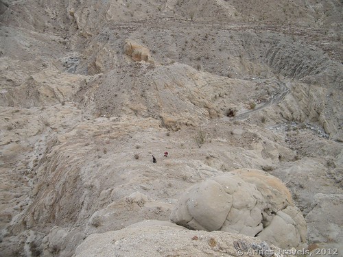
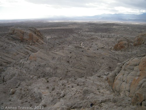
After about a half mile (0.8 km), you will come to the Truckhaven Rocks. These are large monolith-like slabs that seem to slope up out of the ground. They’re not very difficult to scramble up; simply exit the wash on the right side and climb up. (Climbing out of the left side has good views, too.) Even those in my group who aren’t fond of bouldering found these an easy climb. The other good thing about the rocks is that once you’re out of the wash and even a short way up them you can turn around and see a lot of desert below you. It’s so desolate; they say all deserts are desolate, but this one seems to have less plants and more sand than most I’m used to in the US. It’s just a wide expanse of land punctuated by spindly bushes and ocotillo, with an occasional boulder sanding like sentinels watching over the expanse. In another direction, it’s all rocks and mazes of washes, and again, it’s so desolate. It’s quite a nice view if you like deserts the way I do.
There are several rocks to explore, and you can even keep going if you want to. We never did, opting instead to head back down the wash to our vehicle. This is where a compass or GPS compass comes in handy. With the GPS, you can simply plug in the parking lot coordinates (above) and follow it back across country. If you have a compass, you can head south, and you’ll eventually reach the road (though where along it is very difficult to say!). The whole area is worth some more exploration than I’ve given it, so feel free to link to any articles you’ve written about the area if you’ve explored further!
Round Trip Trail Length: About 1.5 miles (2.4 km)
Facilities: None, although there might be something at the campground
Fees: None
Trail 


Road 


Signs 


Scenery 


Would I go 100 miles out of my way for this? 


Overall Rating: 


This Week’s Featured Product!
Interested in the geology of Anza-Borrego Desert State Park? Here’s the guide you’ve been looking for! The 200 page book covers the geology and paleontology of the region in an interesting, sometimes humorous, manner.



Thank you so much for bringing this to our attention. This is a very informative article with a lot of information, great content!
Pingback: 10 Places to Go Exploring in the Western US - Anne's Travels