I don’t know why, but my group has a fascination with throwing rocks across rivers into foreign countries. It’s not animosity. Perhaps it’s because they like the challenge of trying to throw that far, or perhaps it’s like a piece of them has gone over and touched foreign soil. Whatever the reason, Santa Elena Canyon has been a favorite hike in Big Bend National Park, in part because it’s a prime place to throw rocks into Mexico. It always seems to make it onto our “to-do” hike list, even though the trail is fairly short (about 1.5 miles (2.5 km) RT) and it’s a long way from the main part of the park (42 miles (68 km) from the Panther Junction Visitor Center). The hike is also great for geologists and those looking for spectacular canyons – this one is pretty cool to look at! Naturalists might like it, too, because there are signs about Big Bend’s flora and fauna along the way!
Important GPS Coordinates for Santa Elena Canyon:
Parking lot: 29.167290 N / -103.610127 W (29N 10’ 1.144” -103W 36’ 36.4572”)
Beginning of the switchbacks: 29.165799 N / -103.612420 W (29N 9’ 56.8758” / -103W 36’ 44.712”)
Getting to Santa Elena Canyon
From the Panther Junction Visitor Center, head west on the park’s main road. Pass the road for the Chisos Basin after 3 miles (4.8 km); keep going another 10 miles (16.9 km) to a well-signed road that goes to Castolon and Santa Elena Canyon. Turn left and drive this road to its end, 34 miles (54.7 km) later. Along the way you’ll pass attractions including Sam Nail Ranch, Burrow Mesa Pouroff, and the Castolon Visitor Center (closed during the summer; the store is open all year). Be on the lookout for the canyon; it’s quite a pretty sight as you’re driving along towards it. A map of the area can be found at http://www.nps.gov/bibe/planyourvisit/upload/BIBE_map1_2007.pdf. Note: the canyon may be closed in spring due to nesting birds; check at the Panther Junction Visitor Center before you drive down here.
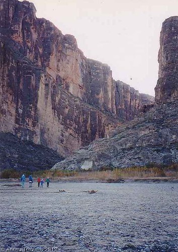
The most interesting thing about the parking area (which could be bigger; you may have trouble finding a place to park) is the high-water mark painted on the restrooms (pit toilets). At least five feet above the ground, it marks how high the water came during a flood many years ago. From the parking lot, walk along the trail that looks like it’s heading toward the canyon. There are many social trails as well as the real trail; most will eventually get you where you want to go. You’ll pass through vegetation for a while, then come out into what appears to be a dry streambed. The trail can become a little faint here; keep heading toward the canyon (often there are cairns marking the way). Occasionally, there will be a stream to cross, and the streambed can be quite muddy if it’s rained or there has been a recent flood. Helpful hikers have put down sticks and rocks to help others cross the stream or the muddy sections, but don’t try crossing the stream without the sticks, stones, etc. because it can be a rushing torrent and too dangerous to cross by wading.
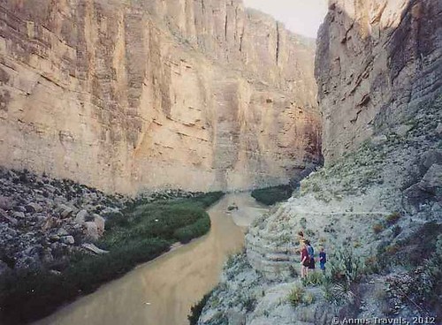
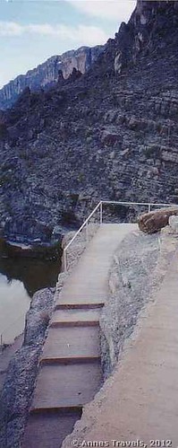
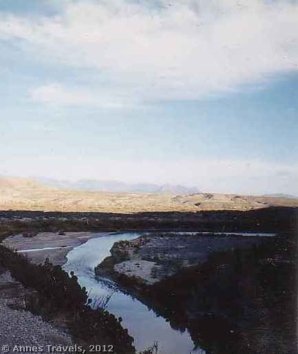
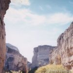
Once you’ve crossed the streambed, you will come to the mouth of the canyon. Here the trail begins in earnest, with switchbacks quickly taking you up along the side of the canyon wall. There are many steps here, as well as some handrails. Be on the lookout for small signs along this section of the trail – they talk about the flora and fauna of Big Bend. When you reach the top of the switchbacks, look around you. Behind you are the Chisos Mountains. Ahead of you (really, all around you) is Santa Elena Canyon, magnificent, tall, awesome, and filled with the sound of the Rio Grande below you. From here, several of my group members tried to throw rocks across the river into Mexico—and succeeded, I might add!
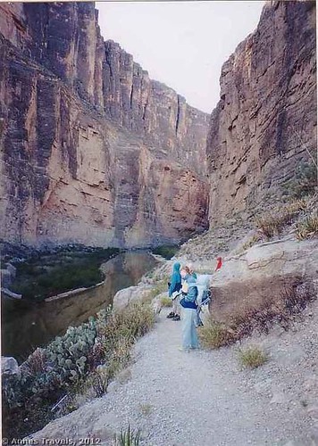
From the top of the hill, the trail closely follows the wall of the canyon on the American side of the river. The trail rises and falls as it winds its way across rock and sand to a point called “The Overlook”, which is where many people turn around (the trail beyond this is rougher and discourages many hikers; translated, the trail beyond here is more fun). From the Overlook, you can see upstream and downstream; it is quite impressive. After the Overlook, the trail winds its way along the canyon wall through sandier places and more vegetation. The height of the Rio Grande will determine how far you can go; eventually, the river will met the wall, and you can’t go any further on foot.
Return by the way you came. The magnificence of the canyon (not to mention the rock-throwing possibilities) is what makes this hike one of the classics of Big Bend National Park!
Round Trip Trail Length: About 1.6 miles (2.5 km)
Facilities: Primitive restrooms
Fees: $20 to enter Big Bend National Park, good 7 consecutive days. America the Beautiful (Interagency), Senior (Golden Age), Access (Golden Access), Volunteer, Military, and Big Bend Annual Passes also accepted. Educational fee wavers may be granted; visit http://www.nps.gov/bibe/planyourvisit/feesandreservations.htm for more details.
Trail 


Road 


Signs 


Scenery 


Would I go 100 miles out of my way for this? 


Overall Rating: 


This Week’s Featured Product!
If you’re looking for more great trails in Big Bend, try this book. It covers more than 50 hikes across the park, from mountains and springs to canyons and desert.


Will bookmark this post.
I’m not sure where you are getting your information, but good topic. I need to spend some time learning more or understanding more. Thanks for magnificent info I was looking for this information for my mission.
Thank you for this article post, it was just what I was searching for. There is so much information here, so I thank you so much for enlightening my mind.
Pingback: The Best Hikes in Big Bend National Park