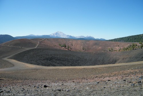
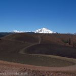
Today I’d like to talk about one of my favorite attractions at Lassen Volcanic National Park. Admittedly, it’s not very well known—although I believe a saw a picture of it in a National Geographic Magazine at one point—but we’ve really enjoyed ourselves both times we’ve visited the attraction simply known as “Cinder Cone” in the north-east section of the park. It is a fascinating geological phenomenon, and there is a very interesting and pretty view of the surrounding lava fields at the top. You can also see nearby mountains, including Mt. Lassen and Mt. Shasta. Children especially enjoy climbing to the top and then being able to slide back down.
To get to the cinder cone, take Hwy 44 approximately 24 miles east of Manzanita Lake to an unpaved road just east of Old Station that leads to Butte Lake. The road will be on your right if you are traveling from Manzanita Lake. Although the road is defined as “dirt”, a regular vehicle could probably make the road without difficulty. The parking area—which is near the boat launch—has restrooms (real ones; not the pit-type) and picnic tables.
The trail (4 miles round trip, although it feels longer once you start climbing the cinder cone) starts from the end of the parking area near the boat launch. It has a printed guide which you can buy (for a small fee) and numbered posts along the trail that indicate when to read out of the booklet about the region’s geology and plant life. Some of it is fascinating, but I found other parts of the booklet to be pretty boring and a lot of conjecture without much proof. Still, if you’re into knowing how volcanoes work and how this lava got here, it would probably be worth getting the booklet. Last time we hiked the trail a few of the numbered posts seemed to be missing, but we may just have missed them.
The first 1.2 miles of the trail are fairly flat, although you are hiking slightly uphill through a pine forest. This will be nice on the way back when you will be hiking downhill, but for now it can seem like quite the climb, especially in the summer when the weather is hot. If it gives you an idea of the elevation, the first time we visited Lassen, it was June and the mountain was still snowed in (they’d had a freak snowstorm in April, and the road near the mountain was opened only two days before we arrived). However, down here there was no snow, and hadn’t been any for quite some time. In August, this hike was fairly warm, although nothing unbearable. Still, we seriously considered jumping in the lake when we got back 🙂
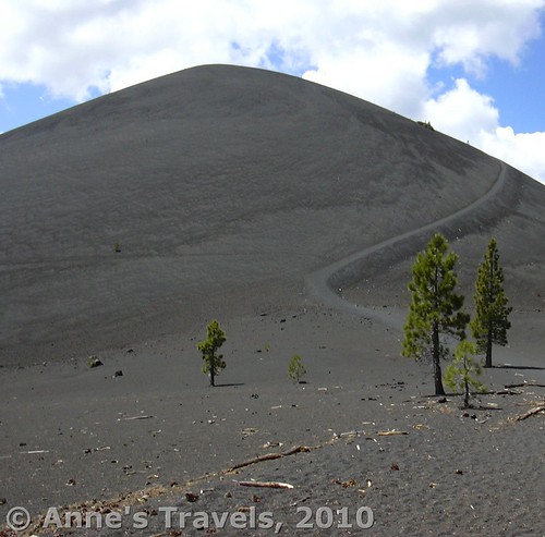
Then you can suddenly see the cinder cone looming ahead of you. Because the cinders were thrown up in a ring around the volcano, it looks like a huge black pile of stone. If you’re already tired, this may look impossible, but believe me, the view is worth the hike to the top. The trail veers off to the left across the cinder flats to the base of the cinder cone. From here on there is no shade, so be prepared (water, sunscreen, hat, etc.).
The hike up the cinder cone is very steep, rocky, and, to be honest, very strenuous. You are climbing a spiraling trail up cinders, so for every step you take, the cinders make you slide back half a stride. I’m really not trying to get you to give up, but I also don’t want to make it sound like a stroll in the park. With plenty of rests and some determination we made it to the top in about a half and hour. The children in our group could probably have made it up and down twice in the time it took us to just climb up once. Ah, youth.
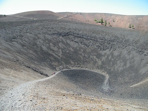
Once you get to the top, you can look down into the cinder cone itself. A trail does go down to the bottom, and some of us hiked down both times we’ve climbed the cone. The view slowly disappears as you descend into the crater, and wind and other noises cease. Heat from the sun shining on the black cinders hits your face, and reminds you that black absorbs heat better than white does. At the bottom is a large pile of rocks that was once a sort of roofless structure. However, someone must not have liked it, as it disappeared between our first and second visits. Remember if you’re thinking about climbing down to the bottom…you have to climb back up too!
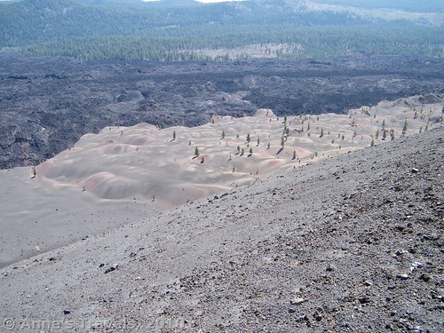
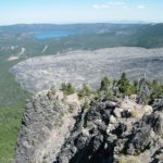
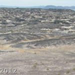
My favorite view is from the east side of the cone (go about a quarter of the way around the cone to the left after you come up). From here, you can see over the strangely shaded red-grey-and-almost-purple Painted Dunes, the black Fantastic Lava Beds, the lake you parked near, and the forests of the hills beyond. If you turn around you can see into the cinder cone and the mountains far off in the distance. You can see both Mt. Lassen and Mt. Shasta not as far off as might be imagined!
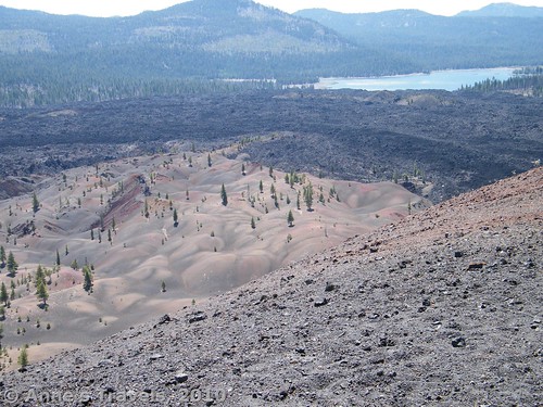
View from the crater rim–the Painted Dunes and Fantastic Lava Beds. I believe the lake in the background is Butte Lake.
You can actually walk all the way around the cone’s top. I highly recommend this, as the views are nice, and it’s just a nice walk. It’s not fully flat, but it’s still enjoyable. Return the way you came. Sliding back down the cinder cone is tons of fun, even if you do get your shoes full of cinders. It’s so much fun to run and slide down the trail. The children especially like it, because they’re lighter, and slide better. Still, it can make the climb worthwhile, and is much faster than climbing up 🙂
Read my more recent adventure to the Cinder Cone here.
Trail 


Road 


Signs 


Scenery 


Overall Rating: 


This Week’s Featured Product!
Take a hike in Lassen Volcanic with this award-winning book to the park’s trails!


