In the last several posts I’ve been chronicling my trek around Horseshoe Mesa in the Grand Canyon. There’s only one last segment to go: the trail that connects the Tonto Trail to the Grandview Trail near the Last Chance Mine on Horseshoe Mesa, sometimes known as the East Horseshoe Mesa Trail. Although the views from this trail aren’t as fabulous as the rest of the loop, there are several fascinating elements that make it worth your while. These include Page Spring (a lovely side jaunt that makes a good place to rest for a few minutes) and a real mine shaft that you can safely walk into. Perhaps my interpretation of this section of trail also is tinted because we were tired, we ran out of water in this section, and we had our closest encounter ever with a rattlesnake! If this is the case, the views may be nicer than I remember!
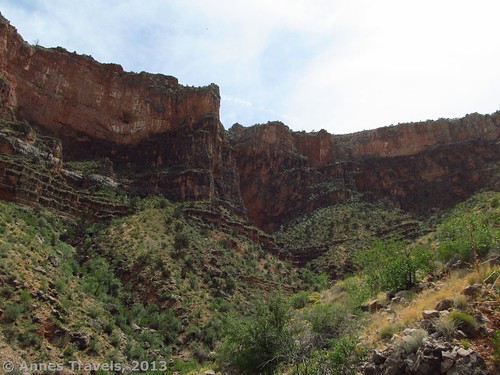
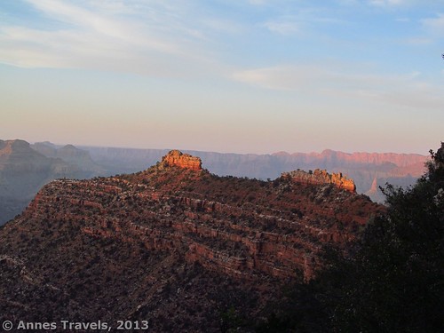
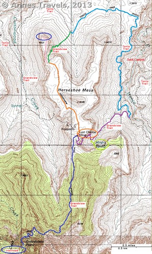
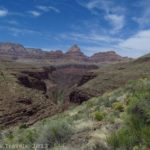
We turned onto the East Horseshoe Mesa Trail from the Tonto Trail, thrilled to have finally found the trail up and knowing now for sure that the trail was much longer than my original estimate of 12.5 miles (20.1 km) (at the end of the trail, my GPS was reading 17.75 (28.5 km) and I took off 0.25 miles (0.3 km) because I’d walked the trail to Page Spring more than once). Our water was also running low (I’d packed for 14, not 17, miles), which didn’t help the moral of the group. However, we persevered, occasionally looking back at the views behind us. The main canyon disappeared fairly quickly from view, but the side canyon we were climbing was quite impressive.
There is one place maybe about half a mile (1 km) from the Tonto/East Horseshoe Mesa trail junction where the trail goes both straight and right as it approaches a wash. You want to go right and descend into the wash fairly quickly; going straight, the trail peters out fairly quickly and you’re left with no trail in the middle of scrubby desert. Not a fun feeling!
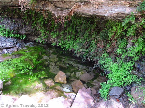
About 2 miles (3.2 km) from the Tonto Trail, a marked junction will point toward a trail on the left that leads to Page Spring. Also known as Miner’s Spring, the side trail is about 0.1 miles (0.2 km), and it’s well worth the time and distance necessary to go to the spring (and that from a person who doesn’t think much of hiking to springs!) The trail is very narrow and seems to end in a kind of dry streambed surrounded by trees; keep going slightly further and you’ll find the spring. We decided to spend a little while resting in the cool of the spring area before continuing. When we visited in May, we didn’t see any poison ivy, which was a great plus for those in my group who are highly allergic. We also met one group here; these were the first people we’d seen since before we’d reached Horseshoe Mesa that morning. We met several people on our way back up the Grandview Trail; otherwise, it was a pretty deserted hike.
Actually, this was where we split up. We realized we didn’t have enough water to get back to the top and we didn’t have any water purification tablets (I now carry tablets in my first aid kit), so the two fastest members of our group went back up and we figured the rest of us would take a slower pace and they’d meet us along the way. As I took stock of what little water we had left (we’d give most of it to those going ahead), we discovered that one of our empty bottles had miraculously filled with water! It was just enough to get us to where we met up with those who’d gone back ahead of us – about 1.5 miles (2.5 km) above Horseshoe Mesa on the Grandview Trail. I don’t recommend this splitting up thing at all, but it worked in our situation this time.
We spent about an hour and a half all told at the spring – precious time, but well worth it because it gave us the “umph” to keep hiking up the rest of the way. As we continued hiking up the East Horseshoe Mesa Trail about 4:30pm, the youngest member of our group (8 years old) suddenly stopped, pointed next to where he was standing, and said, “Look, there’s a snake.” And then we all heard the warning rattle like rocks in a tin can: a rattlesnake. “Run!” I screamed, and he ran, fast – a hundred feet or so up the trail, he stopped.
“Is this far enough?”
By this time, the slower members of our party had come up to us and were wondering what on earth we were all doing standing in the middle of the trail going nowhere. “Rattlesnake,” we explained. By this time, the rattlesnake was really mad, and I could see it by standing on a rock by the side of the trail. We finally decided that I’d keep an eye on the snake while everyone else left the trail and scrambled across the brush and scree back to the trail far ahead of the snake. As mad as it was, the rattler didn’t move, so we all got safely by and continued up the trail.
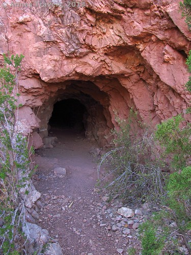
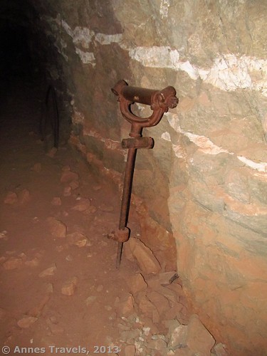
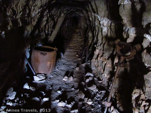
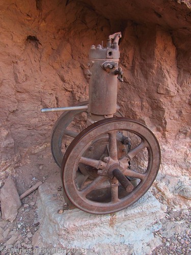
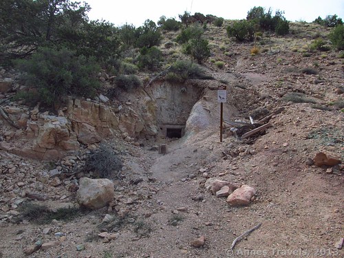
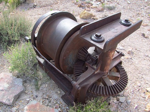
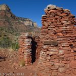
Not far beyond this, we came to the first of the mine entrances I saw from the East Horseshoe Mesa Trail. This is the most interesting of the mines. Besides the mining equipment outside the shaft, it’s safe (as mines go) to walk into the shaft for a few yards (meters) to a gate. Beyond this gate are an old jackhammer, a bucket, a metal pipe, and several other objects. It was fascinating to see, and even more fascinating to read about later at http://minegates.com/grandviewlastchancemine1.htm
The trail continues steeply upward, scaling the side of Horseshoe Mesa. About a mile (1.6 km) beyond Page Spring the trail summits the mesa and meets with the Grandview Trail. Just before this, we passed another mine, although this one was gated much earlier and had signs about radiation danger nearby. There is more mining equipment in the area, though not as much as at the first mine shaft. When we finally came to the Grandview Junction, we should have turned left to ascend back to the rim. However, some of us decided we wanted to use the primitive toilets, so we went back to the Last Chance Mine buildings before turning around and heading up the Grandview Trail.
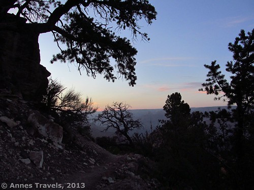
The sun set during the last mile on the trail (1.6 km), but it was just getting dark as we finally climbed the last stairs onto the Grandview Viewpoint. I checked my watch: 8:07, exactly 15 hours after we’d started that morning. I’d seen some absolutely stunning scenery; would I do it again? Not unless I was backpacking! I’d go down to the western arm of Horseshoe Mesa again in a heartbeat, though…but not for another year or two yet!
Key GPS Coordinates for Grandview Trail
Grandview Trail beginning: 35. 99846N / 111.98764W (5:07am)
Grandview Trail/East Horseshoe Mesa Trail (to Page Spring Junction): 36.01831N / 111.97578W (7:35am)
Grandview Trail/Cottonwood Trail Junction: 36.02014N / 111.97576W (7:40am)
Cabin on Horseshoe Mesa: 36.02033N / 111. 97594 (7:45am)
Grandview Trail Junction with Path to Tonto Trail: 36.03136N / 111.98270W (8:40am)
End Grandview Trail and End Horseshoe Mesa (great views!): 36. 03569N / 111.98386W (8:50am)
Trail from Horseshoe Mesa/Tonto Trail Junction: 36.03667N / 111.97782W (10:40am)
Possible Trail up to Horseshoe Mesa (we went straight): 36.02264N / 111.96686W (1:05pm)
Second Trail from Tonto Trail back up around Horseshoe Mesa toward Page Spring (East Horseshoe Mesa Trail): 36.02113N / 111. 96426W (1:30pm)
Turn right here; don’t go straight: 36.02072N / 111.96852W (1:50pm)
Page Spring Trail Junction: 36.01719N / 111.97297W (2:15pm)
Grandview Mine 2: 36.01725N / 111.97580W (4:20pm)
End Grandview Trail: 35. 99846N / 111.98764W (8:07pm)
The gpx file for the Horseshoe Mesa Loop can be downloaded – please note that the section across Horseshoe Mesa (the Cottonwood Canyon Junction to the western arm) and a section of the trail up the east side of Horseshoe Mesa are not accurate due to a GPS malfunction. I apologize for any inconvenience.
Download GPS File File size: 382.1 KB Downloaded 469 times
(Note: I do my best to ensure that all downloads, the webpage, etc. are virus-free and accurate; however, I cannot be held responsible for any damage that might result, including but not limited to loss of data, damages to hardware, harm to users, from use of files, information, etc. from this website. Thanks!)
Getting to Horseshoe Mesa
From the west end of the Rim Drive (just south of the Grand Canyon Visitor Center), drive 8.7 miles (14 km) to the Grandview Point Road, on your left. Turn down this road; drive to its end and park as best as you can. This parking lot fills up quickly during the day and you are expected to park in a legal parking space. Overnight hikers are supposed to park on the far side of the loop at the end of the road, but dayhikers and sightseers also use this parking area. Hike down the Grandview Trail and across Horseshoe Mesa, then down the Tonto Trail, turning right at the bottom of Horseshoe Mesa (click the links for directions).
Round Trip Trail Length: The East Horseshoe Mesa Trail is approximately 3 miles (9.5 km). The entire loop is (according to my GPS when I returned to the parking area) 17.5 miles (28.2 km) (down the Grandview Trail, across Horseshoe Mesa, down to the Tonto Trail, across the Tonto Trail, up to Horseshoe Mesa via the East Horseshoe Mesa Trail that goes by Page (Miner’s) Spring, and back up the Grandview Trail)
Facilities: Primitive toilets at the trailhead (no water; make sure to fill up at the visitor center or Desert View before attempting a hike); extremely primitive toilets near the Last Chance Mine on Horseshoe Mesa
Fees: $25 fee to enter Grand Canyon National Park, valid 7 days. America the Beautiful (Interagency), Senior (Golden Age), Access (Golden Access), Volunteer, Military, and Grand Canyon Annual Passes also accepted.
Trail 


Road 


Signs 


Scenery 


Would I go 100 miles out of my way for this? 


Overall Rating: 


This Week’s Featured Product!
After our little water disaster on the Horseshoe Mesa Loop, I decided it was time to put some water purification tablets in my first aid kit. I finally chose these because they’ll last about 5 years, are small, and are inexpensive as water purification goes. They were also recommended to me by a hiking acquaintance and have good reviews (i.e., no one has gotten sick while using them that I know of).

Pingback: Day Hiking the Cirque of Towers Overlook - Anne's Travels
Pingback: Epic Hiking Fail to Epic Hiking Success - Anne's Travels