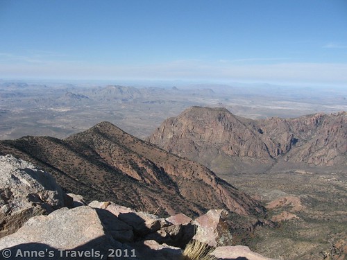
One of Big Bend’s claims to fame is that it is the only national park in the US that has an entire mountain range inside of the park. The Chisos Mountains stick up out of nowhere, ascend to a height of 7,825ft, and then descend again before they have a chance to interrupt the flow of the Rio Grande River and enter Mexico. Not surprisingly, there is a trail to the highest point in the mountain range: Emory Peak. This is a 9-mile RT trek up from the Chisos Basin, but the views are well worth the climb. You’re at the top of the world here, and you can see for miles and miles in every direction, well outside of Big Bend National Park, and well across the boarder into Mexico.
The trailhead is located in the Chisos Basin, so park your vehicle in the Chisos Basin Parking lot. This parking area can fill up quickly, so it is a good idea to get an early start on the hike. To get to the parking area, from the Panther Junction Visitor Center, drive 3 miles west on the main road. Then turn left onto the road up to the Chisos Basin. This turn will be 10 miles east of the Ross Maxwell Scenic Drive, if you’re coming from that direction (at which point you will want to turn right on the road to the Basin). You will want to follow the road up to the Basin for 6 miles to the end, and park in one of the numerous parking areas at the top. The trail to the Window and many other trails also start from this parking area.
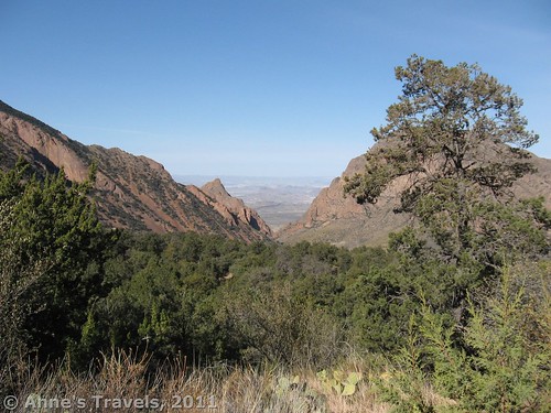
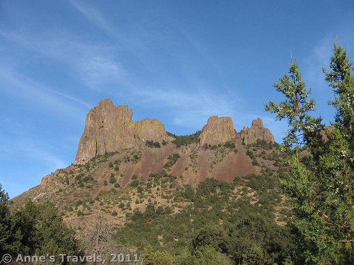
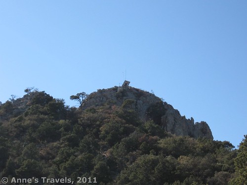
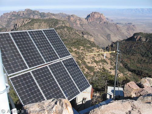
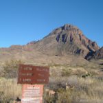
The trail to Emory Peak starts to the left of the visitor center at the Chisos Basin parking lot. Go down a flight of stairs to a dirt/gravel trail where a signpost will tell you which trail to take. This section of the trail is called the Laguna Meadow Trail; you will be taking several different trails on your way up to the mile-long Emory Peak trail to the summit. Not far down the Laguna Meadow Trail, the Pinnacles Trail branches off on the left—follow the signs. The trail has been going steadily up all the way, but here the switchbacks really begin. When you stop to rest, you can sometimes see the Chisos Basin spread out beneath you. The view gets better as you climb, but often there are trees blocking the view. However, at one point maybe a mile or so up the Pinnacles Trail there is an awesome view of the Chisos Basin and the Window. If you’re not up to climbing the peak, you might want to come up the trail just to see this view. Along the way up the Pinnacles Trail, you will be able to see a peak on your left. We mistook this for Emory Peak, but that peak is actually hidden from view at the moment, although it would be on your right if you could see it. Eventually you will be able to see Emory peak high above you on your right, with radio antennas and a solar panel on top.
After hiking 3.5 miles up the Pinnacles Trail, you will come to the junction with the Emery Peak Trail on your left. Just before this there is a primitive toilet. Although the trail levels out at the top of the ridge, be ready to climb again when you start the last mile to Emory Peak—this part is quite steep and rocky. The very end of the trail is a rock scramble, so many people leave their packs just below the top to free their hands for the final scramble to the top. It is very doable to get all the way to the top, but it’s not something you’ll want to try if you’re afraid of heights. Having someone with you to help you up the especially steep sections is quite helpful. And remember, you have to climb back down!
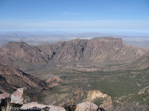
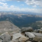
At the top of the peak are radio antennas, a solar panel, and a pile of rocks over on the far side of the peak. The view is incredible: all of Big Bend is stretched out before you, as well as Mexico and much of the area surrounding Big Bend. Take some time up here to enjoy the view and to rest before you try scrambling back down the rock face to the trail below. The peak itself was named for William H. Emory, the chief surveyor of the US boundary Survey team of 1852.
Return the way you came. All junctions are well marked, but I would still recommend getting a map (free of charge) at the visitor center. You can also get a map of the hiking trails in the Chisos Mountains Here. There are also many backcountry campsites along the trail. You can sign up for them at the Panther Junction Visitor Center ($10 per permit).
Trail 


Road 


Signs 


Scenery 


Would I go 100 miles out of my way for this? 


Overall Rating: 


Round Trip Trail Length: 9 miles (14.5 km)
Facilities: Picnic area, restrooms, campground, hotel, visitor information, etc., etc., etc., at trailhead; primitive (very primitive!) toilet about a mile from the peak.
Fees: $20 per vehicle; good 7 days. America the Beautiful (Interagency), Senior (Golden Age), Access (Golden Access), Volunteer, Military, and Big Bend Annual Passes also accepted
This Week’s Featured Product
Enjoy a dream hike using this book for planning! There are so many great suggestions and tips as well as hikes and other activities to take part in.

Pingback: Anne's Travels » Backcountry Car Camping in Big Bend pt 1
Pingback: The Best Hikes in Big Bend National Park