Sometimes there are hikes that you just know as soon as you arrive (at the parking area or the destination) that this is one epic hike. Gnarl Ridge, high on the southern side of Mt. Hood, was one of those hikes. As soon as I crested the ridgeline and saw the view, even though it was mostly behind clouds, I knew that this was a hike to remember, a hike that I could safely say is one of the best in Mt. Hood in terms of views. It’s so totally worth the 9.8 to 12.5 miles RT!
Quick Stats
We’d already hiked to Elk Meadows earlier in the day; from there, you’ll want to follow the signs toward Gnarl Ridge. There is a cutoff trail from the meadows up to the Gnarl Ridge Trail, so you don’t have to do the entire loop around the meadows before trekking upward toward the ridge proper. (If you don’t want to do Elk Meadows, turn left at the sign above Newton Creek toward Gnarl Ridge instead of Elk Meadows). This post begins from the Gnarl Ridge cutoff junction on the northern side of Elk Meadows. (If you need to figure out how to get to Elk Meadows, click here.)
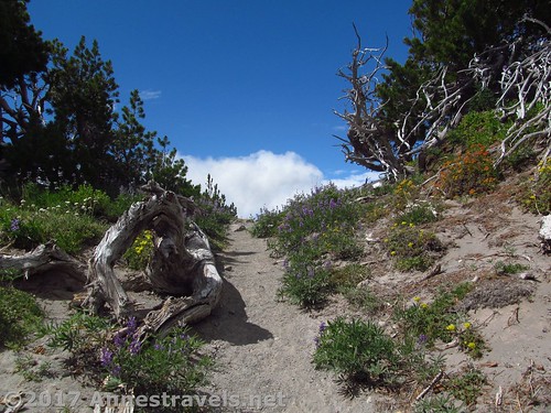
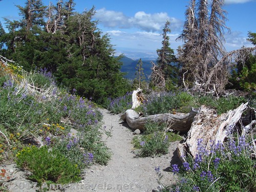
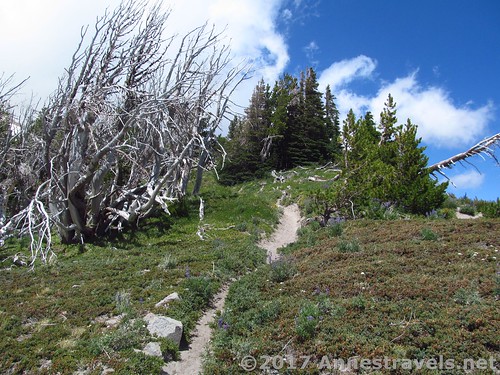
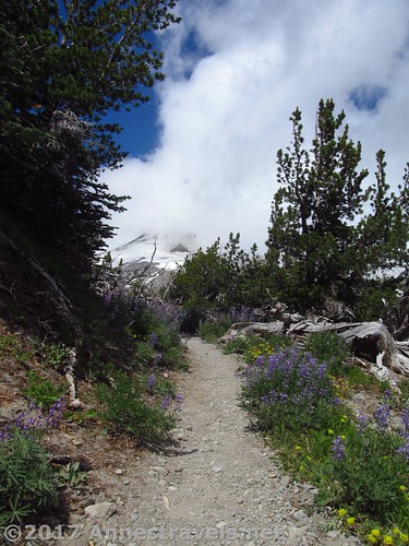
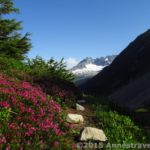
Part of the trail on Gnarl Ridge – there are stands of twisted trees with lovely wildflowers in the summer
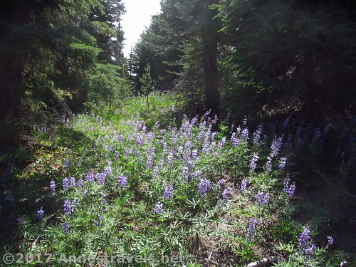
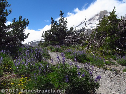
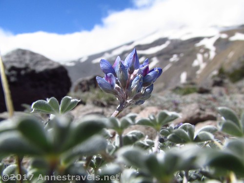
From the junction, the trail climbs quickly through the forest; 0.6 mile later, the trail will T into the Gnarl Ridge Trail. Turn right (uphill) to continue through forest and occasional meadows (not much in terms of view) on the extremely dusty trail. In summer, the lupines can be quite nice in this section.
Only 0.3 miles after turning onto the Gnarl Ridge Trail, the trail T’s into the Timberline Trail. You’ll want to turn right (uphill – notice how you’re always climbing?) to continue ascending through the forest.
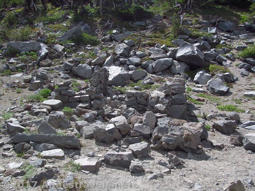
The next thing worthy of note is about 1.6 miles later – the ruins of a CCC warming hut. There are a number of these huts on Mt. Hood (I’ve seen two others intact; one below Cooper Spur and the other on McNeil Point), but this one apparently hasn’t stood the test of time (or vandals?)
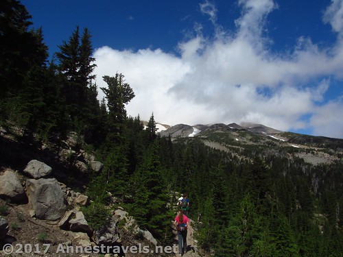
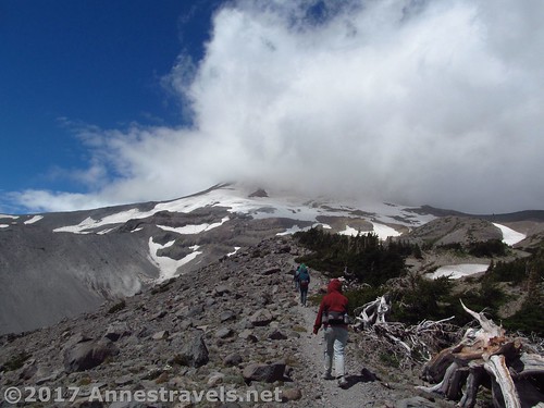
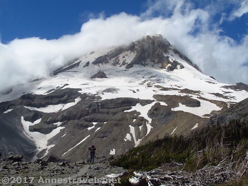
This is where things begin to get exciting in terms of views. Mt. Hood is beginning to show its head (or would have been for us, if the peak hadn’t been socked in), and 0.05 miles after the warming hut, the trail hits the ridgeline. Right ahead is Viewpoint #1, a great place to turn around for a 9.8 mile RT hike (11.0 if you take in Elk Meadows, too).
Now the views are pretty good from Viewpoint #1. You could walk back down with great memories of spectacular views. But if you really love views (like me!) or you really want to experience Gnarl Ridge, turn right to continue up the rib of the ridgeline. There is a trail (this is actually part of the Timberline Trail, one of the rare parts (in my experience) that actually has spectacular views of the mountain), so it’s not a difficult hike other than for the incessant climb.
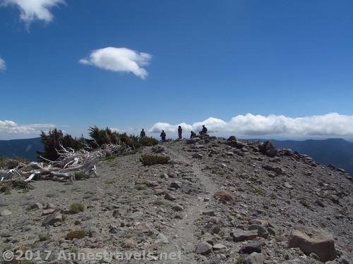
Viewpoint #2 is 0.1 miles up the ridgeline; Viewpoint #3 0.2 miles further and Viewpoint #4 0.2 miles beyond that. This is another great place to turn around, with a few boulders to sit on, etc. The view gets better with each viewpoint.
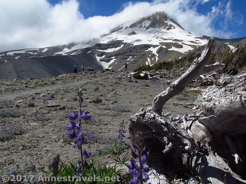
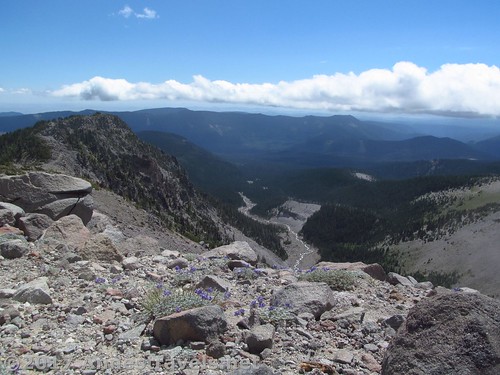
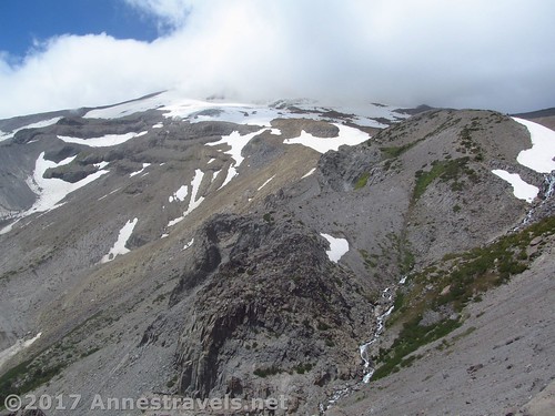
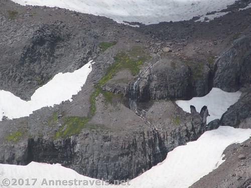
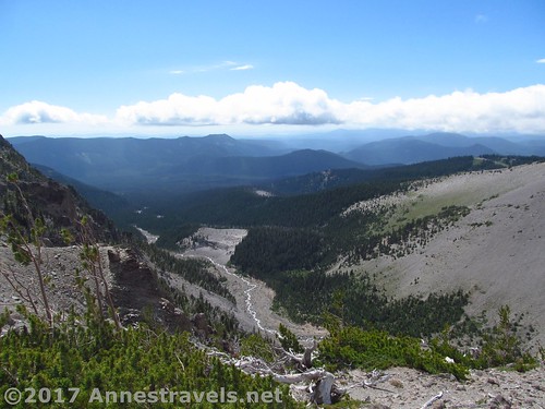
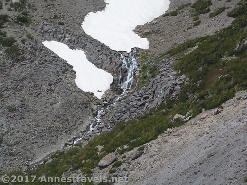
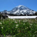
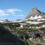
All this time, the trail goes through stands of twisted trees, around boulders, through wildflower displays, across gravel patches, and generally through absolutely stunning views of Mt. Hood. Below is the stark drainage of Newton Creek and the lower hills of the Cascades south of Mt. Hood. Also visible on the slopes of Mt. Hood are a few waterfalls – spectacular!
Probably my favorite viewpoint, though, was Viewpoint #5, 0.2 miles beyond Viewpoint #4. The trail becomes rougher and more exposed, finally topping out on the very edge of an outcrop. Below is the canyon, above is Mt. Hood in all its glaciated splendor, and not so far away is a really pretty waterfall. Gorgeous!
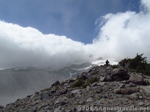
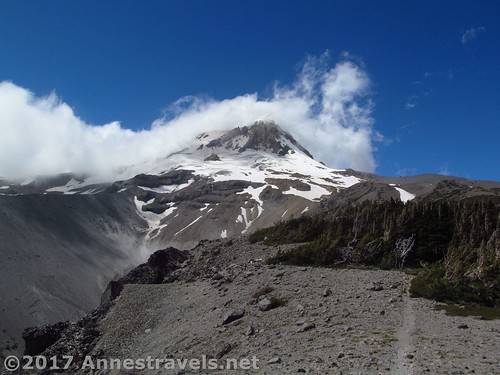
All this time, the clouds were swirling around Mt. Hood, more or less totally socking it in. We finally decided the clouds weren’t going away, so we hiked back down the ridge. The people in front then headed back down the Timberline Trail back toward the warming hut. However, those of us who are a little slower (maybe because we keep stopping to look at the view?) were in for a real treat. As we were about to turn back into the trees, we glanced back one last time at Mt. Hood and, lo and behold, the clouds parted, and there was the very peak of the big mountain. Wow!
Well, that slowed us down a bit! We stood there, snapping pictures, grinning from ear to ear, totally amazed at the splendor of the peak and the privilege of getting to see it on a day when we technically “shouldn’t” have had the chance!
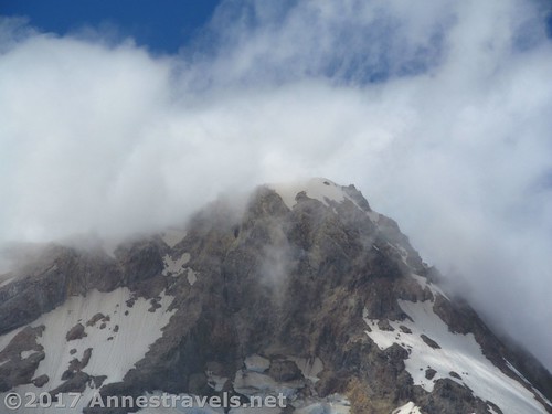
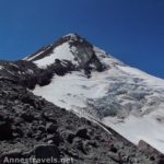
We could see the actual peak! (That’s probably the picture I was taking when the last picture was taken!)
In total, the hike was 12.5 miles for us (up through Elk Meadows, then down via the Gnarl Ridge Trail). Leaving out Elk Meadows would be closer to 11.3 miles RT. But as I said before, the view makes it totally worth it!
Round Trip Trail Length: 9.8 miles (up to Viewpoint #1 without the Elk Meadows Loop), 11.0 miles (up to Viewpoint #1 with the Elk Meadows Loop), 11.3 miles (up to Viewpoint #5 without the Elk Meadows Loop), or 12.5 miles (up to Viewpoint #5 with the Elk Meadows Loop)
Net Elevation Change: Up to 2,484ft. (4,434ft. at the parking area to 6,918ft. at Viewpoint #5)
Facilities: Primitive restroom at the parking area & a couple picnic tables. There are free-range camping opportunities slightly further up the road.
Fees: $5/day, waived with Northwest Forest Pass & Interagency (America the Beautiful) passes
Trail Notes: This is an incredible view; my personal favorite of Mt. Hood other than Cooper Spur (with Owl Point being close in there, too.) However, be prepared for crossing Newton Creek (no bridge, though you might find a downed tree or two) and for the relentless climb.
Trail 


Road 


Signs 


Scenery 


Would I go 100 miles out of my way for this? 


Overall Rating: 


Key GPS Coordinates
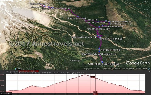
Gnarl Ridge Parking: 45.32223N / -121.63344W (45° 19′ 20.0274″ / -121° 38′ 0.3834″) (4,434ft.)
Trail beginning: 45.32237N / -121.63361W (45° 19′ 20.5314″ / -121° 38′ 0.9960″) (4,437ft.) (0.0; ended 12.5)
Elk Meadows / Umbrella Junction: 45.32740N / -121.63182W (45° 19′ 38.6394″ / -121° 37′ 54.5520″) (4,548ft.) (0.4)
Ski Trail Junction: 45.32875N / -121.63098W (45° 19′ 43.4994″ / -121° 37′ 51.5274″) (4,549ft.) (0.5)
Newton Trail Junction: 45.33496N / -121.62614W (45° 20′ 5.8560″ / -121° 37′ 34.1040″) (4,596ft.) (1.08)
Newton Creek crossing: 45.33666N / -121.62712W (45° 20′ 11.9760″ / -121° 37′ 37.6320″) (4,626ft.) (1.2)
Pick up trail after crossing: 45.33620N / -121.62597W (45° 20′ 10.3194″ / -121° 37′ 33.4914″) (4,609ft.) (1.4)
Elk Meadows / Gnarl Ridge Trail Junction: 45.34086N / -121.62318W (45° 20′ 27.0954″ / -121° 37′ 23.4480″) (5,267ft.) (2.4; return 10.32)
Elk Meadows Trail Junction: 45.34202N / -121.61996W (45° 20′ 31.2714″ / -121° 37′ 11.8560″) (5,174ft.) (2.6)
Elk Meadows / Gnarl Ridge / Polallie Campground: 45.34579N / -121.614267W (45°20’44.8500″ / -121°36’51.3600″) (5,039ft.) (3.4)
Elk Meadows / Gnarl Ridge Tie (???): 45.34554N / -121.61453W (45° 20′ 43.9434″ / -121° 36′ 52.3080″) (5,046ft.) (3.4)
Elk Meadows / Gnarl Ridge Trail Junction: 45.34610N / -121.62026W (45° 20′ 45.9594″ / -121° 37′ 12.9360″) (5,149ft.) (3.79)
Gnarl Ridge Trail Junction: 45.34915N / -121.62989W (45° 20′ 56.9400″ / -121° 37′ 47.6040″) (5,527ft.) (4.4; return 9.5)
Timberline Trail Junction: 45.35178N / -121.63322W (45° 21′ 6.4074″ / -121° 37′ 59.5914″) (5,647ft.) (4.7; return 9.29)
Ruins of CCC Warming Hut: 45.36126N / -121.64909W (45° 21′ 40.5360″ / -121° 38′ 56.7240″) (6,567ft.) (6.3; return 7.85)
Viewpoint #1: 45.36137N / -121.65016W (45° 21′ 40.9320″ / -121° 39′ 0.5754″) (6,526ft.) (7.8 on return)
Viewpoint #2: 45.36186N / -121.65156W (45° 21′ 42.6960″ / -121° 39′ 5.6160″) (6,542ft.) (7.7 on return)
Viewpoint #3: 45.36223N / -121.65244W (45° 21′ 44.0274″ / -121° 39′ 8.7834″) (6,602ft.) (6.6; left 6.69; return 7.63)
Viewpoint #4: 45.36324N / -121.65520W (45° 21′ 47.6634″ / -121° 39′ 18.7194″) (6,716ft.) (6.8; return 7.4)
Viewpoint #5 (turn around): 45.36550N / -121.65840W (45° 21′ 55.7994″ / -121° 39′ 30.2400″) (6,918ft.) (7.1)
The gpx file for Elk Meadows and Gnarl Ridge can be downloaded – please note that this and the GPS Coordinates are for reference only and should not be used as a sole resource when hiking this trail.
Download GPX File size: 295.3 KB Downloaded 194 times
(Note: I do my best to ensure that all downloads, the webpage, etc. are virus-free and accurate; however, I cannot be held responsible for any damage that might result, including but not limited to loss of data, damages to hardware, harm to users, from use of files, information, etc. from this website. Thanks!)
Getting to the Elk Meadows Trailhead for Gnarl Ridge
From Hood River, head south on OR-35S for about 30 miles. Turn right; there should be a sign pointing toward the Elk Meadows Trailhead just before the road. You’ll want to make a quick left after turning, as veering right will quickly end you up in the parking area of a ski lodge (or something like that). Anyway, keep driving 0.3 miles to the trailhead, on right.
Alternatively, from Government Camp, head east on US-26E for about 2 miles, then take the exit for OR-35N toward Hood River. Continue on OR-35N 7.5 miles. Turn left; there should be a sign pointing toward the Elk Meadows Trailhead just before the road. You’ll want to make a quick left after turning, as veering right will quickly end you up in the parking area of a ski lodge (or something like that). Anyway, keep driving 0.3 miles to the trailhead, on right.
Zoom map out to browse nearby hikes & places of interest
This Week’s Featured Product!
Looking for more hiking options on the Timberline Trail and other scenic hikes on Mt. Hood? Check out this book!


What a wonderful hike! The photos are amazing and it looks like there are, indeed, some spectacular views! My daughter lives in Portland and hikes all the time. I’ve sent her some of your posts on a few occasions. Your hikes are so fabulous 🙂
Looking forward to ready more of them!
I hope someday you can hike these too Ashley – they are amazing!
Pingback: Sneak Peak: A Land of Volcanos and Oceans - Anne's Travels