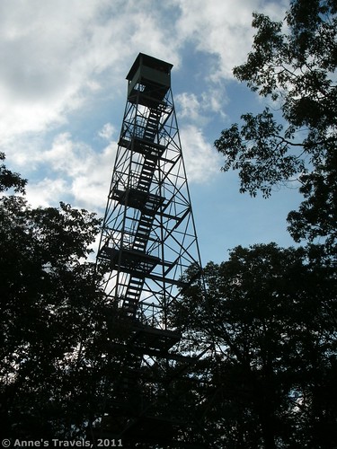
While visiting the Headwaters of the Mississippi River, a park ranger told us about another of the park’s features: a 100-foot observation tower, located in the middle of Itasca State Park. Having an hour or two to spare, we decided to check it out. I’m so glad we did. The view from the top was beautiful in the early evening light, and the “hike” up to the tower wasn’t too hard. Just the climb to the top of the tower was enough to give the faint-of-heart the shakes, but I loved it, and every member of my group made it to the top, even those who don’t particularly care for heights. The tower is so tall, though, that the people left at the bottom look like little ants. (OK, not that small, but it really gives some perspective!) You can even see the Headwaters of the Mississippi River from up there, although not as well as I’d hoped.
To get to the Observation Tower, from the town of St. Cloud, take US-10 North for approximately 33 miles (mileage will depend on where in St. Cloud you start). Then keep left onto the exit ramp, and drive an additional 55 miles on US-10. In the town of Wadena, turn right onto US-71 and head north. After 55 miles, turn Left onto SR-200 and drive 6.5 miles. You will pass the south and east entrances to Itasca State Park. Turn left into the north entrance, and follow the signs to the Mississippi Headwaters and Wilderness Drive. You will need to turn right at the T, then go past the parking area for the Mississippi Headwaters. Keep driving, and then take a left onto the Wilderness Drive. This is a one-way road for most of its length, so you’ll have to drive most of the way around it to get to the Observation Tower. You will know you are getting close when you see a sign for Elk Lake. The parking area is still a short ways beyond this, beyond the parking area for the DeSoto Trail. A short dirt/gravel access road will bring you up to the parking area. A primitive restroom is located at the far end of the parking area.
Walk over to the gate and head up what looks like an old road. It’s 0.3 mile from here up to the tower, and it’s all uphill. Thankfully, the trail is shaded, so it’s not as hot as it might be if it was sunny and there were no trees. Still, it’s all uphill, and somewhat steep at times. Actually, it’s not so steep as it is relentless: it’s all uphill. However, the trail isn’t so long that it really gets grueling. About half way up, you will come to a trail junction. Follow the signs for the Tower. A map of Itasca State Park can be found at http://files.dnr.state.mn.us/maps/state_parks/spk00181_summer.pdf
- Center of map
- map
- GPS Coordinates of Fire Tower (47°11’9″ N, 95°11’18″ W)
GPS Coordinates of Fire Tower (47°11’9″ N, 95°11’18” W)
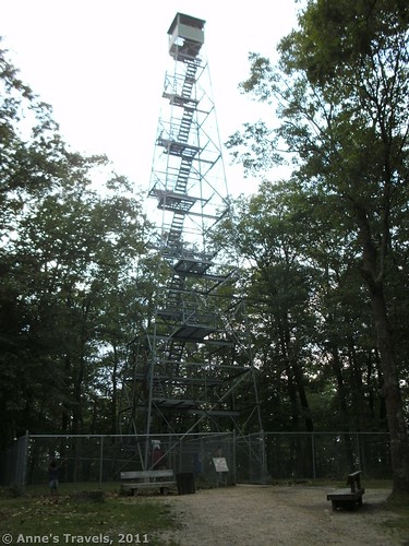
Eventually, you will come out into a clearing, and the tower will be directly in front of you. As you are climbing the hill, the first thing you can see about it is the chain-link fence that encloses the tower. This is closed during the winter and during storms for safety reasons. So, don’t be scared off by the fact that the fence is there—it could very well be open! An interpretive sign talks about watchtowers and what they were used for. This can be helpful, as you may have to wait a while to get up in the tower: only 6 people are allowed at a time, so there can be quite a line at times.
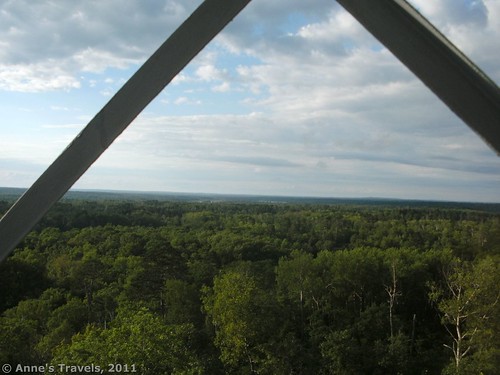
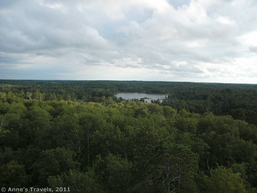
Once you start climbing, the real fun begins. The stairway goes higher and higher, leaving the ground very far behind. It’s especially bad after you’ve gone about ¾ of the way up. One member of my group almost freaked out at this point, but his older brother managed to convince him that it was all right, and he really enjoyed himself at the top. At the top, you can see in all four directions, forests everywhere, and numerous small lakes and ponds, many with islands. You can even see the Headwaters of the Mississippi, but, unfortunately, it’s far enough away that you can see where it should is, not so much the headwaters themselves. Signs on the roof of the tower tell you what you are seeing.
Return by the way you came. It’s a nice little hike, but do be aware that by the time we were hiking down in the middle of the evening, the mosquitos were getting pretty bad. They weren’t bad earlier, though, so you’d probably be ok earlier in the day.
Round Trip Trail Length: 0.6 miles
Facilities: Primitive restrooms at the parking area, campground, ranger station, etc. nearby
Fees: $5 daily fee to enter Itasca State Park
Trail 


Road 


Signs 


Scenery 


Would I go 100 miles out of my way for this? 


Overall Rating: 


This Week’s Featured Product!
For even more hiking adventures, check out this book with 40 different hikes in Minnesota. Lakes, waterfalls, and viewpoints all feature in this guide.




Pretty fantastic article. My partner and i only just stumbled upon your blog site and also preferred to say that we have seriously enjoyed reading your blog blogposts. In any case I’ll become subscribing in your posts and also I hope an individual write-up yet again soon.
Excellent info once again. Thumbs up=)
whoah this blog is fantastic i love reading your posts. Keep up the good work! You know, lots of people are looking around for this information, you can aid them greatly.
Your answer was just what I ndeeed. It’s made my day!
Pingback: 11 Amazing Trails of the West that are 1 Mile (or Less) in Length