I’ve been to Craters of the Moon National Monument several times, and it’s got to be one of the best volcanic areas in the US. For miles, it seems, there is nothing but cinder cones and lava fields. And the park even lets you experience these volcanic remains along several trails and walking through lava tubes. However, one thing that struck me about the park is that it didn’t seem to have any craters. How can you have a park named Craters of the Moon that doesn’t have any craters? At last, on my most recent visit to the monument, I found that the park actually does have craters: many of them! You just have to get off of the scenic drive, and out onto the trails of the park. The craters I found that give the park its name are along the North Crater Trail in the main section of the park.
There are actually two different places that you could park to do this hike. The first is the North Crater Flow parking area just south (toward the loop) of the visitor center and the Lava Flow Campground. If you’re doing this trail in the afternoon (which I don’t recommend because of the exposed nature of the trail), this is a good place to start. However, if you’re starting in the morning—especially the early morning—drive around the loop and park in the parking area for the spatter cones. Either way, the trail is 1.8 miles one way, or 3.6 miles round trip. Because there are parking areas on both ends of the trail, leaving a shuttle vehicle at one end is an option.
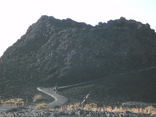
We started out very early one morning in August. Both parking areas were closed for paving that day, so we parked in the Inferno Cone parking area, and then walked down the road a few hundred feet to the splatter cones. (To see what I’m talking about, view the map at http://www.nps.gov/crmo/planyourvisit/loader.cfm?csModule=security/getfile&pageid=395621.) We walked the short, wheelchair accessible trail to the splatter cones (mounds of lava that were created when small volcanos shot “blobs” of lava up into the air and the “blobs” fell back down around the small volcano and hardened). The air was cool, but we knew that it would get a lot hotter as the day went on. I highly recommend starting your hike this early (before 6:00am). Not only is it cool, but you miss the crowds, and the sun is less direct that it will be later in the day, so you can get better pictures.
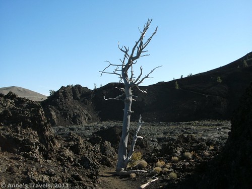
The trail is paved at first, although I wouldn’t recommend taking a wheelchair on it. The pavement is fairly uneven (it looks like they’ve put down asphalt right on top of the lava), and the trail goes up and down some short, but steep, hills that I wouldn’t want to have to drive a wheelchair up or down! After the first ½ mile or so, the pavement ends, and the trail becomes dirt or cinders. Signs mark the beginning of the trail. Eventually, you will be following cairns around some craters and across a lava field, but for the most part the trail is fairly easy to follow. There are a few social trails, but these are fairly easily recognized. You don’t want to descend into a crater until you do so almost at the end of the trail by switchbacking past some dead trees.
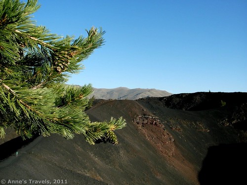
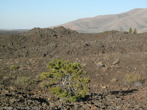
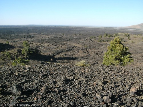
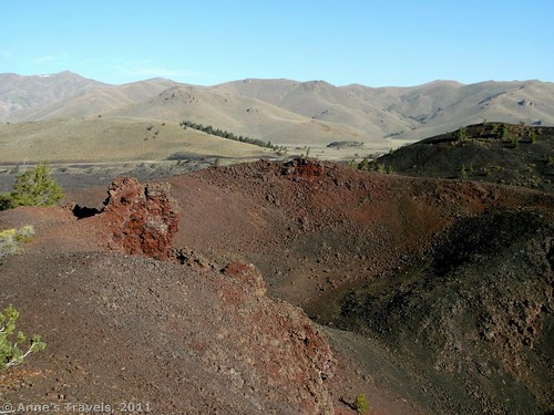
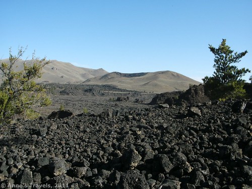
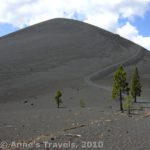
At any rate, the trail starts out winding its way through a lava field. My guess is that this lava was shot quite a distance, either from the craters you’ll see later, or by the splatter cones. The lava itself is “aa” and is in fairly large chunks (6-12 inches in diameter). After you’ve walked for a little ways, the trail will begin to skirt several large craters. This is how “craters of the moon” got is name, and now I’ve finally seen why! This was my favorite part of the hike: the huge black craters full of cinders with the desolate Idaho landscape so close by, over the lava fields beyond the highway. That is a con of this area: you can see the highway. Still, the views are very nice by Idaho standards, and I highly recommend that you at least hike this far along the trail. Also, keep your eyes open for large rocks in this area. They are actually quite light, and some of the members of my group were showing us how they could easily lift such large rocks with one hand!
Even if you’re not up to the whole hike, I highly recommend that you go this far before turning around. However, if you’re up to more, some interesting sites await those who go farther. Eventually the trail will suddenly descend downward over white rock in switchbacks through some dead trees. After you get to the bottom, you will actually be in the crater of the North Crater Flow. This is a very interesting area, with rocks everywhere and some cool little rock formations made out of the lava. We discovered a little cave made out of lava and had fun climbing in and out of it. The trail is very difficult to find in this area, and the ground is rough, so watch your footing. Head out towards the cliff on the opposite side of the crater. There are cairns marking the way, especially on the steep trail up the other side. It’s not too hard to find, once you’re on the other side.
Walk up the trail up the side of the cliff. From the top of here there is also a very nice view of the North Crater Flow, as well as the desolate Idaho scenery you saw earlier. From here, the trail descends slowly to the North Crater Flow parking area. There are more nice views along the way.
From here, you have a choice to make. Do you want to return the way you came, or do you want to walk up the road back to your vehicle? We chose the second option, but the choice is really up to you. There is no sidewalk along the road, so if you have children this may not be the best option. By this point it was only 8 or so in the morning, so there wasn’t much traffic. Later in the day if there is a substantial amount of traffic, this is probably not a good idea. I’m guessing the road is slightly shorter than walking back on the trail. You could also have left a shuttle car in this parking area and then parked at the splatter cones.
So if you’re looking for an awesome volcanic trail that actually gets you out of sight of the park road…and you want to see the craters that give Craters of the Moon its name…check out this nice little trail, and you won’t be disappointed.
Round Trip Trail Length: 1.8 miles if you have a shuttle car, 3.6 miles otherwise.
Facilities: None in the parking area for the splatter cones or for the North Crater Flow. Restrooms are located at other parking areas on the loop and at the visitor center.
Fees: $8 per vehicle. Interagency, Senior (Golden Age), Access (Golden Access), and Volunteer passes also accepted.
Trail 


Road 


Signs 


Scenery 


Would I go 100 miles out of my way for this? 


Overall Rating: 


This Week’s Featured Product!
With over 100 trails, this is a great resource for hiking in Idaho. It covers both the plains and mountains of the state.




This post is very usefull thx!
It’s really a nice and useful piece of information. I’m glad that you shared this useful info with us. Please keep us informed like this. Thank you for sharing.
Good blog! I really love how it is easy on my eyes it is. I’m wondering how I might be notified whenever a new post has been made. I’ve subscribed to your feed which may do the trick? Have a great day!
Hi Rueben,
Yes, subscribing to the RSS feed should work. I know several people who use Google reader and the posts appear each week just fine.
Anne