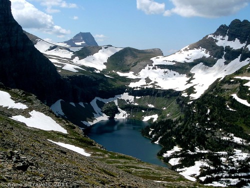
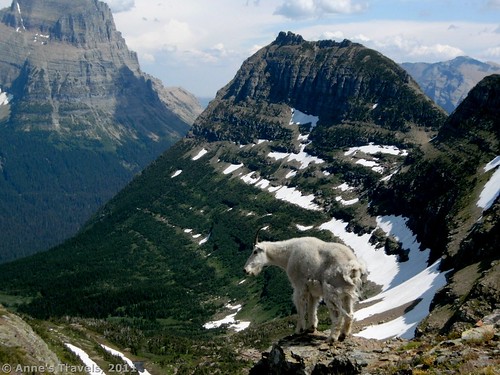
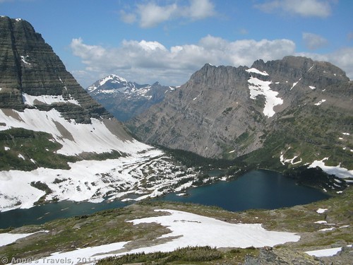
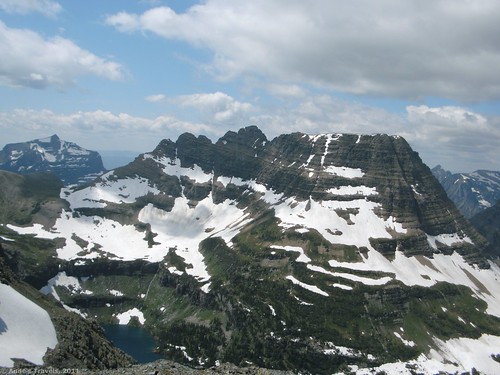
One of the things I’ve realized about Glacier National Park is that they don’t tell you about all of the trails that are out there. You look at the literature they give you, and there’s a lot of hiking, mostly to lakes. However, the scope of hiking in the park goes far beyond what’s in the literature. It seemed like everywhere I went, I found trails that existed, and that the park people knew about, but that wasn’t included in the park literature. The best of these that I experienced was definitely Reynolds Mountain, near Logan Pass. The views while climbing up are exquisite: much nicer than I could ever describe. Hidden Lake is right below you, studded with lovely cascades trickling down into the lake (at least early on in the season!). Combine this with wall-like mountains that remind me of the Andes, Himalayas, Rocky Mountains, Teton Range, and Cascade Range all in one, and you have a hike that you won’t likely forget quickly. And it’s only about 7 miles RT!
The trail for Reynolds Mountain begins off of the Hidden Lake Trail in Logan Pass. So, to get to the trail, you’ll have to park in the Logan Pass Visitor Center parking lot, or take the free shuttle up to the pass. The parking area fills up quickly, by noon the days we were there in mid-August, but the shuttle is inadequate for the number of visitors, so it’s best to get an early start. We pulled in between 9 and 10am, and there were still plenty of parking spots on Thursday. I don’t know what it would be like on the weekend, but it would likely be much more crowded.
The trail itself begins behind the visitor center. There are no signs, so just go up the steps or ramp and take the paved trail that heads directly away from the visitor center and parking lot. This is the way most people go, so follow the crowd if nothing else. You will very quickly (immediately) come out into a meadow. This is the trail to Hidden Lake.
When we were there is August, there had been a big snowfall late in the spring, and it had been an unusually cold and wet summer. This had led to much more snow on the trails than would normally have been around in mid-August. Take this into consideration as I describe the trail conditions.
Not far up the meadow, the trail begins to climb along a boardwalk. This boardwalk will take you most of the way to Hidden Lake. However, when we were there most of the trail and boardwalk was covered with snow, so we were skidding up and down snowbanks more than walking on the boardwalk. It’s perfectly doable, although you should be sure-footed to try it. Enough people have walked the trail that it’s not hard to follow.
Follow the Hidden Lake Trail for about a mile. It’s only a mile and a half to the overlook of Hidden Lake, so if you want to you can do that and then come back to the trail junction. However, if you’re unsure, take my advice and just do the Reynolds Mountain trail. The views are by far better. I did take the trail to the Hidden Lake Overlook, and it’s nice, but it is crowded. And, as I said above, the views of the lake are better from the Reynolds Mountain trail.
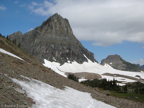
Unfortunately, there is no sign marking the Reynolds Mountain Trail (or Route, as the park people call it). The trail just branches off on the left side of the trail as you’re walking towards Hidden Lake and then heads off towards a clump of evergreen trees. You’ll just have to keep an eye out for it. I missed it completely on our way to Hidden Lake, but saw it when we were coming back (I was looking for it then, too!). When we were there, you could see about 20 feet of trail before it disappeared into a snowbank. Thankfully, plenty of people had taken the trail before us, so there was a nice trail of footprints over the snow. We followed these up through the grove of pine trees towards the towering wall of rock ahead of us.
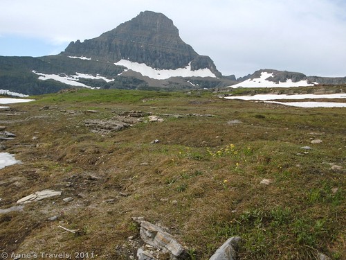
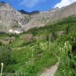
When we were there, the trail up to the saddle was probably 80% covered with snow. However, in many places we could skirt the snow, which was much easier (especially in the afternoon after the sun had been melting the snow into slush) than trying to cross the slippery, snowy trail. Where there wasn’t snow, or where the snow couldn’t be avoided, we walked on the trail or the footprints that marked where the trail would have been had there not been so much snow. Keep following the trail for another 2 miles or a little less as it makes its way up to a saddle between two huge mountains (the mountain right in front of you (on the left side of the pass) is Reynolds Mountain; I’m not sure of the name of the mountain you’re walking along the side of). As you walk, take time to look out over the amazing view back towards Logan Pass and down the valley towards St. Mary’s Lake. Outstanding! Incredible! Spectacular! How many different ways can I describe it?!? It’s sooo beautiful!
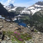
However, the really beautiful part comes when you reach the saddle. From here, you can see down onto Hidden Lake. Snowcapped mountains rim the lake, and little cascades tumble down into the water. Meanwhile, the water shimmers, and blue sky above makes you feel like you are on the top of the world. I can’t really describe it; it’s just too pretty for words.
After you’ve gaped at the view for a while, turn left and keep walking along the edge of Reynolds Mountain. The views continue to be spectacular the entire way. In this section, I ran across one more patch of snow; but that was the end of the snow until it was time to go back. Eventually (maybe ½ mile later; probably a little less than that) you will come to a split in the trail. You probably have already passed a few trails leading straight up towards the peak. However, here one of these trails leads down towards a saddle, while the other goes around to the back side of the mountain. If you want to climb Dragon Back, go down towards the saddle (in other words, turn right), and then climb up the ridge on the other side. This looks very impossible from above, but from the saddle it doesn’t look so bad. I’ve never tried it, but would like to next time 🙂 I hear there are some great views of Hidden Lake from the top!
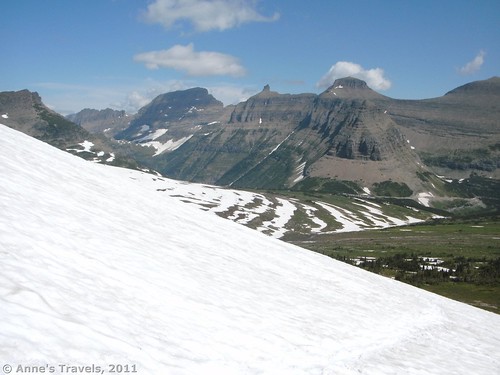
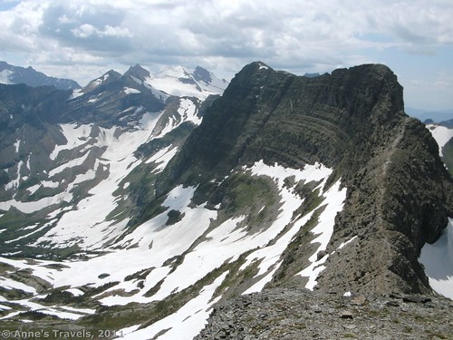
However, if you don’t want to climb Dragon Back, keep walking on the high trail (go left). This trail will take you to the back side of Reynolds Mountain, with outstanding views of Dragon Back and the valley next to it. To me, Dragon Back from this side reminds me of towering Andean walls, like those around Machu Pichu in South America. Another peak in the distance reminded another member of my group of pictures he’s seen of Mt. Everest. The other mountains are reminiscent of those I’ve seen in the Cascades in Washington State, the Teton Range in Wyoming, and, of course, the Rocky Mountains (that’s where we are, after all!).
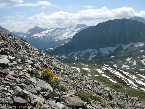
If you’re interested in actually climbing the mountain, from the back side you can scramble up at least part way. We went up a side canyon, scrambling over slippery scree and rocks, and finally got up to a shelf where we got an outstanding, amazing, awe-inspiring view of everything we’d seen earlier on the hike, only higher up. It’s well worth it if you can figure out how to get up there, but if you’re not sure on your feet, don’t try it. If you’re not sure on your feet, or you just want a longer hike, from the back side of the mountain you can also keep walking east along the back side of Reynolds Mountain. I don’t know how far this goes, but it looks like a long ways. Return by the way you came.
So, 7 miles may be a little short or long depending on how far you go. This is a great hike because you can go farther or shorter depending on what you want to do. Oh, and it’s much less crowded than the Hidden Lake Trail…you’ll have to battle the crowds up to the trail junction, but then you’ll probably have the trail to yourself. We saw a few other groups on a Thursday in mid-August, but it was empty compared to other parts of the park.
Round Trip Trail Length: About 7 miles
Facilities: Restrooms, trail information, etc. at the parking lot/visitor center. Note that when we were there the only restrooms were a row of portable toilets.
Fees: $25 pass to enter Glacier National Park, good 7 days.
Trail 


Road 


Signs 


Scenery 


Would I go 100 miles out of my way for this? 


Overall Rating: 


This Week’s Featured Product!
Explore more than 60 hikes in the Absaroka-Beartooth Wilderness. The area is beautiful and well worth the time to visit.

Regards for this post, I am glad I noticed this website on yahoo.
Sup , I am making a site almost like wikipedia and your articles would fit the context good. Would you care if I link back to this article?
Do you mind if I quote your writing in my Thesis paper? I would think this article suits my topic perfectly. Well ya, thanks for posting this article.
Henriette,
Feel free to quote the site on your Thesis Paper, with proper citations. Thanks!
Anne
Tien,
Yes, feel free to link back to the article.
Anne
Anne, we were in GNP this past summer and hiked up to the Hidden Lake overlook, but the trail beyond the overlook was closed due to bear activity….sorry we missed Reynolds Mountain, sounds spectacular! One hike we did that was off the beaten path was Firebrand Pass: http://www.hikinginglacier.com/firebrand-pass.htm. Although it is a ranger led hike, there were only 5 of us on the hike, including the ranger. It starts outside the park on Highway 2 about 6 miles south of East Glacier. We only passed a few other hikers during the entire day – so a great secluded hike. One of my favorites!
Hi Kathy,
Thank you for suggesting the hike–it looks awesome!
Anne
woh I am pleased to find this website through google.
Pingback: Anne's Travels » Views at Logan Pass of Hidden Lake
Anne, I posted a couple days ago about going to Big Bend this month. I see you have been all over the place, I am jealous 😉 so glad I found your site, was researching Tetons, YNP and GNP, fingers crossed that my family and I get to go later this summer. Now I can put on some great music read your blog see your wonderful photos and know what to expect and make informed decisions. Thanks Jeff
So glad you like to blog! It’s been about 20 years in the making, lol, although I’ve only been blogging for about 5 years 🙂
Anne
Pingback: Celebrating 20 Years of Family Vacation - Anne's Travels
Pingback: Alternate Views of Famous American Wilderness Areas
Pingback: The Mountain Peaks Belong to Him - Anne's Travels