On our way home from hiking Indian Pass and Santanoni Peak in Adirondack Park last fall, we saw a sign near Long Lake pointing toward Buttermilk Falls. Several of us remembered it from an earlier visit with friends about 20 years ago, so it seemed like a good place to stop and see the fall colors. As it turned out, the colors weren’t showing too much yet, but it’s still a great waterfall and well worth the stop if you happen to be in the area!
Quick Stats
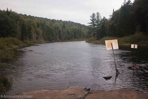
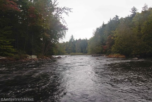
The trail leads down from the unassuming parking area (it is marked, though not super-well). If you go generally left, you’ll end up at the landing for portaging canoes and other watercraft around the falls. It’s so peaceful not that far upstream from the waterfall!
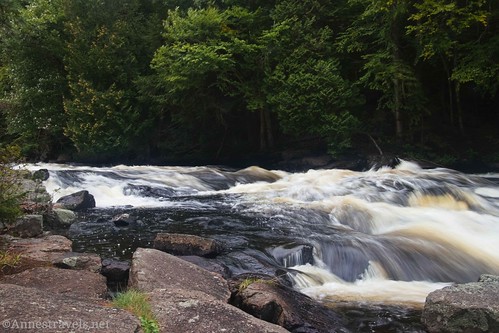
Turn downstream and follow one of the many paths down along the Raquette River/through the forest. Along the way, you’ll probably see the lip of the falls, as well as small cascades just above the main drop.
Closer to the bottom of the waterfall, you may see picnic tables. This is a “picnic area,” and it’s apparently fairly well-used. It certainly would be a nice spot for a picnic. We thought about eating lunch here, but it began to rain about the time we were considering this option. So we moved on to the picnic area at the Fourth Lake Campground. (Fun fact: If you’re camping in one of the state park campgrounds, your reservation gets you into state park fee areas for free, even on the day that you check out of your campground.)

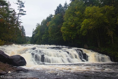
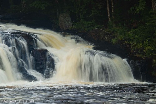
Once below Buttermilk Falls, you get a much better view of the waterfall, itself. I hear it can get fairly low in the summer, but we’d had a rainy fall so there was quite a bit of water. It’s actually multiple smaller falls over multiple drops. It’s quite impressive, even in the fall, and I expect it would be even more impressive during spring snowmelt.
Below the falls, the river goes back to being pretty placid.
We walked out on rocks into the middle of the river for better views. I’ve heard of people wading in the area and also swimming (not in the falls, which are very dangerous). I don’t personally recommend it. When we visited with our friends, he caught a huge snapping turtle that was not very happy. Who knows; it or its offspring might still be in the area!
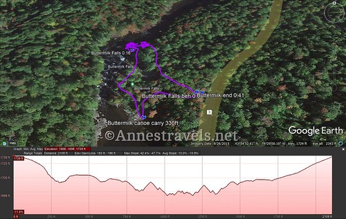
About the time we were ready to leave, the sky started to sprinkle on us. All the more reason to keep moving toward home! Take one of the trails back toward the parking area; if you do it right, you can make the entire hike into a sort of loop, which is what I did – more by accident than by trying, but it all works!
Round Trip Trail Length: I went a total of 0.4 miles, but I explored quite a bit. It’s probably not more than a quarter mile RT if you just go to the lower views of the falls and back to the parking area.
Elevation gain: 186ft. (1,739ft. to 1,668ft.)
Facilities: None
Fees: None
Trail Notes: The area is fairly heavily traveled, so chances are the trails are pretty worn. Watch your step. I saw people wearing flip-flops, but I would want something with more support. Swimmers and anglers both enjoy the water downstream of the falls (no swimming in the falls, themselves). I’ve heard that the ice formations on the falls are fantastic in the winter if you can handle the slippery trails.
Trail 


Road 


Signs 


Scenery 


Would I go 100 miles out of my way for this? 


Overall Rating: 


GPS Coordinates for Buttermilk Falls
Trailhead: 43.914286,-74.483038 (43°54.85716′, -074°28.98228′ / 43°54’51.4296″, -074°28’58.9368″) (1,699ft.) (0.0)
Canoe Portage Trail: 43.914124,-74.483678 (43°54.84744′, -074°29.02068′ / 43°54’50.8464″, -074°29’01.2408″) (1,677ft.) (330ft.)
Buttermilk Falls: 43.915056,-74.483943 (43°54.90336′, -074°29.03658′ / 43°54’54.2016″, -074°29’02.1948″) (1,648ft.) (0.16)
End: 43.914300,-74.483095 (43°54.85800′, -074°28.98570′ / 43°54’51.4800″, -074°28’59.1420″) (1,698ft.) (0.41)
The gpx file for Buttermilk Falls can be downloaded – please note that this and the GPS Coordinates are for reference only and should not be used as a sole resource when hiking this trail.
Download GPX File size: 15.1 KB Downloaded 107 times
(Note: I do my best to ensure that all downloads, the webpage, etc. are virus-free and accurate; however, I cannot be held responsible for any damage that might result, including but not limited to loss of data, damages to hardware, harm to users, from use of files, information, etc. from this website. Thanks!)
Getting to Buttermilk Falls
From the town of Long Lake, drive east on NY-28N/NY-30 South. After about 3.0 miles, you’ll want to turn right onto North Point Road, which should be signed for Buttermilk Falls. Drive about 2.1 miles to a small parking area/gravel pulloff on the right.
If you’re coming from the south, the turnoff onto North Point Road is about 9.5 miles north of Blue Mountain Lake.
This Week’s Featured Product!
Have fun and see beautiful waterfalls with this guide to fifty falls in Adirondack Park! From short strolls to longer hikes, there’s a wide variety of falls… and if you take selfies with the falls, you can earn a couple of different patches. How fun is that? Buy your copy here.


