In my perusals of unofficial routes in Death Valley, I ran across three hikes that seemed fascinating (to me, anyway!) in Panamint Valley: Panamint Dunes (which is actually an official route, though its trail is pretty much invisible in many places), the War Eagle Mine (which has a road to it, but you’d want serious 4×4 for that), and Lake Hill (which is so unofficial that there isn’t even a parking lot for it). I enjoyed all three immensely on my trip to Death Valley last fall, but today I’d like to talk about Lake Hill (also colloquially known as the Chocolate Drops). While trailless, it’s not hard to tell where to go, and it’s a fairly easy scramble to great views of the Panamint Valley playa and the surrounding mountains.
Quick Stats
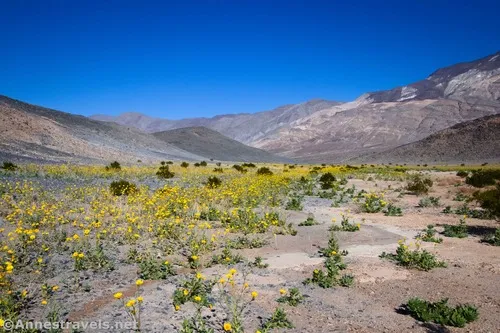
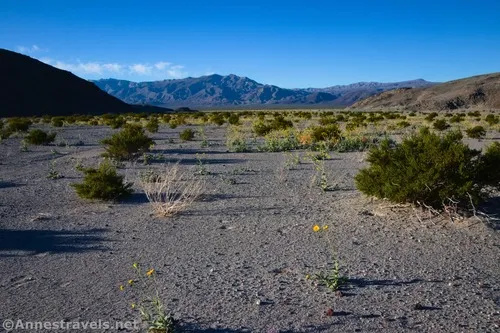
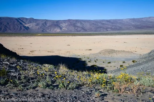
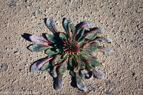
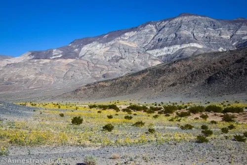
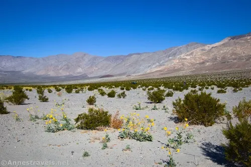
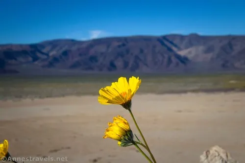
The desert was blooming profusely when I visited due to an unprecedented amount of rain in the late summer and fall. (It’s not uncommon for the area to receive not a drop of rain between May or June and November, so this bloom was definitely not expected.) We loved all of the wildflowers!
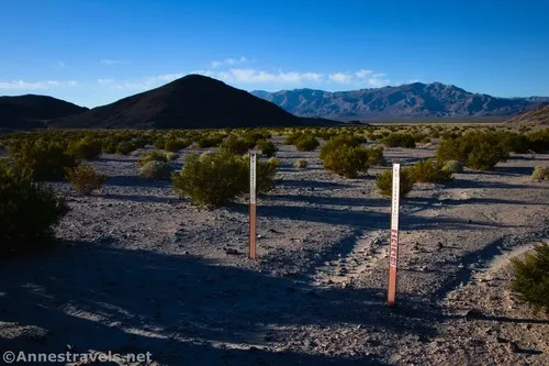
We parked next to the signs marked “Wilderness” just north of Lake Hill (the one hill on the left as you’re driving north (with your back to the paved road) on the Lake Hill Road). There is also a tiny campsite on the right a short distance before this – it’s a better place to park (and definitely more official), but someone was drinking his morning coffee there, so we pulled over in the wide spot in the road next to the signs. You could probably fit two cars here. Be careful to park out of the way of traffic, stay on the road, and not crush the desert.
After parking, we headed pretty much straight south toward Lake Hill. There is an old road to follow for a bit; whatever you do, make sure that you aren’t trampling desert flora and that you’re leaving no trace as much as possible. Footprints can last a long time out here.
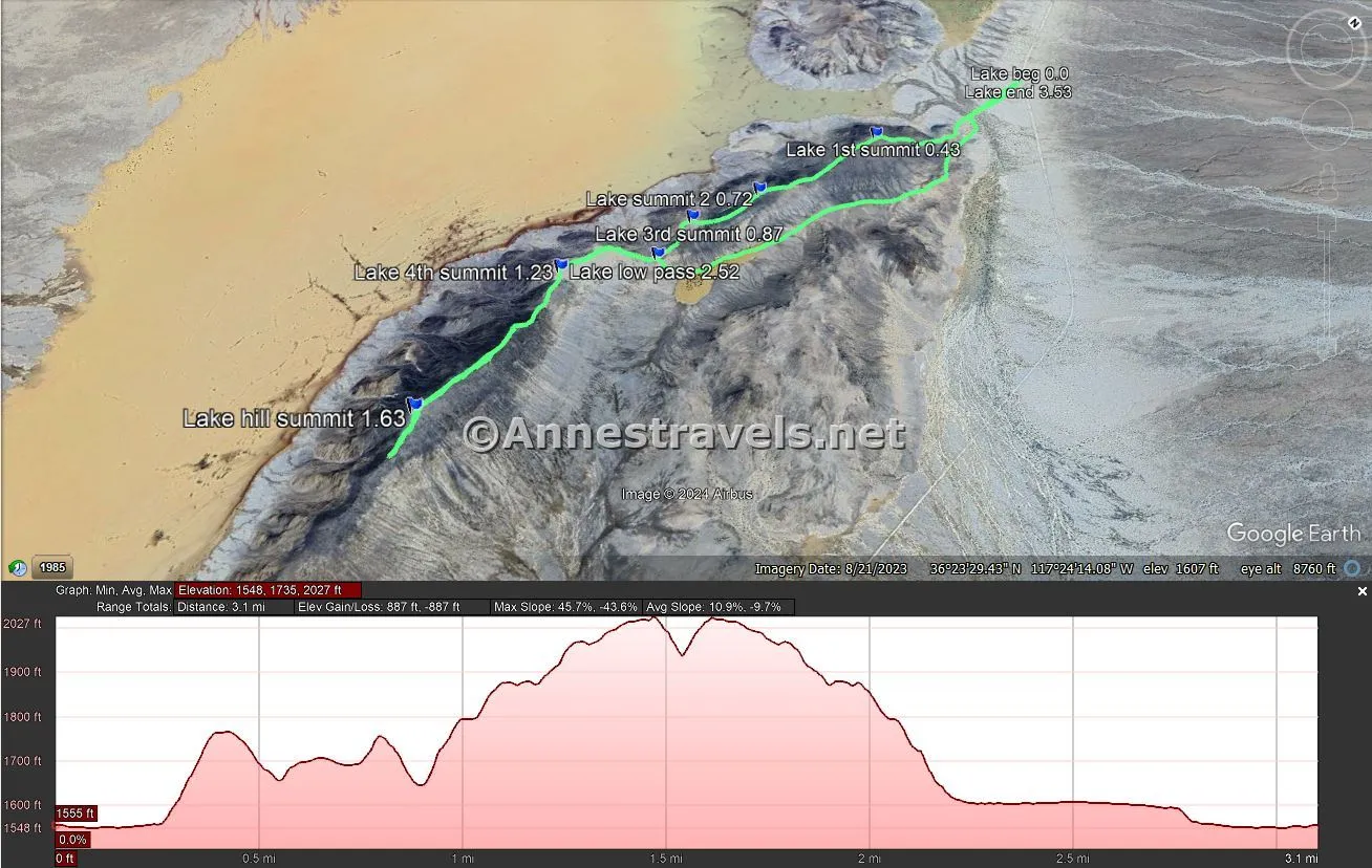
There are two ways to climb Lake Hill. The first (which is the way we returned) is to head left up the valley along the east side of Lake Hill. Below after the third summit, climb up to the pass (marked “Low Pass” on the map and GPS coordinates) and then turn left up the ridgeline to the top of Lake Hill (the highest point on the hill). This is a scrabbly, sandy scramble that is not fun at all; the tread improves once you reach the saddle.
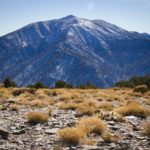
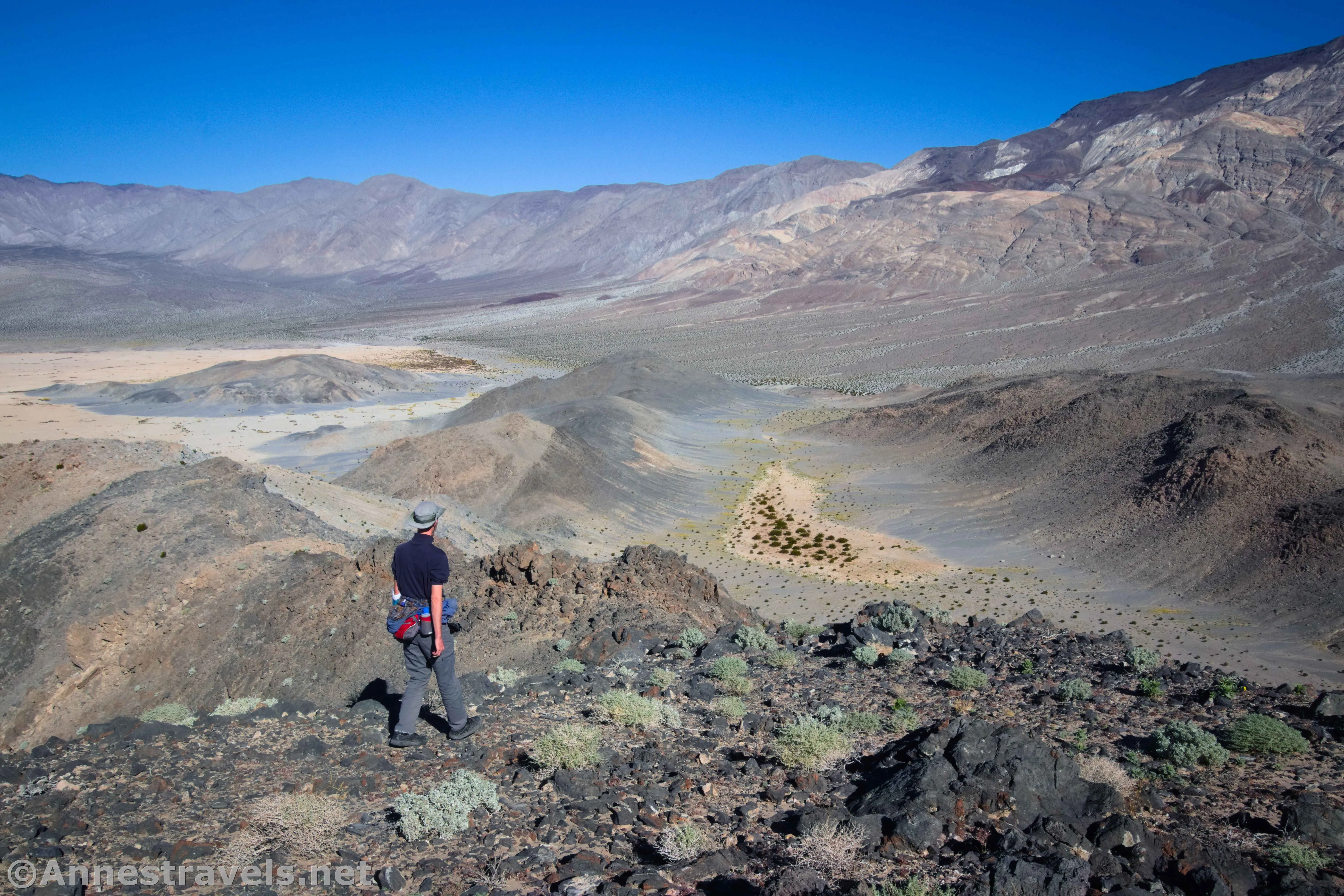
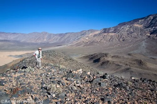
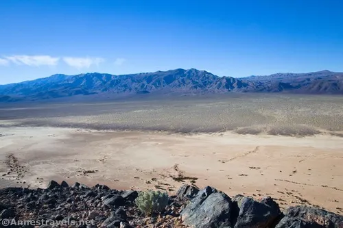
The second way to ascend Lake Hill (which is the way I recommend for the best views) is to head pretty much straight up the north side of Lake Hill. As you climb, views get better down on the Panamint Valley Playa to the west as well as surrounding mountains.
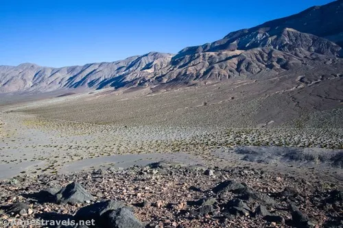
There are three false summits with saddles between them that must be crossed – so you’ll get more elevation loss and gain than by taking the first route. However, you also get great views the whole way, instead of the view being blocked by other hills as you walk up the valley.
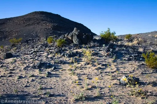
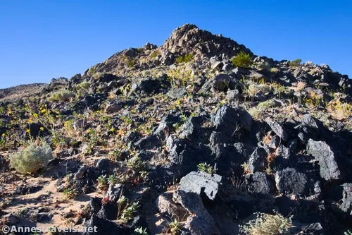
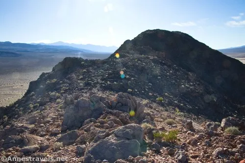
Occasionally, you’ll find a trail. Follow the trails if you can, as they usually take you around inconvenient rocks, etc., that might be difficult to scramble over or around.
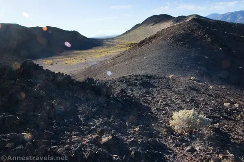
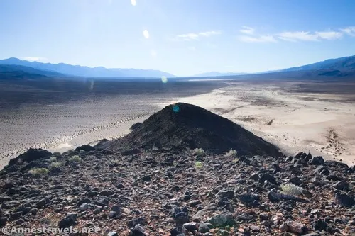
After the third summit, the ridgeline drops steeply down into the low saddle about mile 0.9 or 1.0. While it’s frustrating (all of that hard-earned elevation gain is lost!), it’s an indication that there’s only one more hill to climb.
Follow the social trail (or the ridgeline if a social trail isn’t visible) up the final ridgeline, passing over a fourth summit above the low saddle. It’s a long climb, but believe me, it’s worth it! Be sure to continue along the ridgeline until you reach the point where it begins descending again, about 1.6 miles from our start point. This is the peak of Lake Hill.
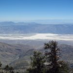
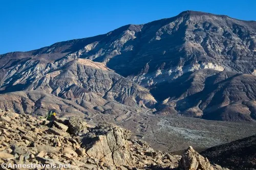
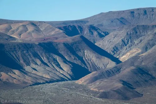
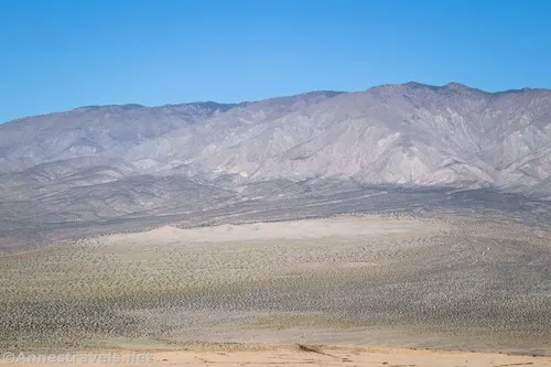
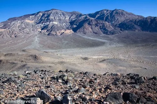
A summit register is in a pile of rocks with the register inside. Otherwise, just sit back and enjoy the views. There are so many! To the east is the Cottonwood Mountains, which become very colorful as you look north toward Panamint Butte. A lot of prospecting took place in these hills, so keep your eyes open for mine audits. Panamint Canyon is almost directly east of Lake Hill, with Panamint Butte to the north of the canyon.
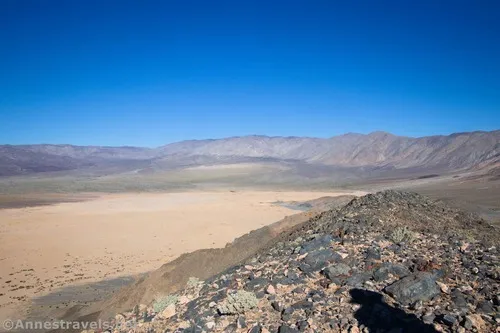
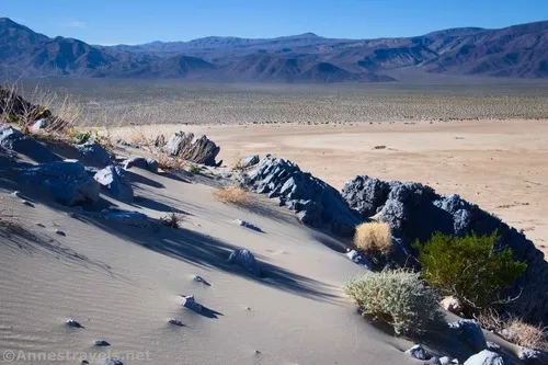
To the north and slightly west are the Panamint Dunes, and to the west are the canyons below the Darwin Plateau. Rainbow Canyon (“Star Wars Canyon”) is visible almost directly across the valley, to the right (north) of where the road disappears up to Father Crowley Vista. South of this is the Argus Range.
To the south is the rest of Panamint Valley. And southeast are the Panamint Mountains (which includes Telescope Peak, though I’m not sure if you can see the peak from here).
When you’re done enjoying the scenery, hike back down the way you came. We opted to descend from the low pass to the east (right while descending Lake Hill) and into the valley. As I mentioned before, this was not a fun descent. It had quite a bit of loose rock and sand. Watch your footing and do your best to leave no trace!
Once in the valley bottom, turn left (north). When I visited, the valley was filled with yellow flowers, plus a few hidden gems of other colors. Gorgeous!
At the end of the valley, head north to return to your vehicle (or head east if you parked in the camping spot instead of by the wilderness signs).
And that’s a wrap! It’s not a long hike, but it does require mild scrambling, and there is no trail. So just remember to put on your adventure boots/shoes before embarking on this one!
Round Trip Trail Length: I went 3.5 miles
Elevation Gain: 887ft. (1,548ft. to 2,027ft.)
Facilities: None. You can camp for free in pre-designated sites along the Lake Hill Road.
Fees: $30/vehicle, valid 7 days. America the Beautiful National Parks & Federal Lands Passes and Death Valley Annual Passes are accepted.
Trail Notes: There is no trail, so keep your eyes open for landmarks and follow the ridgeline if all else fails. Don’t walk on the playa when it’s wet. Don’t try this hike outside of the months of November-April, as it’s very exposed, and hiking on the black rock of Lake Hill is much hotter than the surrounding air temperature. Bring the essentials, especially water, even though it’s not a long hike. Do your best to stay on durable surfaces like rocks or washes instead of leaving footprints in the dirt.
Trail 
![]()
![]()
![]()
![]()
Road ![]()
![]()
Signs ![]()
![]()
![]()
![]()
Scenery ![]()
Would I go 100 miles out of my way for this? ![]()
Overall Rating: 
![]()
![]()
GPS Coordinates for Lake Hill
Beginning: 36.4034640°, -117.4033280° (36°24.20784′, -117°24.19968′ / 36°24’12.4704″, -117°24’11.9808″) (1,558ft.) (0.0)
1st Summit: 36.3981860°, -117.4042110° (36°23.89116′, -117°24.25266′ / 36°23’53.4696″, -117°24’15.1596″) (1,757ft.) (0.43)
2nd Summit: 36.3947240°, -117.4050280° (36°23.68344′, -117°24.30168′ / 36°23’41.0064″, -117°24’18.1008″) (1,701ft.) (0.72)
3rd Summit: 36.3928180°, -117.4054040° (36°23.56908′, -117°24.32424′ / 36°23’34.1448″, -117°24’19.4544″) (1,734ft.) (0.87)
4th Summit: 36.3893860°, -117.4061050° (36°23.36316′, -117°24.36630′ / 36°23’21.7896″, -117°24’21.9780″) (1,868ft.) (1.23)
Summit of Lake Hill: 36.384751,-117.404479 (2,019ft.) (1.63)
Low Pass: 36.3915940°, -117.4052240° (36°23.49564′, -117°24.31344′ / 36°23’29.7384″, -117°24’18.8064″) (1,649ft.) (2.52)
End: 36.4033630°, -117.4032880° (36°24.20178′, -117°24.19728′ / 36°24’12.1068″, -117°24’11.8368″) (1,557ft.) (3.53)

The gpx file for Lake Hill can be downloaded – please note that this and the GPS Coordinates are for reference only and should not be used as a sole resource when hiking this trail.
Download GPX File size: 86.8 KB Downloaded 58 times
(Note: I do my best to ensure that all downloads, the webpage, etc. are virus-free and accurate; however, I cannot be held responsible for any damage that might result, including but not limited to loss of data, damages to hardware, harm to users, from use of files, information, etc. from this website. Thanks!)
Getting to the Lake Hill Trailhead
From Stovepipe Wells, head west on CA-190. After 26 miles, turn right on the unmarked gravel Lake Hill Road. Drive 4.4 miles to the signs on the left.
From Panamint Springs, drive east on CA-190. About 1.9 miles beyond the turnoff (on the right) for the Panamint Valley Road, turn left on the unmarked gravel Lake Hill Road. Drive 4.4 miles to the signs on the left.
Today’s Featured Product!
Explore the wild and less-visited part of Death Valley – the western part of the park, including Panamint Valley – with this guide. More than 200 destinations are featured, from easy strolls to long adventures. Buy your copy here.