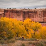
Willow Springs Canyon is a mostly-unknown scramble of a hike near the western border of Arches National Park. You’ll need 4×4 to get to the trailhead, but with high clearance, you can get close enough to the trailhead to walk the extra 0.7 miles (each way). Your reward for the effort of getting to the trailhead (and a bit of Class 2 scrambling) includes two desert springs, a few small slot sections, and a dozen or more interesting potholes that are sometimes full of water. It’s definitely one of those hikes where you never know what you’ll see around the next bend of the canyon!
Quick Stats
Willow Springs Canyon begins along the Willow Springs Road. I drove in from US-191 through the brand-new UtahRaptor State Park (no fee to drive through at this point), but you can also come in through Arches National Park (the Willow Spring Road begins across the main park road from the Balanced Rock parking area). Either way, you’ll need a 4×4 vehicle to get to where the Willow Springs Road crosses Willow Springs Wash. There are several sandy washes between the Arches Main Park Road and the wash, and from US-191, the road is only high clearance (no 4×4 needed) until about 0.7 miles from the wash – a slickrock section with potholes just before entering Arches National Park wasn’t something I would drive my 2WD, high clearance van across. I did cross part of the slickrock section, then pulled over to park on the left (north), but even better is the parking spot for one of the Red Hot Bike Trail on the right (south) just before this slickrock.
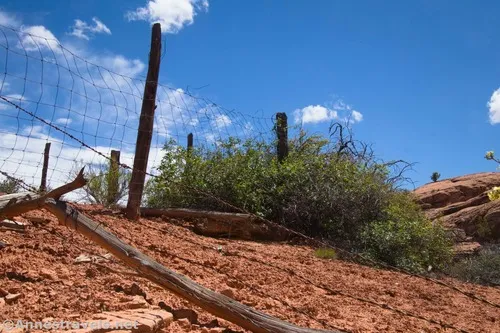
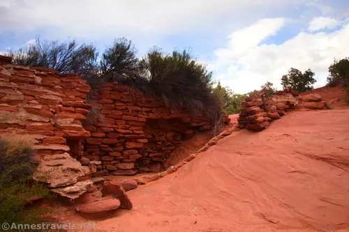
If you park before entering Arches National Park, pass through the green gate and then continue hiking down the road about 0.6 miles beyond the gate (Willow Springs Wash is not the first wash you’ll cross, BTW). The trailhead for Willow Spring Canyon is on the eastern side of the wash, so if you’re coming from US-191, walk across the wash and then look for a very vague trail on the right (south side of the road) (if you’re coming from Arches National Park, the path will be just before entering the wash). It will lead downstream to the ruins of an old shed.
Just beyond this is the remains of a corral. Continue downhill along the now slightly more visible path as it drops steeply (and over crumbly dirt) into the bottom of the wash. This area is brushy and looks very difficult – press on, as the route will get easier.
Turn left to continue downstream; chances are that you’ll see water unless it’s been very dry. Follow the water as it descends a slickrock slope (like a small waterfall), then through another set of trees. These can be a bit of a bushwhack – don’t worry, it gets better!
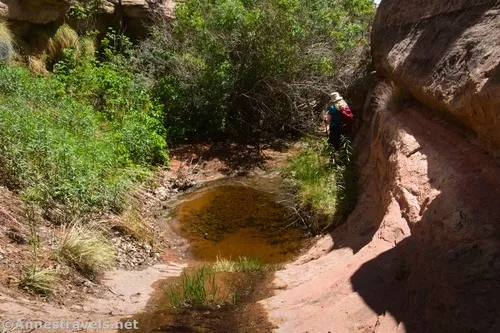
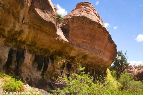
Pass by a seep on your left, then work your way along the right wall of the canyon with the water on your left. A tenth of a mile beyond the seep, the route goes down an easily-scrambleable but also a very much major dryfall – and you’ll be out of the brush for good. While you might not see it while hiking downstream, you’re actually entering a bigger wash here – so make note of this junction for your return trip. (For all of you who want to know, this other wash will take you back up to the road a bit west of Willow Springs Wash.)
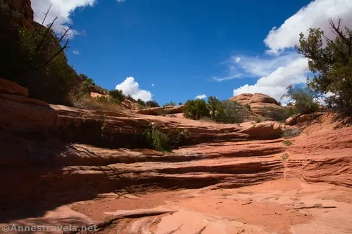
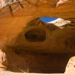
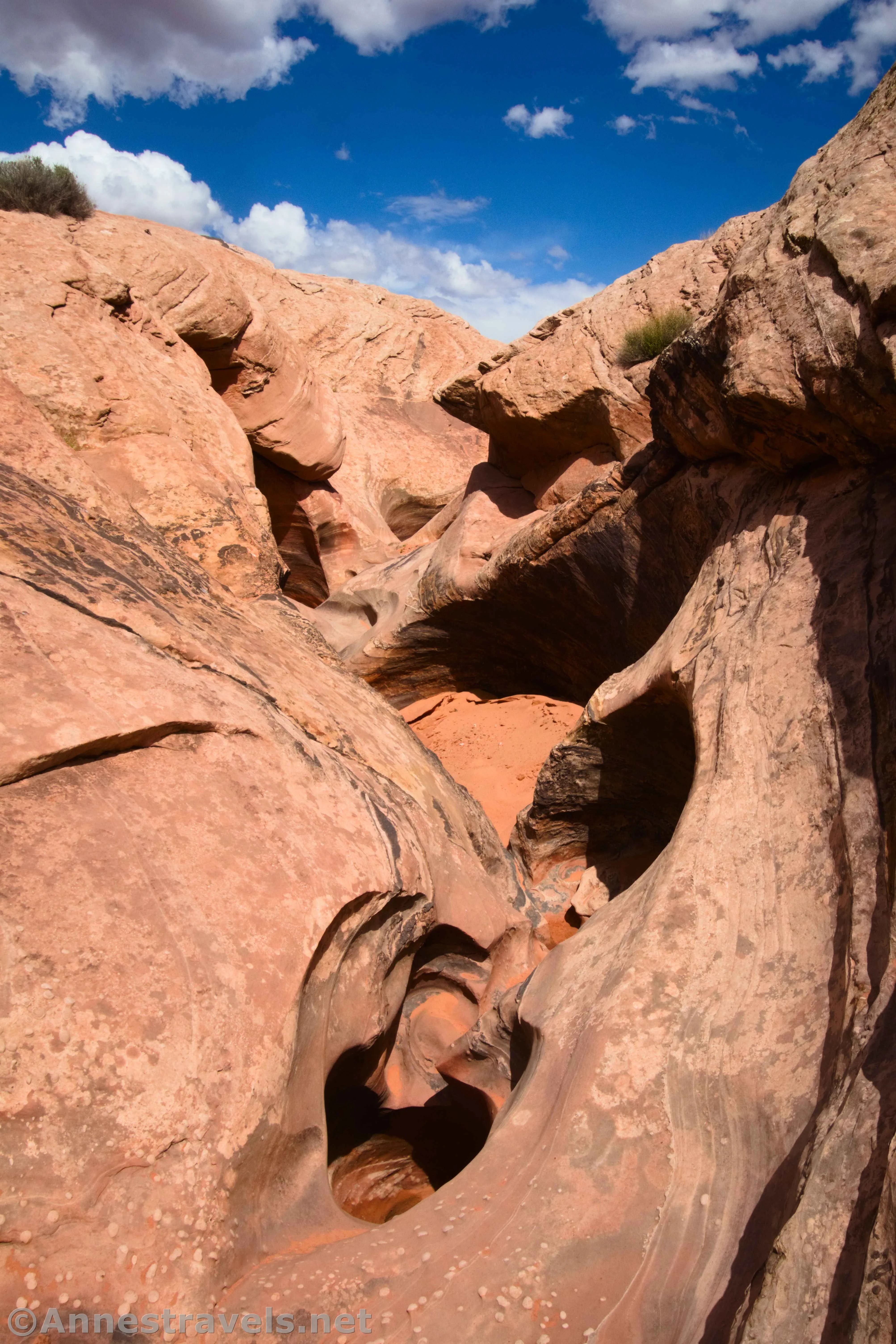
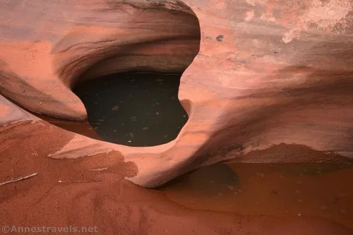
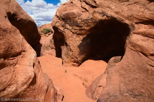
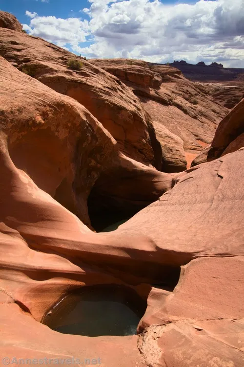
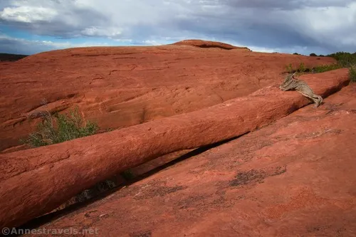
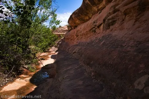
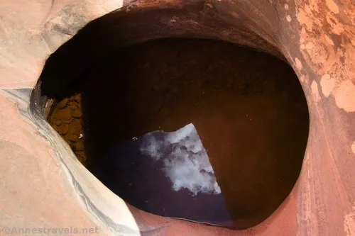
Continue to walk downstream. There isn’t anything too exciting for the next half mile, just the canyon and an alternating sandy and slickrock tread. Occasional texture in the rock walls adds interest. About a mile from the road, you’ll come to the first slot section – this is the indication that life is about to get more interesting, because the first of the potholes is just below this.
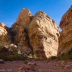
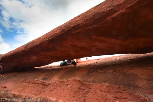
As you continue downcanyon, exactly how much of the canyon bottom you’ll be able to hike down will depend on how many of the potholes are full of water. Some of the potholes are big enough and deep enough that you’ll need to bypass them even if they’re dry. The good news is that most of the dryfalls and potholes are easy to bypass on the right or left side of the canyon, usually with a Class 2 scramble. There are also a few small slots, but none were enough to make my claustrophobic-prone group member to be too nervous.
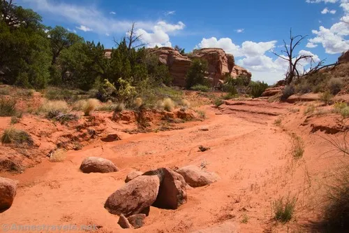
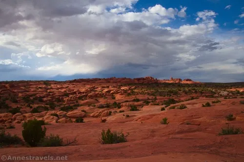
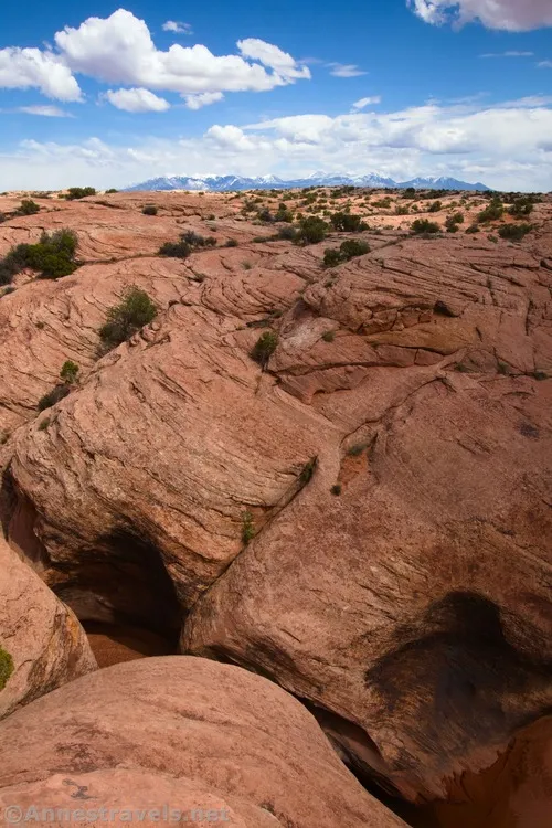
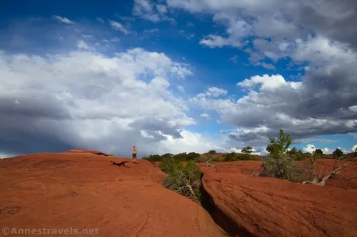
There are multiple sets of potholes as you move downcanyon. Be sure to look out to the desert beyond the end of the canyon, as some buttes stick up out of the plain.
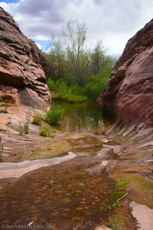
About 2 miles downcanyon from the road, the stream suddenly appears out of the slickrock. Like, one second, it’s a dry wash, and the next, there’s water. It’s pretty wild! Just below this, the water trickles down into a riparian area.
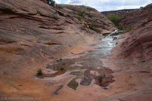
At this point, Willow Springs Canyon empties into Courthouse Wash (yes, the same that goes under the road near Courthouse Spires in Arches National Park). I hear that you can continue another tenth of a mile or so into Courthouse Wash, but it’s a nasty bushwhack. So I stopped at the point where the greenery begins.
You can get back to the trailhead by retracing your steps, or by climbing up on the west side and hiking back cross-country (be so very, very careful to travel on durable surfaces – slickrock and washes – as there is quite a bit of delicate desert around here).
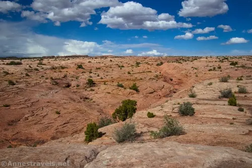
Or you can do the crazy thing like I did and climb up on the eastern side of the canyon. It starts out as slickrock, then I picked up a wash heading northeast. That worked for a bit, but eventually even that headed in a direction I didn’t want to go. So it was a bit of an adventure and definitely required some scrambling.
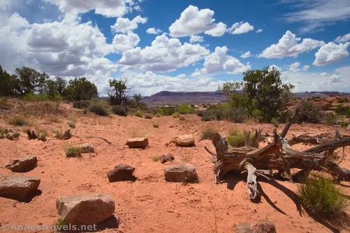
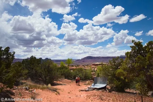
My goal was to get back to the road and then explore the area northeast of Willow Springs Canyon. I’d read about three arches in the area. To be honest, if I’d just retraced my steps and then headed east on the road, I probably would have been better off. But I finally did make it back to the road (only 2 miles from the riparian area) and headed off into the area I wanted to explore.
Despite having coordinates (and following footprints), I only found one – Slanted Eye Arch – and that was almost an accident because it looked like there might be an arch in the area.
I’m sad that I wasn’t able to find Concealed Bridge. If I’d had more time, and more than just the (very wrong) coordinates, I might have been able to search around and find it. However, I’d gotten a late start, the sun was beginning to set, and a storm was blowing in. So I was in a bit of a hurry to get back to the van and get out of there before the rain started!
I dropped into the wash to head back to the road. Along the way, I found an old dam.
I finally regained the road about 1.5 miles after leaving it. We turned west (right) and made quick tracks… and yes, we made it before the rain!
I dropped into the wash to head back to the road. Along the way, I found an old dam.
I finally regained the road about 1.5 miles after leaving it. We turned west (right) and made quick tracks… and yes, we made it before the rain!

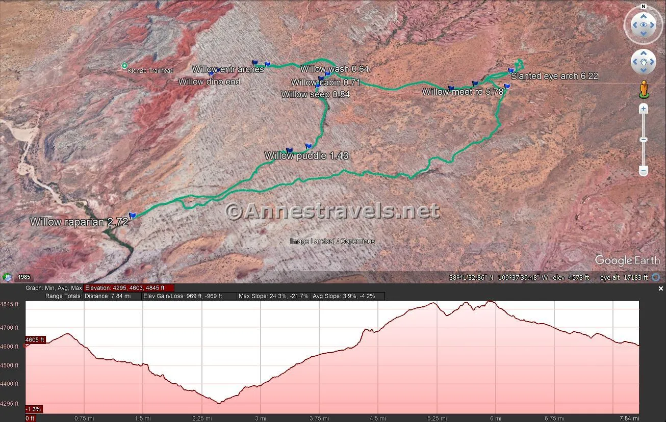
Round Trip Trail Length: If you start at the trailhead and go to the end, you’re talking 4.2 miles RT. From the high clearance trailhead, it’s about 5.5 miles. I went 8.4 miles.
Elevation Gain: Willow Springs Canyon alone is 505ft. (4,643ft. to 4,396ft.). From the high clearance trailhead, it’s 617ft. (4,670ft. to 4,296ft.). I went 969ft. (4,845ft. to 4,295ft.)
Facilities: None
Fees: Technically $30/vehicle, valid 7 days, to enter Arches National Park. America the Beautiful National Parks & Federal Lands Passes and Southeast Utah National Parks Passes are accepted.
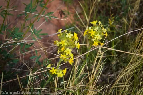
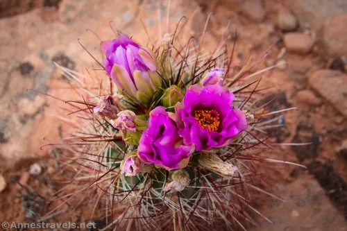
Trail Notes: Be ready for quite a bit of easy scrambling and wayfinding. Staying in the canyon, finding your way is easy; outside the canyon, it’s deceptively difficult. The area can be very hot in the summer (even May was hotter than I appreciated). The area with Slanted Eye Arch is beautiful and would make for a great exploration.
Trail 
![]()
![]()
![]()
![]()
Road ![]()
![]()
![]()
Signs ![]()
![]()
![]()
![]()
Scenery ![]()
![]()
Would I go 100 miles out of my way for this? ![]()
Overall Rating: ![]()
![]()
![]()
GPS Coordinates for Willow Springs Canyon
Where I parked: 38.7016710°, -109.6366710° (38°42.10026′, -109°38.20026′ / 38°42’06.0156″, -109°38’12.0156″) (4,608ft.) (0.0)
Enter Arches National Park: 38.7014650°, -109.6352000° (38°42.08790′, -109°38.11200′ / 38°42’05.2740″, -109°38’06.7200″) (4,622ft.) (no mileage)
Willow Wash: 38.7006450°, -109.6272120° (38°42.03870′, -109°37.63272′ / 38°42’02.3220″, -109°37’37.9632″) (4,642ft.) (0.64)
Cabin: 38.7000980°, -109.6282070° (38°42.00588′, -109°37.69242′ / 38°42’00.3528″, -109°37’41.5452″) (4,616ft.) (0.71)
Fence: 38.6995340°, -109.6289420° (38°41.97204′, -109°37.73652′ / 38°41’58.3224″, -109°37’44.1912″) (4,598ft.) (0.78)
Seep: 38.6986080°, -109.6293390° (38°41.91648′, -109°37.76034′ / 38°41’54.9888″, -109°37’45.6204″) (4,585ft.) (0.84)
Dryfall: 38.6974920°, -109.6291260° (38°41.84952′, -109°37.74756′ / 38°41’50.9712″, -109°37’44.8536″) (4,568ft.) (0.95)
Puddle: 38.6917690°, -109.6300880° (38°41.50614′, -109°37.80528′ / 38°41’30.3684″, -109°37’48.3168″) (4,511ft.) (1.43)
Slot: 38.6913410°, -109.6320080° (38°41.48046′, -109°37.92048′ / 38°41’28.8276″, -109°37’55.2288″) (4,493ft.) (1.57)

Riparian area: 38.6855210°, -109.6464320° (38°41.13126′, -109°38.78592′ / 38°41’07.8756″, -109°38’47.1552″) (4,262ft.) (2.72)
Meet road: 38.6978300°, -109.6084840° (38°41.86980′, -109°36.50904′ / 38°41’52.1880″, -109°36’30.5424″) (4,846ft.) (5.78)
Slanted Eye Arch: 38.6999050°, -109.6074990° (38°41.99430′, -109°36.44994′ / 38°41’59.6580″, -109°36’26.9964″) (4,840ft.) (6.22)
Dam: 38.6984090°, -109.6118250° (38°41.90454′, -109°36.70950′ / 38°41’54.2724″, -109°36’42.5700″) (4,754ft.) (7.06)
Regain road: 38.6978790°, -109.6145540° (38°41.87274′, -109°36.87324′ / 38°41’52.3644″, -109°36’52.3944″) (4,735ft.) (7.23)
End (where I parked): 38.7017240°, -109.6366560° (38°42.10344′, -109°38.19936′ / 38°42’06.2064″, -109°38’11.9616″) (4,608ft.) (8.64)
The gpx file for Willow Springs Canyon (and my exploration up to Slanted Eye Arch) can be downloaded – please note that this and the GPS Coordinates are for reference only and should not be used as a sole resource when hiking this trail.
Download GPX File size: 117.5 KB Downloaded 62 times
(Note: I do my best to ensure that all downloads, the webpage, etc. are virus-free and accurate; however, I cannot be held responsible for any damage that might result, including but not limited to loss of data, damages to hardware, harm to users, from use of files, information, etc. from this website. Thanks!)
Getting to the Willow Springs Canyon Trailhead
From the Main Park Road in Arches National Park, turn onto the Willow Springs Road across the road from the Balanced Rock parking area. Drive 3.5 miles – at first, the route is fine for any vehicle; after the picnic area, high clearance is advised. The road degrades until it requires 4×4. About 3.5 miles from the Main Park Road, the Willow Springs Road crosses the Willow Springs Canyon wash. Park nearby but not in the wash, and don’t block traffic.
From US-191 10.1 miles north of the bridge over the Colorado River outside of Moab (and 18.6 miles south of I-70), turn onto the Willow Springs Road toward UtahRaptor State Park. Follow the main road; there are multiple turnoffs, but in general it’s not hard to figure out which way to go. The most difficult is after 1.5 miles, when you want to turn left (going straight – at least at this point – takes you into a camping area). The road passes several mountain biking areas and finally exits UtahRaptor State Park – camping is not permitted, even though the area between the state park and the national park is BLM land. Pass by the Willow Springs Dinosaur Trackway on the right. Just before the road enters Arches National Park 3.8 miles from US-191, the slickrock becomes a mess of potholes, barring further 2WD travel. Continue through the gate and another 0.6 miles to Willow Springs Canyon.
Today’s Featured Product!
Take the “best” hikes in Arches National Park with this guide to nearly 25 trails within the park. Most are real trails, but a few go beyond to fascinating features you might only read about online. Buy your copy here.