
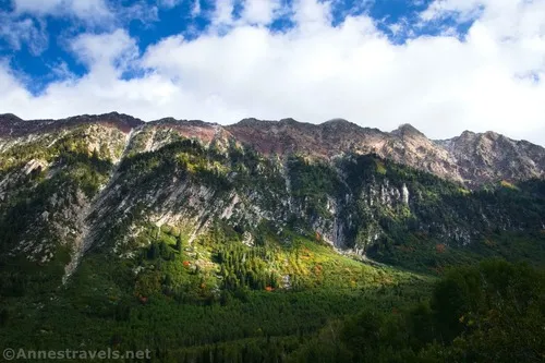
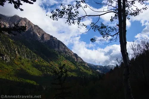
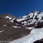
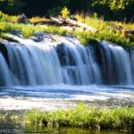
I needed a short hike on a rainy day south of Salt Lake City that didn’t have an entry fee. That’s a lot of specifics for a single hike, but three different waterfalls hit the spot: Gloria Falls, Hidden Falls, and Mossy Ledge Falls. None have official trails, but that doesn’t stop Gloria Falls from being an extremely popular hike. I happened to get on the trail early enough to have the entire thing to myself until the hike down (at which point I was definitely hiking against the current, so to speak) – but that was more due to timing than intentionality. After a day of rain, the falls were gorgeous in September, and I even had fall colors across the canyon from the trail!
Quick Stats
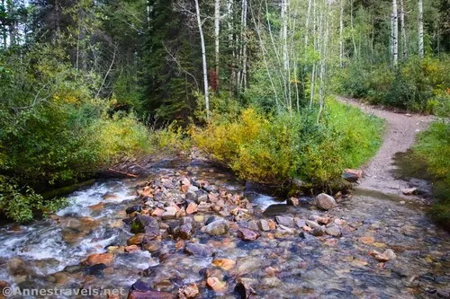
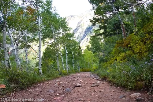
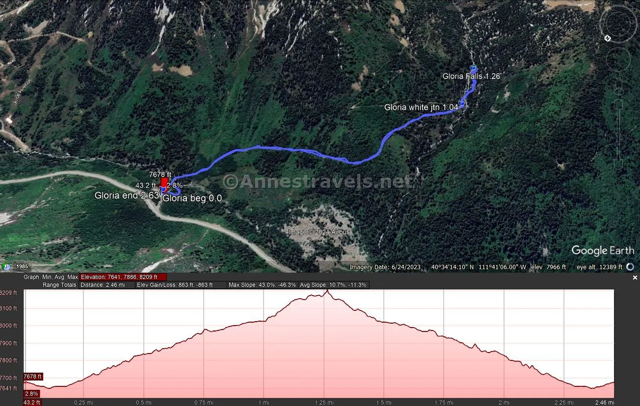
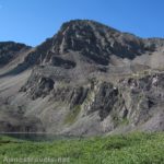
The path begins at the White Pine Trailhead – no mention is made here of Gloria Falls. Descend to cross a bridge over Little Cottonwood Creek, then follow the trail upwards through the aspen and fir forest. There are peek-a-boo views out to Little Cottonwood Canyon.
After a mile, arrive at a major trail junction. White Pine Lake goes left, while Red Pine Lake goes right toward a signboard. Turn right and cross the creek via a small bridge.
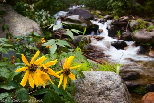
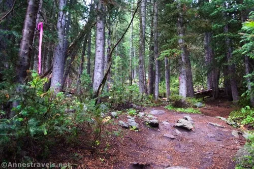
A very short distance beyond the bridge, the Gloria Falls Trail goes off on the left (uphill). As of fall 2023, this junction was not marked, nor was the trail especially noticeable besides some pink ribbons. Follow these ribbons (assuming they still exist!) and the becoming-better-worn social trail up through the woods. The creek will be on your left, but you’re rarely very close to it. The social trail is a little bit of a scramble, but it’s not too bad (remember that I was hiking the day after a storm, so it was somewhat muddy).
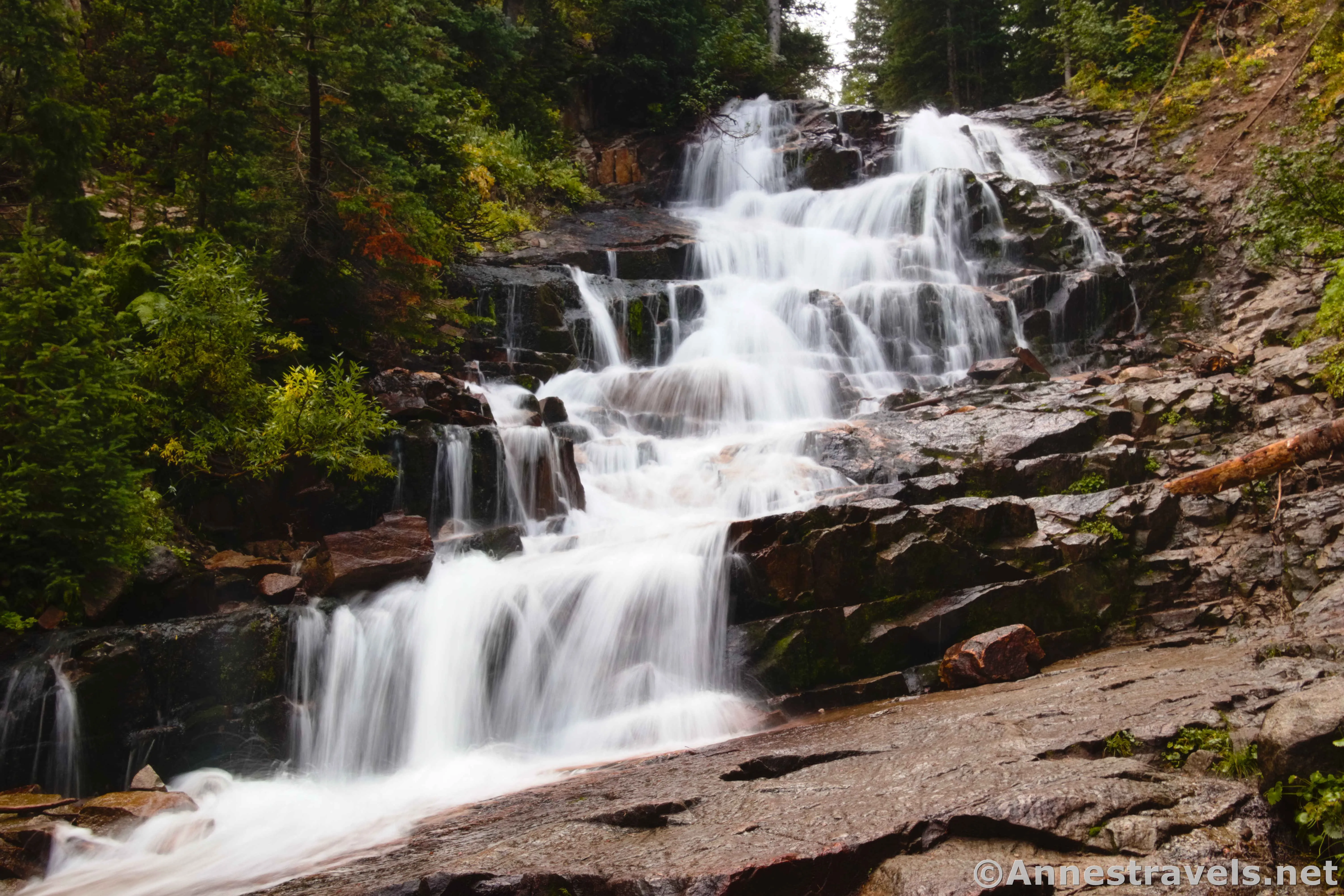
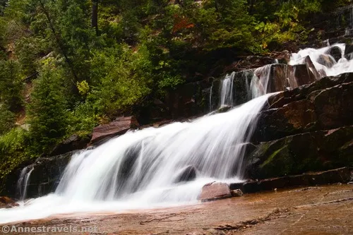
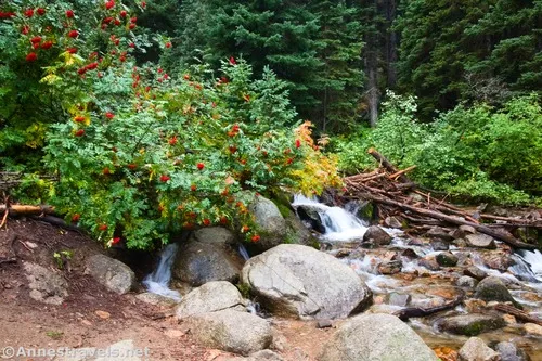
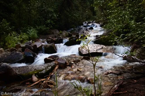
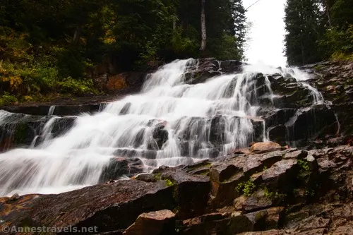
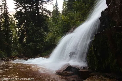
The route ends at Gloria Falls, 1.25 miles from the trailhead. It’s a lovely cascade, about 50ft. tall if you count all of its multiple steps.
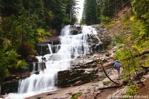
We took our photos, explored a (very) little, and then headed back down. Swimming isn’t allowed in the stream (it’s part of Salt Lake City’s water supply), but it was much too chilly to want to get in the water anyway!
On our way back down, we met quite a few groups – singles, couples, even several moms with a group of elementary-aged kids (who were doing a fantastic job of hiking up the steep path… this wasn’t their first hike, I’d guess). And the parking area was nearly full. Since it had been nearly empty when we arrived, that was a bit of a shock! A Friday morning just didn’t seem like that exciting a time for hiking… but I guess I’d be wrong. Arrive early on weekends!
Round Trip Trail Length: 2.5 miles
Elevation Gain: 863ft. (7,641ft. to 8,209ft.)
Facilities: Vault toilet at the trailhead
Fees: None
Trail Notes: Swimming, wading, etc. is prohibited. So are dogs. The trail up through the forest is steep, though not bad by Wasatch standards. I think I’ve already made my point to visit early in the day for any hope of solitude. In the autumn, this trail is especially gorgeous, though I’d imagine the waterfall would be better in the spring.
Trail 
![]()
![]()
Road
Signs ![]()
![]()
Scenery ![]()
![]()
Would I go 100 miles out of my way for this? ![]()
![]()
![]()
Overall Rating: ![]()
![]()
GPS Coordinates for Gloria Falls
TH: 40.5755430°, -111.6812860° (40°34.53258′, -111°40.87716′ / 40°34’31.9548″, -111°40’52.6296″) (7,675ft.) (0.0)
White Pine Lake Junction: 40.5660790°, -111.6894190° (40°33.96474′, -111°41.36514′ / 40°33’57.8844″, -111°41’21.9084″) (8,034ft.) (1.04)
Gloria Falls: 40.5640450°, -111.6886940° (40°33.84270′, -111°41.32164′ / 40°33’50.5620″, -111°41’19.2984″) (8,189ft.) (1.26)
End: 40.5754500°, -111.6811670° (40°34.52700′, -111°40.87002′ / 40°34’31.6200″, -111°40’52.2012″) (7,675ft.) (2.63)
The gpx file for Gloria Falls can be downloaded – please note that this and the GPS Coordinates are for reference only and should not be used as a sole resource when hiking this trail.
Download GPX File size: 47.1 KB Downloaded 55 times
(Note: I do my best to ensure that all downloads, the webpage, etc. are virus-free and accurate; however, I cannot be held responsible for any damage that might result, including but not limited to loss of data, damages to hardware, harm to users, from use of files, information, etc. from this website. Thanks!)
Getting to the Gloria Falls Trailhead (White Pine Trailhead)
From I-15, take Exit 295 for UT-209 and 9000So. At the end of the exit ramp, turn right (if coming from I-15N) or left (if coming from I-15S) onto W 9000 S aka UT-209E. Continue to follow UT-209E for the next 7.2 miles. Take a slight right onto UT-210E, following the sign for the Ski Areas (Snowbird and Alta). You’ll begin ascending into Little Cottonwood Canyon. After 5.3 miles, turn right into the parking area (if you get to the ski area, you know you’ve gone too far).
Today’s Featured Product!
Explore creeks, mountains, canyons, and much, much more in this guide – all of which are within 60 miles of Salt Lake City. 60 hikes showcase the area’s natural beauty. Buy your copy here.

Pingback: Sneak Peak: The Rest of the Trip! (SLC, Sawtooths, Utah, Loveland Pass) – Anne's Travels