
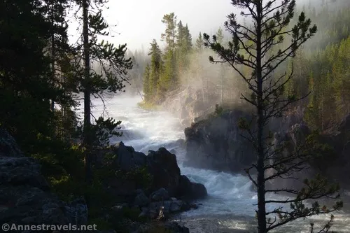
After our success on the Wilderness Loop in Petrified Forest National Park, it made sense to try out one or two of the other “official routes” in the park (they’re not really trails, but they’re also usually pretty easy to follow). The Blue Forest Trail was another great hike, so we headed up to do the Billing Gap route next. Of the three, there’s no question that this was the looser, but it was also a nice and very quiet hike to an overlook that didn’t include petrified wood – so that’s one thing in its favor, for sure! Instead, the trail wanders along the side of the mesa top to end overlooking a valley with rock formations and badlands. It was definitely pretty, even if we couldn’t find the return loop of the hike – but more on that in a minute.
Quick Stats
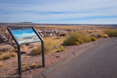
The trail begins along the Blue Mesa Road. The trailhead isn’t marked; it’s just before the pulloff with a sign called “People and Change.” Just walk back along the road until you see a trail heading off approximately due east into the desert. It looks like this:
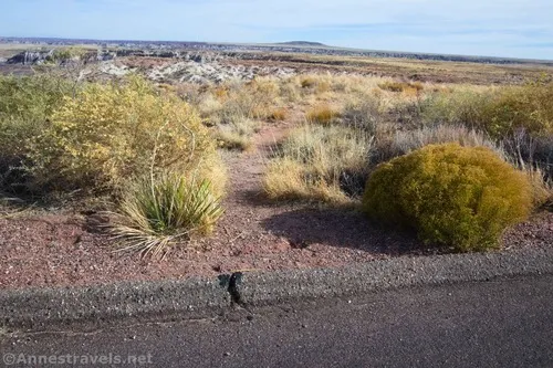
This trail is fairly easy to follow as a dirt single sandy track through the grass and occasionally over rocks. If in doubt, just keep going generally west, keeping the cliff off of the mesa not too far away on your left.
Views are good to the north. I especially enjoyed all of the badlands.
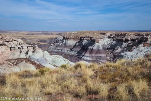
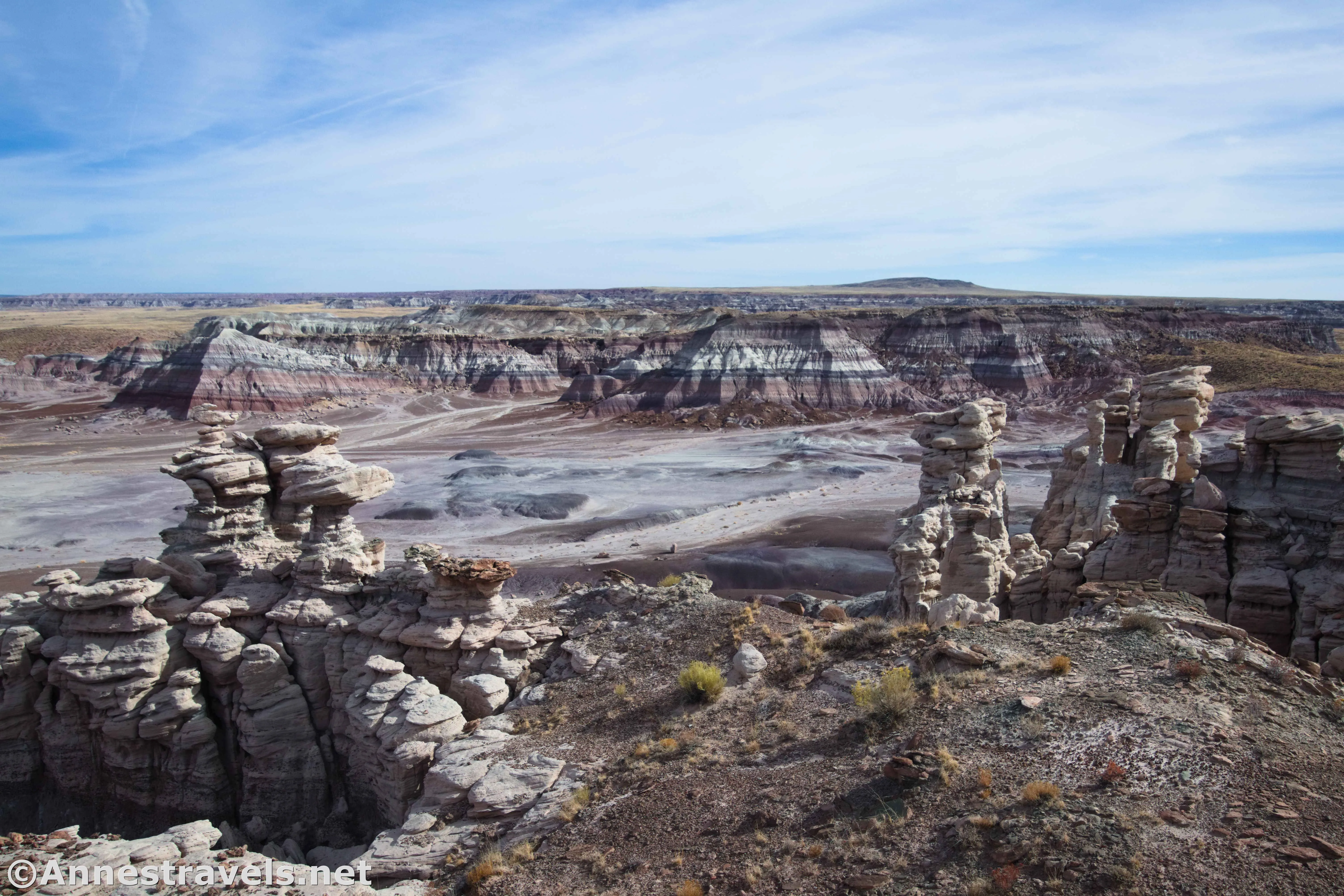
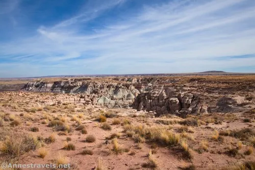
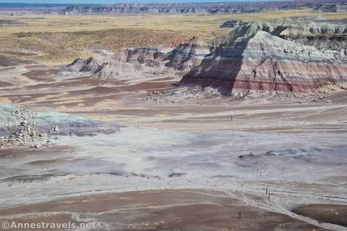
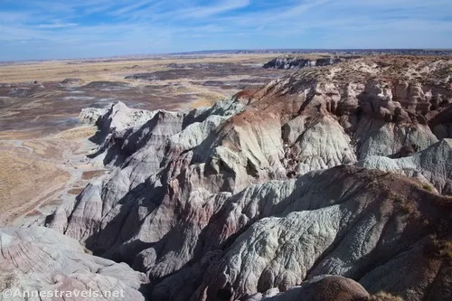
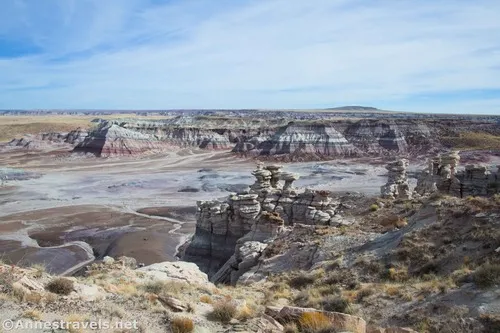
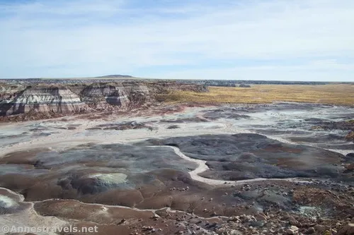
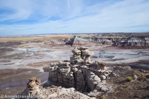
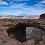
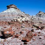
It’s almost exactly a mile from the parking area to the unmarked overlook down on Billings Gap. From here, you can look down into the gap. On the near side of the gap are some wild rock formations.
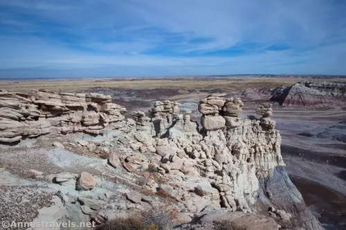
The far side of the gap has colorful badlands.
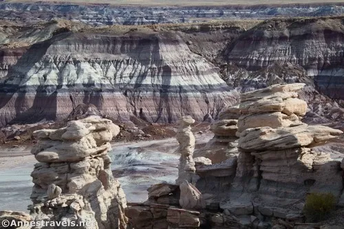
Plains stretch away on either side of the gap. It looks like someone has put a fence across the gap; I’d guess this is for grazing cattle. This part of Petrified Forest was added to the national park in 2004. There’s also a route that goes through Billings Gap if you want a much longer hike that starts from a slightly different place.
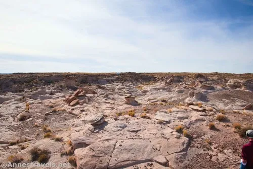
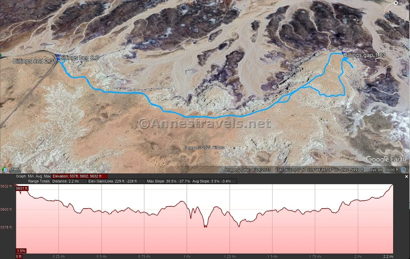
My map showed that the trail looped from here along the southern side of the mesa and then back to the trailhead. So we headed off in that direction. However, the only interesting thing we could find was more rock formations. The trail wasn’t making itself know, either (it’s hard to see with all of the grass in the way, and the mesa top rolls more than you’d expect given how flat it looks), so we somehow or other ended up back on the route along the north side of the mesa. Oh well – at least it was an easy path to follow back to the road!
Round Trip Trail Length: 2.0 mile out & back to the overlook; with my wandering around the south side, I ended at 2.3 miles.
Elevation Gain: 229ft. (5,632ft. to 5,578) – This is probably an overestimate, as my software doesn’t handle cliff edges well and sometimes calculates elevation as though I tumbled over the edge several times.
Facilities: None
Fees: $25/vehicle, valid 7 days. Cash – though legal tender – is not accepted. America the Beautiful National Parks & Federal Lands passes and Petrified Forest National Park Annual Pass are accepted.
Trail Notes: Because this is not an official trail, it’s not marked. You should be willing to wayfind before attempting it, and you should also be ready to wayfind your way back if necessary. Stay away from the cliff edges, as there are no guardrails. You may want to explore a little along the edge of Billings Gap to find the best viewpoint.
Trail 
![]()
![]()
![]()
![]()
Road ![]()
Signs ![]()
![]()
![]()
![]()
Scenery ![]()
Would I go 100 miles out of my way for this? ![]()
Overall Rating: ![]()
![]()
Billings Gap GPS Coordinates
TH: 34.9394730°, -109.7532720° (34°56.36838′, -109°45.19632′ / 34°56’22.1028″, -109°45’11.7792″) (5,631ft.) (0.0)
Billings Gap Viewpoint: 34.9397220°, -109.7393200° (34°56.38332′, -109°44.35920′ / 34°56’22.9992″, -109°44’21.5520″) (5,599ft.) (1.03)
End: 34.9392590°, -109.7532280° (34°56.35554′, -109°45.19368′ / 34°56’21.3324″, -109°45’11.6208″) (5,631ft.) (2.31)
The gpx file for (my version of) Billings Gap can be downloaded – please note that this and the GPS Coordinates are for reference only and should not be used as a sole resource when hiking this trail.
Download GPX File size: 40.7 KB Downloaded 351 times
(Note: I do my best to ensure that all downloads, the webpage, etc. are virus-free and accurate; however, I cannot be held responsible for any damage that might result, including but not limited to loss of data, damages to hardware, harm to users, from use of files, information, etc. from this website. Thanks!)
Getting to the Billings Gap Trailhead
From the beginning of the Blue Mesa Road, drive 2.5 miles to a pulloff on your right. There is a sign here titled “People and Change.” The Blue Mesa Road is 10.4 miles north of the Rainbow Forest Museum (visitor center) and 15.3 miles south of the main visitor center near the Painted Desert.
Today’s Featured Product!
Explore Arizona – including classic trails in Petrified Forest National Park – with this guide. With 221 hikes to choose from, there’s something for everyone and nearly endless scenery. Buy your copy here!


2 responses to “The Route to Billings Gap Overlook”
[…] formations and badlands in Billings Gap, Petrified Forest National Park, […]
[…] also hiked to Billings Gap. While nice, it didn’t quite live up to the hype and we totally lost the trail on the way […]