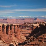
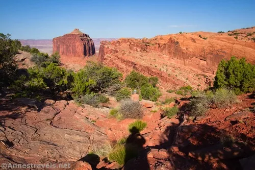
In Island in the Sky, one can find an unofficial trail that everyone seems to know about: False Kiva. I’m not sure if it’s never become official because of the sensitivity of the area or because of some other reason, but there’s a well–worn path much of the way from the road down a wash, through some rocks, and finally into an alcove with a round stone structure that some thought might be part of an ancient kiva. (I guess it’s not.) Part of the alcove was closed off a few years ago (more on that later), but you can still hike to the alcove and see the great view down Holeman Canyon – it’s still very much worth the effort!
Quick Stats
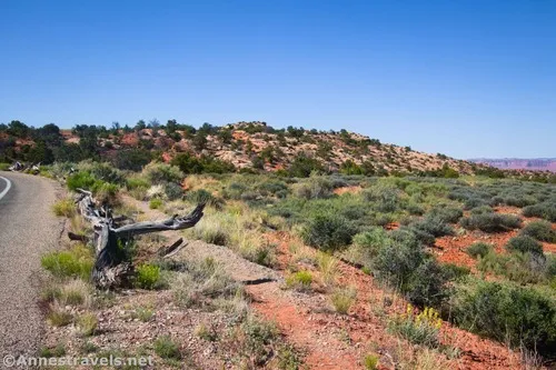
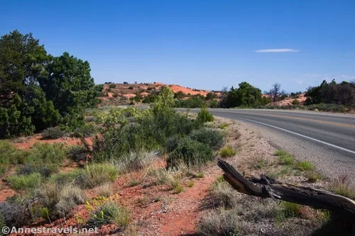
You’re not allowed to park at the trailhead (it’s unofficial, remember), so take your vehicle to the safety of the Alcove Springs Trailhead pulloff. Walk back up the road (back toward the main park road, not toward Upheaval Dome (left if your back is to the Alcove Springs Trailhead)) for a tenth of a mile. The unmarked trailhead is on the other side of the road – it looks like little more than a sandy path that parallels the road before heading right across the desert.
A short distance from where the trail leaves the road, the NPS has put up a signboard. It mentions the closure and possibly would say if the entire trail was closed or other notifications, but it doesn’t give enough information to know what you can and can’t do since the closure took effect. Don’t worry; you’ll be able to see the alcove, the false kiva, and great views.
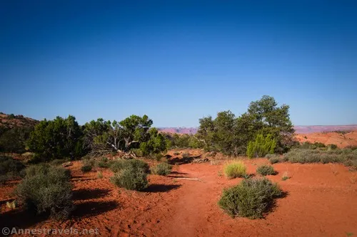
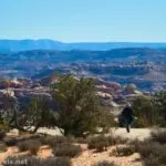
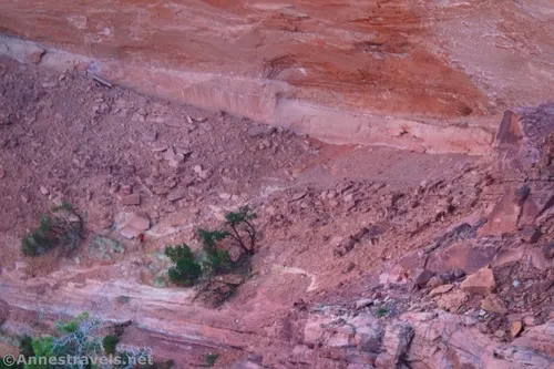
Follow the path as it descends through the desert brush and finally into a wash. The trail continues to descend with the wash for a bit. It’s fairly well-cairned, so keep your eyes open for where the trail goes up and around on the left.
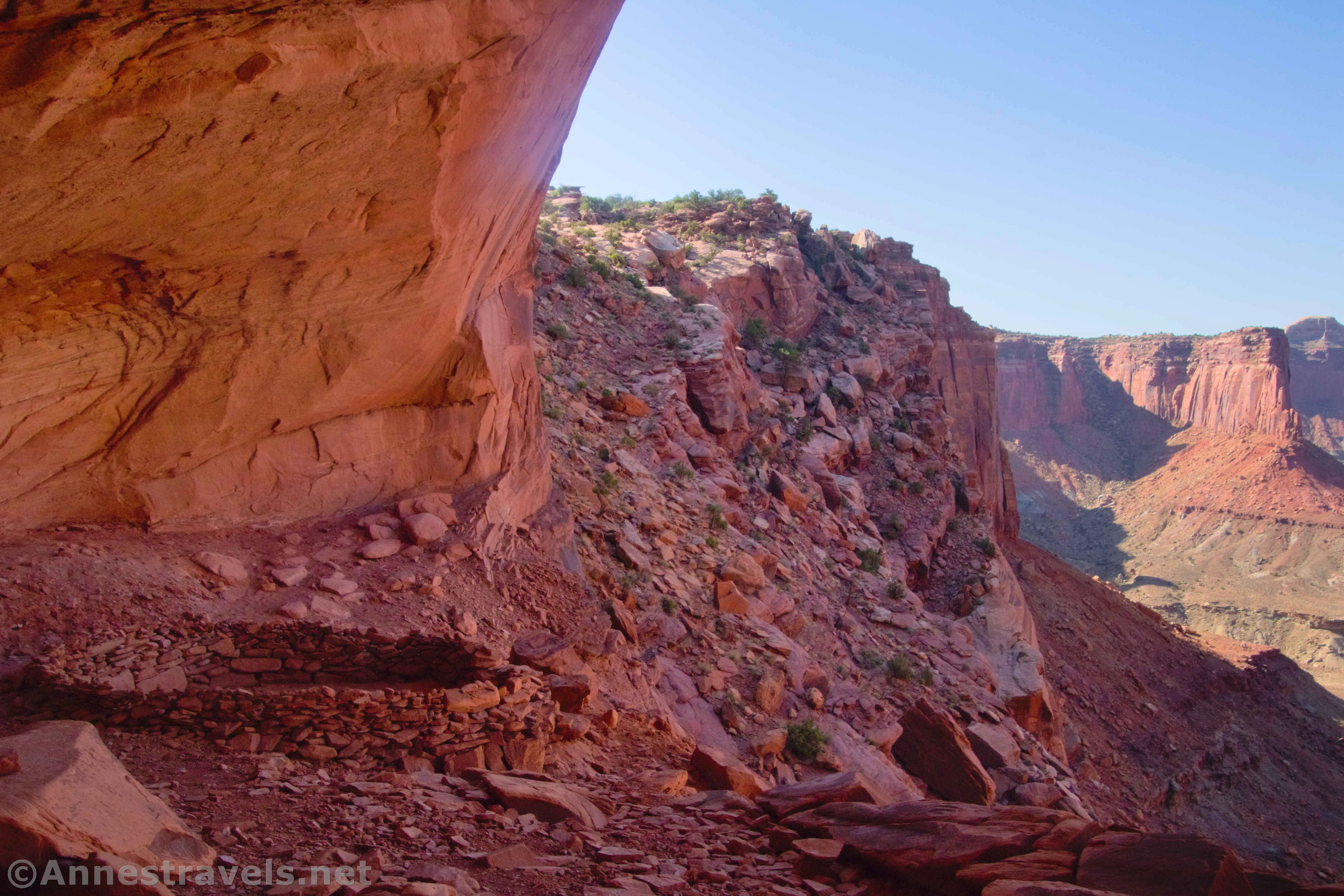
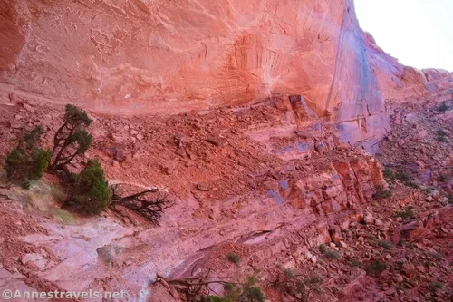
It’s hard to tell while you’re walking exactly what the path does. You can see it in many places, and there are cairns, so you can just keep walking. But what you can’t really tell is that 1) the trail has turned right, and 2) you’re picking your way through a rock slide area between two sheer cliffs (one up, one down) at the head of Holeman Canyon. To be honest, I found it much harder to descend this section than to go back up – scrambling down was seriously hard work, and I was concerned about trying to reascend it!
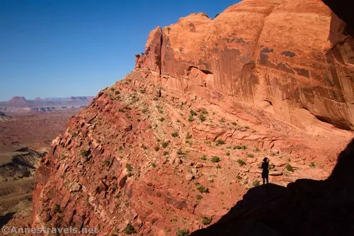
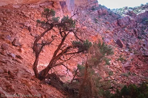
And then the path passes below the alcove before turning right in a long switchback to take you up into the alcove. It was a relief to get here, as the path, while not a stroll in the park, was easier than descending through the rocks.
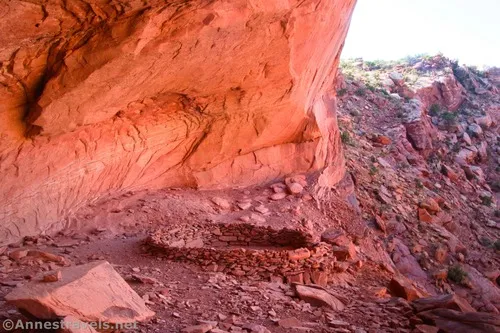
A rope railing on metal wire/posts in a short pile-of-rocks wall shows you the boundary of where you’re allowed to go in the alcove. You can’t miss it and also it doesn’t feel as unfriendly as many barriers. I gather that some people were coming into the alcove and disturbing the false kiva, marking stuff up, etc., so the NPS closed it in hopes of preservation.
I also believe that there is a security camera that goes straight to headquarters, though I’m not certain on all that. Suffice to stay, stay behind the fence – your compliance (and mine) will help to keep the area open for ourselves and others in the future.
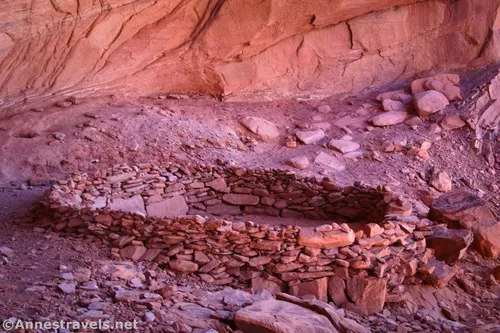
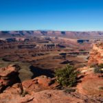
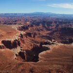
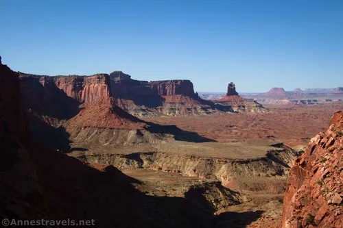
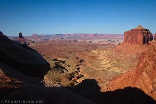
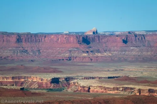
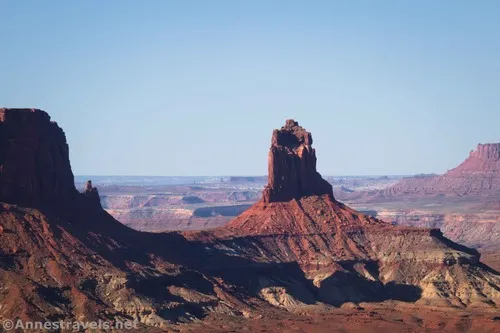
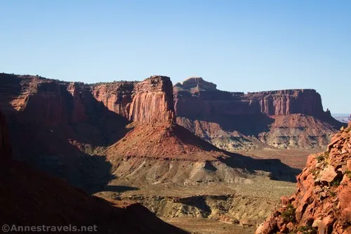
And the view? I can’t speak to what people saw before, except for some highly edited footage I’ve seen online of stars, etc., from the alcove. I can tell you that you can see the false kiva fairly well and that the views down Holeman Canyon are phenomenal.
I only met one other person on a weekday in May, and he was coming back as we were going down. I expect he could see us coming and decided to give us our privacy. At any rate, we had a grand 10-minute chat about the most obscure hikes in Utah (it’s not often you meet someone who knows as much as or nearly as much as you about these trails!), and then we both went our separate ways.
After snapping a few photos or enjoying the tranquility of the alcove for a few minutes, retrace your steps to the parking area. Remember, leave no trace of your visit!
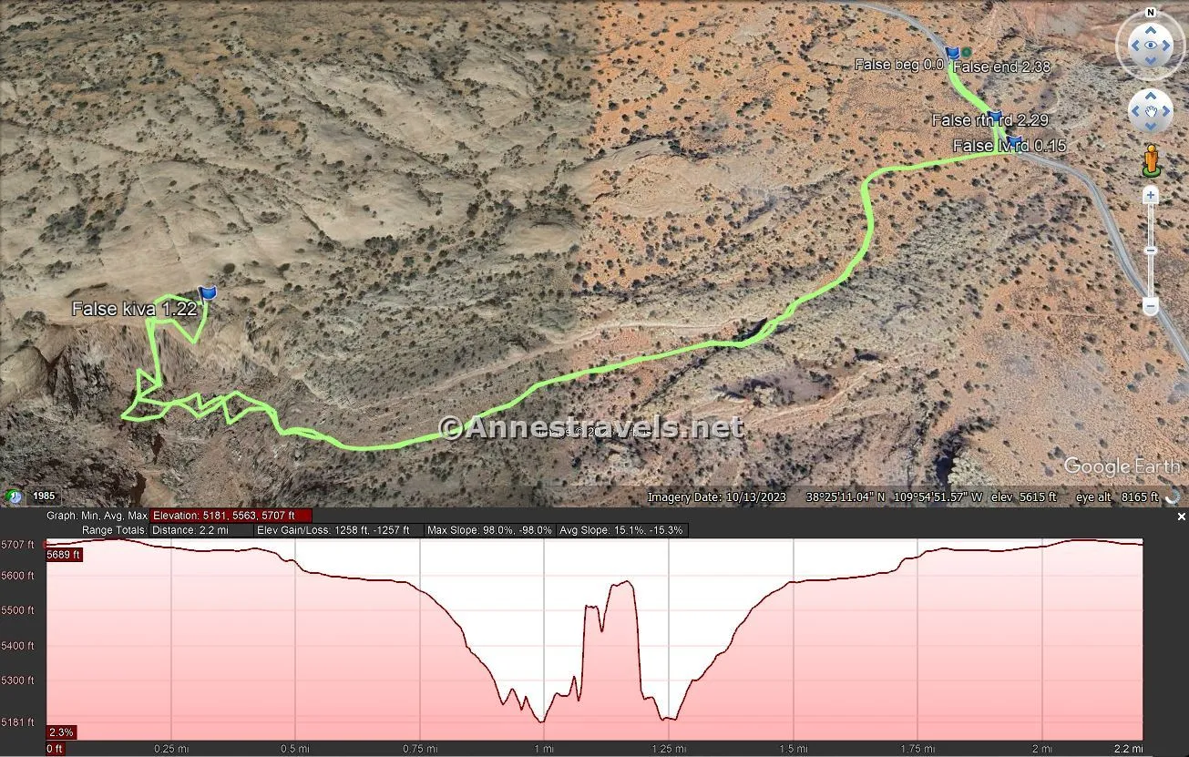
Round Trip Trail Length: I went 2.4 miles including the distance to and from the Alcove Spring pulloff
Elevation Gain: 778ft. (5,707ft. to 5,181ft.)
Facilities: None
Fees: $30/vehicle, valid 7 days at both Island in the Sky and Needles districts of Canyonlands National Park. America the Beautiful National Parks & Federal Lands Passes and Southeast Utah Annual Park Passes are accepted.
Trail Notes: While the trail wasn’t especially hard to follow, it did have a few confusing places. I recommend that you be very comfortable with desert off-trail travel before attempting it, especially because of the rock scramble. Going down was much harder than going up for me; I expect it’s because, while the scrambling rarely gets worse than Class 2+, the rocks are slippery in places. Remember to obey all NPS rules and regulations, respect boundaries, and enjoy your time on this hike!
Trail 
![]()
![]()
Road ![]()
Signs ![]()
![]()
![]()
![]()
Scenery ![]()
Would I go 100 miles out of my way for this? ![]()
Overall Rating: ![]()
![]()
GPS Coordinates for False Kiva
TH (Alcove Spring Pulloff): 38.4229640°, -109.9087880° (38°25.37784′, -109°54.52728′ / 38°25’22.6704″, -109°54’31.6368″) (5,687ft.) (0.0)
Leave Road (not the right TH): 38.4210750°, -109.9085630° (38°25.26450′, -109°54.51378′ / 38°25’15.8700″, -109°54’30.8268″) (5,708ft.) (0.15)
False Kiva: 38.4191280°, -109.9190850° (38°25.14768′, -109°55.14510′ / 38°25’08.8608″, -109°55’08.7060″) (5,575ft.) (1.22)
Return to the road (real TH): 38.4215620°, -109.9086510° (38°25.29372′, -109°54.51906′ / 38°25’17.6232″, -109°54’31.1436″) (5,704ft.) (2.29)
End (Alcove Spring Pulloff): 38.4228940°, -109.9088000° (38°25.37364′, -109°54.52800′ / 38°25’22.4184″, -109°54’31.6800″) (5,688ft.) (2.38)
The gpx file for the False Kiva Route can be downloaded – please note that this and the GPS Coordinates are for reference only and should not be used as a sole resource when hiking this trail.
Download GPX File size: 27.7 KB Downloaded 311 times
(Note: I do my best to ensure that all downloads, the webpage, etc. are virus-free and accurate; however, I cannot be held responsible for any damage that might result, including but not limited to loss of data, damages to hardware, harm to users, from use of files, information, etc. from this website. Thanks!)
Getting to the False Kiva Trailhead
From Island in the Sky Visitor Center, continue south (further into the park) on the main park road. After 6.3 miles, turn right onto the Upheaval Dome Road (the only large junction with another paved road). The Alcove Spring Trailhead is on the right 3.6 miles later. If you get to the loop at the end of the road, retrace your vehicle’s steps 1.2 miles to the pulloff on the left.
More Hikes in Canyonlands National Park
My favorite guide to Canyonlands National Park goes far beyond the traditional viewpoints to the jeep roads and routes that take you to beautiful scenery and little-known histories. But it’s the maps that really make it special. Buy your copy here!