
Zone 5
Great Plains (Iowa, North Dakota, South Dakota, Nebraska, Kansas, Oklahoma)
North Dakota

Shoreline Trail
3.1 mile shuttle or 6.2 miles out & back; 77ft. elevation gain; Easy to Moderate
Views, lake, swimming; Lake Sakakawea
South Dakota

Mount Roosevelt Winter Route
2.9 mile loop; 469ft. elevation gain; Moderate
Views, fire lookout, forest, mountains; Black Hills National Forest
Iowa
Spencer Recreational Trail
10.5 mile shuttle; very little elevation gain; Easy
Rails-to-trails, wetlands, prairie, views; Spencer
Spencer Recreational Trail Guide
Nebraska

Zorinsky Lake Full Loop
7.8 mile loop; 305ft. elevation gain; Easy
Lake, views, wetlands; western Omaha
Kansas

Elk River
14.1 mile shuttle; 866ft. elevation gain; Moderate
Canyons, bluffage, streams, views; Elk City
Oklahoma

Turner Falls
3.5 mile loop; 351ft. elevation gain; Moderate
Waterfall, caves, views; Davis
Zone 6
Great Lakes States (New York, Ohio, Michigan, Wisconsin, Minnesota, Indiana, Illinois)
Minnesota

River Trail Loop
4.8 mile loop; 154ft. elevation gain; Easy
Views, river; Wild River State Park
Wisconsin

Meyers Beach
4.3 miles out & back; 239ft. elevation gain; Moderately Strenuous
Views, lake, caves; Apostle Islands National Lakeshore
Illinois

Stone Bridge Trail
5.8 mile shuttle or 11.6 miles out & back; 317ft. elevation gain; Easy to Moderate
Rails-to-trails, historical interest; Beloit
Stone Bridge Trail Guide, and also here.
Indiana

Coffee Creek Watershed Preserve
3.2 mile loop; 69ft. elevation gain; Easy
Wildlife, creek, forest; Amy Weingartner Branigin Peninsula Preserve
Coffee Creek Watershed Preserve Trail Guide
Michigan
Hickory Ridge Hike & Ski Trail
5.1 mile loop; 163ft. elevation gain; Easy to Moderate
Lakes, forest; Brighton
Hickory Ridge Hike and Ski Trail Guide
Ohio
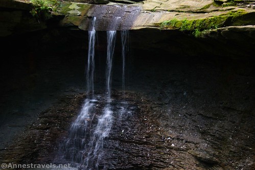
Blue Hen Falls
2.6 miles out & back; 689ft. elevation gain; Moderate
Waterfall, icy falls, forest; Cuyahoga Valley National Park
New York

Storm King Mountain
2.4 mile loop; 460ft. elevation gain; Moderate
Forest, views, rocks; Lower Hudson Valley