
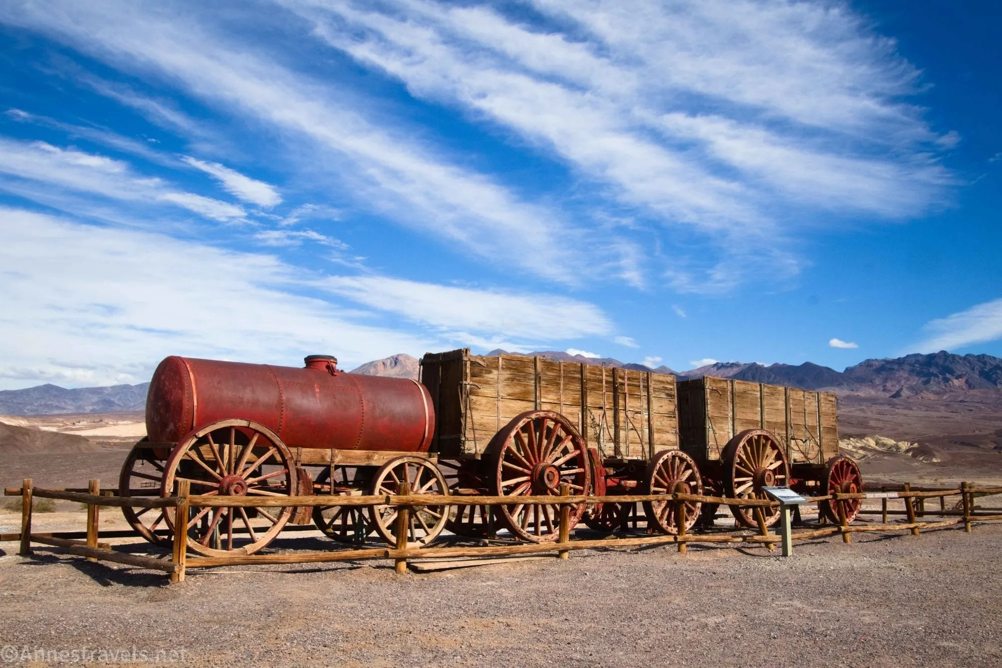
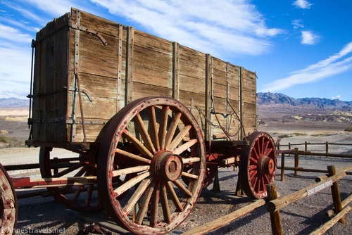
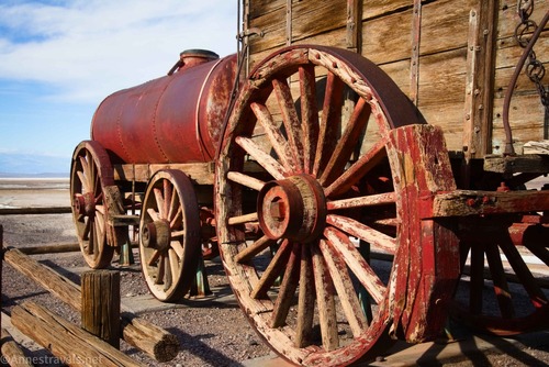
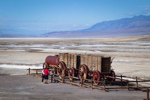
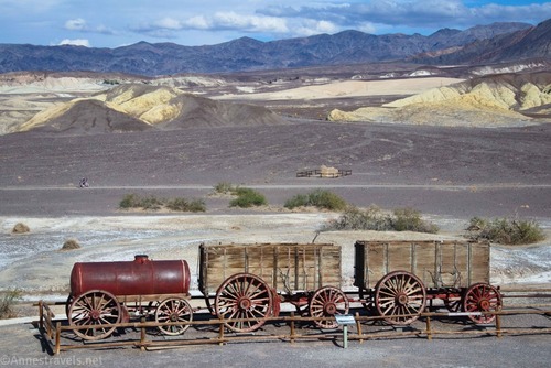
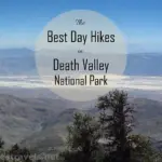
The Harmony Borax Works is one of the classic stops in Death Valley National Park. I like them because they offer both great history and a good view of the surrounding area. The 20 Mule Team, made famous by the borax company that took on that name, hauled the semi-refined borax ore from here out to Mojave or Daggett, California (the closest rail lines). Today, you’ll get to see part of the refinery, learn about the borax mining/refining process, and stand beside two of the original 20 Mule Team borax wagons, plus a tank wagon that carried water for the mules and drivers.
Quick Stats
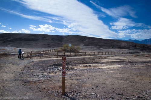
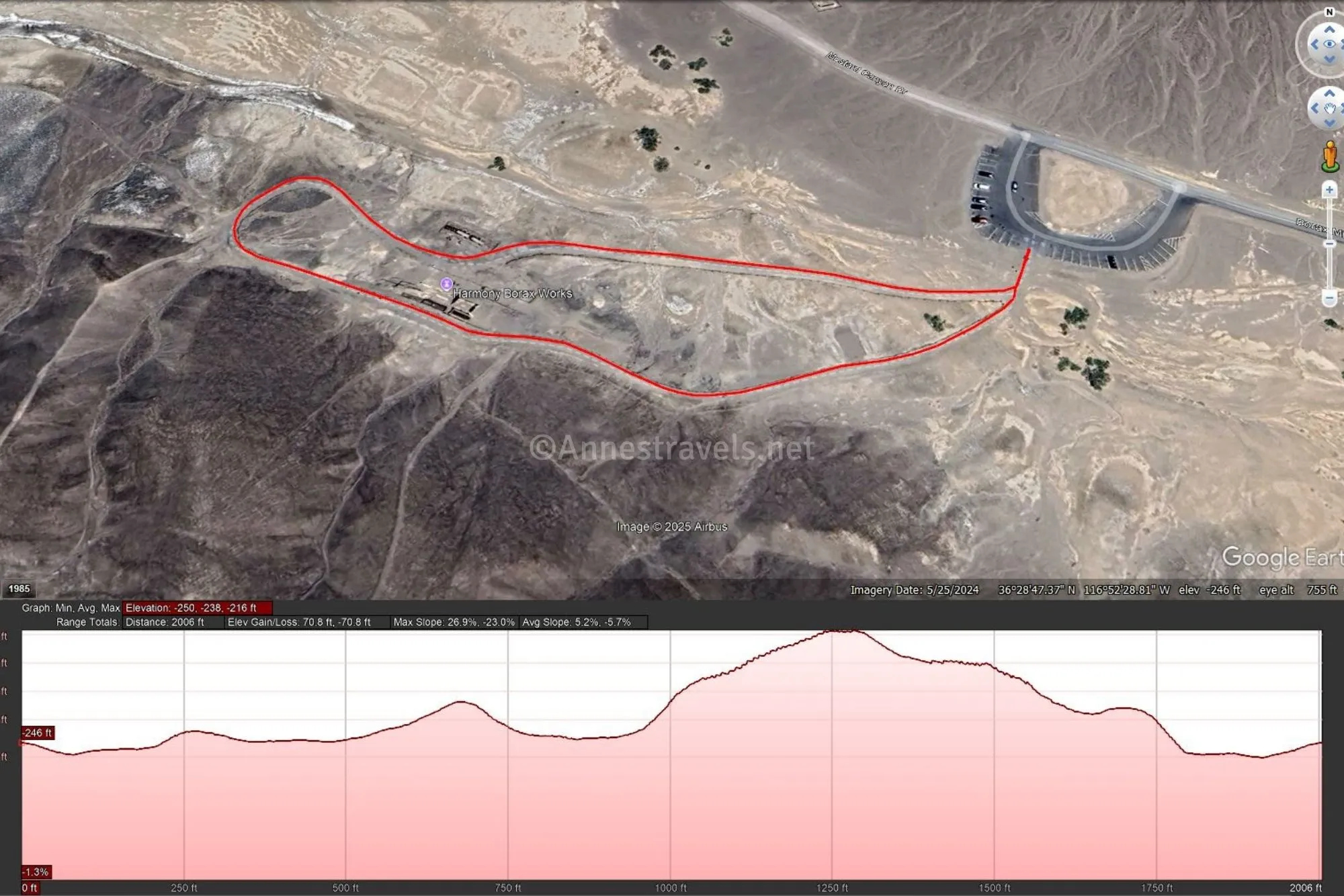
From the parking area just north of Furnace Creek, walk the hard-packed gravel path to where it splits. I like to turn left here, as it takes you up to the refinery first, but you’re welcome to go right to the borax wagons and do the loop counter-clockwise if you prefer.
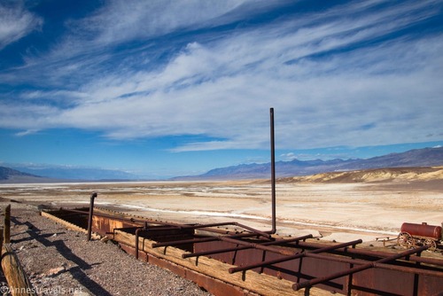
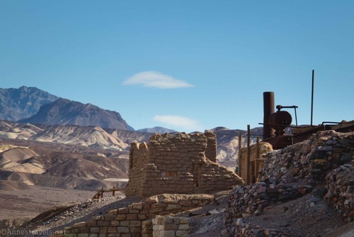
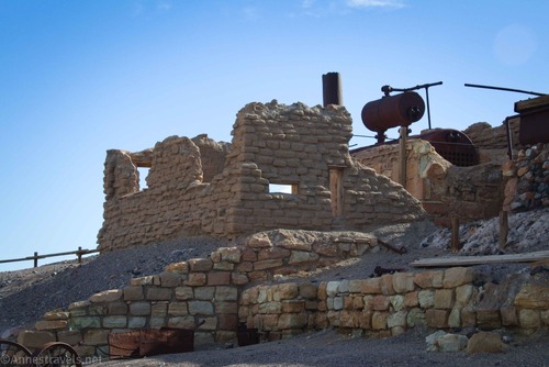
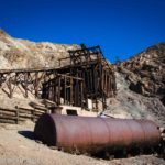
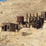
Turning left, the trail quickly climbs up above the refinery. Signs explain the history of borax mining in Death Valley and talk about the refining process.
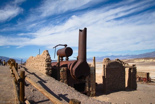
There are several good views of various parts of the refinery along the trail as it drops back down to the level of the wagons.
The wagons (and tank wagon) are the real draw of Harmony Borax Works if you want to see something impressive (though the refinery is much better than I remember from previous visits when it was about 100F in the shade). They’re huge!
Signs here also talk about the 20 Mule Team and the surrounding history. It’s pretty interesting, though I’ll leave it for you to read instead of giving you all of the details before you set foot in Death Valley.
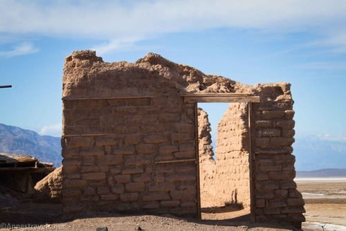
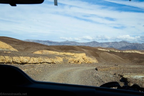
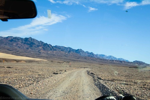
When you’ve finished taking pictures and reading the signs, head back to the parking area. From here, you can go back to the main road the way you drove in or you can continue along the one-way section of road through Mustard Canyon (usually ok for most vehicles, including low clearance). I recommend doing that at least once just for the experience. Along the way, you’ll pass by a couple of old structures on the right – I believe these were homes or offices for the workers at the Harmony Borax Works.
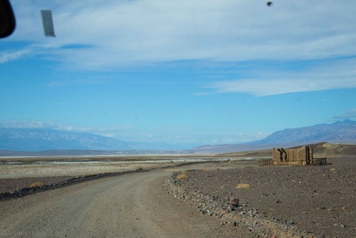
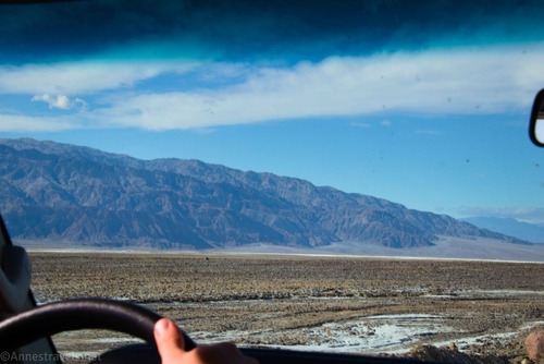
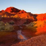
The road passes by some nice views out toward the Panamint Mountains (on the the left) before entering Mustard Canyon.
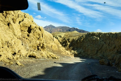
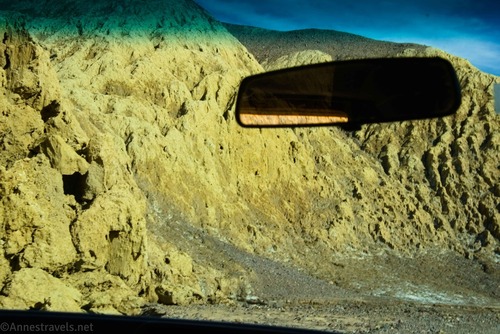
It’s not hard to figure out how Mustard Canyon received its name!
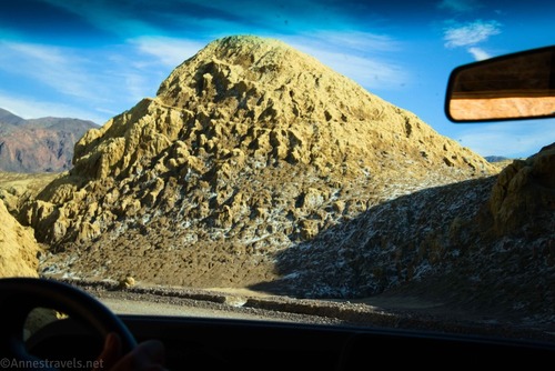
The road twists and turns through the yellow walls for a bit…
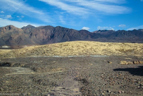
…then exits the canyon into a rough area of hills with views toward the Funeral Mountains.
Before you know it, you’re back at the main highway through Death Valley (CA-190). In total, the Mustard Canyon Drive is only 1.5 miles long (including the access road to Harmony Borax Works) – so it’s not like this is a long detour, though there is some nice scenery along the way!
Round Trip Trail Length: 0.4 miles
Elevation Gain: 71ft. (-250ft. to -216ft.)
Facilities: None
Fees: $30/vehicle, valid 7 days. America the Beautiful National Parks & Federal Public Lands Passes and Death Valley Annual Passes are accepted.
Trail Notes: This is a nice little stroll, and it’s even wheelchair-friendly (though there are some grades, so use caution). I seem to always visit at noon, which isn’t so bad in November but is scorching hot in May.
Road 
![]()
Signs ![]()
Scenery ![]()
Would I go 100 miles out of my way for this? ![]()
![]()
GPS Coordinates for the Harmony Borax Works
TH: 36.480014°, -116.873361° (36°28.80084′, -116°52.40166′ / 36°28’48.0504″, -116°52’24.0996″) (-246ft.) (0.0)
Refinery: 36.479748°, -116.875567° (36°28.78488′, -116°52.53402′ / 36°28’47.0928″, -116°52’32.0412″) (-216ft.) (0.15)
Borax Wagons: 36.479966°, -116.875404° (36°28.79796′, -116°52.52424′ / 36°28’47.8776″, -116°52’31.4544″) (-237ft.) (0.35)
Return to the TH: 36.480014°, -116.873361° (36°28.80084′, -116°52.40166′ / 36°28’48.0504″, -116°52’24.0996″) (-246ft.) (0.4)
The gpx file for Harmony Borax Works can be downloaded – please note that this and the GPS Coordinates are for reference only and should not be used as a sole resource when hiking this trail.
Download GPX File size: 5.8 KB Downloaded 33 times
(Note: I do my best to ensure that all downloads, the webpage, etc. are virus-free and accurate; however, I cannot be held responsible for any damage that might result, including but not limited to loss of data, damages to hardware, harm to users, from use of files, information, etc. from this website. Thanks!)
Getting to Harmony Borax Works
From Furnace Creek, drive north 1.3 miles from the visitor center on CA-190. Turn left onto the road marked for the Harmony Borax Works for 0.2 miles to the parking area. The turn onto the access road is also 9.5 miles south of the Beatty Cutoff.
More Hikes in Death Valley!
Read about the history of Death Valley’s mines along with discovering hikes and exploration opportunities. Showcasing almost 300 different driving and hiking destinations, it’s a great resource for visiting Death Valley. Buy your copy here.


Pingback: Sneak Peak: Petrified Forest, Southern Utah, and Death Valley! – Anne's Travels