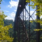
If you want to see the New River Gorge Bridge, the best angle is from the Main Overlook, also known as the Canyon Rim Boardwalk. (Actually, I really like the angle from Long Point, but it’s not as classic as the Main Overlook.) It’s near the visitor center, not very long (but definitely a stairway), and has a great view – so it should be on your must-see list if you visit New River Gorge National Park!
Quick Stats
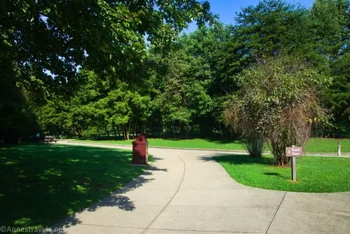
From the visitor center, take the sidewalk toward the highway (right if you’re facing the visitor center). The sidewalk will take you to another sidewalk marked for “Scenic Views.” Turn left on this and head through the trees toward the rim of the canyon.
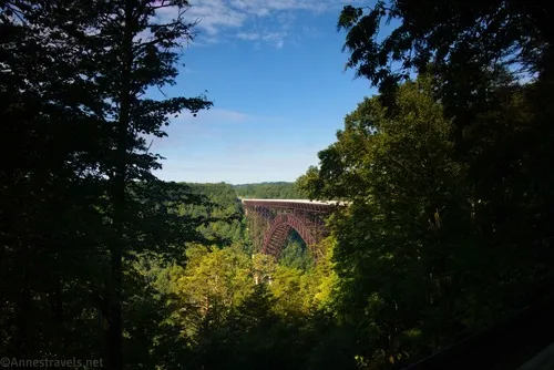
After about 400ft. (from the Scenic Views sign), you’ll come to the upper overlook. Trees have been cut so that you can peer out between them to the New River Gorge Bridge. A sign also describes the bridge and local history.
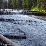
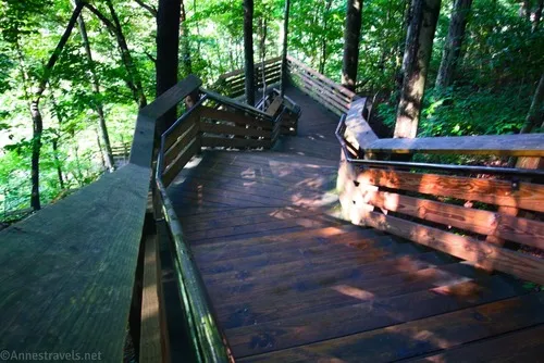
The views here are fine, and if that’s all you can do, you still have a pretty good view. But if you really want to see the bridge and the canyon, walk down the stairs (all 178 of them).
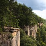
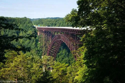
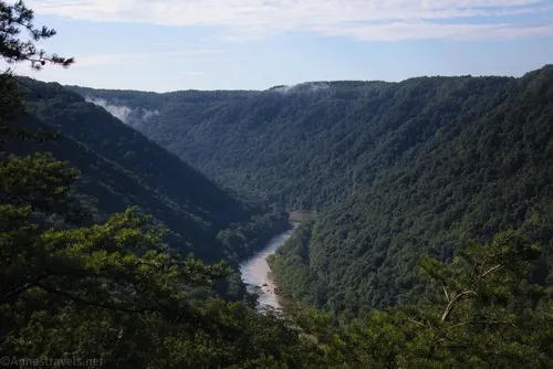
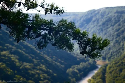
At the bottom of the stairs is a viewing area that looked brand new in 2022. But the best part was the views from here, both of the New River Gorge Bridge…
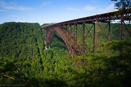
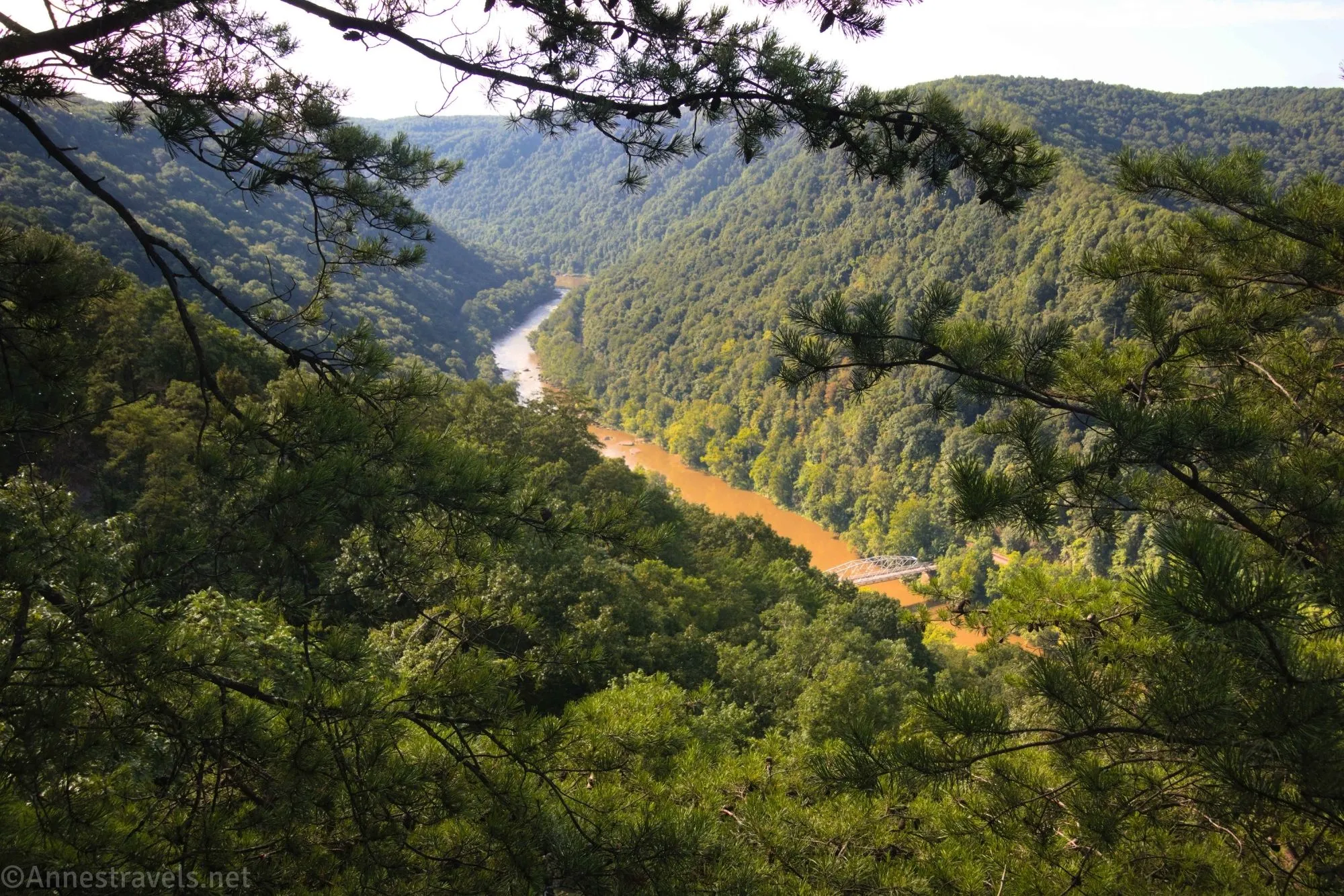
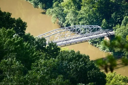
…and up New River Gorge. The morning mist was just lifting off the gorge, so there were still wisps of fog here and there. You also get a good view of the old Fayette Station Bridge, which was the only way across the gorge in this area until the New River Gorge Bridge was built in 1974.
And that’s it! Only 0.3 miles long (RT), but it has some great close-up views of the big bridge, as well as nice views of New River Gorge.
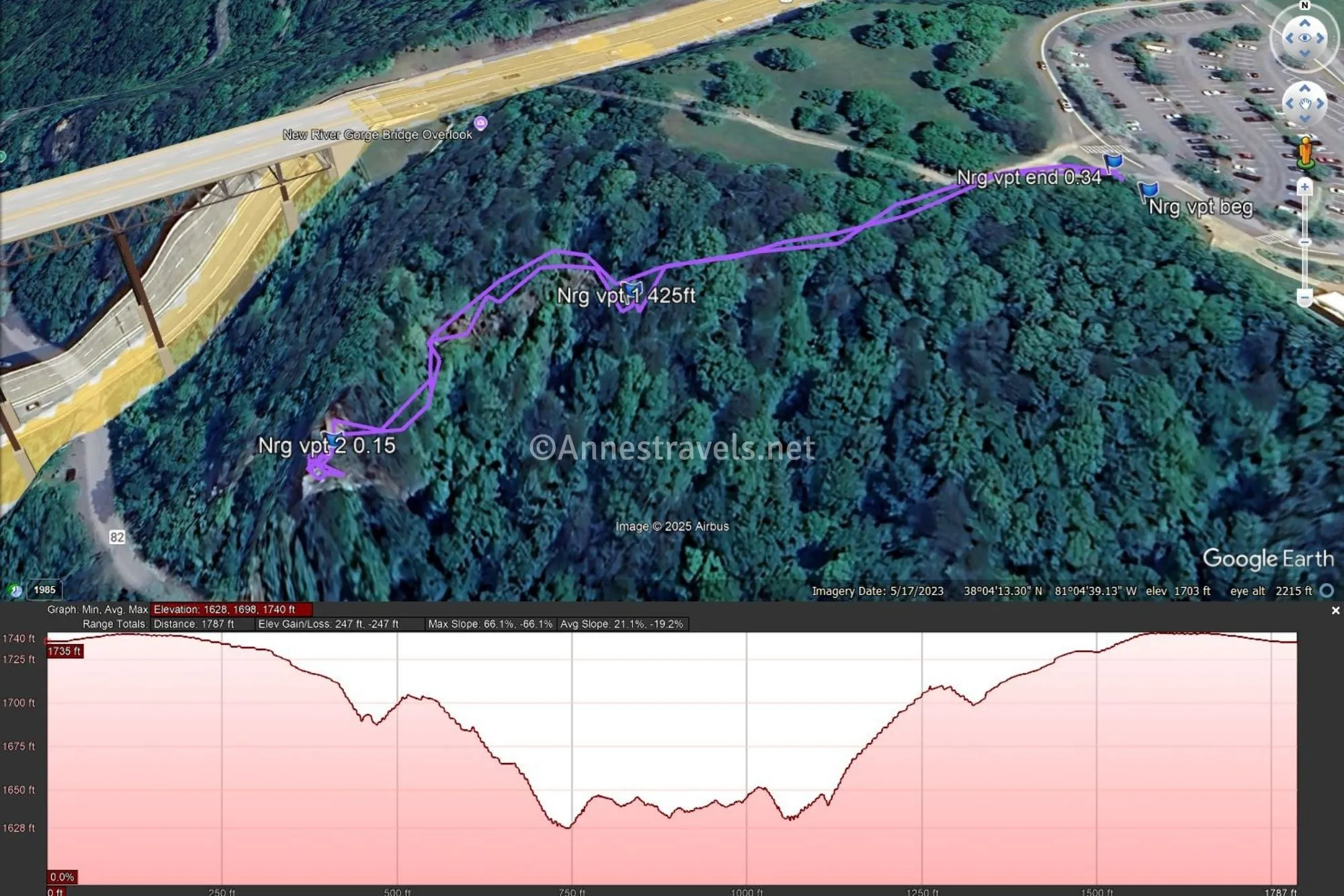
Round Trip Trail Length: About 0.3 miles
Elevation Gain: 247ft. (1,740ft. to 1,628ft.)
Facilities: Restrooms, picnic tables, water, and visitor services at the visitor center
Fees: None
Trail Notes: The stairs are quite a workout! Take your time, and you should be fine. It would have been amazing to watch the mist lift off the gorge, but sadly I didn’t realize how quickly it would go, so it was sunny by the time I arrived at the first overlook, let alone the lower one.
Trail 
![]()
Road
Signs ![]()
Scenery ![]()
Would I go 100 miles out of my way for this? ![]()
![]()
Overall Rating: ![]()
GPS Coordinates for the Canyon Boardwalk
Trailhead: 38.070557,-81.076316 (38.0705570°, -081.0763160° / 38°04.23342′, -081°04.57896′) (1,733ft.) (0.0)
First Viewpoint: 38.0703730°, -081.0776370° (38°04.22238′, -081°04.65822′ / 38°04’13.3428″, -081°04’39.4932″) (1,716ft.) (425ft.)
Lower Viewpoint: 38.0701000°, -081.0783320° (38°04.20600′, -081°04.69992′ / 38°04’12.3600″, -081°04’41.9952″) (1,618ft.) (0.15)
End: 38.0706630°, -081.0763670° (38°04.23978′, -081°04.58202′ / 38°04’14.3868″, -081°04’34.9212″) (1,734ft.) (0.34)
The gpx file for the Canyon Overlook can be downloaded – please note that this and the GPS Coordinates are for reference only and should not be used as a sole resource when hiking this trail.
Download GPX File size: 8.6 KB Downloaded 42 times
(Note: I do my best to ensure that all downloads, the webpage, etc. are virus-free and accurate; however, I cannot be held responsible for any damage that might result, including but not limited to loss of data, damages to hardware, harm to users, from use of files, information, etc. from this website. Thanks!)
Getting to the Canyon Boardwalk Trailhead
From Fayetteville, drive east on US-19N. Cross over the New River Gorge Bridge. Take the first right (about 2 miles total from Fayetteville), then take the first right into the visitor center parking lot.


More Easy Day Hikes in New River Gorge
Appreciate the convenience of all of the best, easy trails in one place in this guide. Maps and photos make it easy to choose trails, too. Buy your copy here!