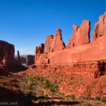
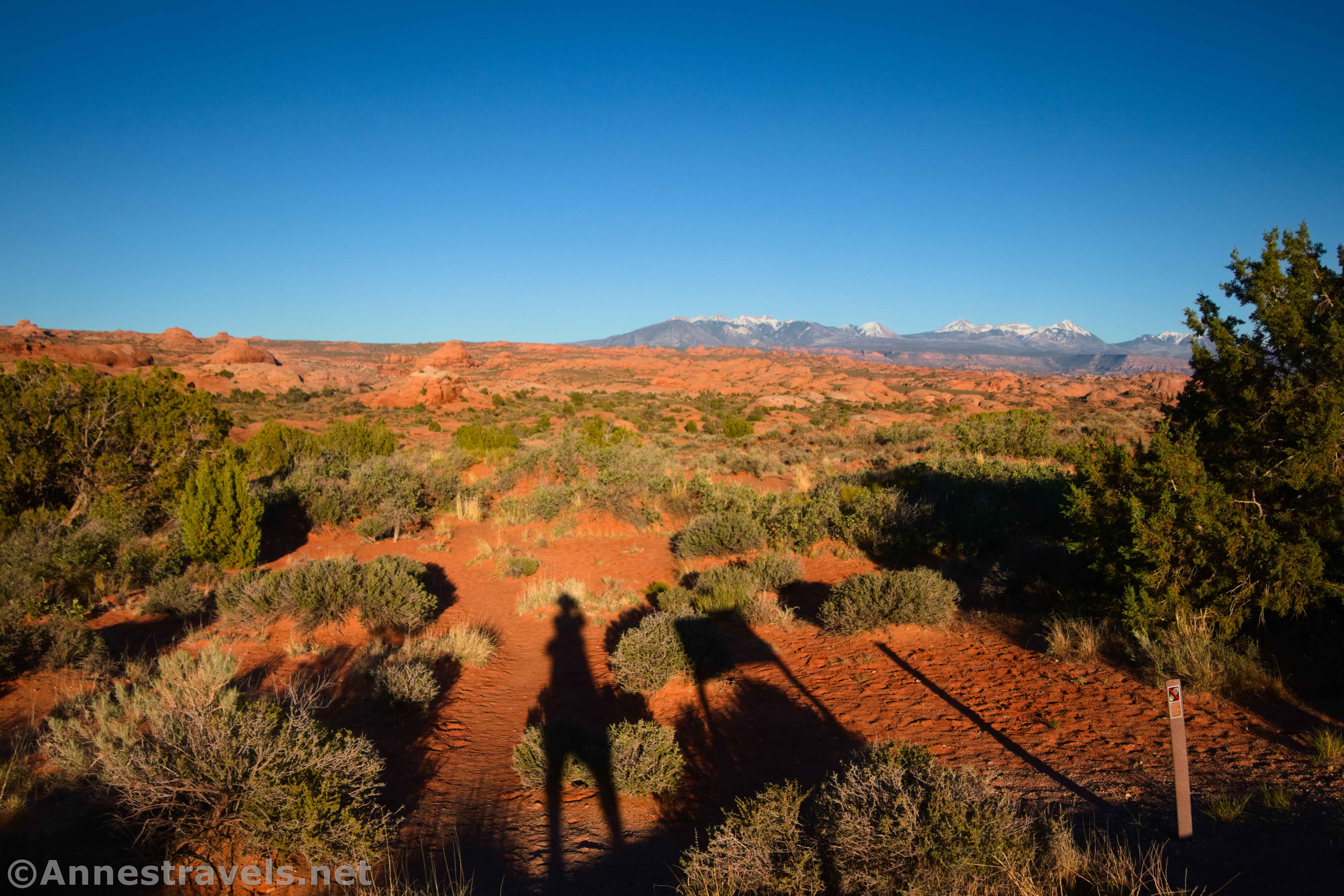
The main park road in Arches National Park is only 18 miles long – but it packs a punch in those miles! The park boasts close to 20 trails and routes, and I had the pleasure of hiking (at least part of) all of those trails a couple of weeks ago. In this post, I’ll tell you about all of the official trails in Arches and whether or not I think they’re worth hiking – which, for the most part, they are!

These trails major on arches and rock formations (which makes sense), but there are also some good views and a bit of history. The other overwhelming factor about these hikes is that they’re short. Three miles round trip to Delicate Arch is quite long, as park trails go. That’s not to say that the trails are easy – many require scrambling on one level or another – but as I told another hiker near Sand Dune Arch, “I’m just not used to this much instant gratification!”
Without further ado, here are the official trails in Arches National Park, starting in the south (near the park entrance and the visitor center) and ending in the north (at Devils Garden). At the end of the post, I’ll include an itinerary for how you could hike all of these trails in 6 days – my itinerary was a little different, since it involved interruptions, other hikes, and poor weather in the middle of a lot of beautiful hiking.
Trails in Arches: Main Park Road – Visitor Center to the Windows Road
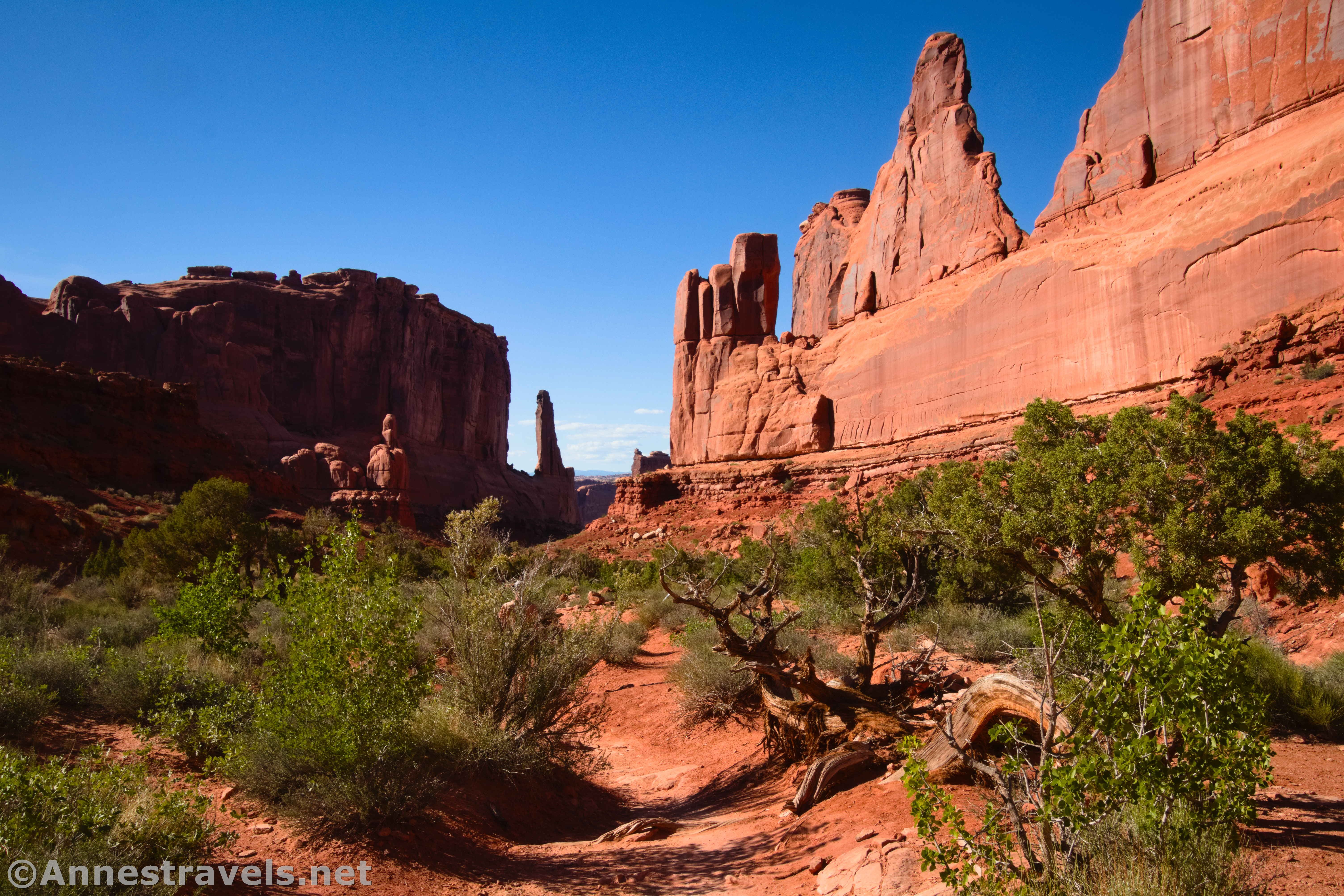
Park Avenue
2.0 miles out & back (or 0.1 miles out & back to the viewpoint)
Rating: 5 stars
I loved this hike! It’s especially gorgeous in the later afternoon, though mid-morning is also beautiful. Rock formations (some with fun names) rise on either side of the canyon. Even the viewpoint is well worth the visit, though hiking down to the Courthouse Towers Viewpoint at the end of Park Avenue is even better.
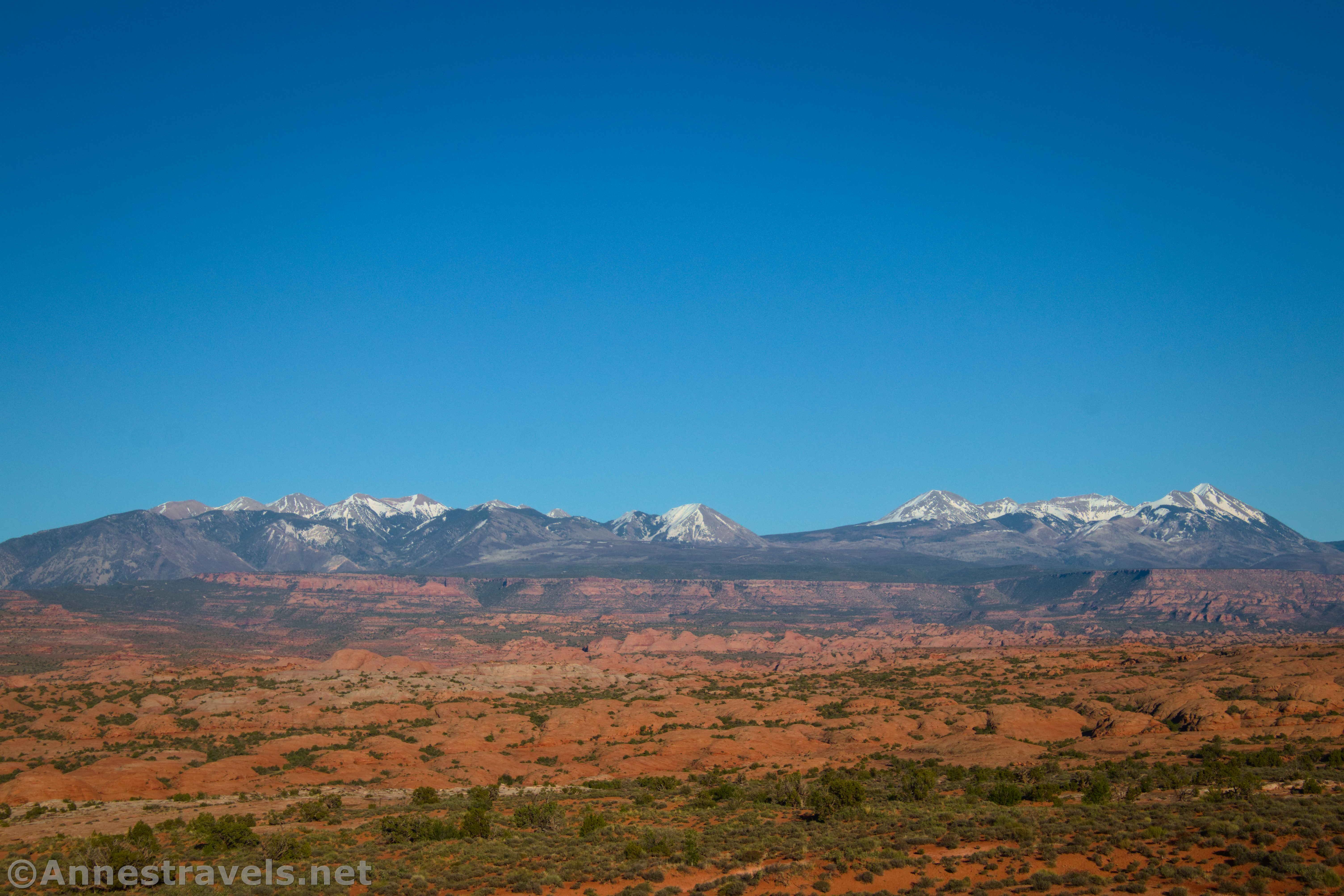
La Sal Mountains Viewpoint
Minimal hiking
Rating: 3 stars
The views down on the rock formations of Courthouse Wash are quite good in the morning. And in the afternoon/evening, the views to the La Sal Mountains are excellent. However, those views are good elsewhere, too; thus the low rating.

Courthouse Towers Viewpoint
No hiking
Rating: 2 stars
A simple overlook of the rock formations on the edge of Courthouse Wash, especially of the Three Gossips Formation and Sheep Rock. There are better views elsewhere in my opinion, but it’s still a good, quick stop.
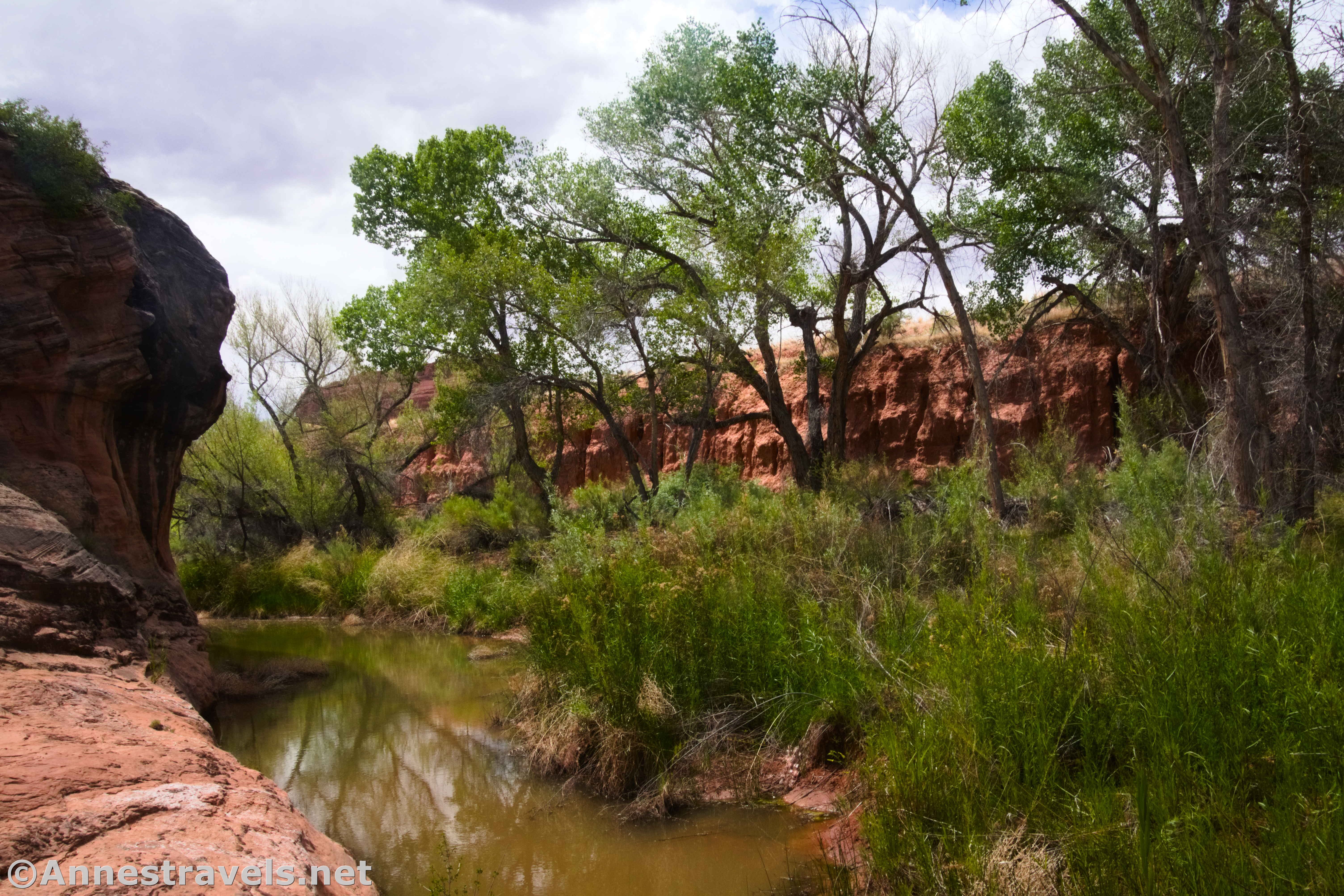
Lower Courthouse Wash
Up to 10 miles out & back
Rating: 2 stars
While the trail isn’t marked, it’s also a semi-official route. The path takes you through riparian areas and along a perennial stream in a canyon. There isn’t much in the way of views, but it’s usually more pleasant than the desert on a summer day.
Petrified Dunes Overlook
No hiking
Rating: 1 star
The views from the pulloff are best of the La Sal Mountains and to the (somewhat distant) Windows area – and thus are best in the afternoon. The Great Wall (across the road) would be nice enough in the morning. Still, it’s not worth more than a cursory stop – or maybe not even that.
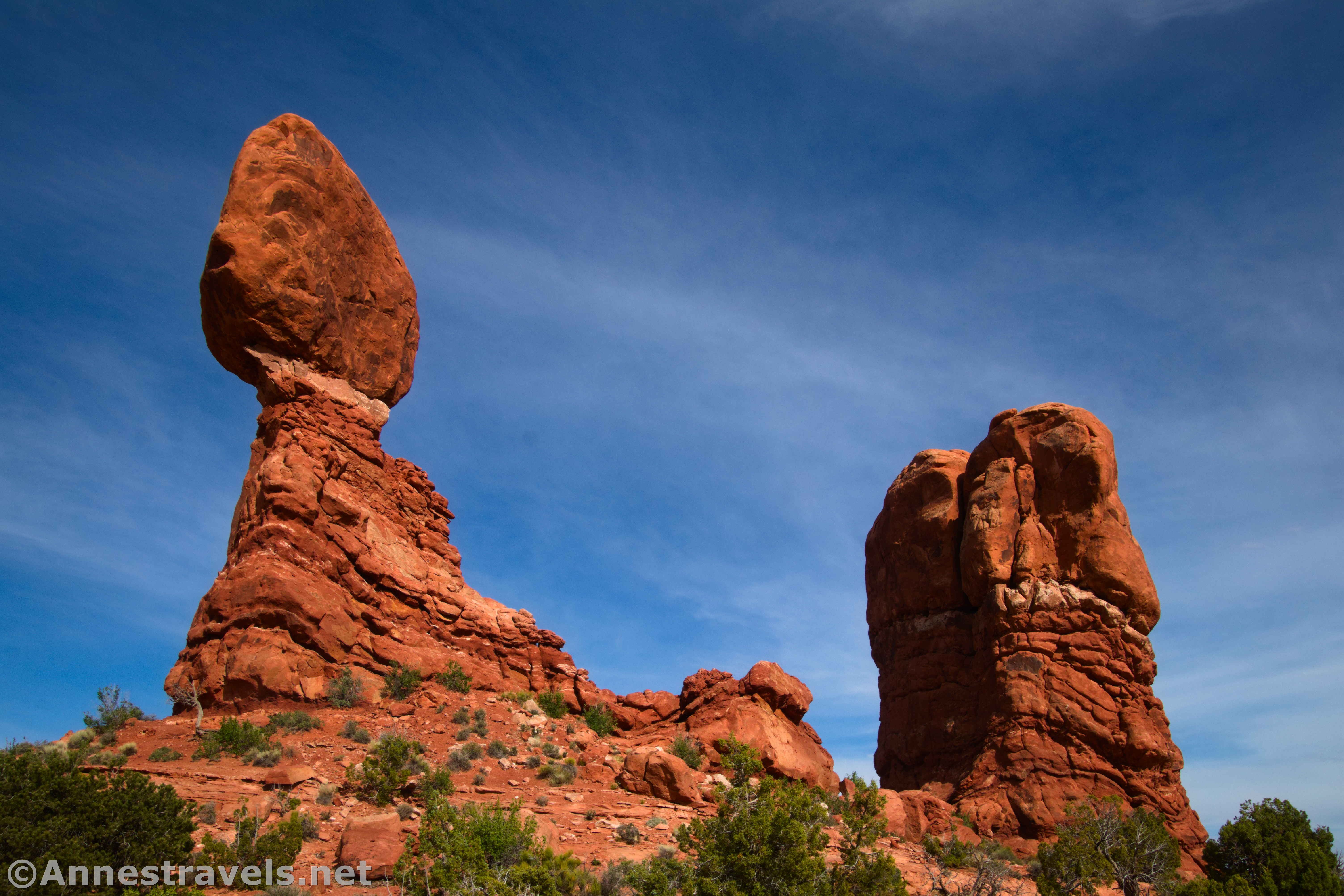
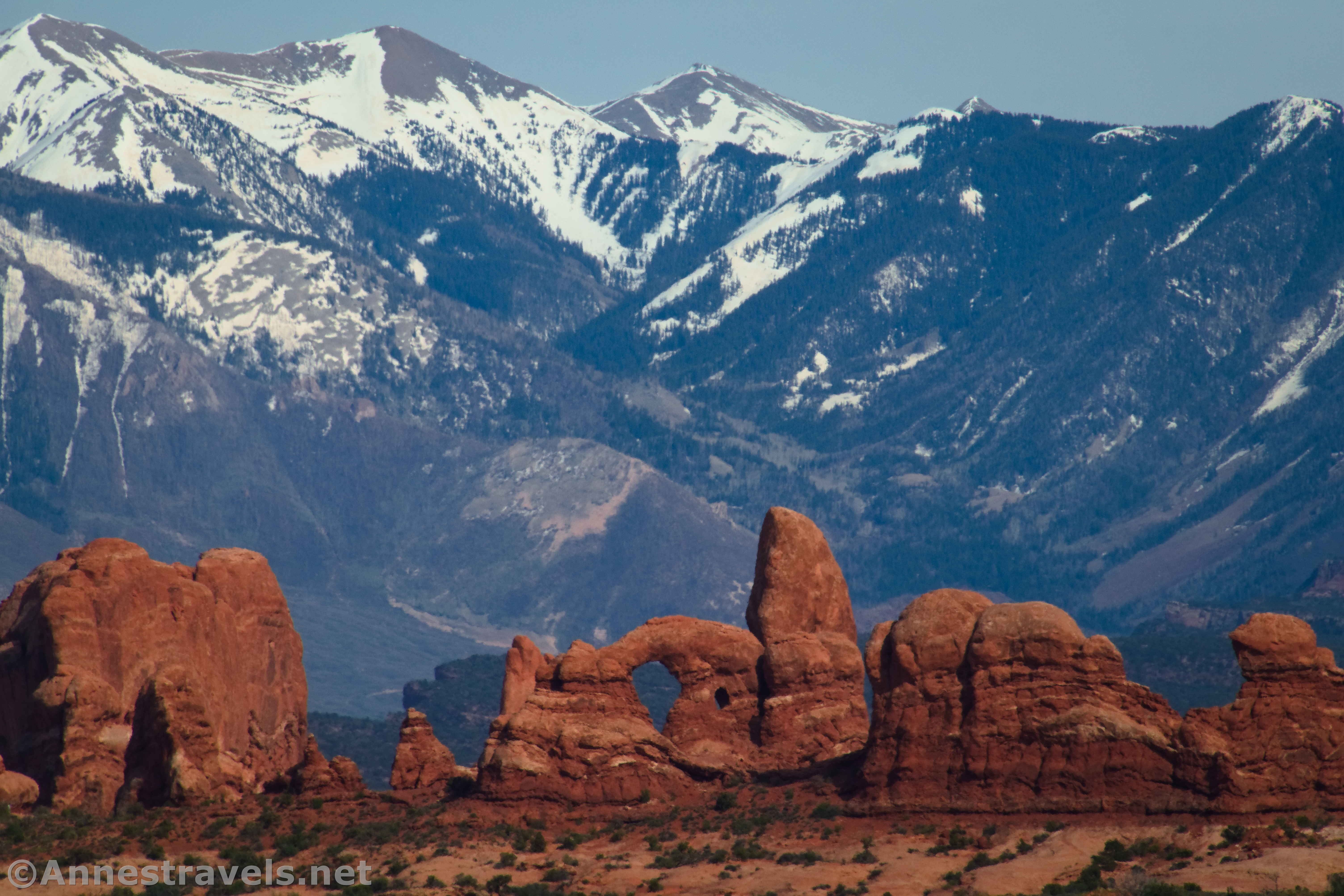
Balanced Rock
0.3 mile lollipop loop
Rating: 5 stars
I always figured that I could see the Balanced Rock better from the road than by getting close. That may be true, but the views of the surrounding area make it well worth the paltry mileage. Turret Arch in the shadow of the La Sal Mountains was my favorite view, but looking up at the huge rock on its spindly spire is also pretty cool. I’d recommend visiting in the early evening.
Trails in Arches: Windows Road
The road to the Windows strikes off on the right shortly after the Balanced Rock Trailhead.
Pothole Arch
No hiking
Rating: 2 stars
A small pulloff with views to a pothole arch. Best in the morning and then only for a quick stop.
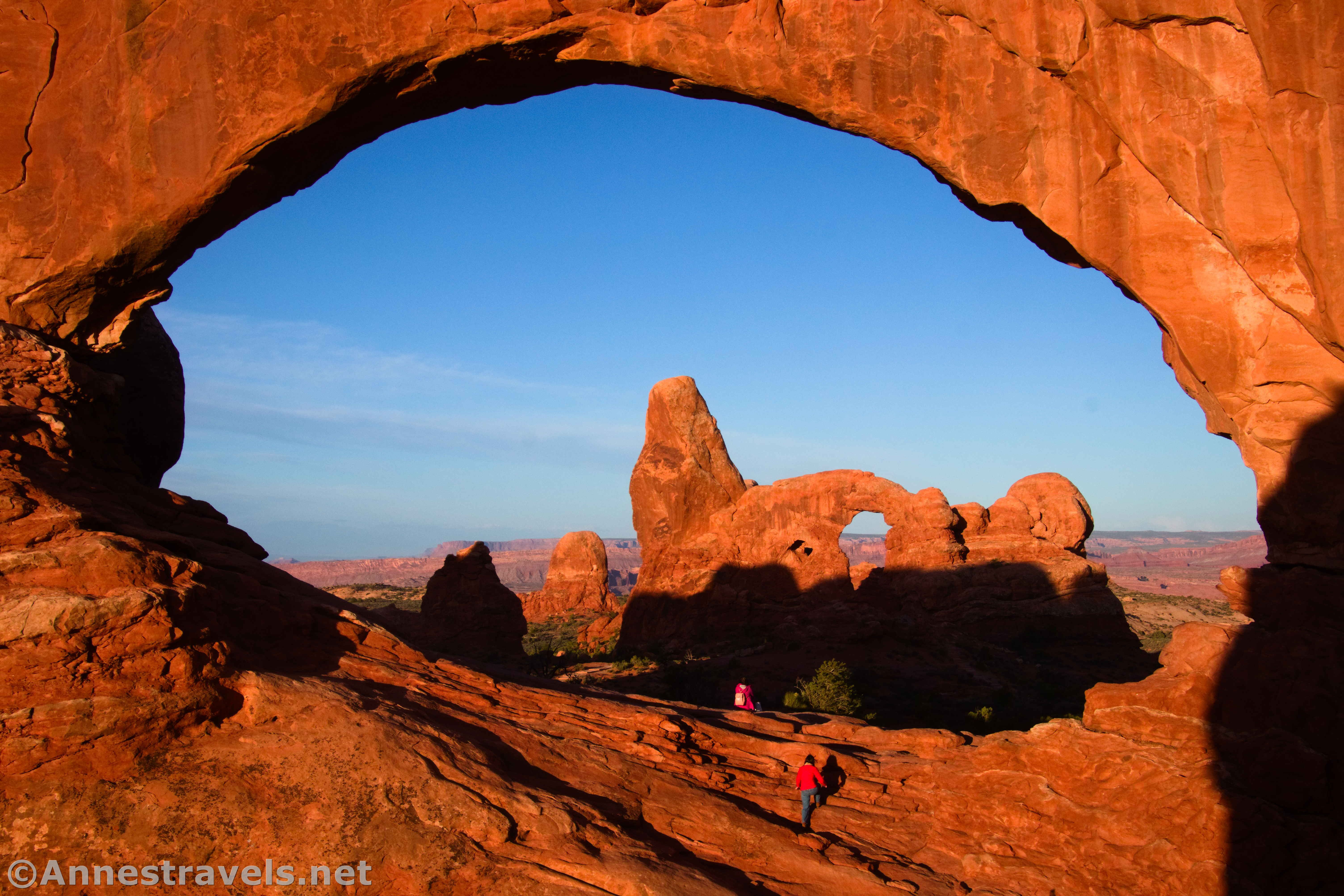
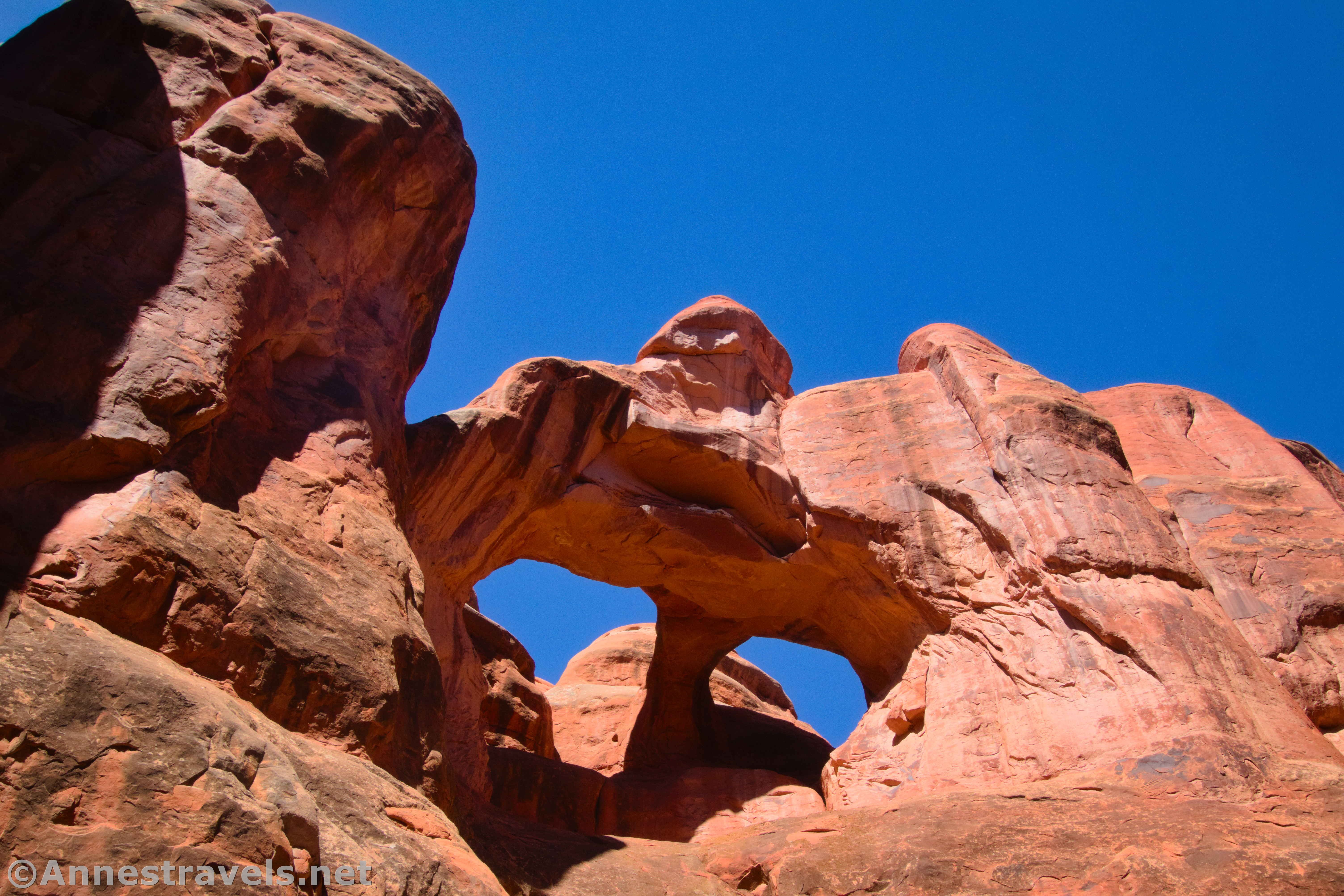
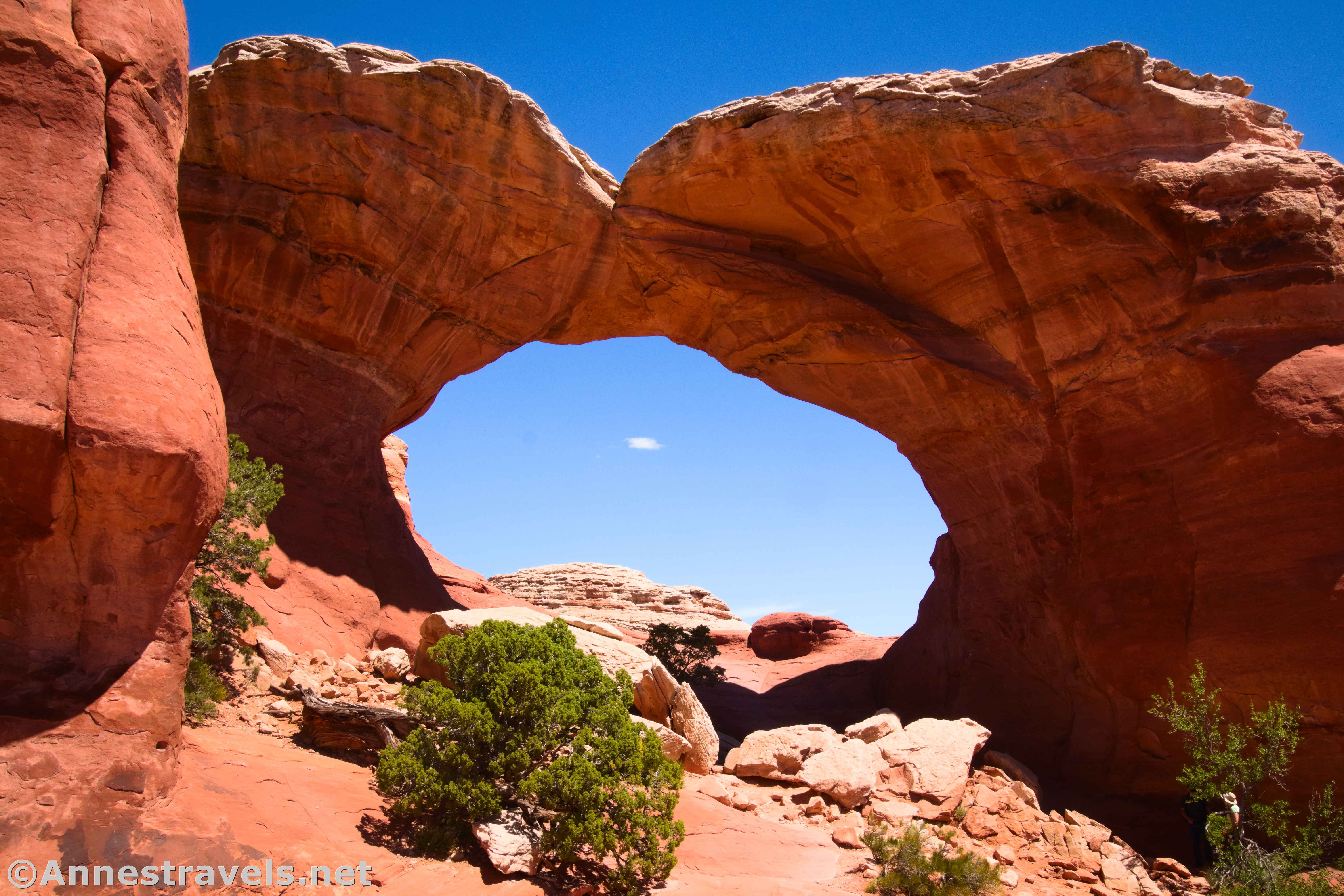
North Window, South Window, and Turret Arch
0.6 mile lollipop loop
Rating: 5 stars
This is a classic morning hike, when photographers line up to take a shot of Turret Arch through the North Window. However, it’s also great in the late afternoon, when Turret Arch is not as much of an attraction, but the light shines brilliantly on the Windows.

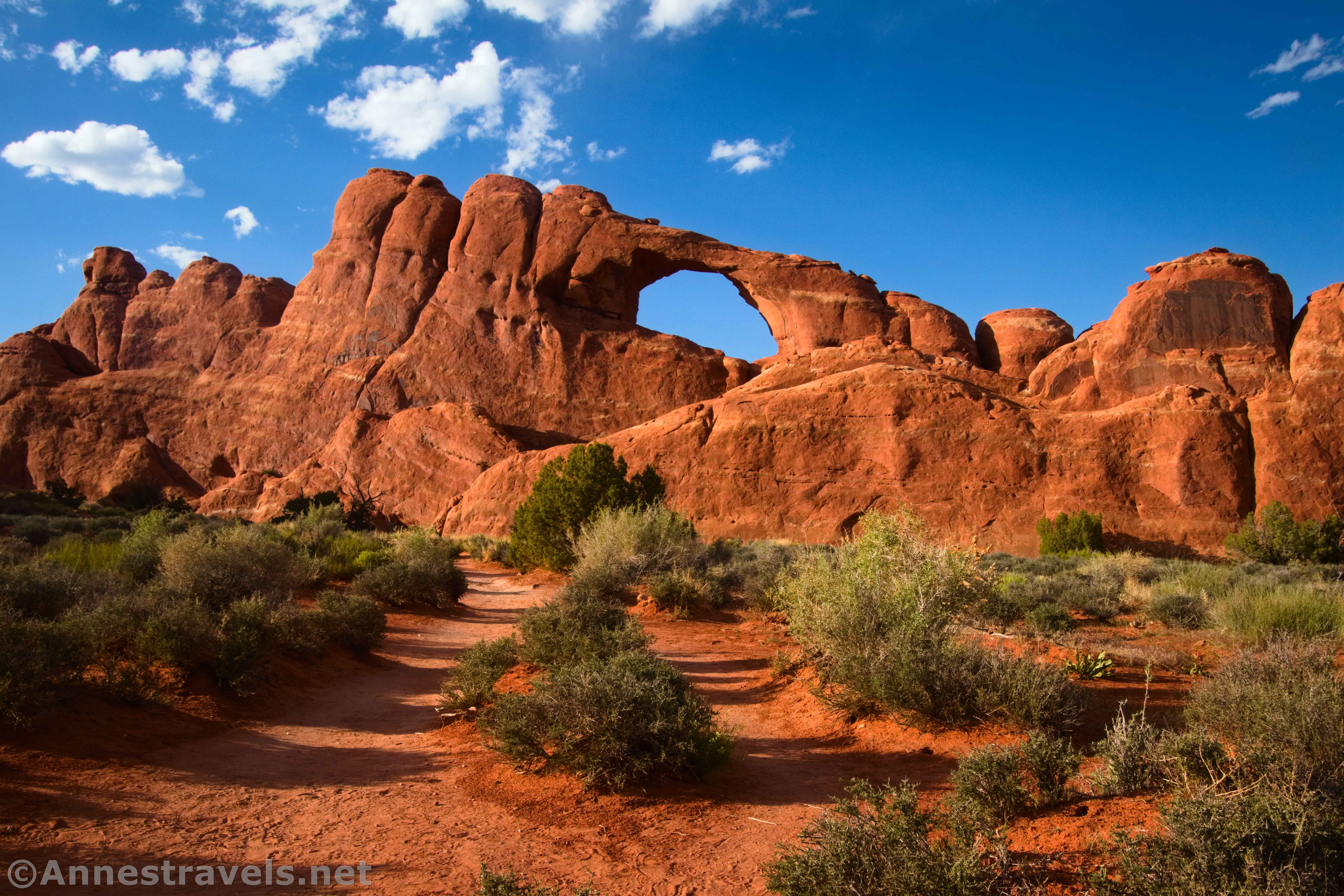
Windows Primitive Loop
1.0 mile loop
Rating: 4 stars
This is a continuation of the North Window, South Window, and Turret Arch loop (it doesn’t actually take you to Turret Arch, so feel free to add that on if you want). After passing the famous arches, it loops behind the Windows with good views to the La Sal Mountains and to the cliffs near the Colorado River before dropping through a saddle between two fins and taking a sandy route back to the parking area.
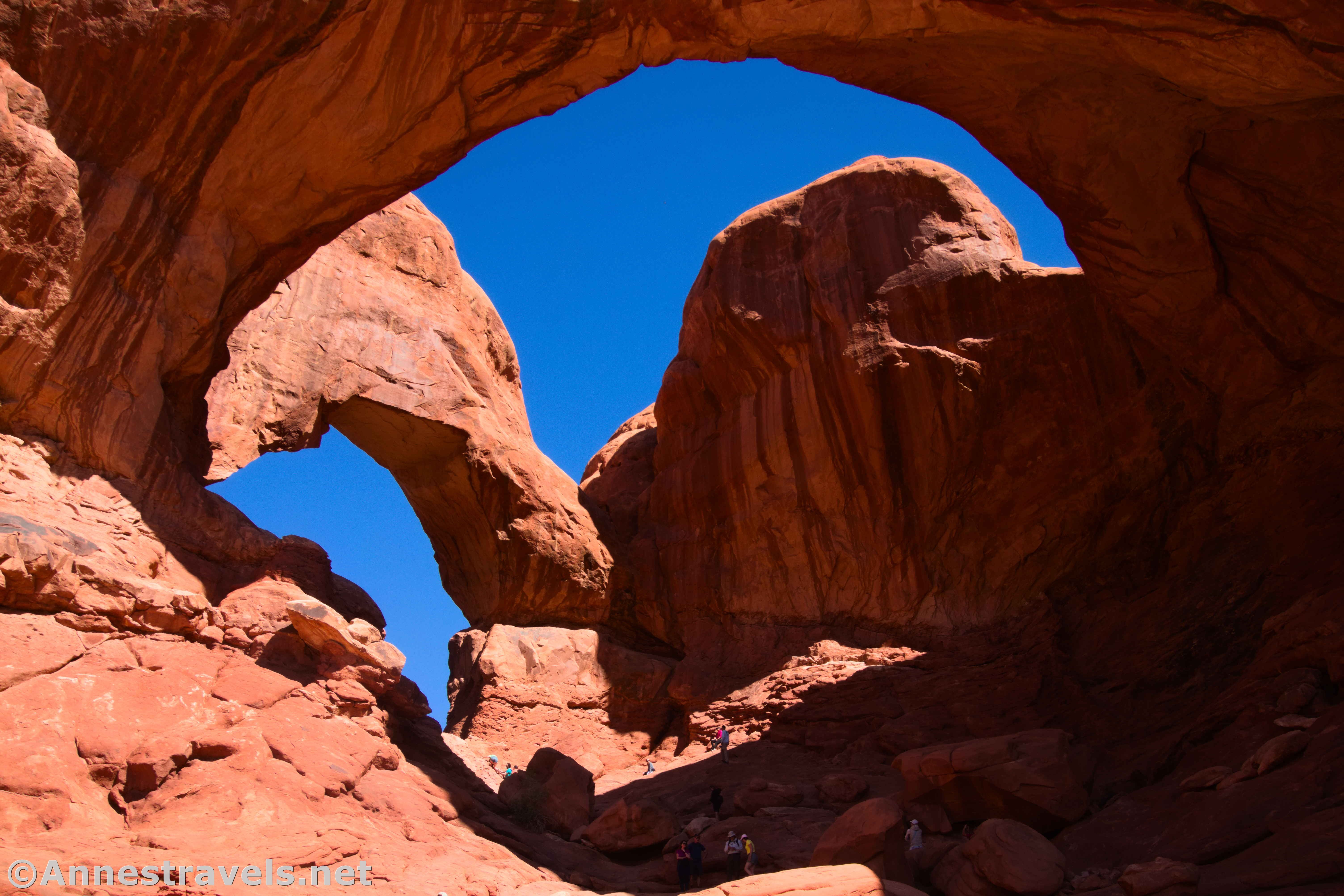
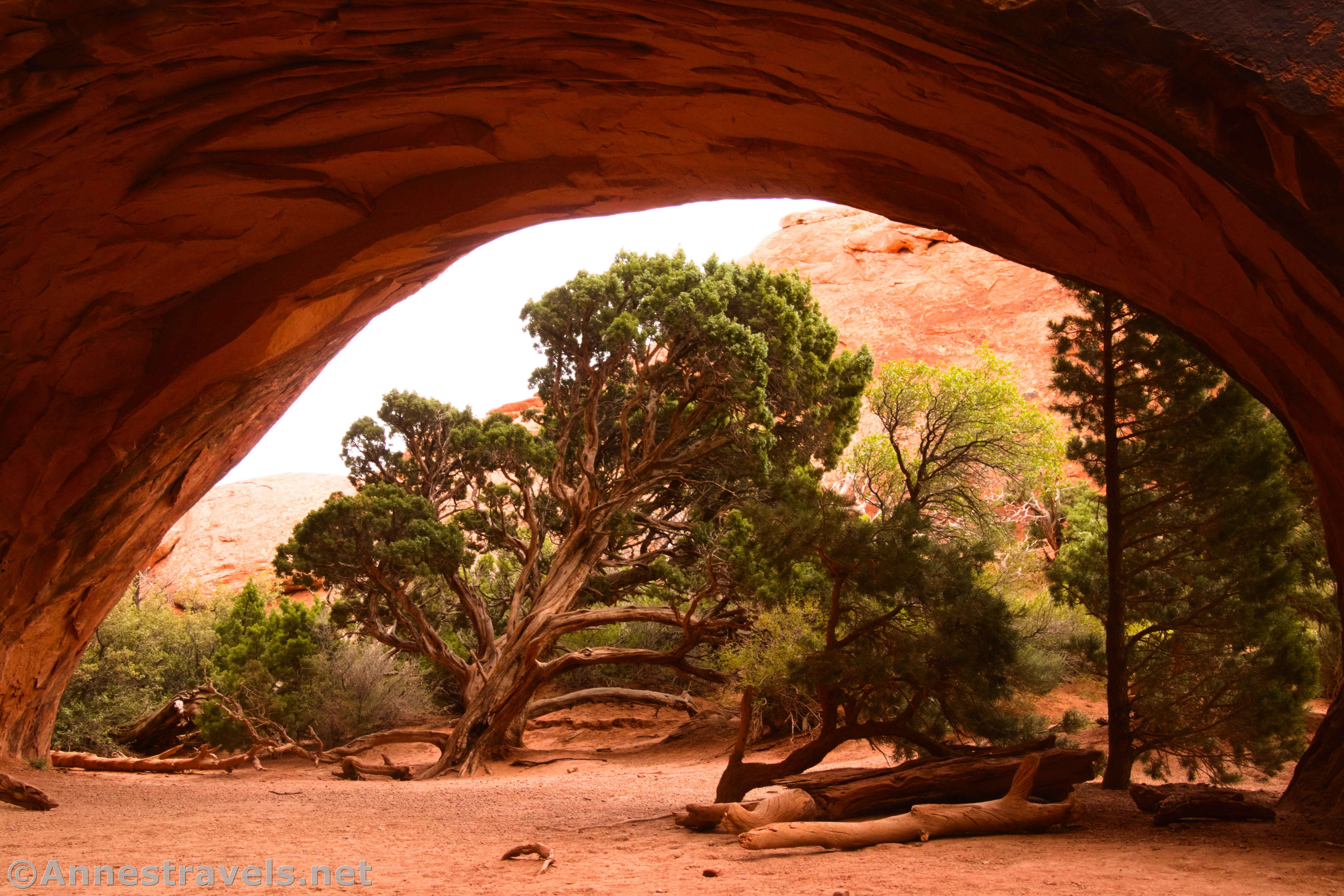
Double Arch
0.5 miles out & back
Rating: 5 stars
Double Arch is a short, easy hike even by Arches standards, and the rewards are great! The arch is spectacular. Someone told me it’s the tallest opening in an arch in the park, and I’d believe it. You can scramble around under it if you want, but use care on the slickrock. I like to visit this one in the early morning.
Trails in Arches: Main Park Road – Windows Road to Delicate Arch Road
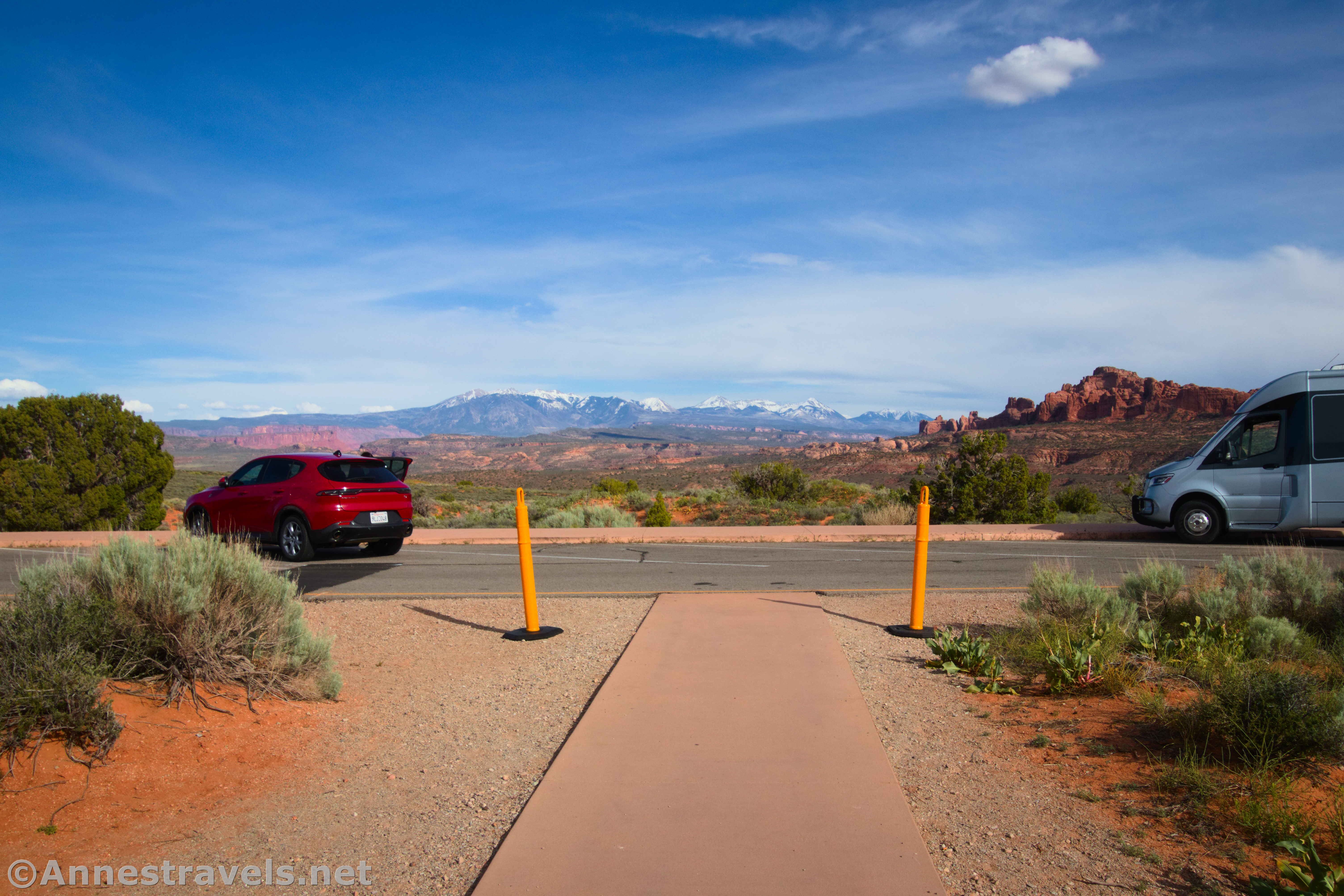
Panorama Point
Minimal hiking
Rating: 4 stars
The views from the sidewalk around the large parking area are spectacular to the La Sal Mountains, down on Salt Valley, and into Cache Valley, especially in the afternoon. There is also a picnic area, amphitheater, and primitive restrooms.
Cache Valley Overlook
No hiking
Rating: 2 stars
It’s not really that the Cache Valley Overlook is all that bad, but compared to Panorama Point, it’s also not quite as exciting. It’s also little more than a pulloff along the hill down into Salt Valley along the Main Park Road shortly before reaching the Delicate Arch Road. Definitely check out this one in the evening rather than the morning.
Trails in Arches: Delicate Arch Road
The Delicate Arch Road strikes right off of the Main Park Road in the bottom of Salt Valley.

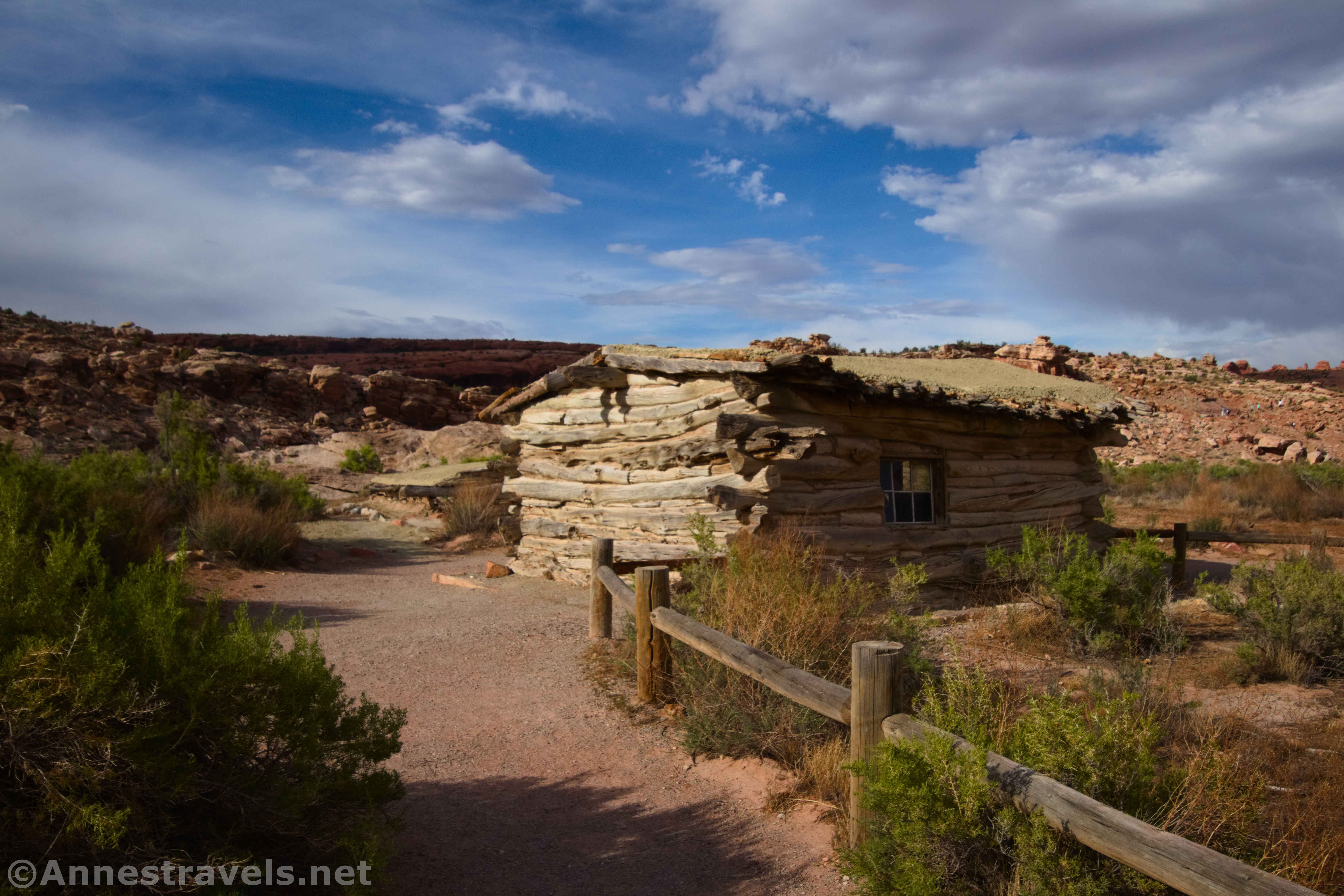
Wolfe Ranch & the Petroglyph Trail
0.5 mile lollipop loop with spur
Rating: 3 stars
The petroglyphs here are nice if not extensive. Wolfe Ranch is a cabin built by an early settler. Both are interesting if not really exciting. And since both are side trails off of the Delicate Arch Trail, feel free to see them while you’re hiking to the famous arch!

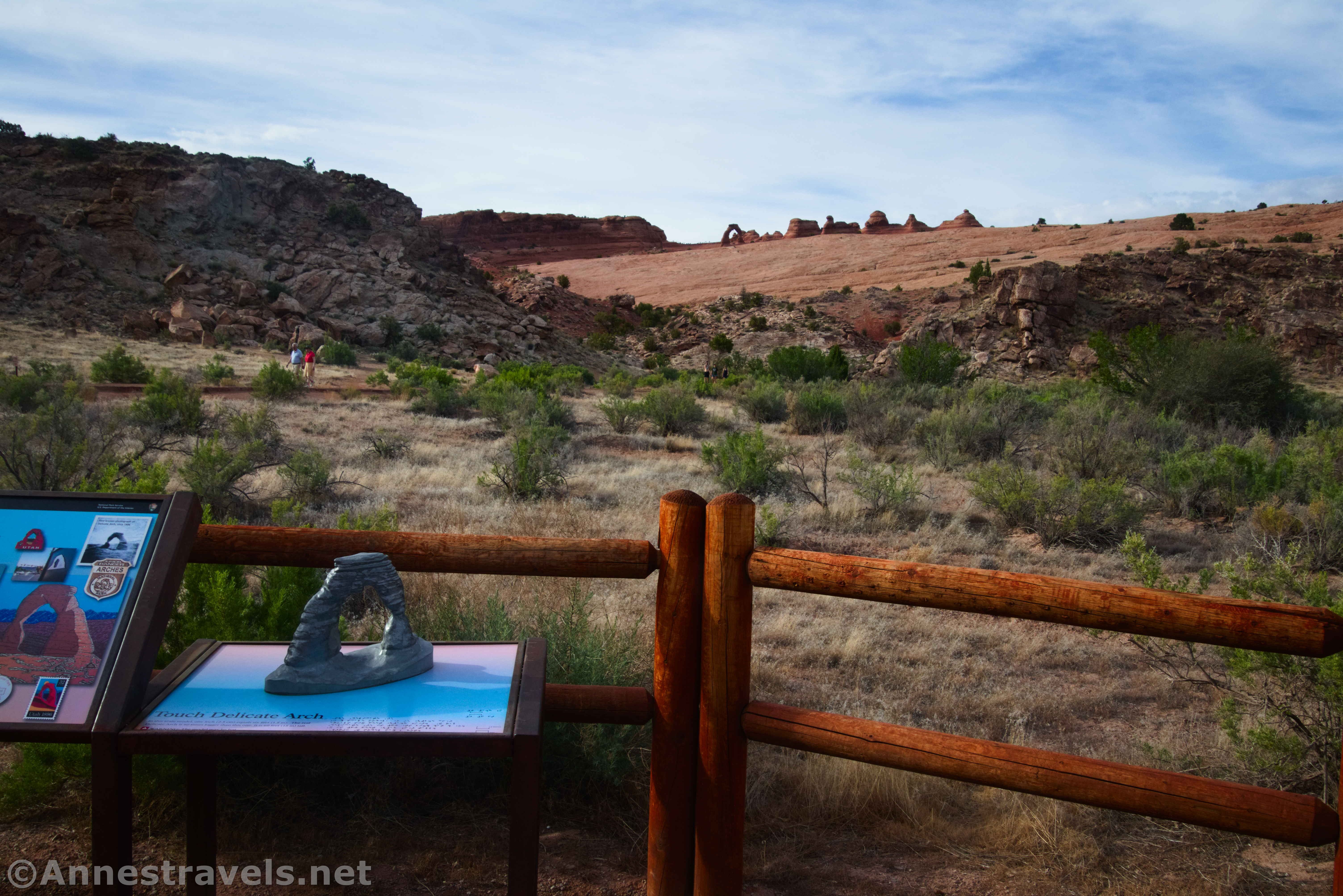
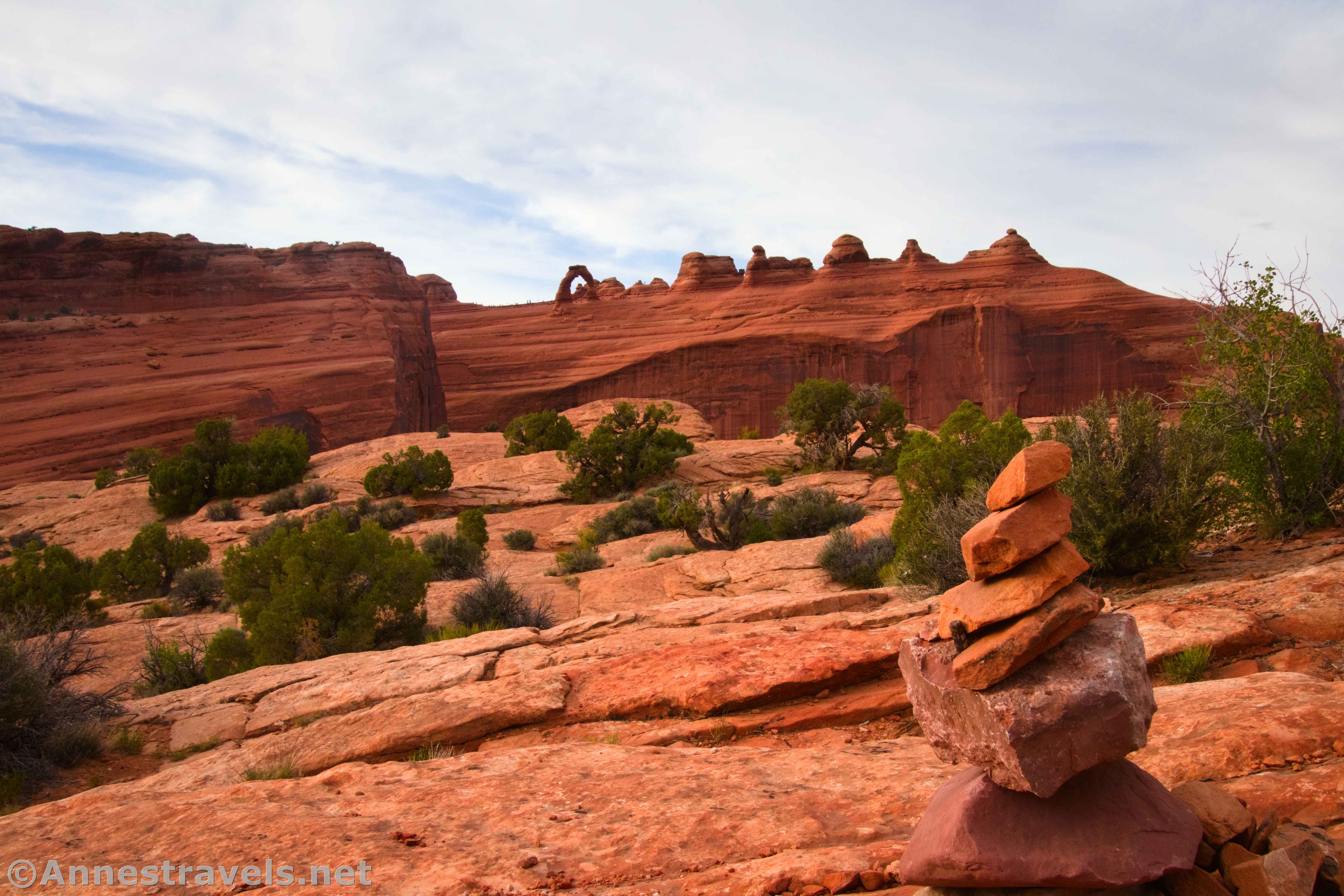
Delicate Arch Trail
3.2 miles out & back
Rating: 5+ stars
There is literally no other hike in the world like Delicate Arch. It requires minor slickrock scrambles, steep grades, and fantastic views along the way, but the arch itself is well worth the effort. Even with the crowds (it’s one of the more popular hikes in the park), it’s still one trail I’d recommend to anyone with the physical ability to hike it. If you can catch it about an hour before sunset, you’ll have some of the best lighting I’ve ever found on my multiple trips to the arch.
Lower Delicate Arch Overlook
0.1 miles out & back
Rating: 3 stars
If you can’t hike to Delicate Arch any other way, then definitely take this trail! The views are good enough. But if you can do the upper overlook (below) or the Delicate Arch Trail, both offer better views of the famous arch. The lighting is best in the fall/winter months, but I always seem to hike it in May and find it nice then, too.
Upper Delicate Arch Overlook
0.6+ miles out & back
Rating: 4 stars
If you can’t hike to Delicate Arch, then this trail should be on your bucket list. It’s steep but hikable up to the viewing area; if you want to strike off across the slickrock, you won’t be alone! However far you hike, the views of the big arch are amazing… especially with the tiny tourists running around near it to give perspective! The hike is better in the fall and winter months, but the rest of the year (especially morning) is good, too.
Trails in Arches: Main Park Road – Delicate Arch Road to Devils Garden
Salt Valley Overlook
Minimal Hiking
Rating: 3 stars
Panorama Point still has a better view, but the Salt Valley Overlook offers a quiet, beautiful view down on Salt Valley and to the La Sal Mountains. I visited in the evening, and that seemed like a great time of day to see it.
Fiery Furnace Overlook
0.15 miles out & back
Rating: 4 stars
The true Fiery Furnace requires a special permit (and wow, do those permits sell out quickly!), but there is a short trail so that anyone who can find a parking space can look down into the maze of fins and spires. There are also great views to the La Sal Mountains. So I’d recommend this one in the late afternoon or evening. That all said, I found the area looked more like the Fiery Furnace from Panorama Point… the flame effect was better from that angle or maybe just further away.
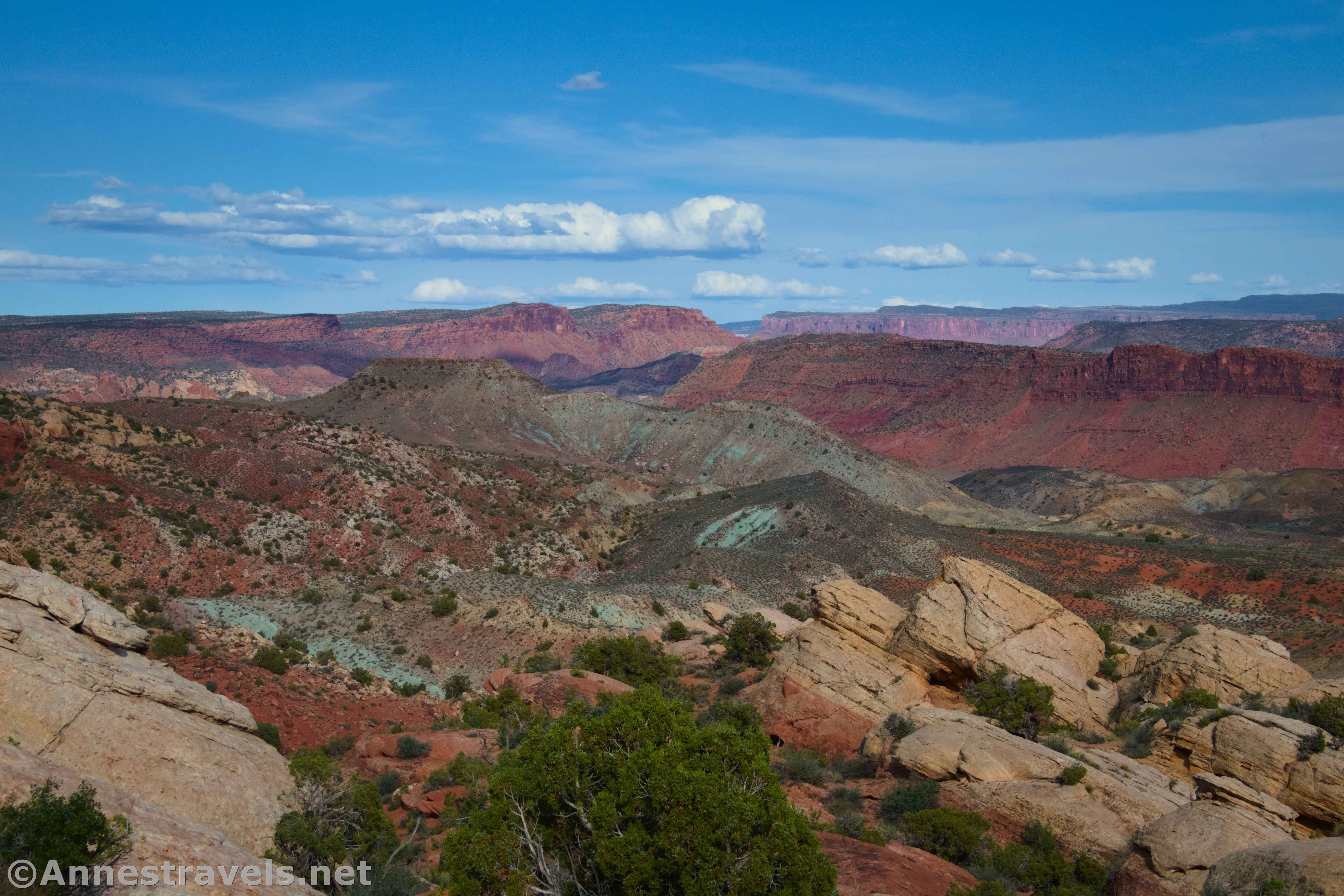
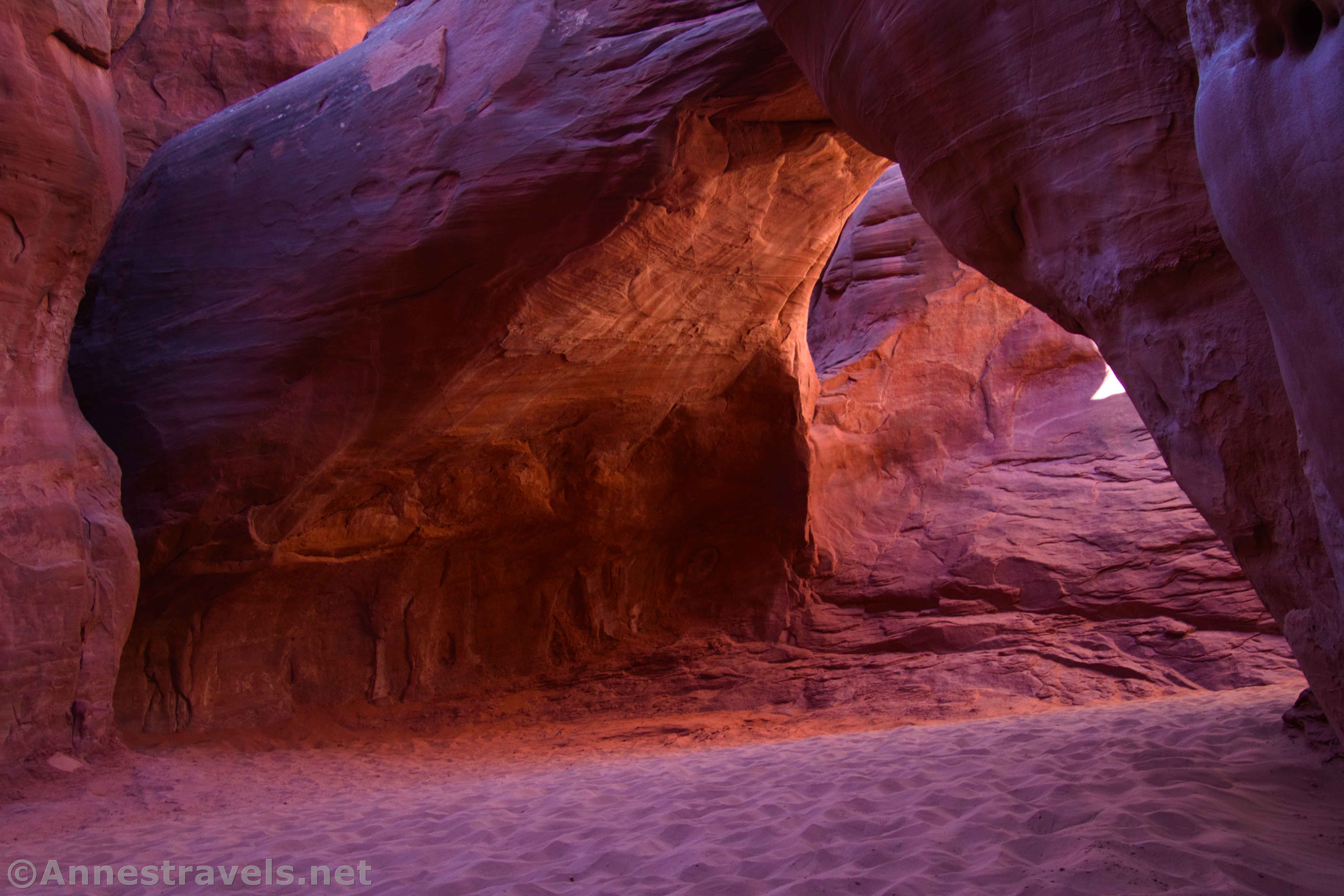
Fiery Furnace
Hiking is very difficult and varies in length
Rating: 5+ stars
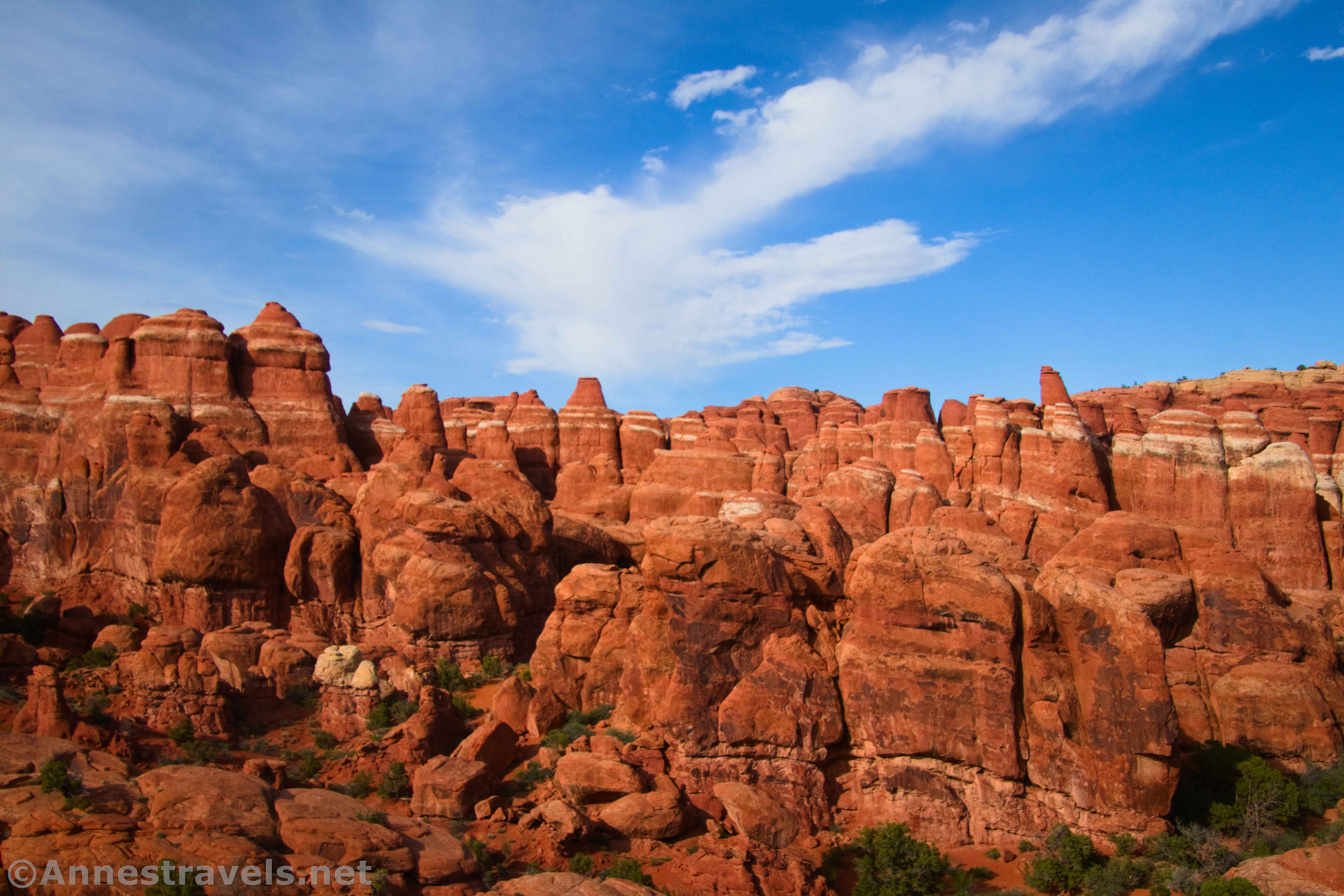
There’s not much I can say about the Fiery Furnace besides “Wow!!!” The area boasts so many spires, arches, fins, slot canyons, and more to explore. To visit, you have two options: You can book a permit for a ranger-led tour (so you don’t get lost – believe me, that’s a real threat), or you can book a permit to self-explore (you can guess which of these I did). The reservations for permits are available at 8am a week before the day of your hike at recreation.gov (there are different listings for the Self-Guided Hike vs. the Ranger-Guided Hike). The reservations are very highly sought-after, and it’s not uncommon for all 100 or so to be booked within 30 seconds. But if you can get in, it’s a beautiful, wonderful world of scrambling, squeezing, and way-finding.
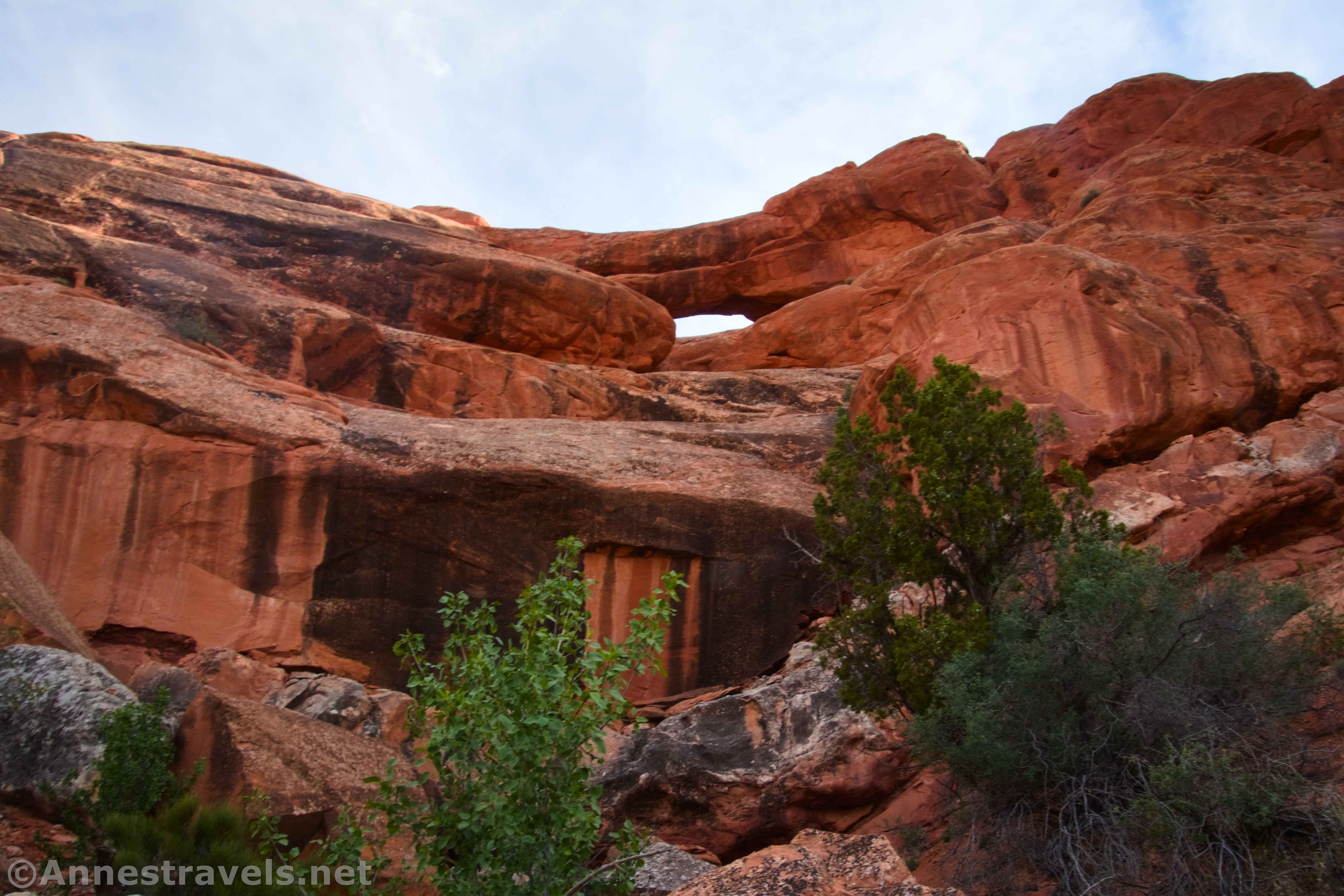
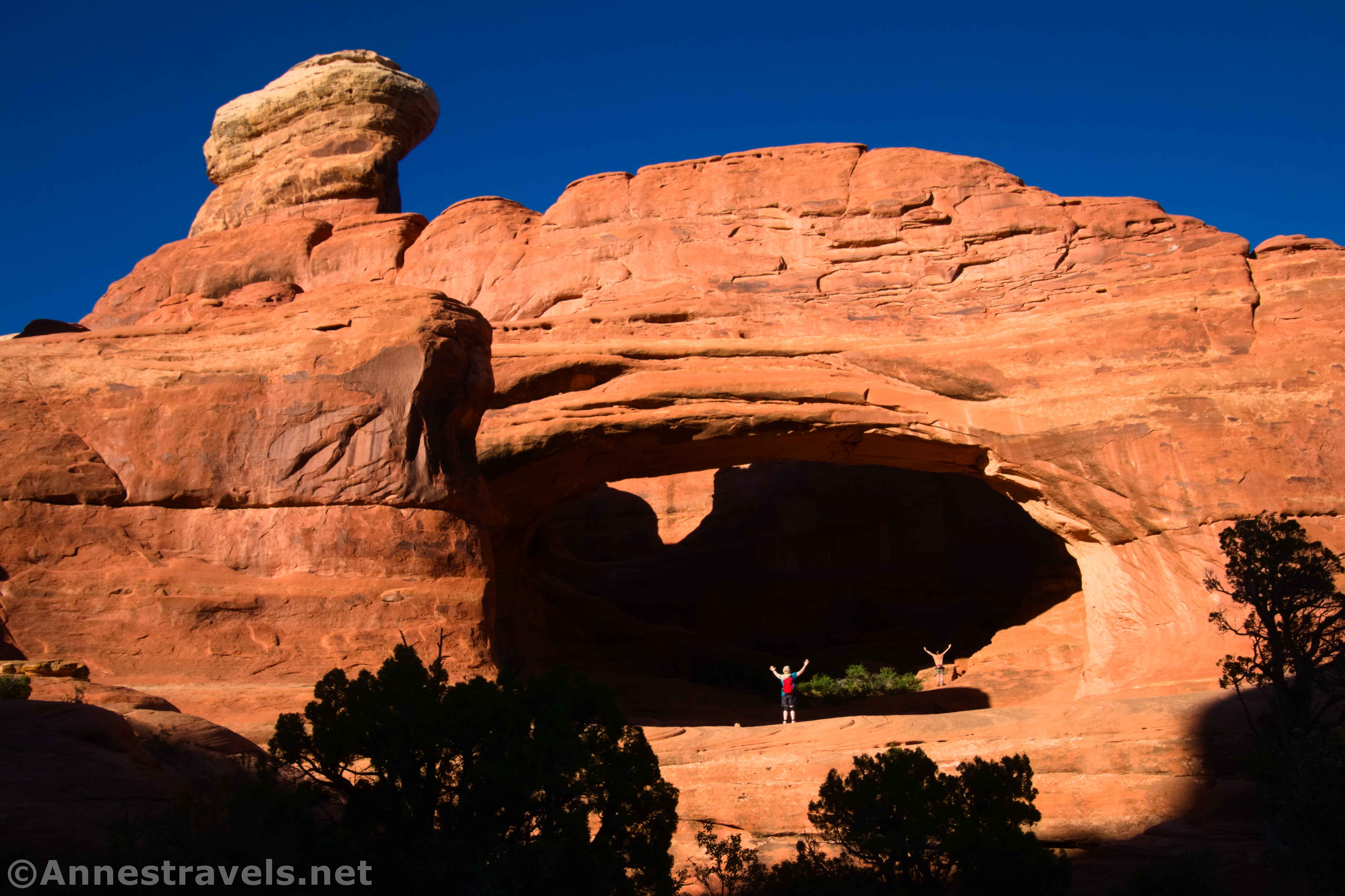
Sand Dune Arch
0.2 miles
Rating: 4 stars
Sand Dune Arch is a great hike in many ways: You get a few views, you get to creep between fins, there is a whole lot of sand, and of course the arch is pretty neat, too.
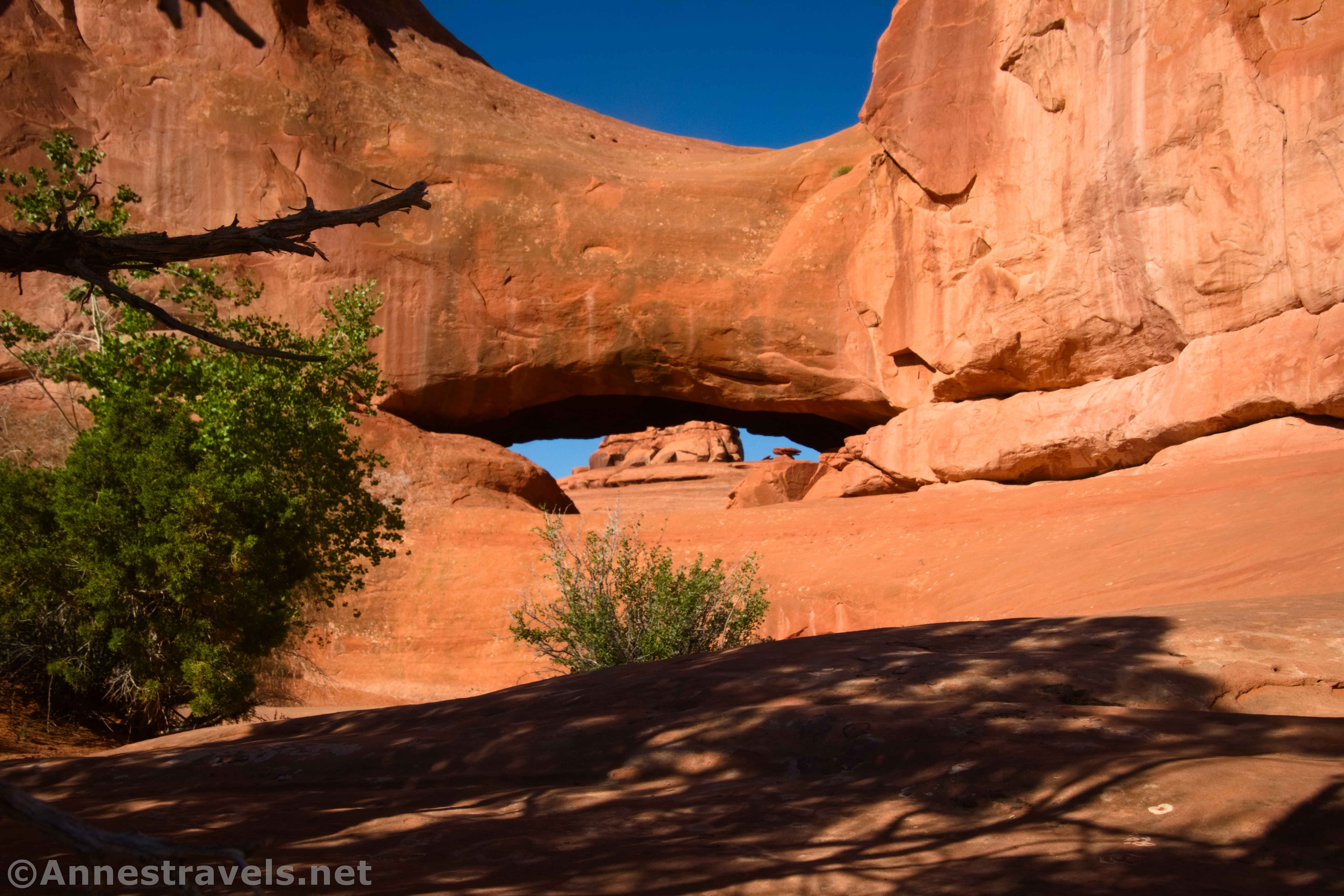
Skyline Arch
0.4 miles out & back
Rating: 4 stars
If you can hike to Skyline Arch in the late afternoon or early evening, you’ll definitely enjoy the views of the arch even more than at other times of day. You can see Skyline Arch from many other places within the park, which makes it even more special to see it close up.
Trails in Arches: Devils Garden Area
Broken Arch & Tapestry Arch
1.8 mile loop with spur
Rating: 4 stars
The Broken Arch Loop, along with the spur to Tapestry Arch, is a fun hike. Besides the two arches, there are also quite a few rock formations, fins, and views. Tapestry Arch is best in the afternoon, but the rest of the hike is nice in both the morning and evening. The trailhead is located in the Devils Garden Campground.
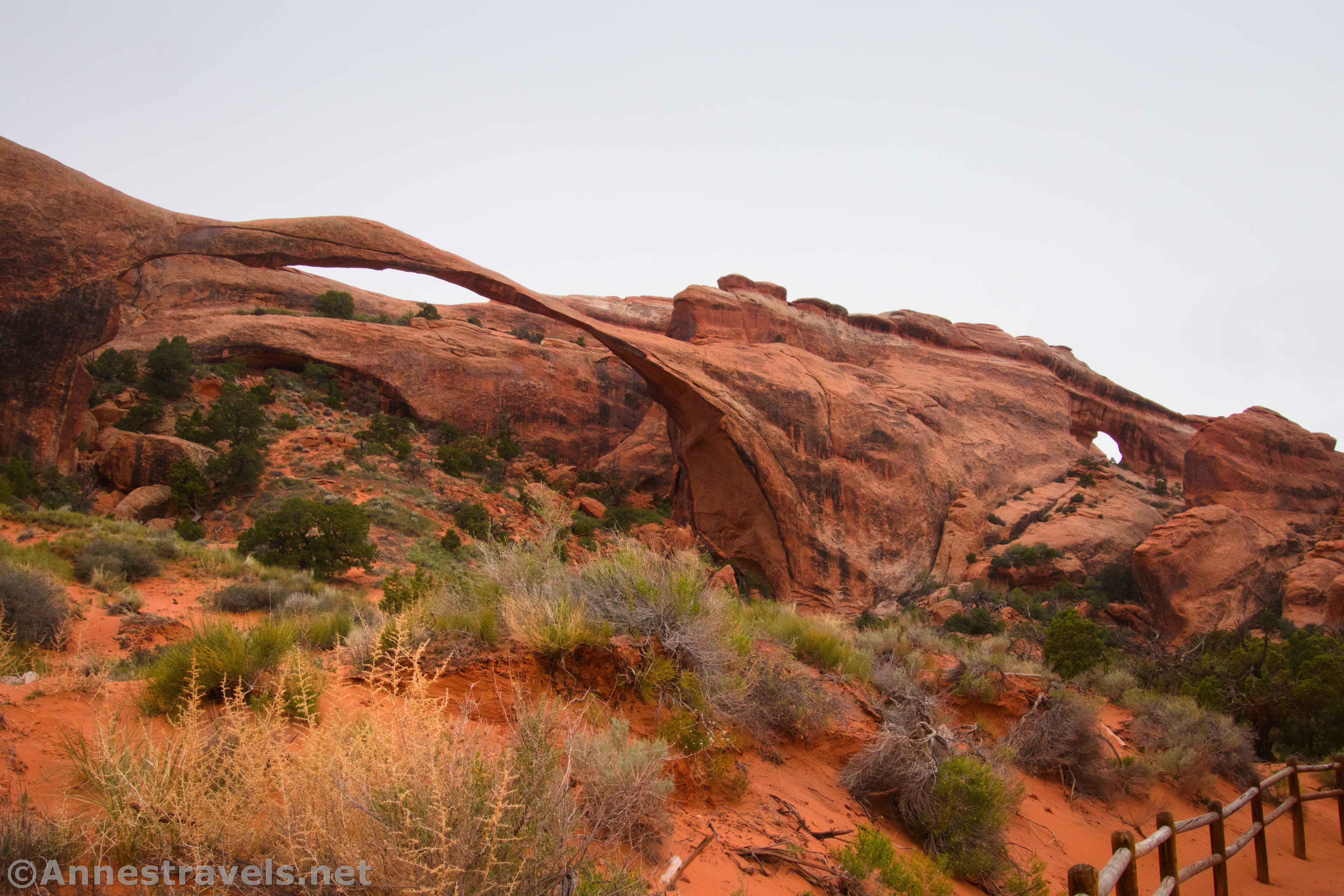
Devils Garden
3.0-7.3 mile lollipop loop with lots of spurs
Rating: 5+ stars
There’s simply no other trail in the park quite like Devils Garden. The first section – to Landscape Arch – is easy enough. Beyond that, it’s a well-marked scramble up sandstone fins, through the desert, and down washes. Your reward is multiple spectacular arches and – especially if you take the primitive loop back – great views of the surrounding area.
Trails in Arches: Off of the Main Road
Most of the trails in Arches National Park are along the Main Park Road. However, three trails are worth highlighting in the hinterlands. Tower Arch and Eye of the Whale Arch are both down dirt roads accessible from the Main Park Road. Lost Spring Canyon (more of a route than a trail) requires a long drive out of the park, along I-70, and then down a maze of dirt roads to the trailhead.
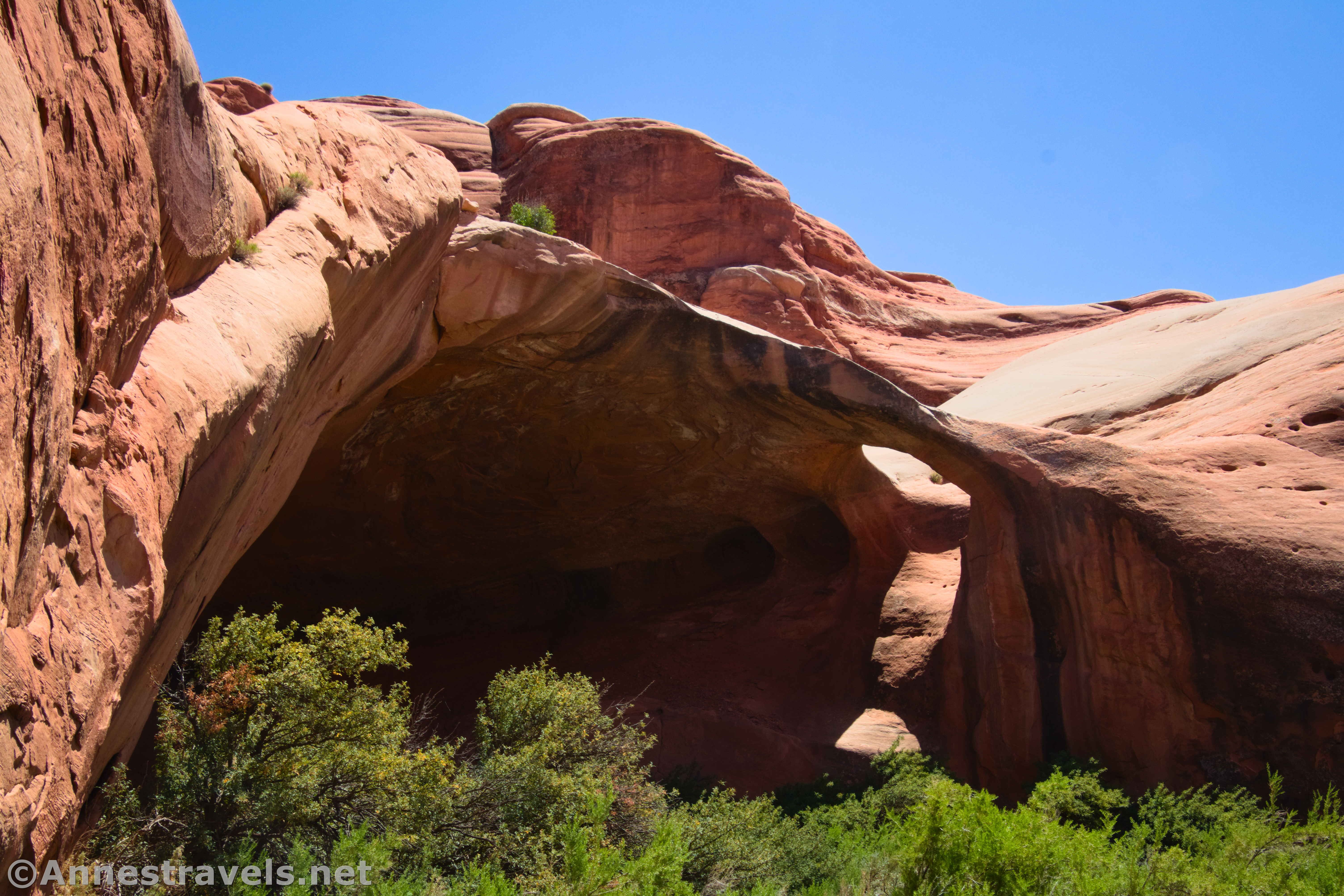
Tower Arch
2.6 miles out & back
Rating: 5 stars
There is a shorter way to get to Tower Arch if you have 4×4, but honestly, you miss out on so much by not following the traditional 2WD route off of the Salt Valley Road (which strikes off of the Main Park Road just south of Devils Garden). The views are jaw-dropping in the evening of rock formations along the trail, plus the arch is well worth the hike. It’s not an easy route by any means, but it was one of my favorite experiences as I hiked through the park.
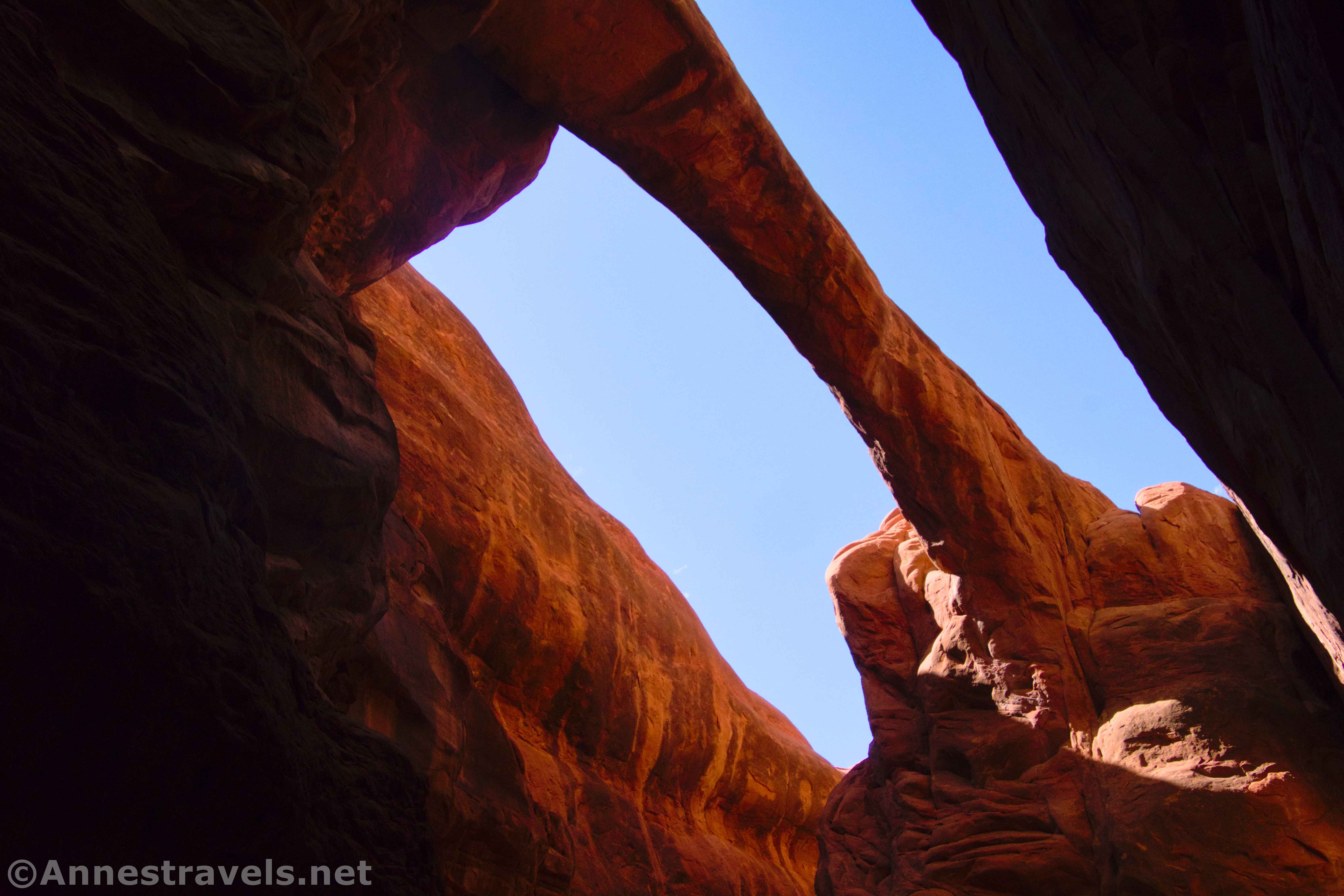
Eye of the Whale Arch
0.5 miles out & back
Rating: 4 stars
It’s short and sweet, but it’s far enough down a 4×4 road – and believe me, you need some pretty serious 4×4 for this road – that it’s mostly just visited by commercial jeep tours. But Eye of the Whale Arch itself is pretty cool, and I enjoyed visiting (even if I had to walk up the road 2 miles each way instead of driving… my van is 2WD). I’d say it’s best in the morning.
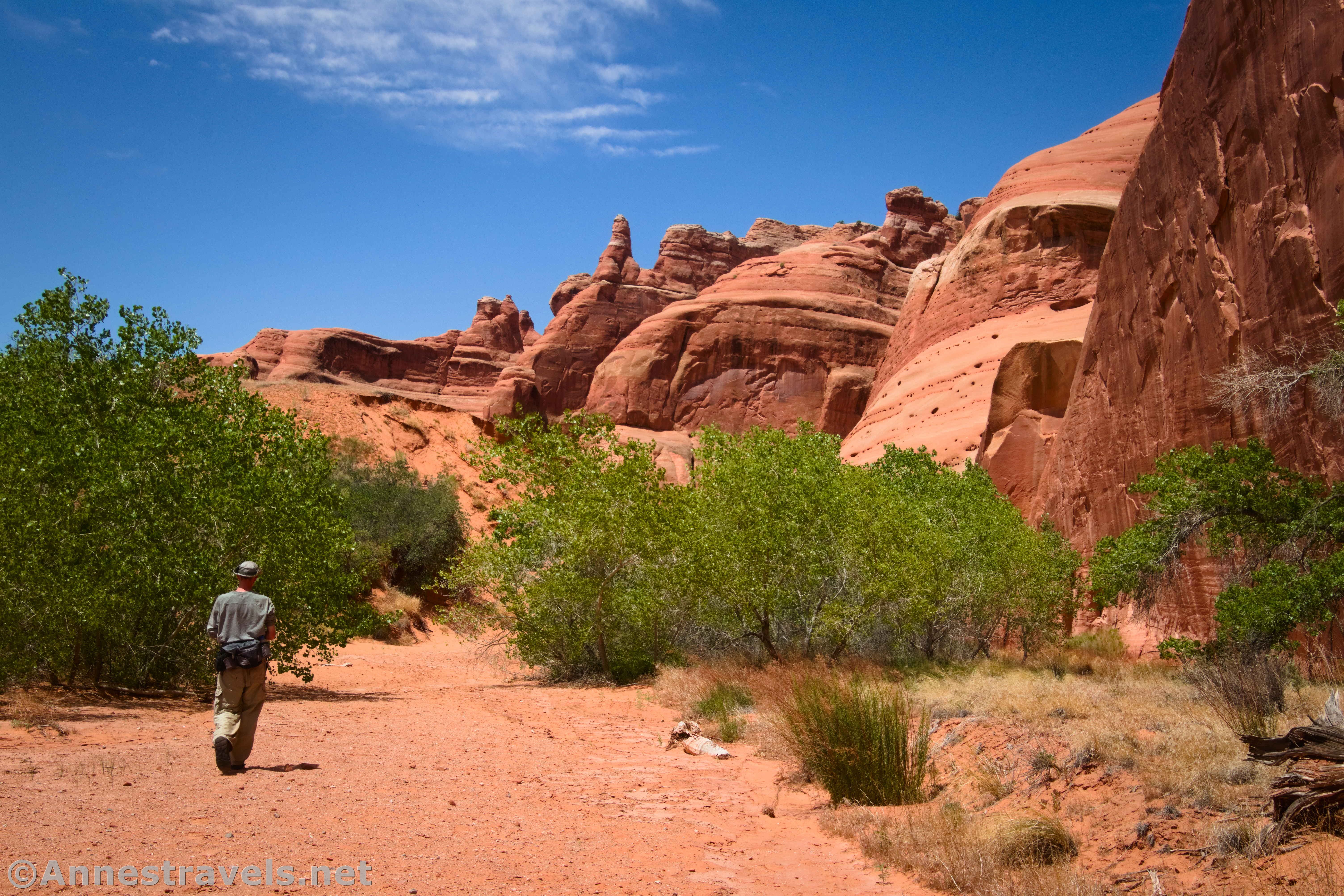
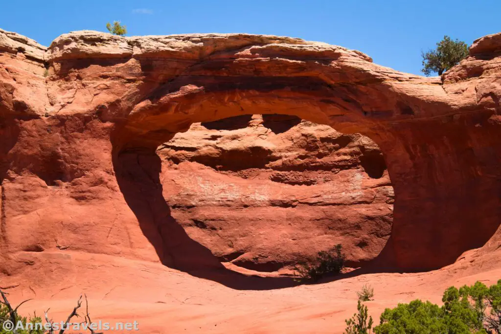
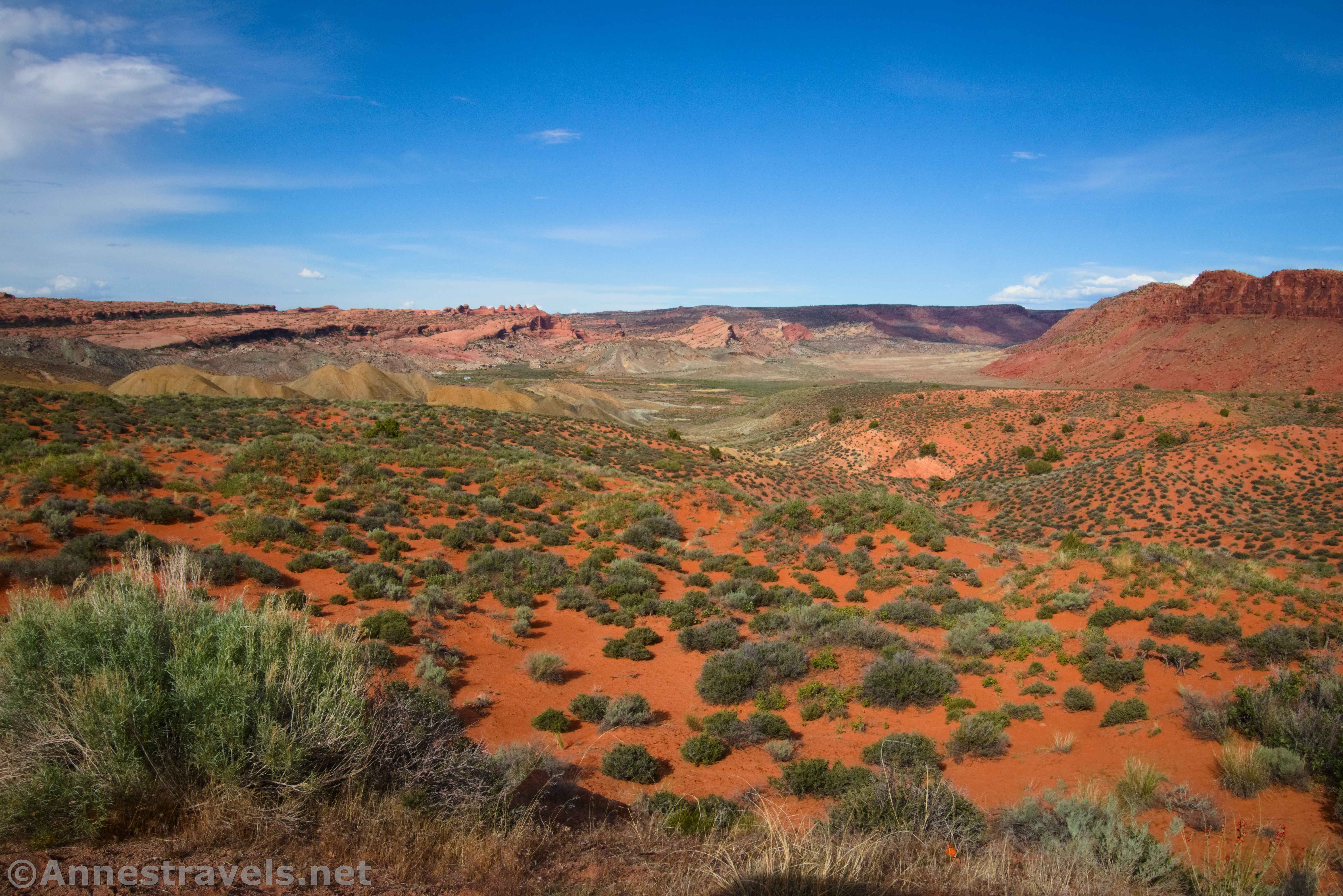
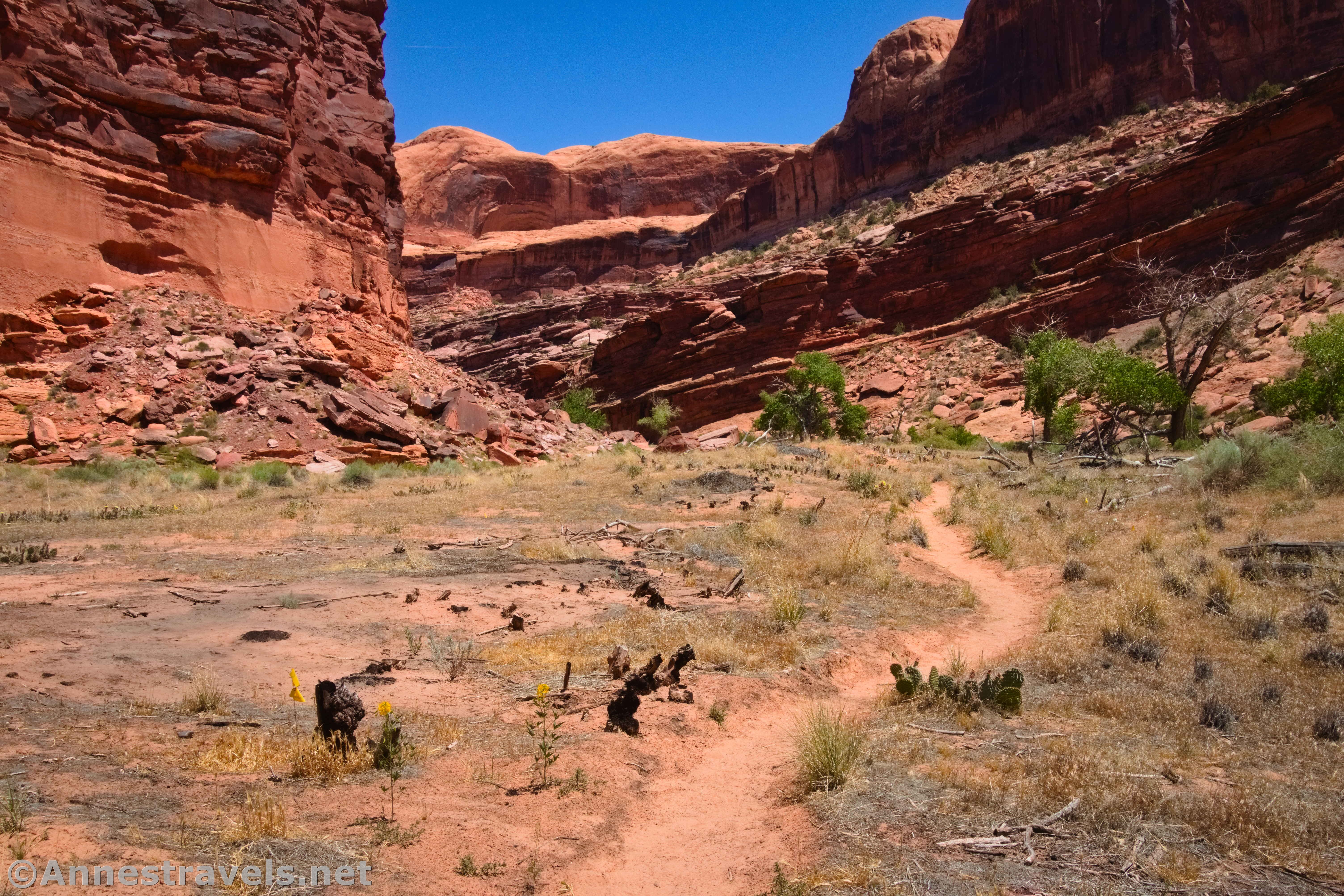
Lost Spring Canyon
7.8+ miles out & back with spurs
Rating: 5 stars
Lost Spring Canyon is located off the Yellowcat Flat – it’s only accessible from I-70 and not from the main part of the park. But if you don’t mind extreme isolation and no services, it offers a great canyon experience. Arches, rock formations, and views of the La Sal Mountains all make an appearance, but the truly special section is when you turn into a side canyon to see more arches, beautiful rock formations, and towering canyon walls. Note that the hike requires significant wayfinding – despite being an “official” trail, it’s not well-marked.

An Itinerary for Hiking All of the Trails in Arches National Park
I’ll pretend that you like to hike about 8 miles a day. Feel free to ease this itinerary out across multiple days… the trails are quite a bit more challenging than the length or elevation gain would suggest.
Day 1
Windows + Primitive Loop + Double Arch (1.7 miles) (If you’re not going to hike the long version (5.4 miles) of Eye of the Whale Arch, drop this down as your first hike of Day 3)
Lower & Upper Delicate Arch Overlook (0.6+ miles)
Sand Dune Arch (0.2 miles)
Broken Arch & Tapestry Arch (1.8 miles)
Balanced Rock (0.3 miles)
Tower Arch (2.6 miles)
Day 1 Total Miles: 6.6 miles
Day 2
Devils Garden (7.3 miles) (You can reduce the mileage and difficulty by leaving off various spurs or doing an out-and-back instead of the primitive loop.)
Day 2 Total Miles: 7.3 miles
Day 3
Eye of the Whale Arch (0.5 miles) (Optional; only if you have serious 4×4. If you have 2WD and still want to do it, it’s about 2.2 miles each way from the Willow Springs Picnic Area to hike to the trailhead, bringing the total mileage up to about 5.4 miles.)
La Sal Mountains Viewpoint (0.1 miles)
Petrified Dunes Overlook (0.0 miles)
Panorama Point (0.2 miles)
Cache Valley Overlook (0.0 miles)
Salt Valley Overlook (0.0 miles)
Fiery Furnace Overlook (0.2 miles)
Skyline Arch (0.4 miles)
Delicate Arch + Wolfe Ranch + Petroglyph Trail (3.4 miles)
Day 3 Total Miles: 4.7 miles
Day 4
Lower Courthouse Wash (10 miles)
Total Day 4 Miles: About 10 miles
Day 5
Fiery Furnace (2.0+ miles) (Only if you can get a permit. I spent an entire day exploring the Fiery Furnace. So keep that in mind and enjoy yourself rather than keeping to this schedule.)
Park Avenue + Courthouse Towers Viewpoint (2.0 miles). (Cross the road to enjoy the Courthouse Towers Viewpoint at the same time.)
Day 5 Total Miles: 4+ miles
Day 6
Lost Spring Canyon (7.8+ miles)
Day 6 Total Miles: More than 7.8 miles
And that’s a wrap! Enjoy your time exploring Arches National Park!
Important Things to Note
The entry fee for Arches National Park is currently $30/vehicle, valid 7 days. America the Beautiful National Parks and Federal Lands Passes, as well as Southeast Utah Parks Passes, are accepted.
April-October, daily timed entry tickets ($2; not covered by passes) are required for entry between 7am and 4pm. Timed entry tickets can be purchased at Recreation.gov.
Camping within the park is extremely limited and sells out months in advance. Consider camping and lodging outside of the park.
Water is available only at the visitor center (near the entrance station) and at the Devils Garden Picnic Area. Carry far more than enough water with you, both in your vehicle and on every hike – and drink it!
Mid-May to mid-September are summer in the park. Expect temperatures to soar over 100F in the sunshine, even if the “air temperature” is only in the mid-80s. Try to plan your visit for a cooler time of year if possible, or don’t hike between 10am and 7pm.

Today’s Featured Product!
Explore 24 hikes in Arches National Park with this guide. Its selling point is that it’s an opinionated guide – the author will tell you exactly what he thinks about each trail. However, it also includes maps, photos, GPS coordinates, and trail descriptions to make sure you enjoy every hike presented – even if the author isn’t so fond of it. Buy your copy here!