Avalanche Peak had been on my “must do next time I’m in Yellowstone” list for about 10 years. (No joke… and yes, I visited Yellowstone during that time.) The more I saw friends’ photos of it, the more I knew it was totally my kind of hike. Mountain views. Cliffs. Meadows. In other words, some of the main reasons I go hiking! Even though the day I finally hiked it didn’t have the best weather (we were watching rainstorms split and go around us as we sat on the summit), we still got just enough sunshine for good photos, and it was as good as I’d hoped – or maybe even better!
Quick Stats
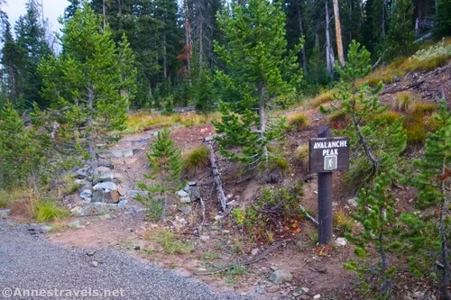
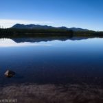
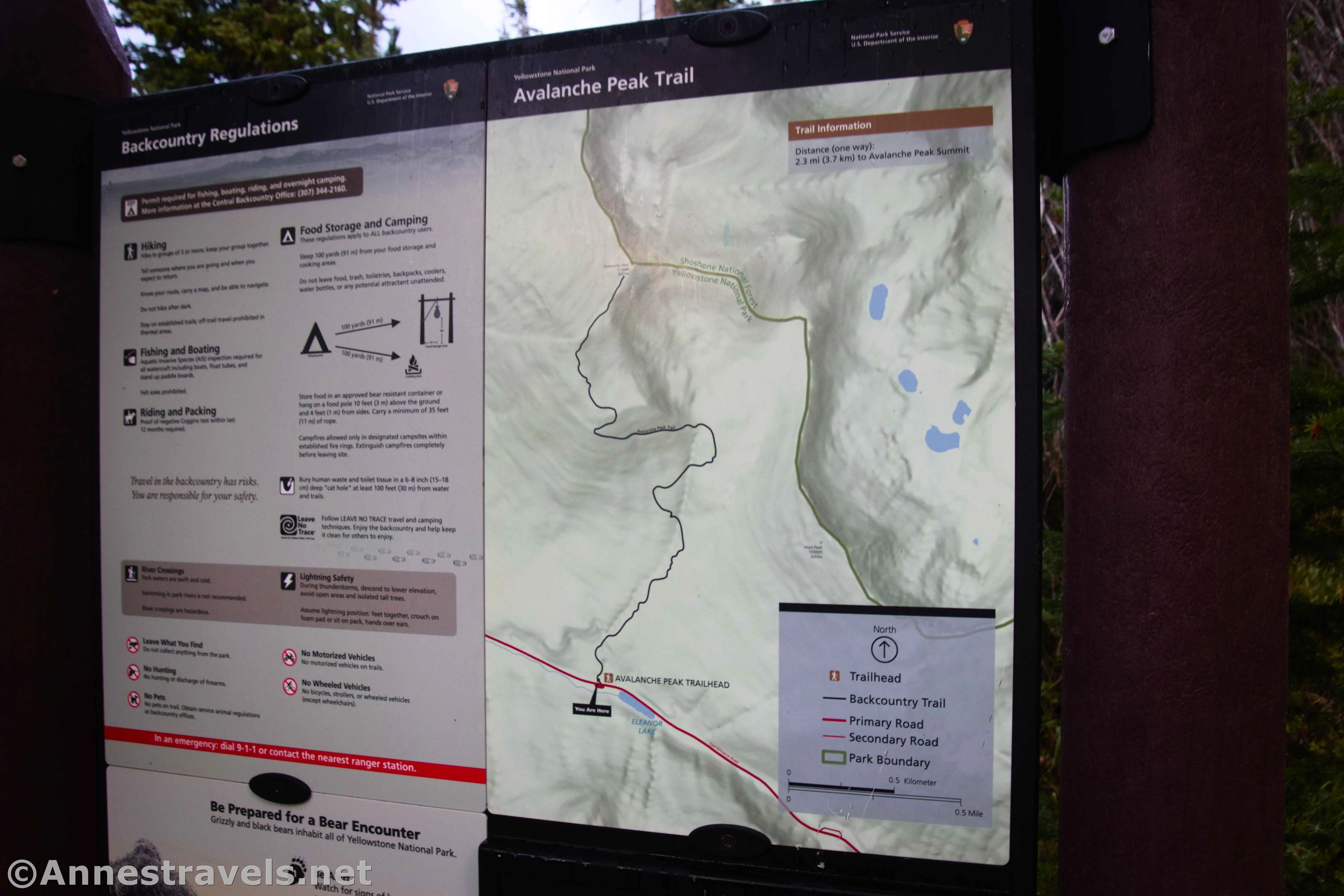
The trail begins across the road from Lake Elenore. (BTW, AllTrails says that there’s a trail around Lake Elenore. There isn’t. Unless you like to hop from rock to rock on the partially dry lakebed, which is, of course, fine, but not a trail.) The parking area is small but should be ample except on busy summer weekends.
Cross to the road to the trailhead sign (be careful; there’s a fair amount of traffic) and immediately begin ascending through the woods. In fact, you’ll go down remarkably little during this hike – it’s just uphill, for what seems like forever!
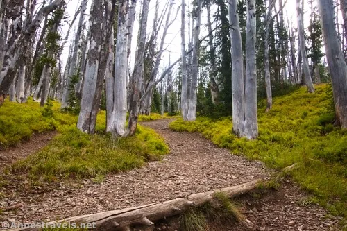
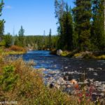
The path climbs steeply through the woods before meeting up with a drainage channel near where the forest becomes dead and white (very likely from a wildfire). Be careful to follow the trail in this section and not the drainage channel.
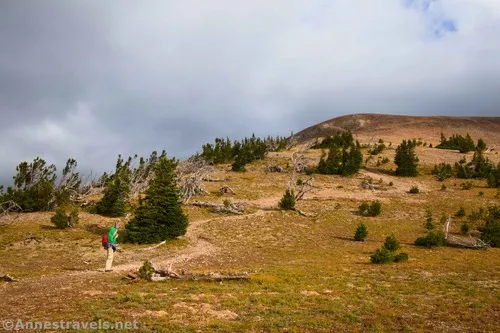
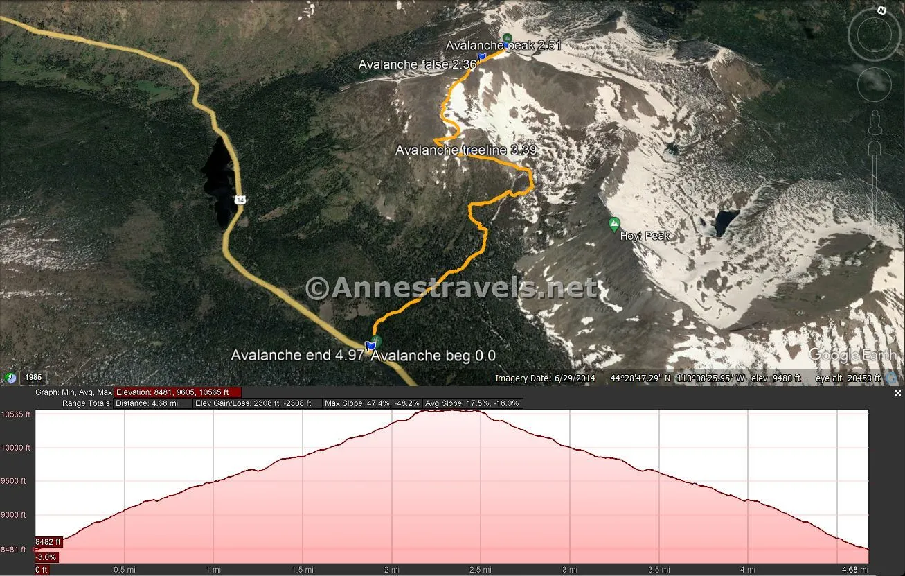
The path finally breaks treeline about 0.6 miles from the trailhead (the steepness makes it feel like about twice that). The grade alleviates slightly, but the trail also worsens, as it passes over several scree sections. There were places where I was glad one of my group members had opted to stay back at the van – she would have had considerable trouble with the slippery gravel on the steep hillside. (And she’s hiked hundreds of miles with me over sketchy terrain, so FYI.)
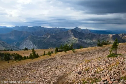
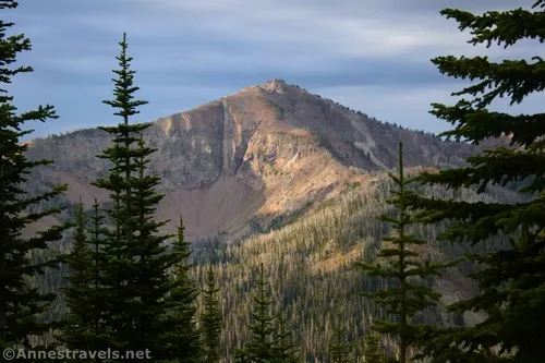
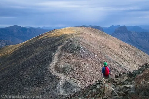
At last – oh, joy – the path turns right and more or less reaches the ridgeline. This is likely one of the easiest sections of trail, even if it’s still ascending to a false summit about mile 2.3.
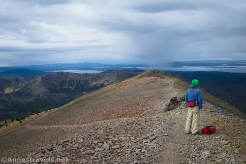
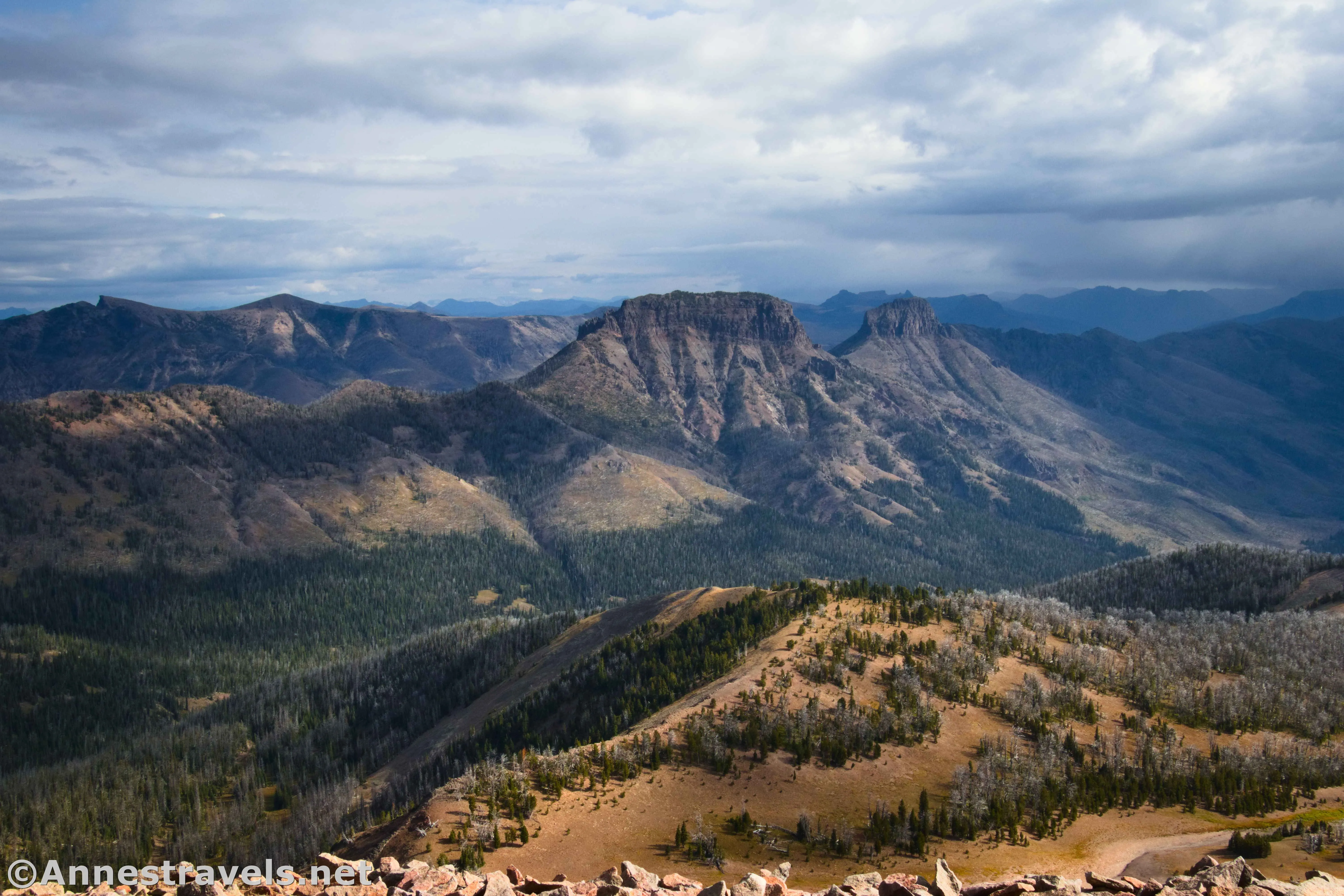
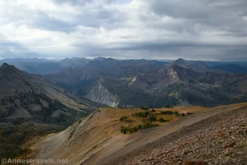
Cross over the false summit (it seems plenty of people are happy enough with this view and don’t go further) and descend slightly into the saddle between the two summits. Less than a quarter mile beyond the false summit, you’ll come to the end of the trail in large scree up on the true summit of Avalanche Peak!
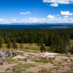
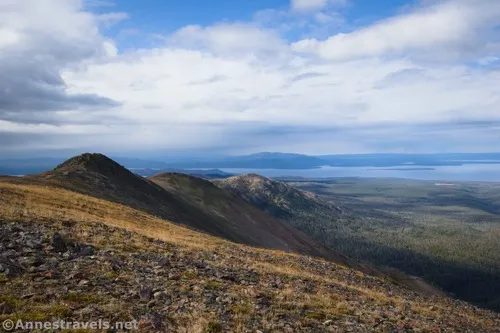
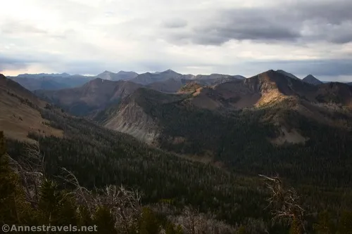
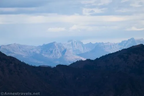
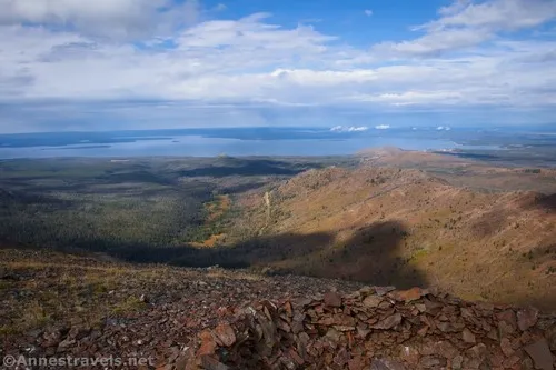
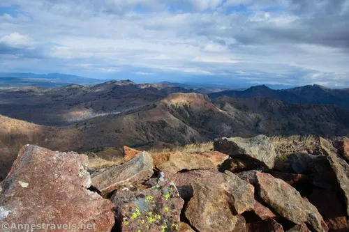
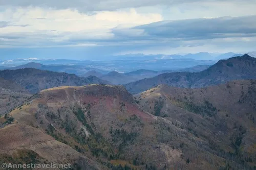
Views are spectacular no matter which way you turn. All three-hundred-and-sixty-five degrees of view will leave your jaw hanging open!
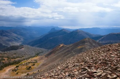
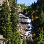
I’ve heard that snow clings to the Avalanche Peak Trail through June and even into July. In mid-September, I found no snow (which would be expected, I guess!) but some great views of trees turning gold. Wow!
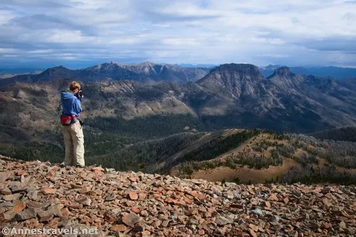
When you’ve had your fill of views (or the sun starts going down), head back the way you came. We met several groups and individuals coming up, but we’d had the entire peak to ourselves for probably an hour as we waited out storms and took advantage of patches of sunshine to get photos. So moral to that story: Hike early if you want solitude!
Round Trip Trail Length: 5 miles
Elevation Gain: 2,308ft. (8,481ft. to 10,565ft.)
Facilities: None
Fees: $35/vehicle, valid 7 days. America the Beautiful National Parks & Federal Lands Passes and Yellowstone Annual Passes are accepted.
Trail Notes: Don’t underestimate the difficulty of this hike. I’d been hiking for about a week in Yellowstone before this, and it was still hard! I expect some of the difficulty is in the elevation, as it’s quite a bit higher than the rest of the park (the peak is at 10,500ft.). Stay off this trail if thunderstorms are predicted or in inclement weather (I should talk, right?), as there’s very little shelter above treeline. Speaking of shelters, both the false summit and the summit have rock wind shelters.
Trail 
![]()
![]()
Road ![]()
Signs ![]()
Scenery
Would I go 100 miles out of my way for this?
Overall Rating: ![]()
GPS Coordinates for Avalanche Peak
TH: 44.4707030°, -110.1425380° (44°28.24218′, -110°08.55228′ / 44°28’14.5308″, -110°08’33.1368″) (8,480ft.) (0.0)
False summit: 44.4879880°, -110.1415080° (44°29.27928′, -110°08.49048′ / 44°29’16.7568″, -110°08’29.4288″) (10,551ft.) (2.36)
Avalanche Peak: 44.4894970°, -110.1399490° (44°29.36982′, -110°08.39694′ / 44°29’22.1892″, -110°08’23.8164″) (10,562ft.) (2.51)
Return to Treeline: 44.4818990°, -110.1401080° (44°28.91394′, -110°08.40648′ / 44°28’54.8364″, -110°08’24.3888″) (9,856ft.) (3.39)
End at TH: 44.4707260°, -110.1425560° (44°28.24356′, -110°08.55336′ / 44°28’14.6136″, -110°08’33.2016″) (8,481ft.) (4.97)
The gpx file for Avalanche Peak can be downloaded – please note that this and the GPS Coordinates are for reference only and should not be used as a sole resource when hiking this trail.
Download GPX File size: 98.9 KB Downloaded 60 times
(Note: I do my best to ensure that all downloads, the webpage, etc. are virus-free and accurate; however, I cannot be held responsible for any damage that might result, including but not limited to loss of data, damages to hardware, harm to users, from use of files, information, etc. from this website. Thanks!)
Getting to the Avalanche Peak Trailhead
From Fishing Bridge Junction, drive east on US-14 toward Cody. After 18.1 miles, the parking area will be on the right.
From Cody, WY, drive west on US-14 toward Yellowstone National Park. After 50 miles, pass through the East Entrance Station (note that if you’re camping in the area, you’ll want to take advantage of one of the forest service campgrounds before the entrance station… there’s nothing beyond this). Drive another 7.7 miles to the parking area on the left.
Today’s Featured Product!
Forty-five incredible hikes are featured in this guide to both Yellowstone and Grand Teton National Parks. From lakes and waterfalls to mountain peaks and geothermal areas, there’s something here for everyone to choose from. Buy your copy here!