

I don’t believe I’d ever hiked around the Balanced Rock in Arches National Park until my most recent visit to the park. I figured that you could see it from quite a few places – and these things usually look better from a small distance away – so why waste the time? Well, it’s definitely not a waste of time to hike the Balanced Rock Trail. It is easier to see from further away, but it’s pretty impressive from up close, and even better, the views around the rock are amazing!
Quick Stats

I intentionally planned my visit for early evening, when the sun would be shining brightly on the west-facing La Sal Mountains. This time of day can be busy (there’s limited parking), but it will be better than the middle of the day and not so hazy as morning.
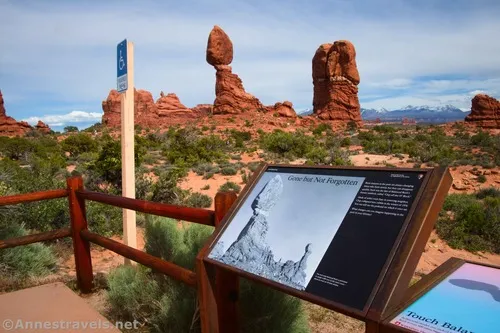
At the far right (when you’re facing the Balanced Rock) of the parking lot, the NPS has made a model of the Balanced Rock along with some signs about it and the “mini balanced rock” called “Chip Off the Old Block” that once stood close to this one.

Walk to the far left end of the parking area to the trailhead. The trail itself is paved and wheelchair accessible at this point.

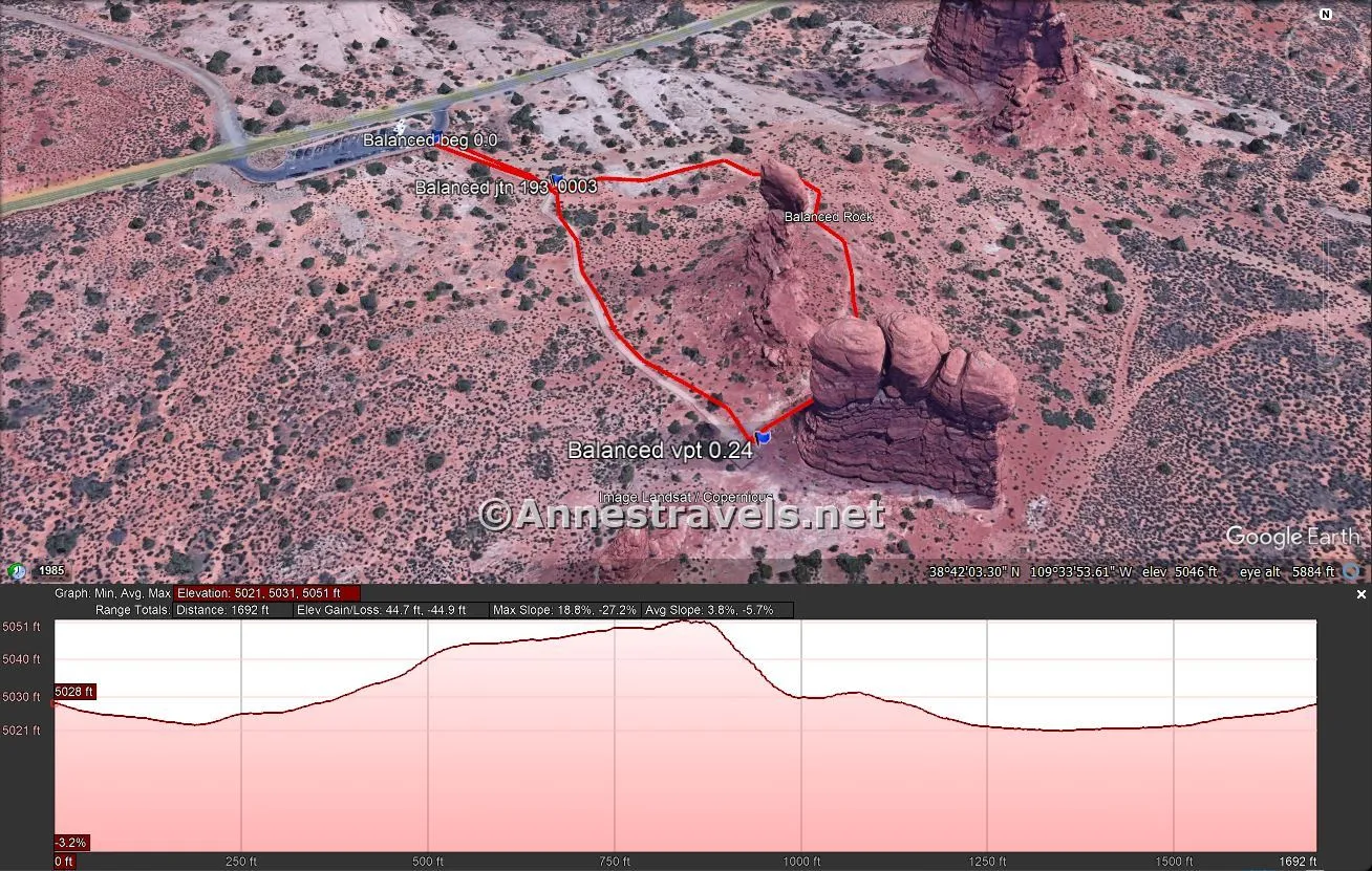
After 200ft., the trail splits. If you’re using a wheelchair, you’ll want to turn right, since the pavement continues. Otherwise, you’re welcome to go either way. I went left because a large group had just gone right, and I wanted to take my pictures without getting in their way (or vice versa).

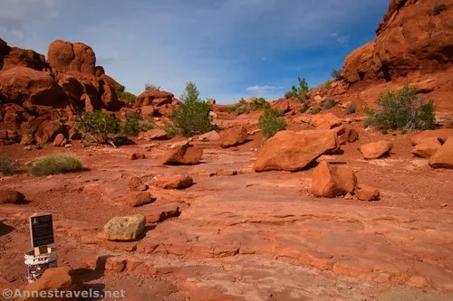
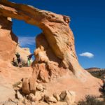
The trail is rough as it winds along the north side of the Balanced Rock, finally culminating in a mildly rocky section on the far side. Views from here are stunning of the La Sal Mountains, Tower Arch, the Parade of Elephants, and the back side of Double Arch. This is why the trail is so worth hiking!

Continue as the path descends down slickrock in nearly-steps to the paved viewing area. I wasn’t personally impressed with the Balanced Rock from this angle, though it’s more impressive than on the northeast side.

From the viewpoint, you can also see the La Sal Mountains and Tower Arch. It’s beautiful!

The paved path travels 0.15 miles back to the junction (turn left) and back to the parking area. Be sure to look back in this section, as the Balanced Rock is impressive.

In all, I hiked 0.4 miles. So it’s not a long trek, but it’s a beautiful way to spend a late afternoon or evening in central Arches National Park!

Round Trip Trail Length: 0.4 miles
Elevation Gain: 45ft. (5,021ft. to 5,051ft.) (The wheelchair-accessible portion of the hike is a total of 28ft. (5,021ft. to 5,031ft.)
Faculties: None, though if you take the gravel road across the main park road from the parking area, you’ll come to a picnic area with restrooms.
Fees: $30/vehicle, valid 7 days. America the Beautiful National Parks & Federal Lands Passes and Southeast Utah Park Passes are accepted. Remember that the park has timed entry, currently 7am-4pm, April 1-October 31 – to enter during this window, reserve your timed entry ticket at Recreation.gov in addition to the entry fee.
Trail Notes: The southern side of the loop (between the trailhead and the viewpoint) is paved and wheelchair accessible. Bicycles and pets are not allowed. The view is also fantastic from the Willow Springs Picnic Area (down the gravel road across the main park road from the Balanced Rock parking area) – I also recommend the picnic area views (or the Balanced Rock views) when a full moon is rising (now I’ll need to dig out my moon photo from before I had a decent camera or knew how to use it!)
Trail 
![]()
Road
Signs ![]()
Scenery
Would I go 100 miles out of my way for this? ![]()
Overall Rating: 

GPS Coordinates for the Balanced Rock
TH: 38.7017160°, -109.5660060° (38°42.10296′, -109°33.96036′ / 38°42’06.1776″, -109°33’57.6216″) (5,036ft.) (0.0)
Balanced Rock Junction: 38.7014950°, -109.5654450° (38°42.08970′, -109°33.92670′ / 38°42’05.3820″, -109°33’55.6020″) (5,039ft.) (193ft.)
Balanced Rock Viewpoint: 38.7003370°, -109.5646420° (38°42.02022′, -109°33.87852′ / 38°42’01.2132″, -109°33’52.7112″) (5,059ft.) (0.24)
End: 38.7017500°, -109.5659960° (38°42.10500′, -109°33.95976′ / 38°42’06.3000″, -109°33’57.5856″) (5,036ft.) (0.40)

The gpx file for the Balanced Rock Trail can be downloaded – please note that this and the GPS Coordinates are for reference only and should not be used as a sole resource when hiking this trail.
Download GPX File size: 6.0 KB Downloaded 76 times
(Note: I do my best to ensure that all downloads, the webpage, etc. are virus-free and accurate; however, I cannot be held responsible for any damage that might result, including but not limited to loss of data, damages to hardware, harm to users, from use of files, information, etc. from this website. Thanks!)

Getting to the Balanced Rock Trailhead
From the Arches National Park entry station, follow the Main Park Road past the visitor center. About 9.0 miles from the entrance station, turn right into a loop parking area signed for the Balanced Rock.
Today’s Featured Product!
Get the scoop on the best and the worst of Arches National Park with this “opinionated” guide. The author covers routes and trails not included in the more famous guides along with his favorites in the park. Buy your copy here!


Pingback: Sneak Peak: Arches, Island in the Sky, and More! – Anne's Travels
Pingback: An Itinerary to Hike All the Trails in Arches National Park! – Anne's Travels