Small local trails tend to be under the radar in terms of visitors. This isn’t necessarily bad – it means the locals can enjoy it in relative peace and quiet. While searching for trails near the Sodus and Wallington Trail last fall, I ran across one of these small local paths called the Bentley Bond’s Trail. It’s not terribly exciting, but the waterfall at the beginning and the view at the end make it well worth the 2 miles RT.
Quick Stats
One note about the trail before I begin – it’s not made for bicycles or for strollers. There’s no reason you can’t take a bike on it (I did), but the roots and hills make it impossible to ride. So you’re better off lacing up your hiking boots/sneakers for this one.
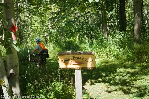
The trailhead is a small gravel pulloff on Red Mill Creek just to the east of Second Creek. It is marked by a cute wooden sign. Another sign nearby says that this is private property; no hunting and no fishing is allowed. Apparently, the trail is an easement to the Genesee Land Trust. So treat this area with extra respect.
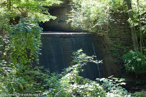
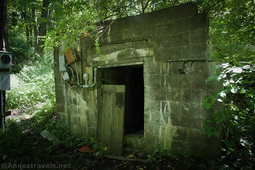
Right after the trailhead, we turned left to descend the very steep path to the waterfall (we left our bikes up top; the trail was too steep and too eroded to want to bring them down to creek level). We passed a bunker of some sort, and then scrambled up the creek a short distance.
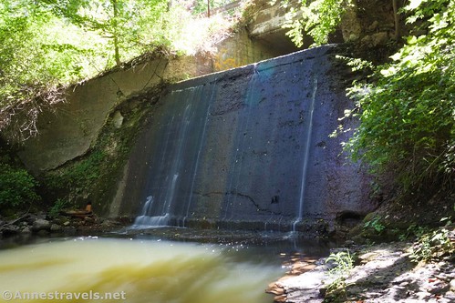
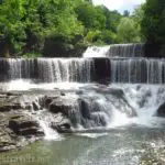
The waterfall, itself, is a concrete drop of about 15ft. from where the stream goes under the road. The waterfall and bunker together make we wonder if perhaps it is left over from some sort of power generation station.
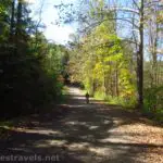
Back up on the main Bentley Bond’s Trail, we took the grassy path into the woods. It’s a little bit difficult to follow at times, since it winds through the woods and sometimes utilizes old (and not-so-old) roads. Follow the blazes (which are also inconsistent) and don’t go out into any fields. You should be ok.
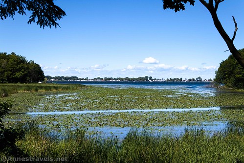
The path is root-infested and climbs and descends some steep hills. It’s definitely a workout. But at long last, it descends one last hill and lands you by a bench and a view out across an arm of Sodus Bay. It’s marshy and peaceful; the perfect place to see wildlife.
The views from here are great, even when the trees are in full-leaf. I did the trail just before Labor Day, so the trees were still in their summer greenery. The end of the trail is shaded by pines, so chances are you’ll have shade there any time of day you hike it.
Overall, I wouldn’t go a crazy distance out of your way for the Bentley Bond’s Trail. But if you happen to be near Sodus Bay or Chimney Bluffs, I highly recommend it for the waterfall, the beautiful views across Sodus Bay, and the potential to see wildlife.
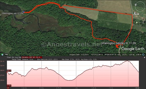
Round Trip Trail Length: 2 miles out & back
Elevation Gain: 223ft. (317ft. to 250ft.)
Facilities: None
Fees: None
Trail Notes: Keep your wits about you, as the trail is a little tricky to follow sometimes. Despite the fact that the trail ends at the marsh, it’s pretty dry. Go in the early morning or evening for the best chance to see wildlife. Fishing is not allowed. A trail also goes south up the creek, but I hear it’s very difficult to follow and crosses the creek without bridges. The waterfall is more scenic in the spring – we were in partial drought at the time I visited, thus the low water flow.
Trail 


Road 


Signs 


Scenery 


Would I go 100 miles out of my way for this? 


Overall Rating: 


GPS Coordinates for the Bentley Bond’s Trail
Trailhead: 43.2356833°, -076.9752833° (N43° 14.141′ W76° 58.517′ / 43°14’08.4600″, -076°58’31.0200″) (283ft.) (11.09)
Viewpoint: 43.2442167°, -076.9749167° (N43° 14.653′ W76° 58.495′ / 43°14’39.1800″, -076°58’29.7000″) (270ft.) (12.09)
The gpx file for Bentley Bond’s Trail can be downloaded – please note that this and the GPS Coordinates are for reference only and should not be used as a sole resource when hiking this trail. Also, note that I cut across a field on the way back to a driveway. I don’t recommend this, but given that we were on bikes, it seemed like a good idea at the time.
Download GPX File size: 39.0 KB Downloaded 128 times
(Note: I do my best to ensure that all downloads, the webpage, etc. are virus-free and accurate; however, I cannot be held responsible for any damage that might result, including but not limited to loss of data, damages to hardware, harm to users, from use of files, information, etc. from this website. Thanks!)
Getting to the Bentley Bond’s Trail
From Sodus Point, drive south on NY-14S. After about 2.5 miles, at the top of a hill, turn left onto Red Mill Road. Directly after crossing the bridge at the bottom of the hill, 0.4 miles from NY-14, a small sign on the left marks the trailhead.
From Rt-104, turn onto NY-14N at the stoplight. After 0.3 miles, turn left onto Ridge Road, then take a quick right to stay on NY-14N. Drive 1.7 miles and turn right onto Red Mill Road. Directly after crossing the bridge at the bottom of the hill, 0.4 miles from NY-14, a small sign on the left marks the trailhead.
From Chimney Bluffs State Park, drive south on Garner Road/Lake Bluff Road for 4.2 miles. Turn right onto Ridge Road for 1.9 miles, then turn right again onto Shaker Tract Road. After 2.5 miles, stay straight on Red Mill Road. The trailhead will be on the right after 0.2 miles, just before crossing the bridge over Second Creek.
This Week’s Featured Product!
If you want to see even more known and unknown waterfalls in the area, I highly recommend this book. With over 100 locations and hikes to see more than 250 waterfalls, it’s a great book for both the adventurer and the casual waterfall-chaser.








We drove there last weekend and the trail is closed. Private property and being logged this summer.
Thanks so much for letting us know. It looked like the area had been logged recently, so I wonder if it’s a summer thing.