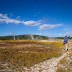
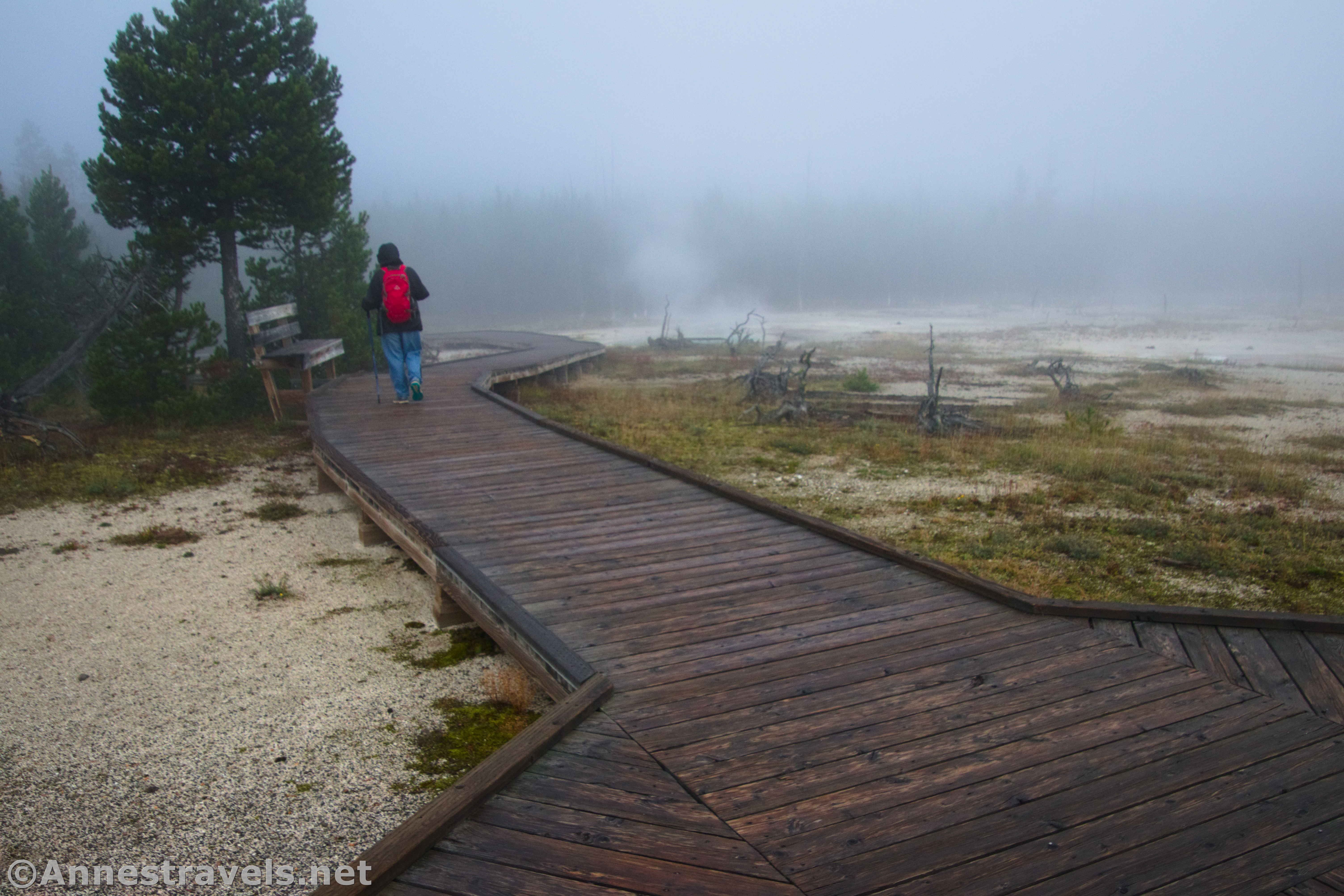
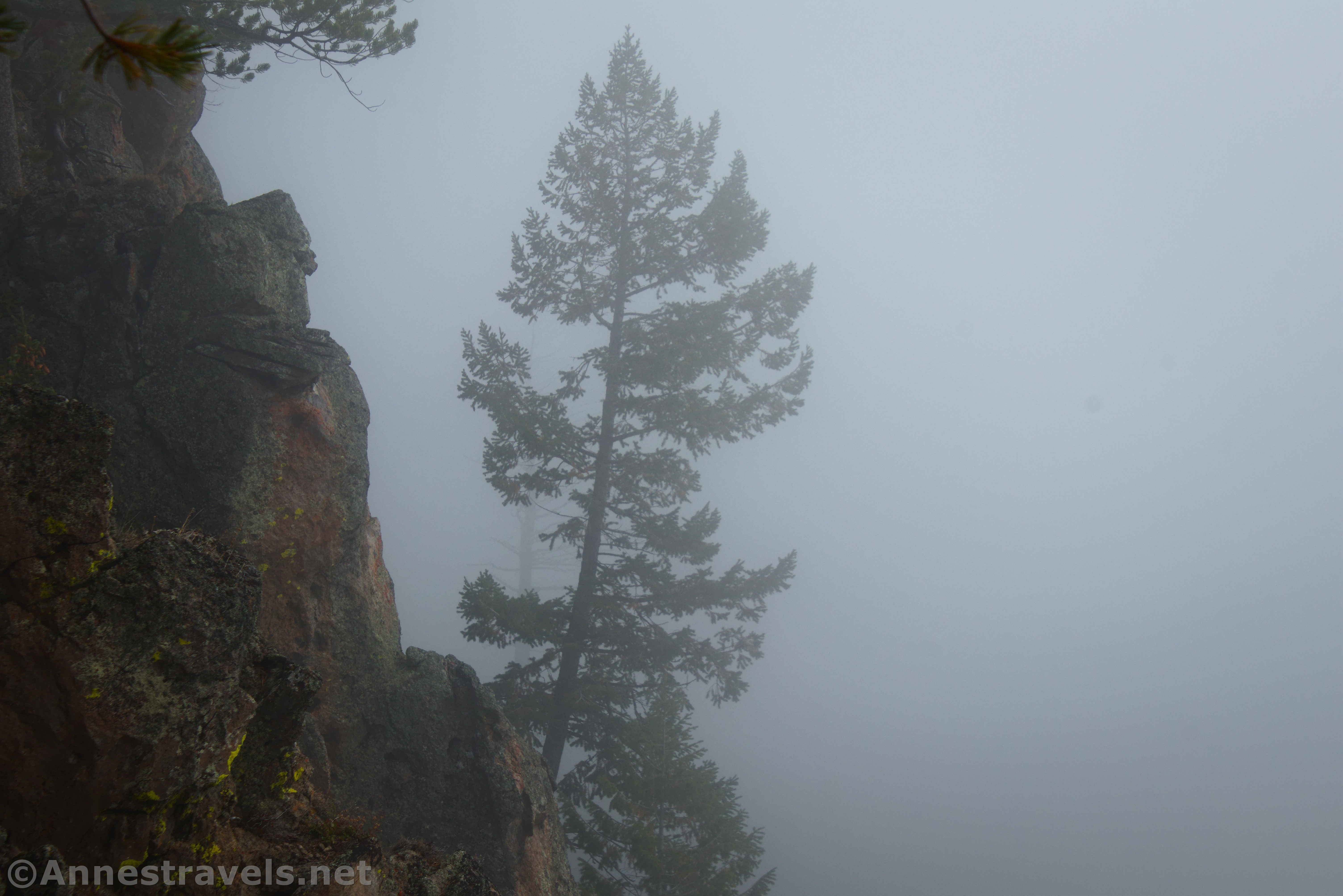
I chose the perfect morning to visit the Biscuit Geyser Basin and Mystic Falls. Perfect, as in it was so misty, I could barely see the geothermal features, and the waterfall was almost obscured! I even climbed up to the overlook, hoping things would clear, but no, we saw more clouds of white mist. I can’t complain at all – the fog added an element of mystery and hiddenness and quietness to the hike, almost like we were alone in a movie come to life. And while I missed seeing the views, the rest of it was a great experience – so I’d do it again if I had to!
Quick Stats
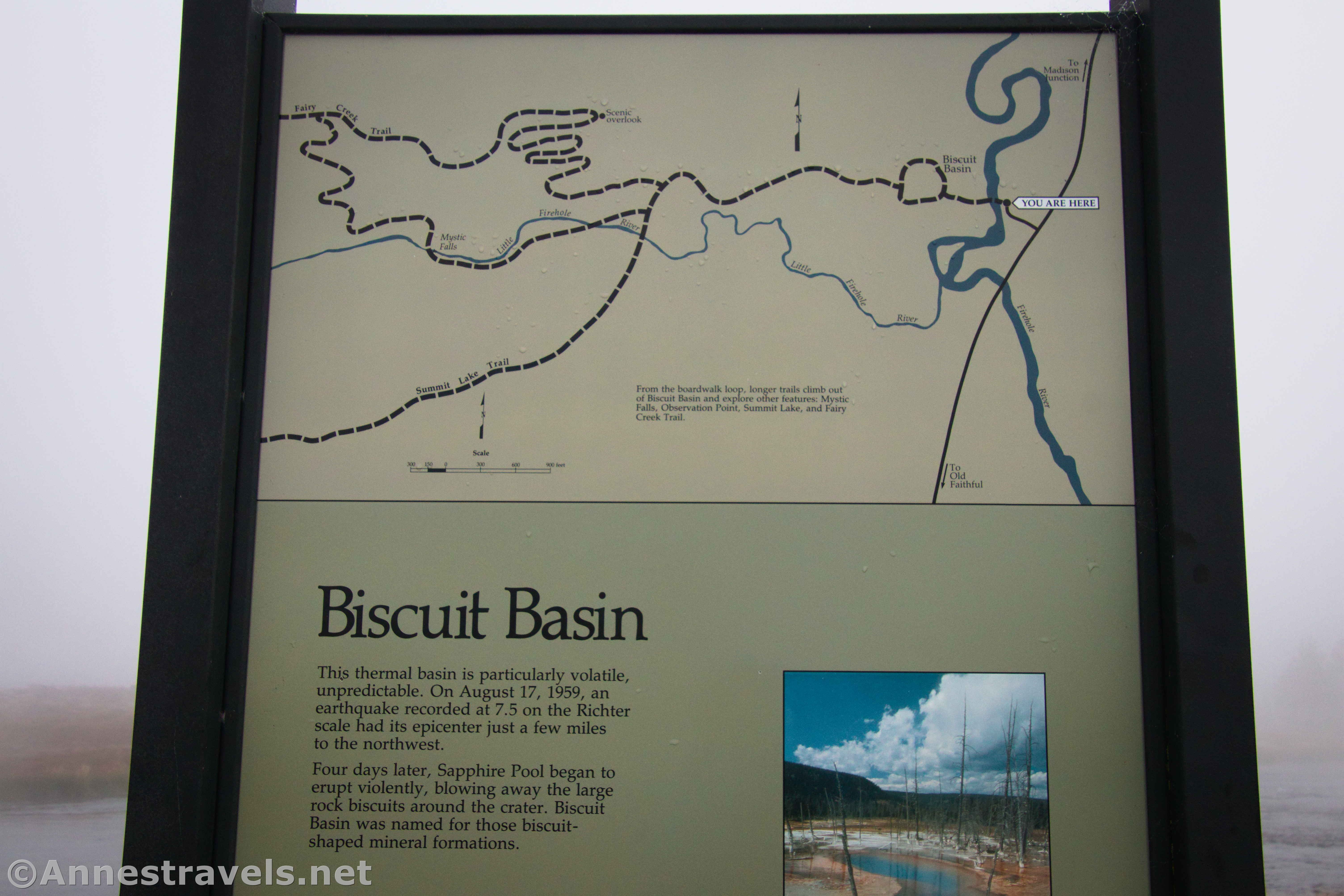
Biscuit Basin is one of the famous areas of Yellowstone, so from 10am to 3pm (thereabouts), it’s not uncommon for the parking area to be full. I figured I’d beat the crowds and arrive at 7:30am. I beat the crowds all right – we had our choice of spots in the almost empty lot!
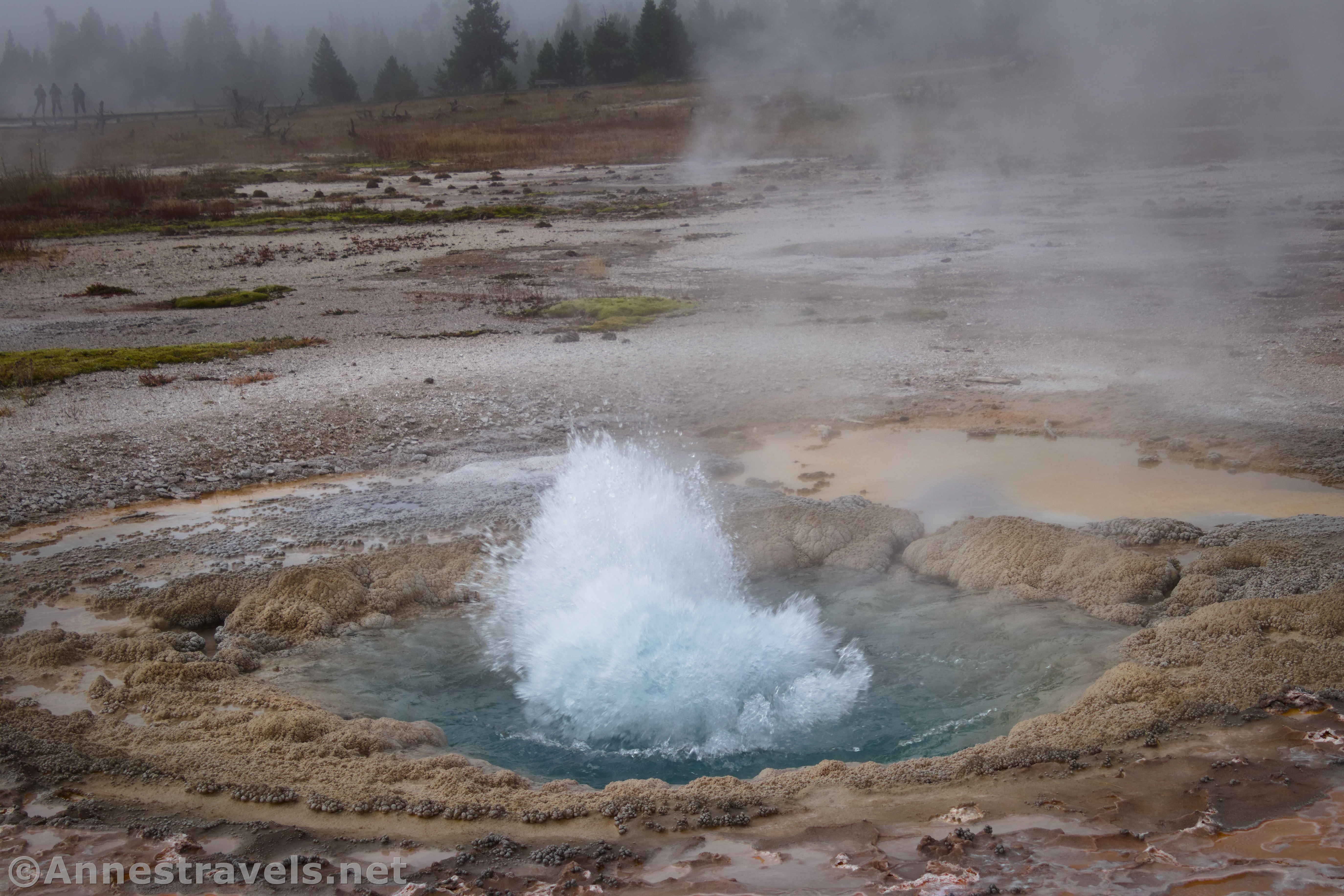
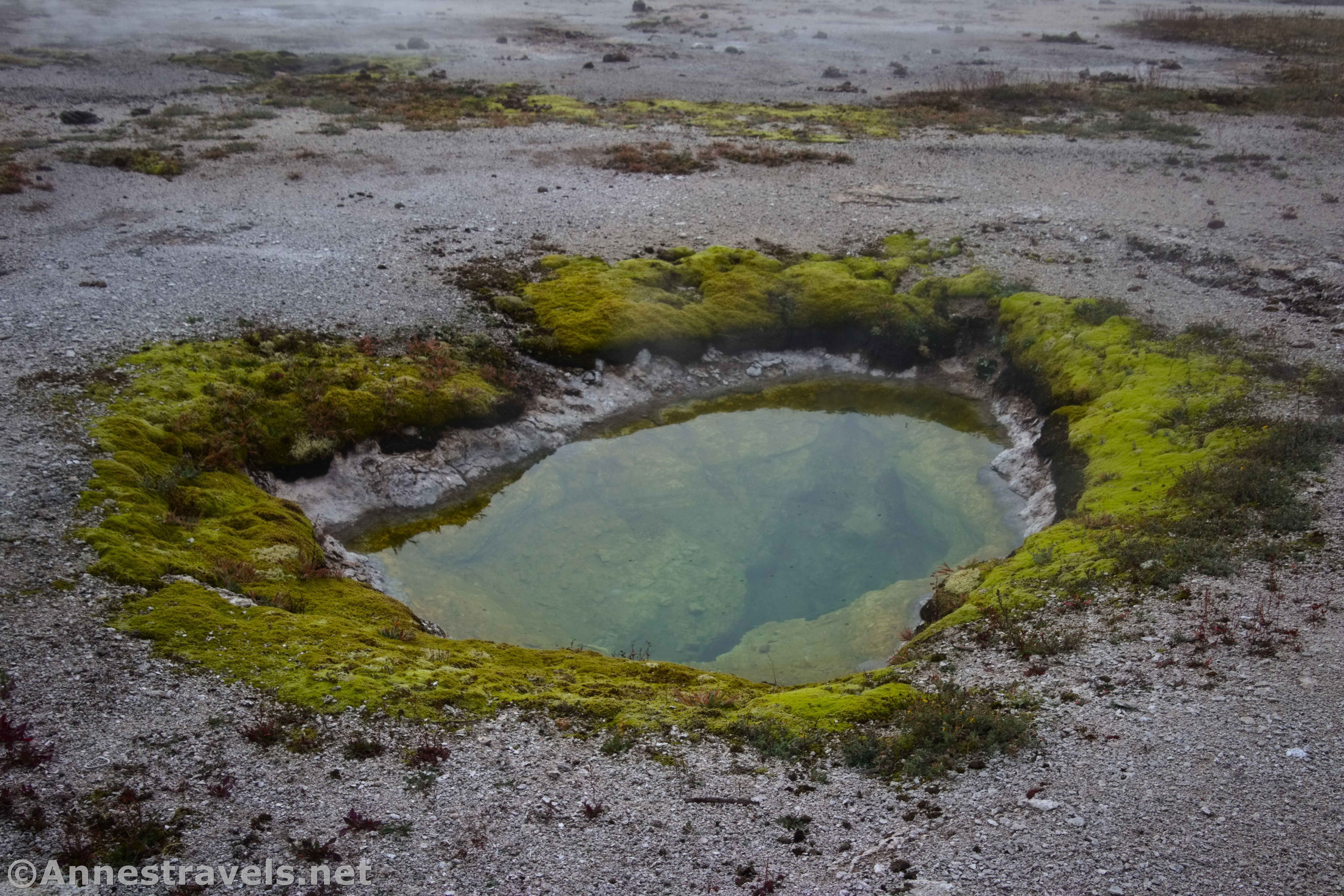
The trail crosses the Firehole River on a sturdy bridge and enters the Biscuit Geyser Basin on a wooden boardwalk. Be sure to look at the Firehole River and the vicinity, as there are few small, steaming waterfalls.
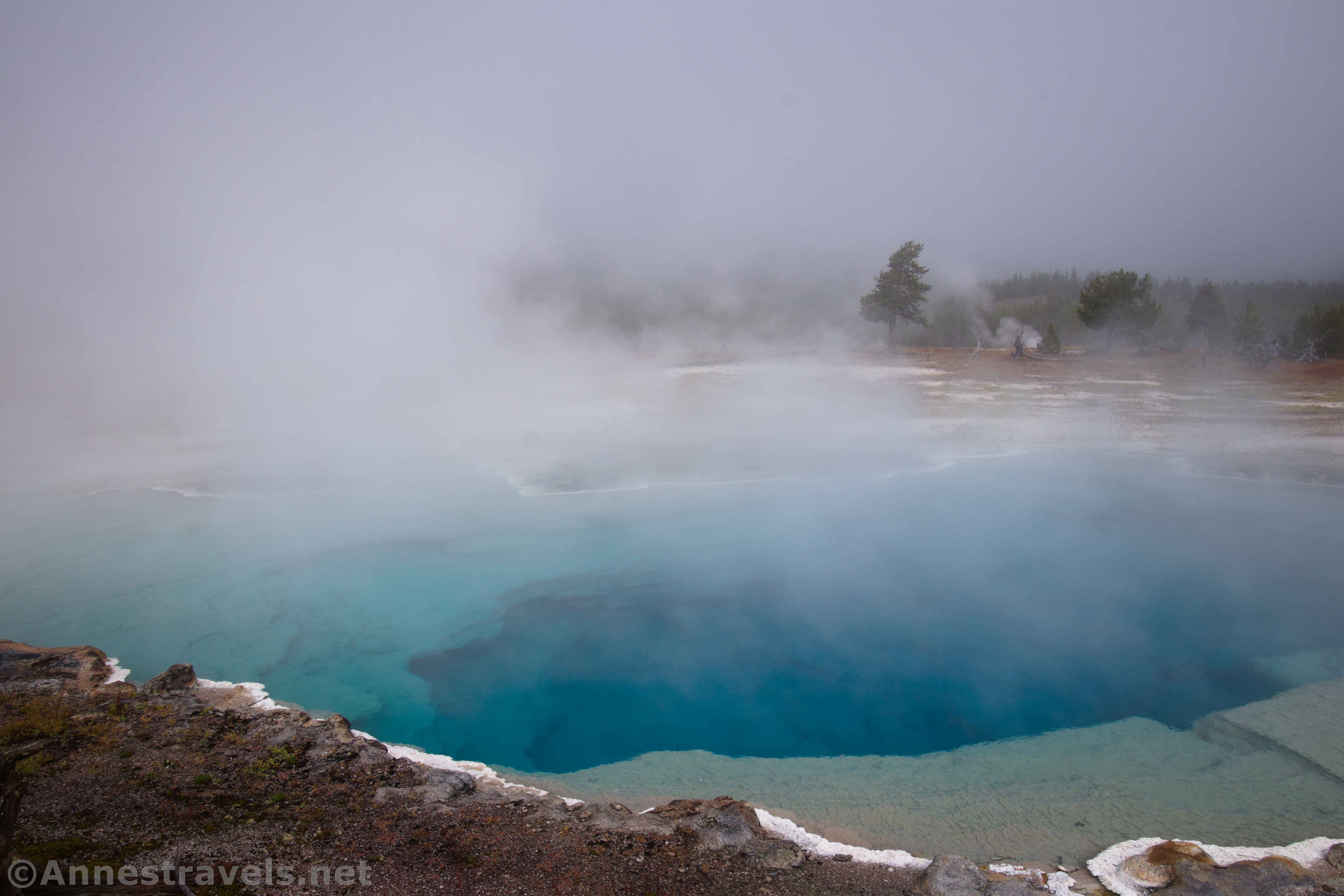
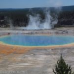
On the other side of the bridge, follow the boardwalk past Black Opal Pool, Black Diamond Pool, and Sapphire Pool. This last pool is how the basin received its name – across the pool, you may see a few “biscuit”-like formations. There were thousands of these until the pool erupted violently in 1959, destroying the delicate features.
At the junction of the boardwalks, you’re welcome to go either direction. I turned left (straight) to pass by features such as Jewel Geyser, Shell Spring, and Avoca Spring. At the next junction, turn left (if you decided to turn right before, you’ll have to turn right at this junction or you’ll find yourself back at Sapphire Pool). West Geyser is very pretty before the boardwalk ends and the path becomes gravel.
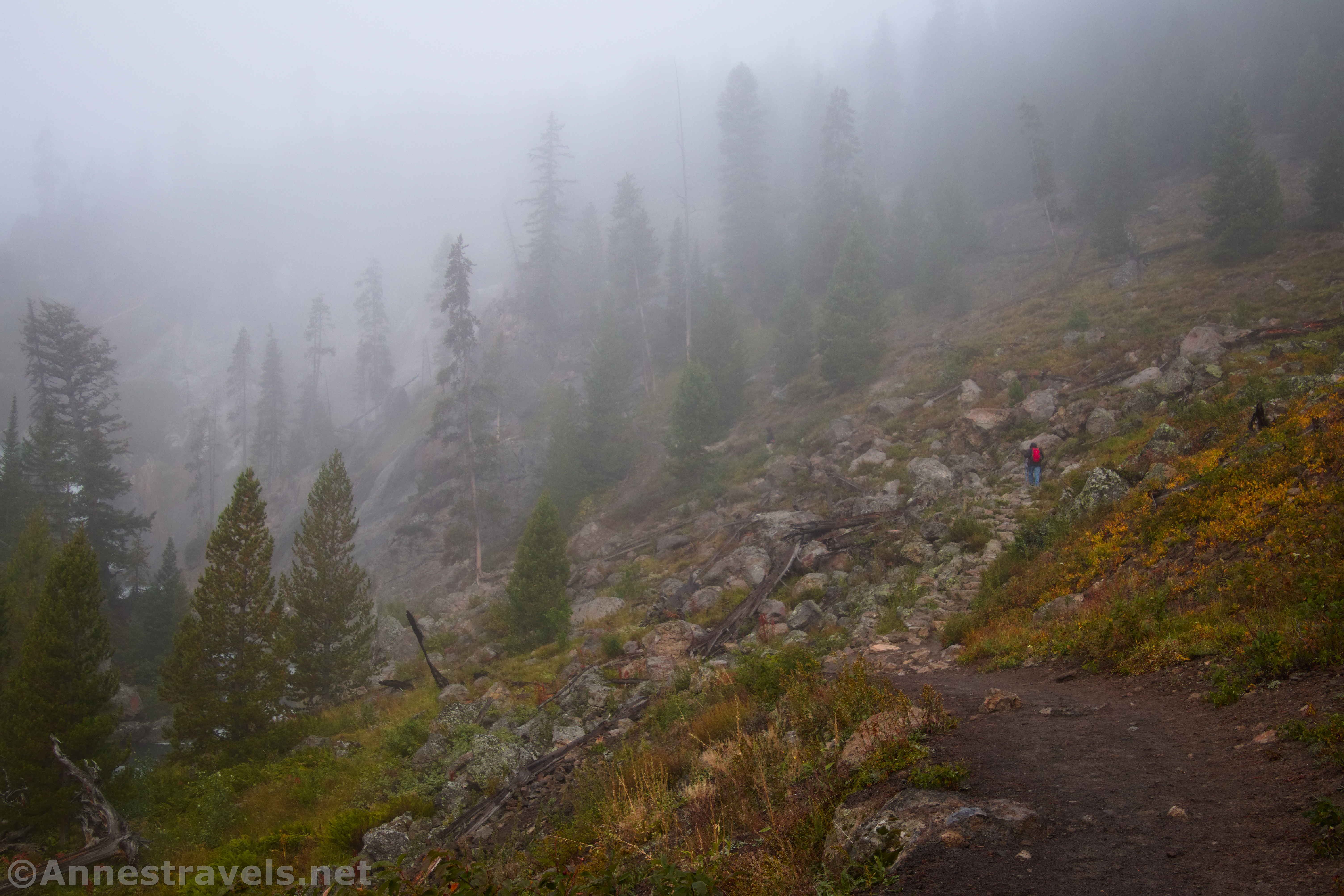
A very short distance beyond the end of the boardwalk, you’ll come to a trail junction with a signboard. Turn right. After 0.3 miles, a trail will strike off into the forest on the right. A trail sign points that Mystic Falls is to the left, while the Overlook and Mystic Falls is straight up this sidetrail. For now, I went left (which is really more like straight) to bypass the Overlook for the moment.
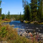
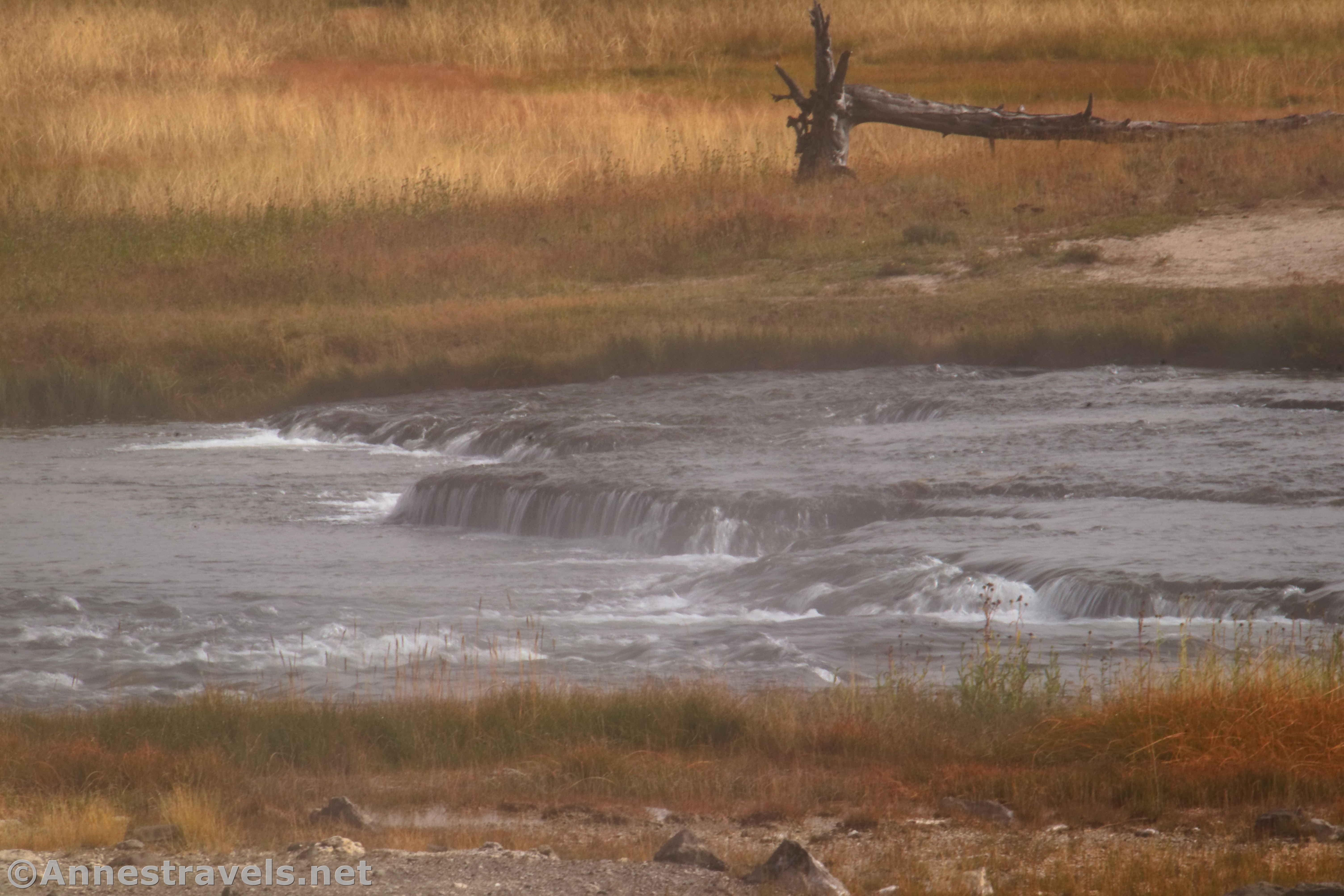
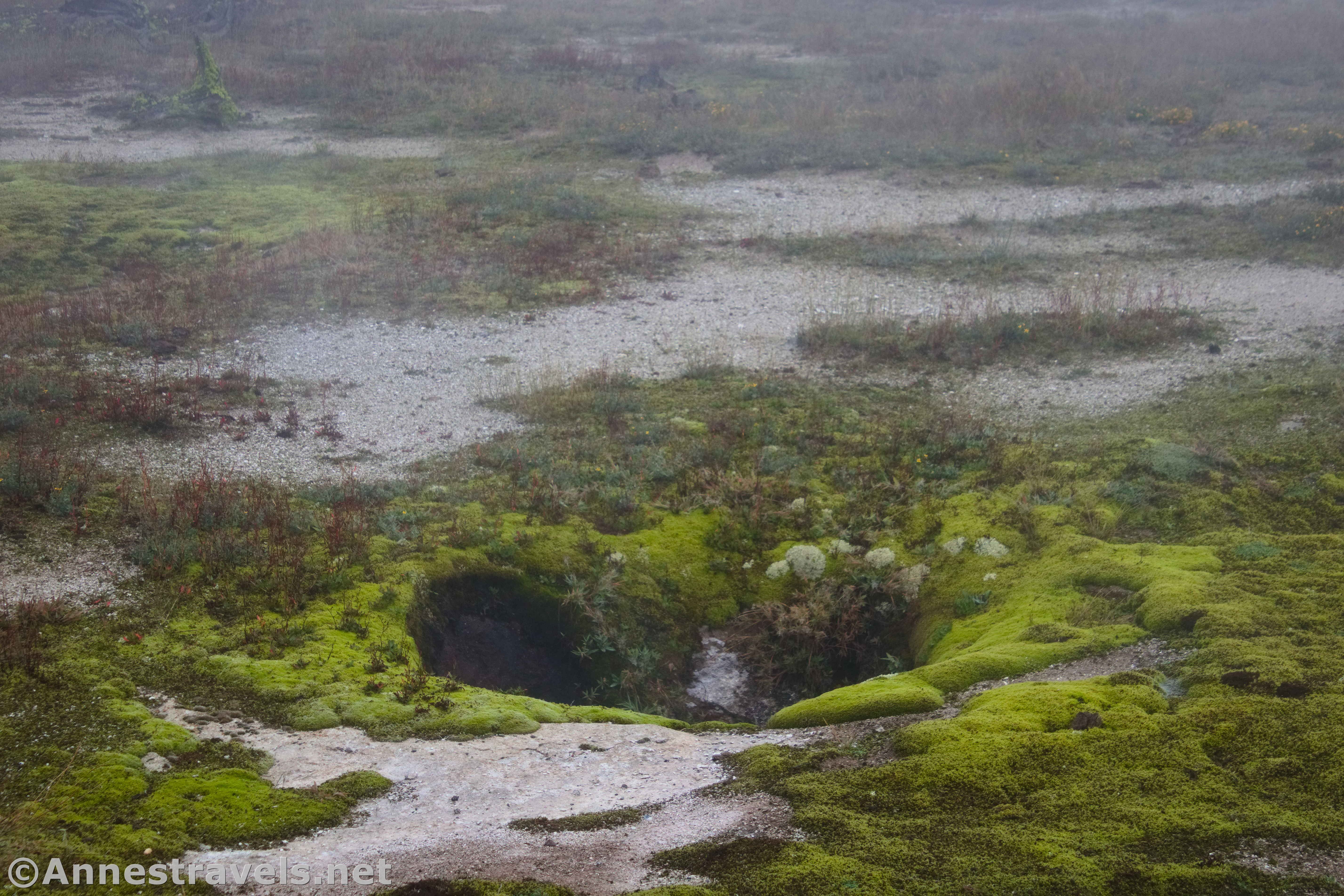
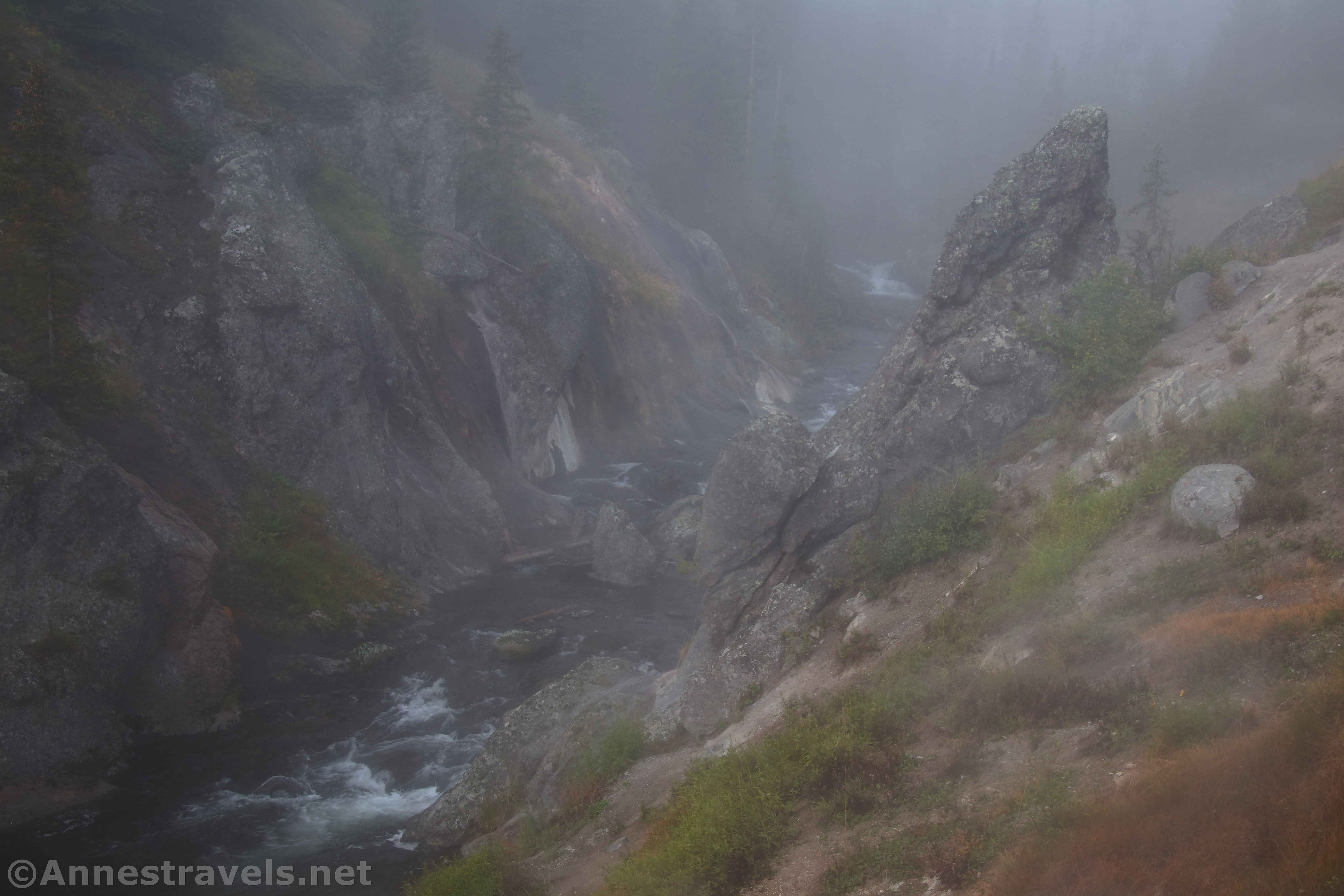
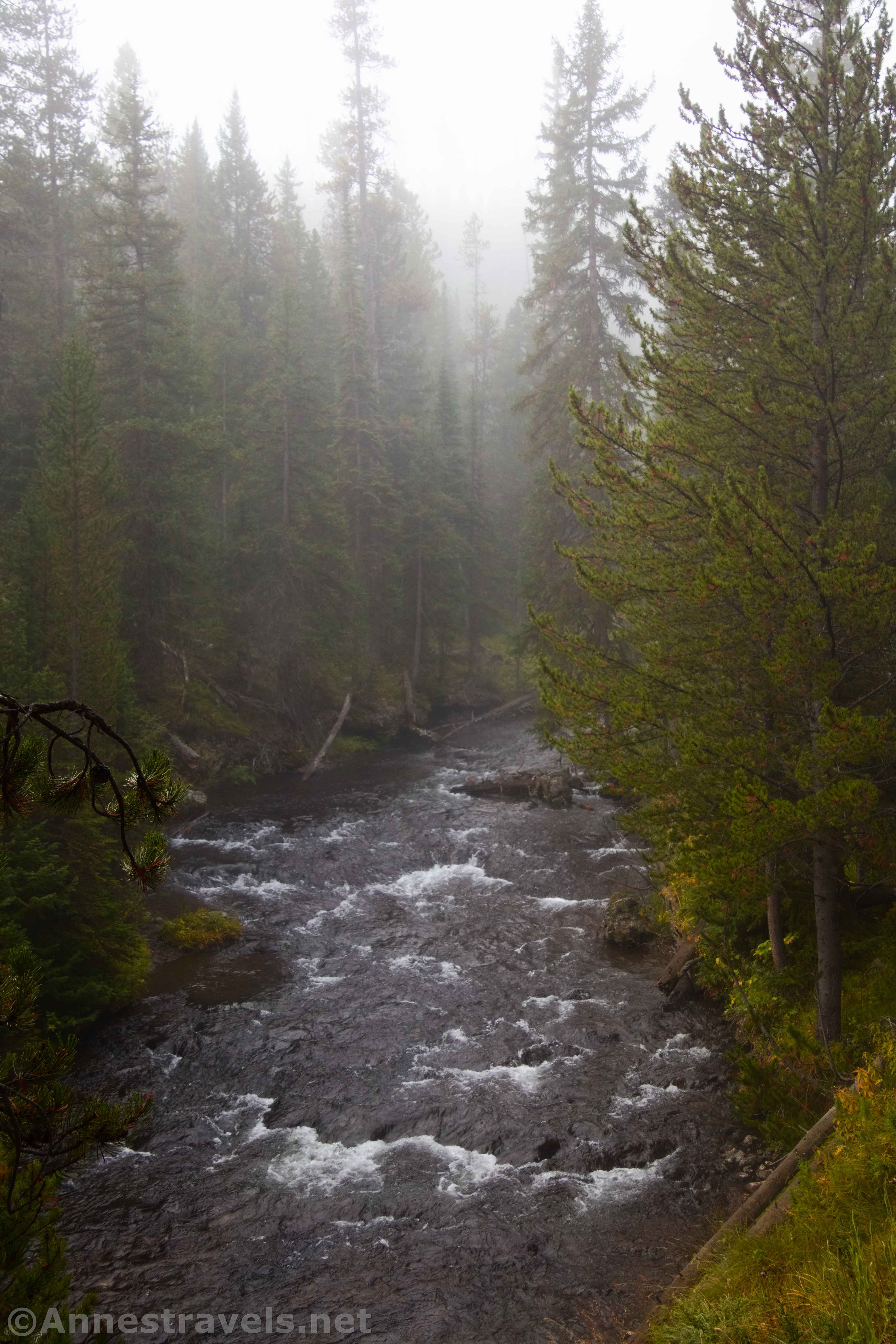
I’m glad I chose to do this part of the trail (which is a loop) clockwise. Hiking up along the river was delightful, especially in the mist. There were little rapids as well as active and inactive geothermal features. (I enjoyed the sight of the inactive geysers, now growing grass.)
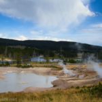
A tenth of a mile beyond the Overlook Trail junction, the path to Summit Lake strikes off on the left. Continue straight through meadows and above the Little Firehole River. This is where you can see geothermal features above the Little Firehole River.
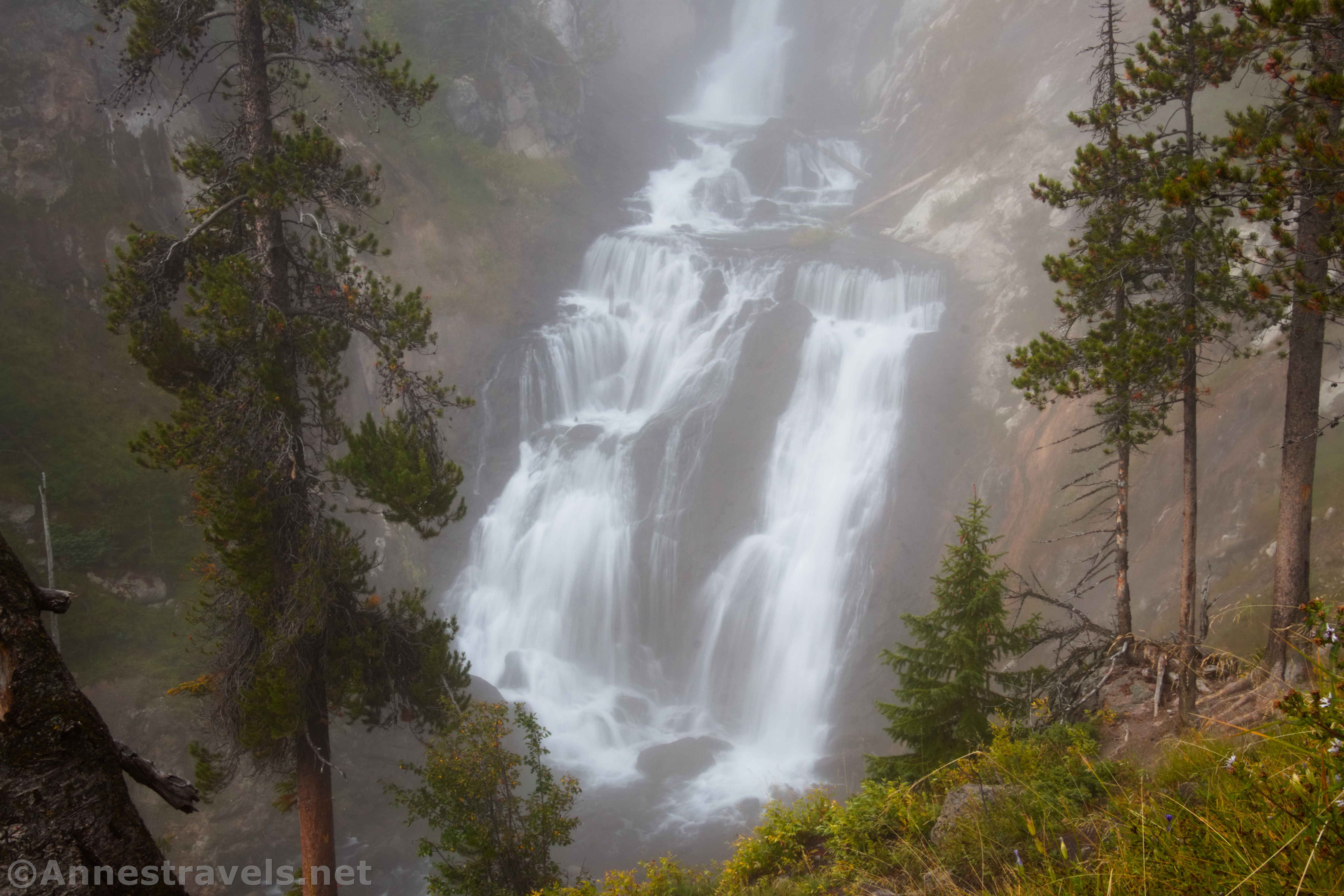
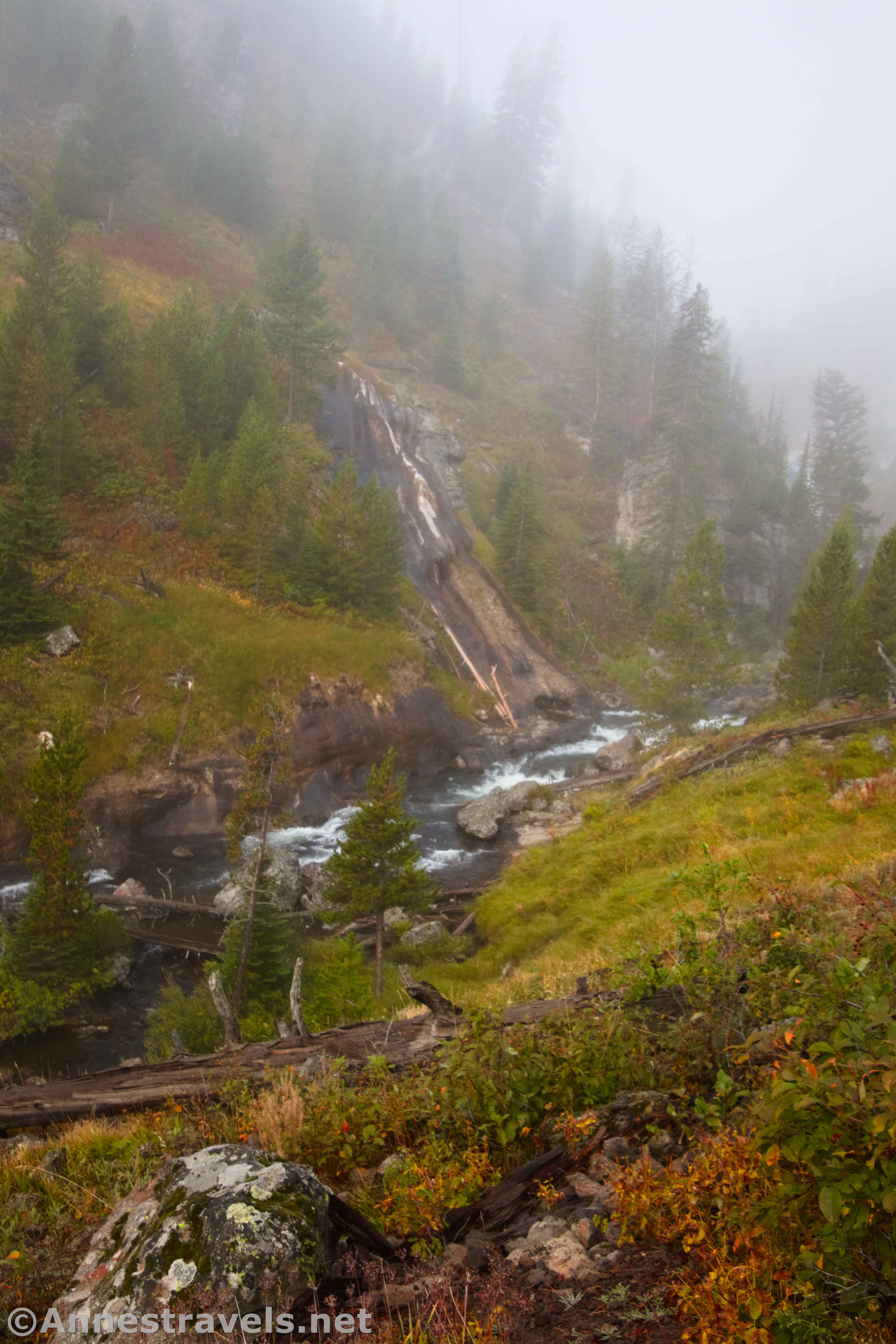
About 1.3 miles from the trailhead, you’ll come to Mystic Falls. It was slightly shrouded in mist when I visited (big surprise, right?), but that added to the mystery around the falls.
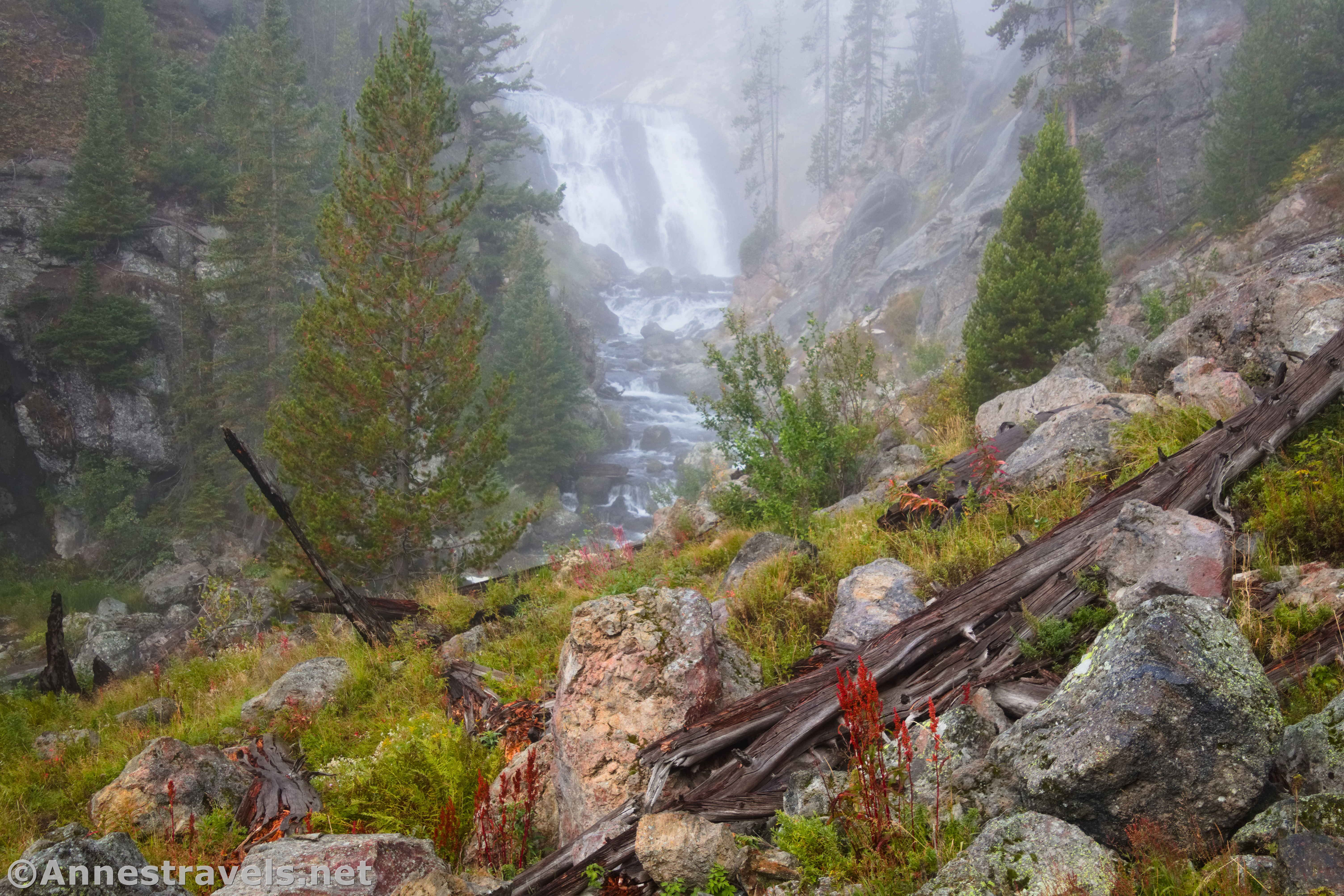
No one is quite sure how the waterfall received its name. The 1872 Hayden Geologic Survey called it Little Firehole Falls after the river. The Arnold Hague Geological Survey 13 years later renamed it Mystic Falls, but they didn’t bother to record why the name seemed to fit. The waterfall is 70ft. high.
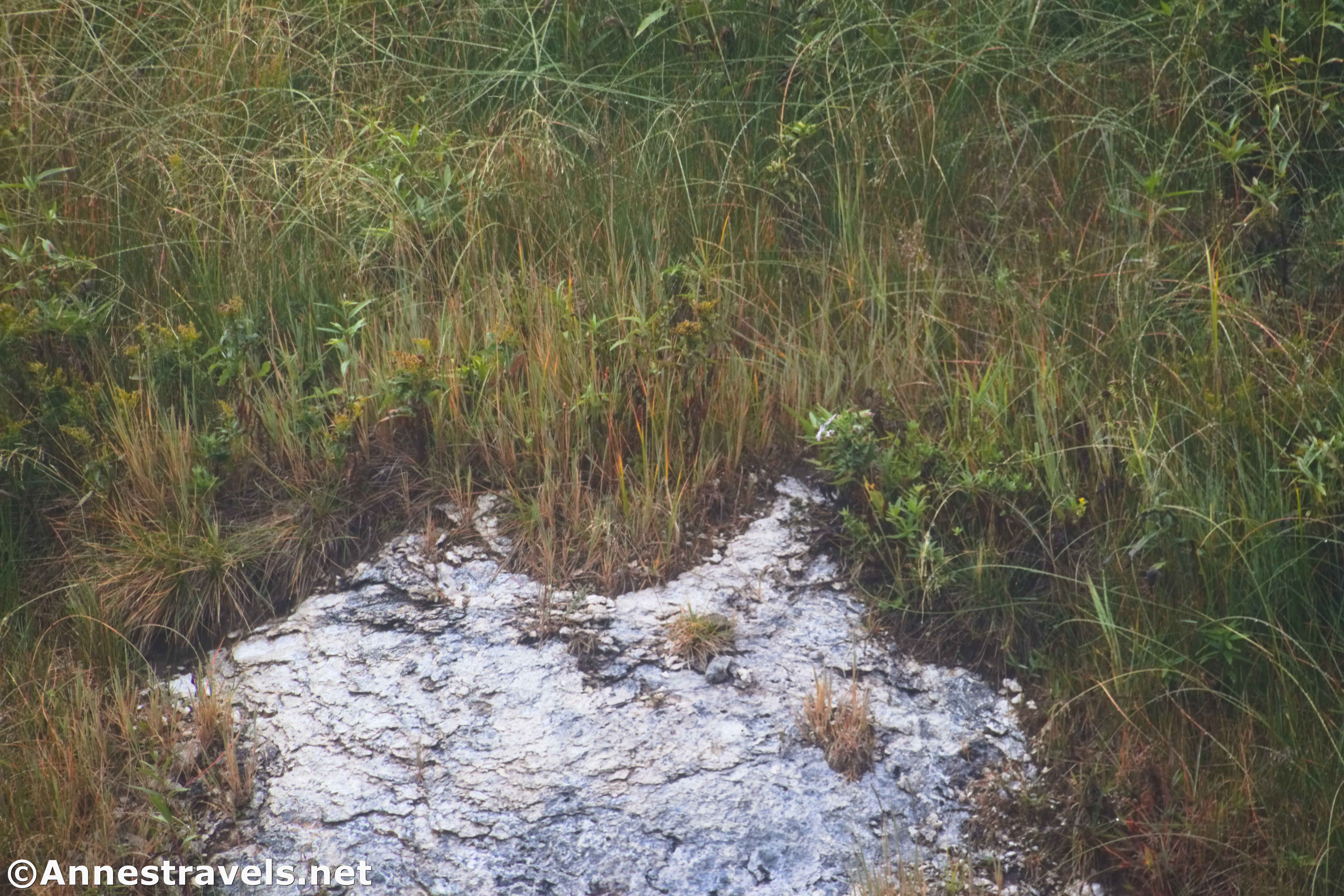
There are quite a few social trails in the area. Then NPS requests that you stay on established trails due to the dangerous nature of many of the social paths. I can say that the area off of the main path is very steep, slippery, and requires some skill to both descend and re-ascend. So yes staying on the main trail is a good idea!
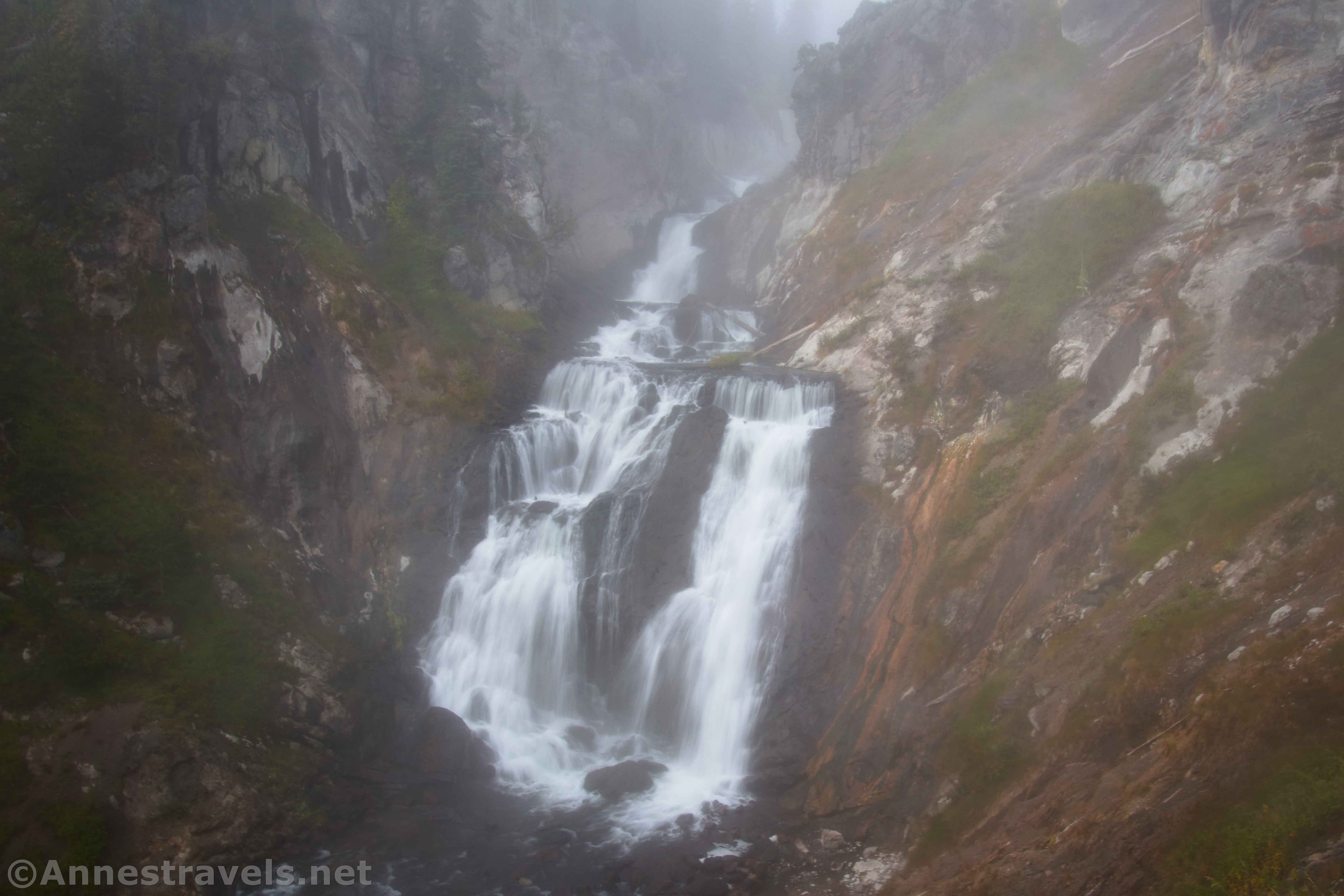
The trail continues to ascend the hillside beyond where you can see Mystic Falls. If you’re in this just to see Mystic Falls, turn around here. Otherwise, keep hiking up to the top of Mystic Falls. It’s a bit of a climb, and also a bit of a downclimb to be able to see above the falls, but I enjoyed it very much. There is a fair amount of geothermal activity up here.
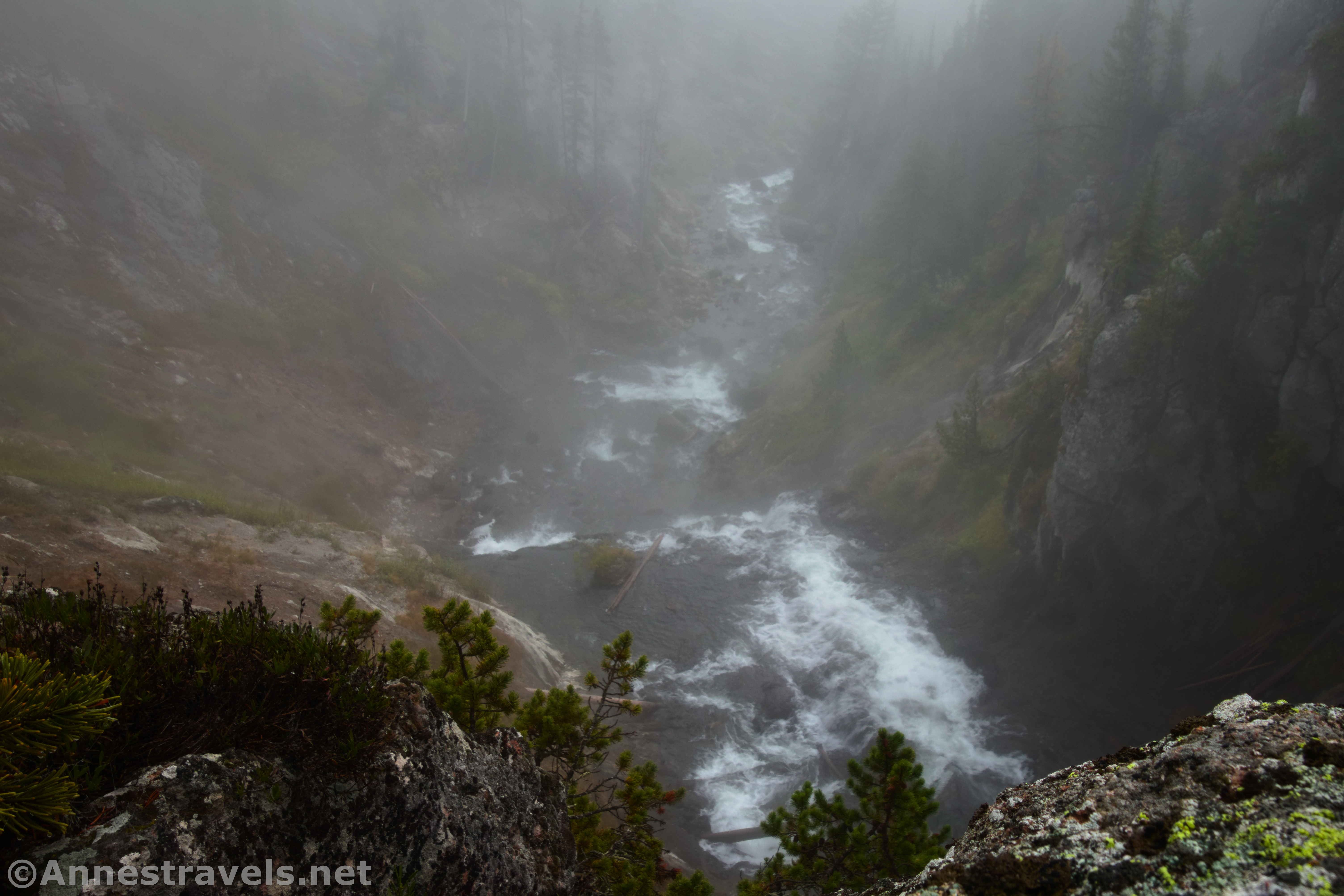
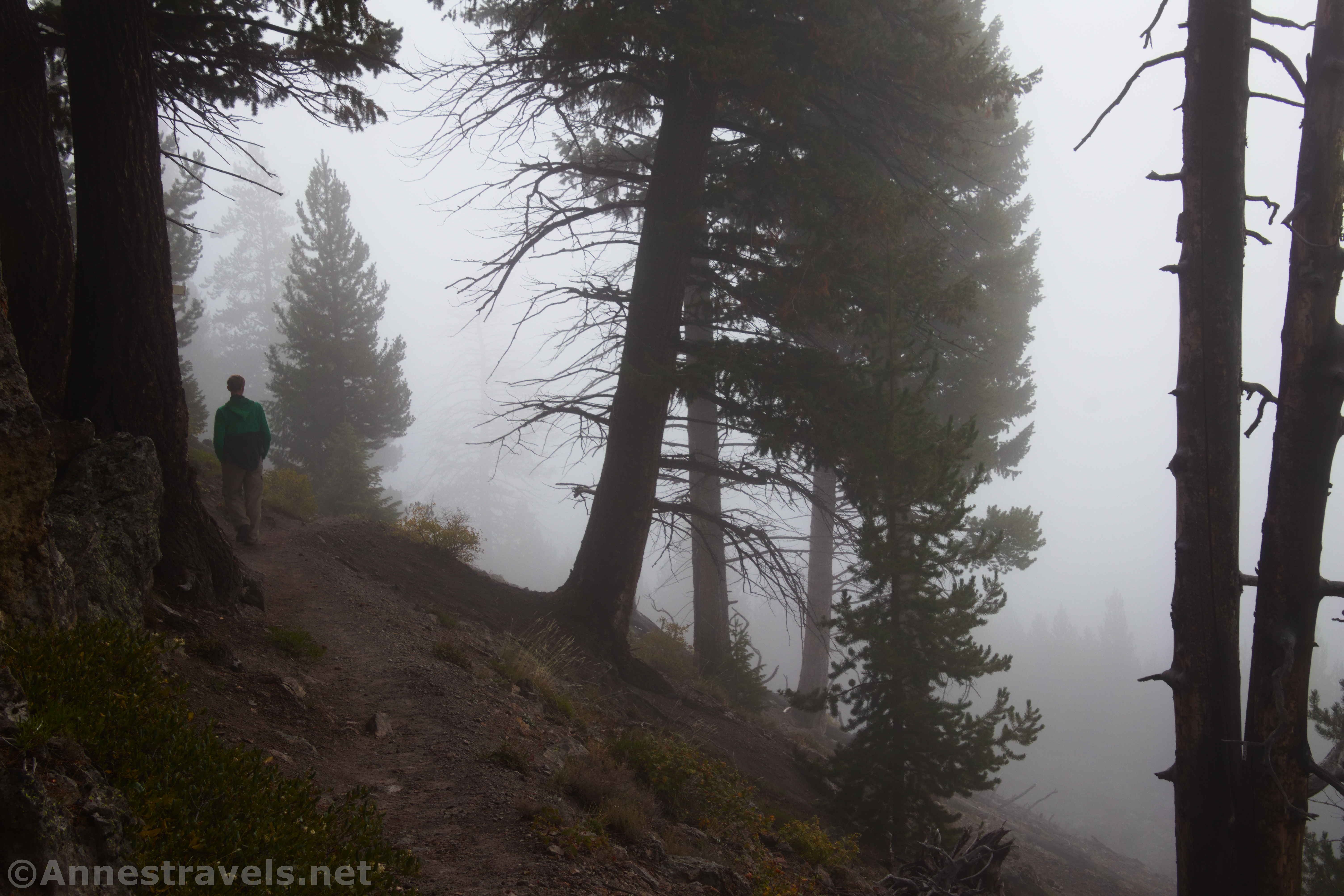
Keep hiking on the main trail up to the Mystic Creek Trail Junction at mile 2.1. Make a sharp right turn here, or you’ll find yourself hiking a very long way up the creek instead of to the viewpoint! (I hear Firehole Falls is up the trail, but it’s about 10 miles RT.) The mist continued as we wound our way through the woods for half a mile.
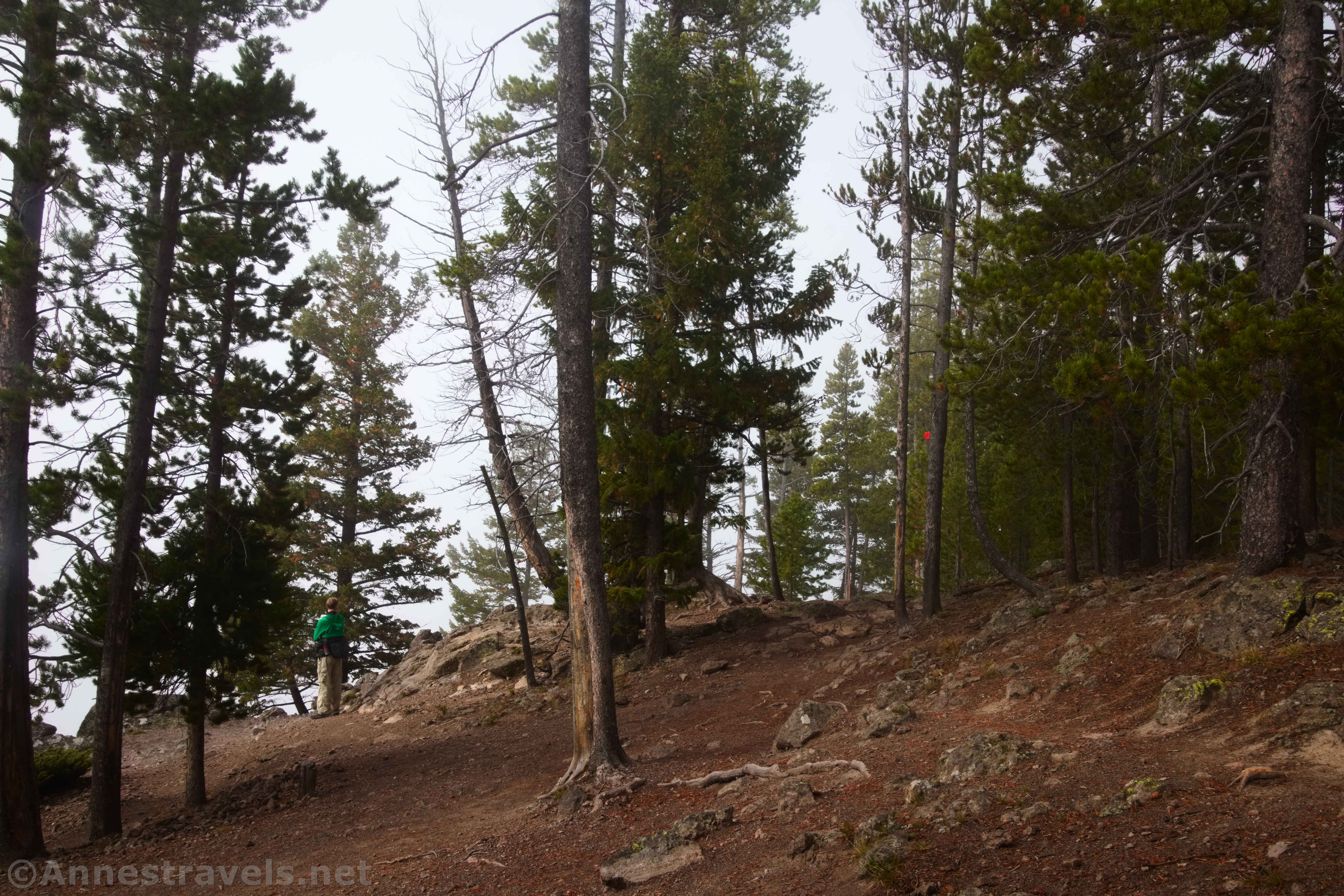
A sign points toward the Overlook, though I sort of figured it out from the trampled ground and a kind of fence along the side of the hill. Otherwise, we couldn’t see much – the mist still hung thickly. Oh well! On a sunny day, I hear that the views are very nice down on the valley, including the Firehole and Little Firehole Rivers and several geyser basins.
Continue to follow the trail as it steeply switchbacks below the viewpoint and back down to the main path. This was a beautiful, almost eerie hike on a misty morning, but I expect it could be hot and unpleasant on a warm day.
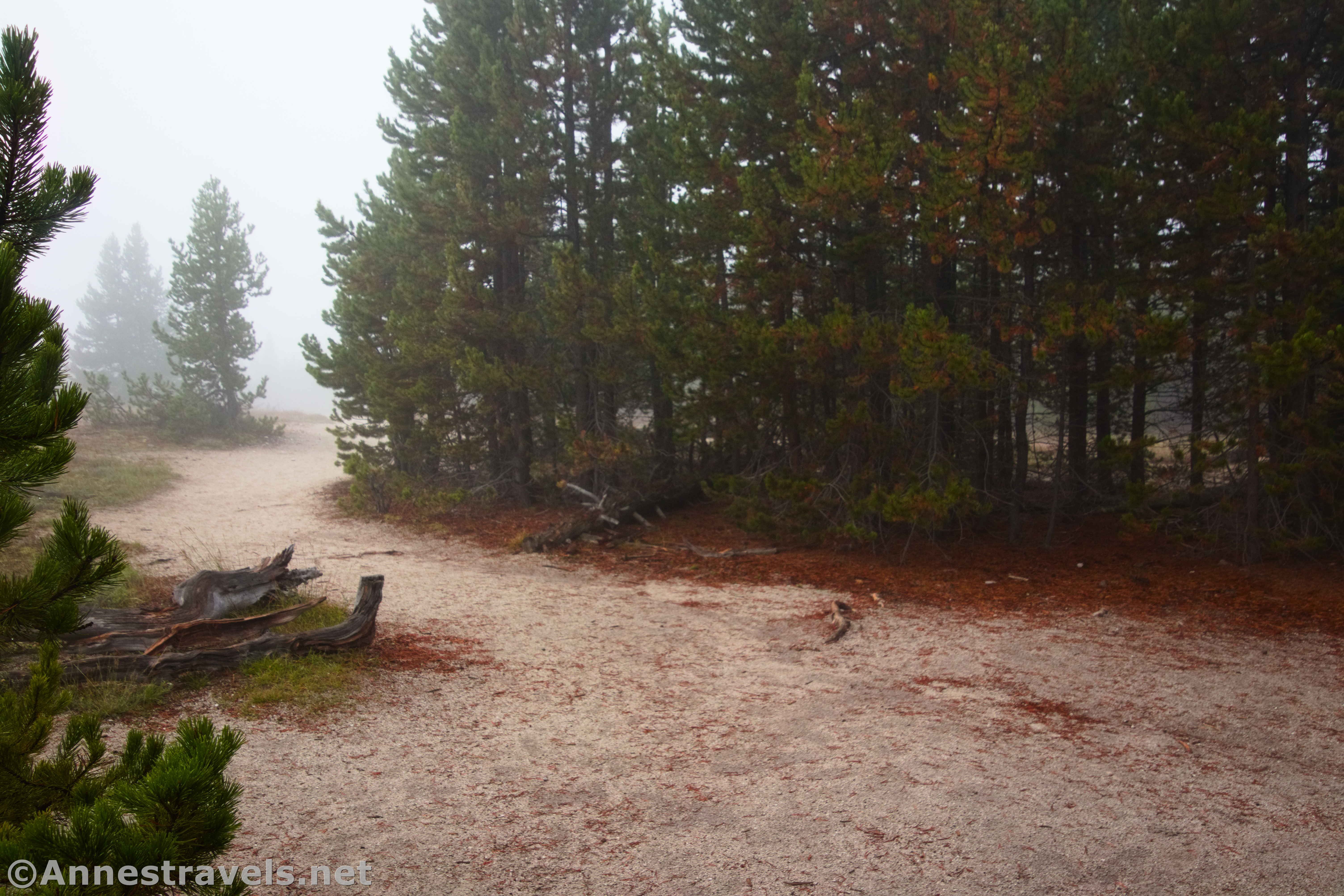
Once back at the main trail, turn left to return to the junction by the signboard. Then turn left again to arrive back at the boardwalk. After passing by West Geyser, turn left to complete the Biscuit Basin Loop (or at least, that’s what I did!) There are several more interesting features, including Mustard Spring (maybe sometimes it’s yellow with sulphur?) and several geysers that may be more or less active at the moment.
Turn left at the final junction to pass by Sapphire Pool and cross the bridge back to the parking area. For a 4 mile hike, that’s a lot of beautiful and varied scenery!

Round Trip Trail Length: I went about 4.0 miles
Elevation Gain: 1,126ft. (7,270ft. to 7,817ft.)
Facilities: None
Fees: $35/vehicle to enter Yellowstone National Park; America the Beautiful National Parks & Federal Lands Passes and Yellowstone Annual Passes are accepted.
Trail Notes: Try to get to the parking area either late or early in the day – it fills up quickly. Mystic Falls, itself, will have better lighting in the morning. The stream steams a little on cold days because of all the geothermal activity pumping hot water into it. The Biscuit Basin boardwalk is wheelchair accessible. After leaving the boardwalk, the trail is reasonable to Mystic Falls and then fairly steep up and then down. However, it’s very obvious the entire way, and it would be difficult to get lost.
Trail 
![]()
Road ![]()
Signs
Scenery
Would I go 100 miles out of my way for this? ![]()
Overall Rating: 
GPS Coordinates for Biscuit Basin and Mystic Falls (including the Overlook)
TH: 44.4850600°, -110.8525650° (44°29.10360′, -110°51.15390′ / 44°29’06.2160″, -110°51’09.2340″) (7,263ft.) (0.0)
Biscuit Basin Loop Junction: 44.4848370°, -110.8557940° (44°29.09022′, -110°51.34764′ / 44°29’05.4132″, -110°51’20.8584″) (7,286ft.) (0.18)
Biscuit Basin/Mystic Falls Junction: 44.4854610°, -110.8573670° (44°29.12766′, -110°51.44202′ / 44°29’07.6596″, -110°51’26.5212″) (7,290ft.) (0.30)

Trail Junction: 44.4856030°, -110.8580990° (44°29.13618′, -110°51.48594′ / 44°29’08.1708″, -110°51’29.1564″) (7,291ft.) (0.35)
Observation point junction: 44.4855460°, -110.8634220° (44°29.13276′, -110°51.80532′ / 44°29’07.9656″, -110°51’48.3192″) (7,316ft.) (0.65)
Summit Lake Junction: 44.4849610°, -110.8640380° (44°29.09766′, -110°51.84228′ / 44°29’05.8596″, -110°51’50.5368″) (7,299ft.) (0.70)
Mystic Falls: 44.4843480°, -110.8729310° (44°29.06088′, -110°52.37586′ / 44°29’03.6528″, -110°52’22.5516″) (7,437ft.) (1.29)
Mystic Creek Junction: 44.4869450°, -110.8750440° (44°29.21670′, -110°52.50264′ / 44°29’13.0020″, -110°52’30.1584″) (7,805ft.) (2.08)
Observation point (Overlook) over Biscuit Basin: 44.4870730°, -110.8660330° (44°29.22438′, -110°51.96198′ / 44°29’13.4628″, -110°51’57.7188″) (7,680ft.) (2.59)
Return to the Observation point junction: 44.4855270°, -110.8634420° (44°29.13162′, -110°51.80652′ / 44°29’07.8972″, -110°51’48.3912″) (7,316ft.) (3.31)
Return to Biscuit Basin Trail: 44.4848320°, -110.8557990° (44°29.08992′, -110°51.34794′ / 44°29’05.3952″, -110°51’20.8764″) (7,286ft.) (3.85)
End at TH: 44.4850700°, -110.8525450° (44°29.10420′, -110°51.15270′ / 44°29’06.2520″, -110°51’09.1620″) (7,264ft.) (4.05)
The gpx file for Biscuit Basin, Mystic Falls, and the Overlook can be downloaded – please note that this and the GPS Coordinates are for reference only and should not be used as a sole resource when hiking this trail.
Download GPX File size: 74.5 KB Downloaded 81 times
(Note: I do my best to ensure that all downloads, the webpage, etc. are virus-free and accurate; however, I cannot be held responsible for any damage that might result, including but not limited to loss of data, damages to hardware, harm to users, from use of files, information, etc. from this website. Thanks!)

Getting to the Biscuit Basin Trailhead
From the Old Faithful exit, drive north on the main park road (Grand Loop Road). After 2.0 miles, turn left into the parking area for Biscuit Basin. Use care, as at least one part of the parking area has fallen victim to a geothermal sinkhole. The NPS does its best to put cones or fences around the holes, but you should still pay attention to where you’re driving as well as the hoards of tourists walking across the parking lot.
The turn into Biscuit Basin is 13.9 miles south of Madison Junction and 3.9 miles south of Midway Geyser Basin.
More Trails in Yellowstone!
Explore the easy but totally beautiful hikes in Yellowstone with this well-prepared hiking guide. It covers 30 trails across the park with a wide variety of features, from lakes and waterfalls to geothermal geysers and mountain peaks. Buy your copy here!