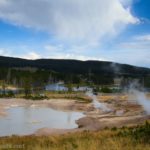
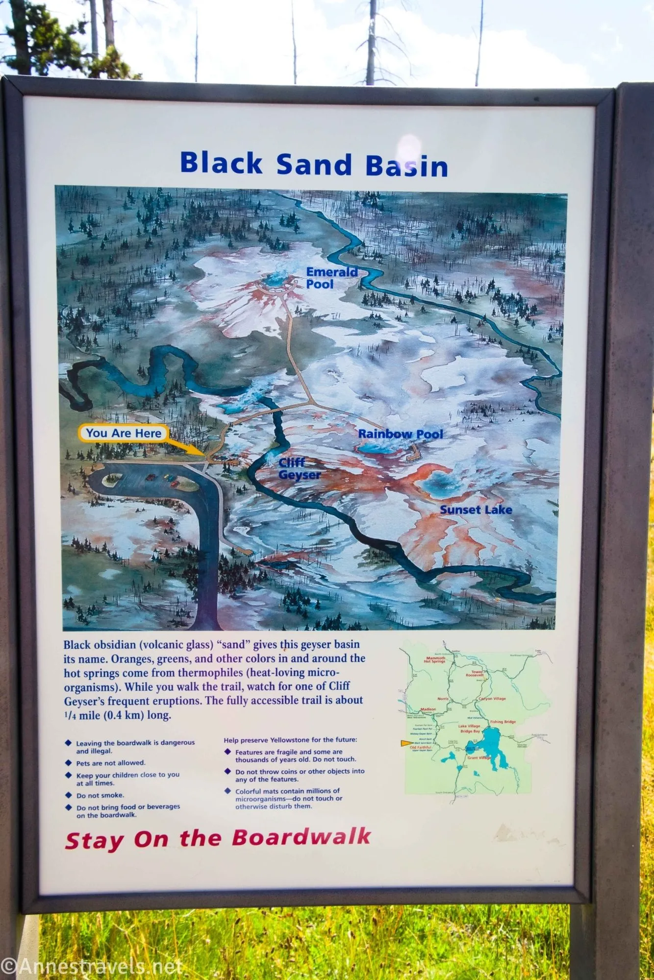
Overshadowed by the nearby Upper Geyser Basin and Biscuit Basin, Black Sand Basin is another little gem in central/western Yellowstone National Park. While it’s not very large and doesn’t have a lot of features, I loved an extremely active geyser and several pools that were remarkably colorful. So it’s worth a 10-minute (well, maybe a little longer than that since it’s about half a mile round trip with very little elevation gain) stop if you happen to have the time!
Quick Stats
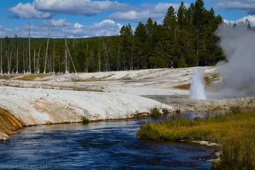
The excitement began for me before I even made it to the trailhead. Along the north/northwest end of the parking area, there are several pools and active features – I especially enjoyed Spouter Geyser…
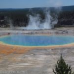
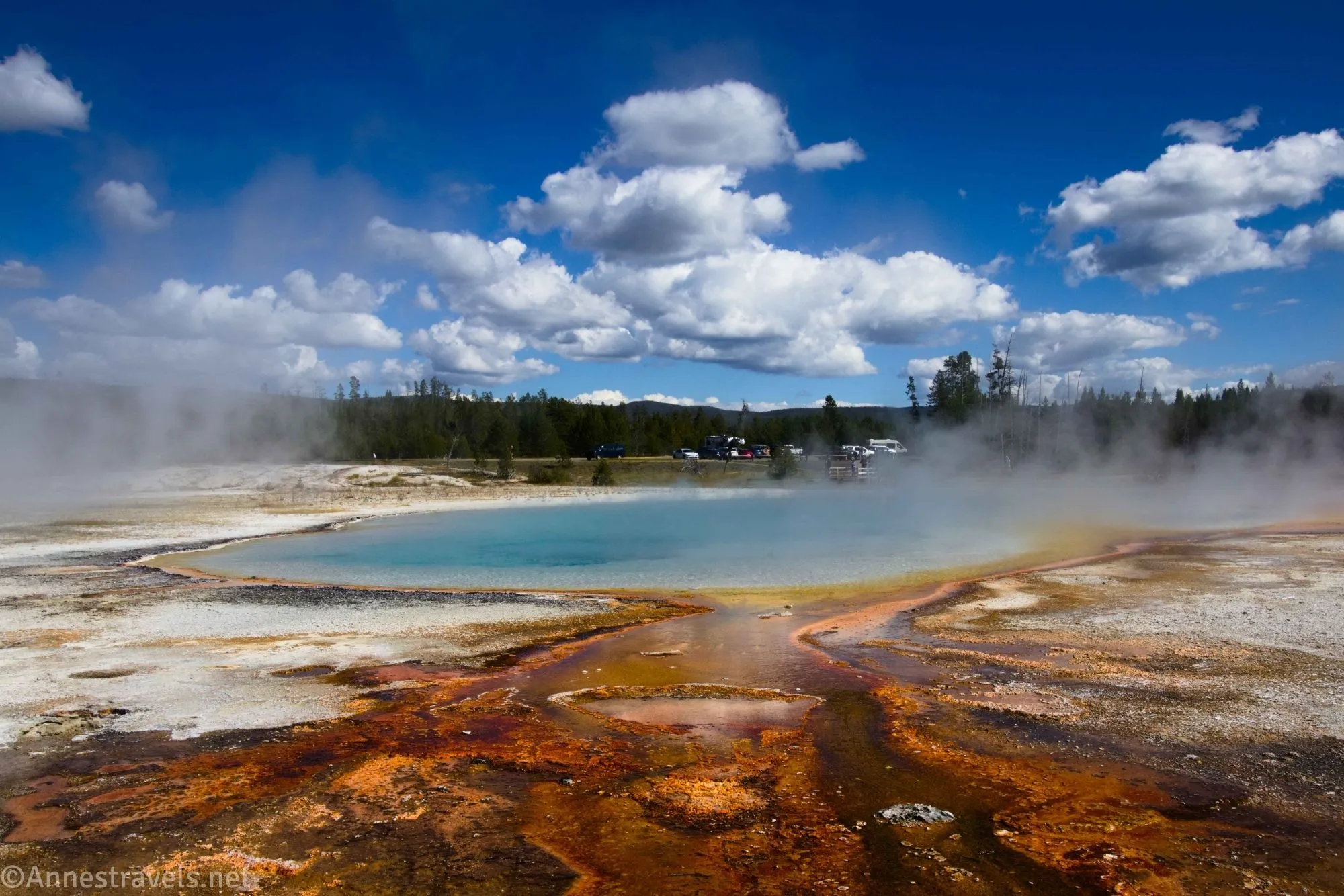
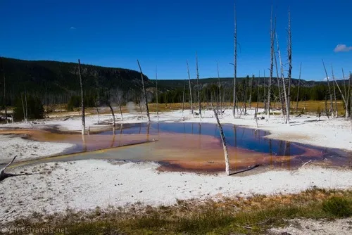
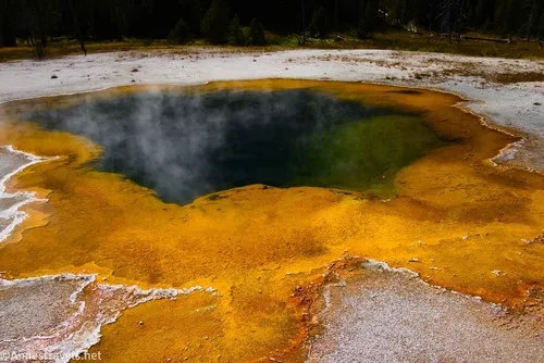
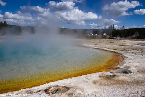
…and the then boardwalk out to colorful Opalescent Pool.
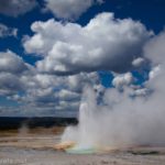
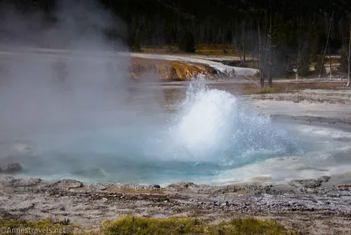
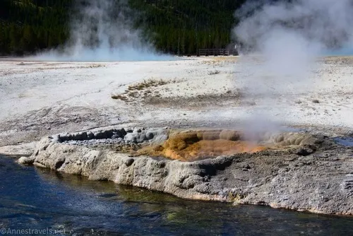
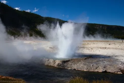
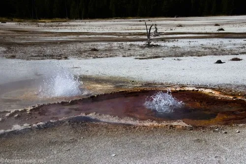
Over to my left, I could see a geyser going crazy. It turns out this is called Cliff Geyser, and it has a regular schedule (maybe over 20 minutes or a little less) where the geyser spouts off about 10 feet in the air, then relaxes, and the pool around it empties into the creek beside the pool.
We ran down from the parking area to the Cliff Geyser viewing area about 150ft. to the right of the trailhead.
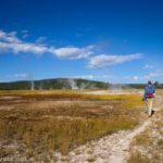
Continue along the boardwalk past a few more features, including another bubbling geyser and Green Spring (which is actually quite colorful).
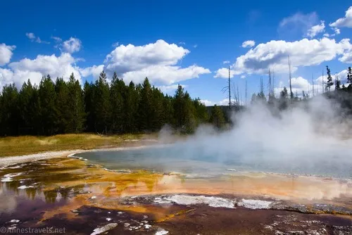
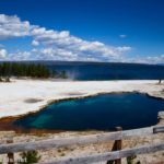
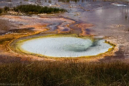
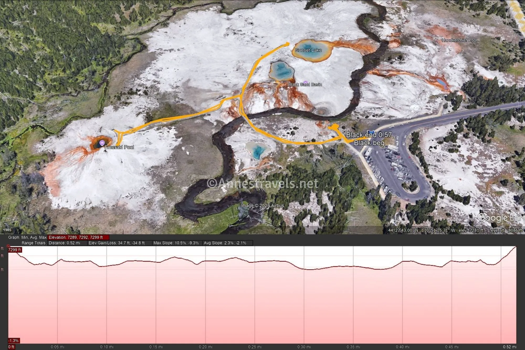
After about 0.2 miles (and shortly after crossing Iron Spring Creek), a boardwalk goes off on the left to Emerald Pool. It’s worth the extra mileage to go out here and see the deep orange of the outside of the pool (and the green of the deeper part of the pool).
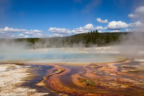
Back at the main boardwalk, there are so many colorful drainage channels from Rainbow Pool – it’s pretty!
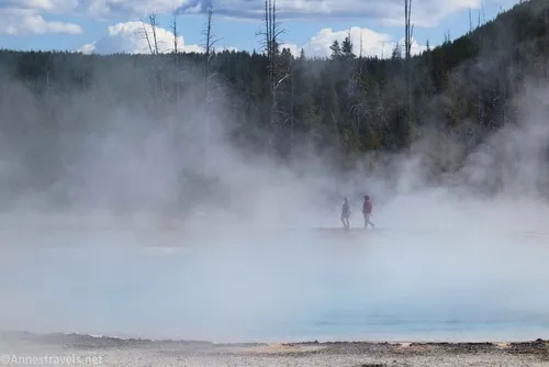
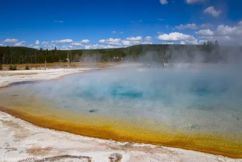
At last, about 0.35 from the trailhead (0.2 without going out to Emerald Pool), the boardwalk ends at Sunset Lake. It’s hard to capture the entire thing in a picture as it’s a large pool.
Walk the 0.2 miles back to the trailhead, enjoying all of the colorful pools along the way!
Round Trip Trail Length: 0.5 miles out & back with a couple of spurs (this does not include the boardwalk out to Opalescent Pool, which doesn’t add significant overall mileage)
Elevation Gain: 35ft. (7,299ft. to 7,289ft.)
Facilities: None
Fees: $35/vehicle, valid 7 days. America the Beautiful National Parks & Federal Lands Passes and Yellowstone National Park Passes are accepted.
Trail Notes: The main boardwalk is nice, but be sure to hike up along the driveway of the parking area to see more features. 99% of the hike is on boardwalks; there isn’t much in the way of elevation gain, so it’s an easy walk.
Road 
![]()
Signs ![]()
Scenery ![]()
![]()
Would I go 100 miles out of my way for this? ![]()
![]()
GPS Coordinates for Black Sand Basin
TH: 44.4622600°, -110.8534000° (44°27.73560′, -110°51.20400′ / 44°27’44.1360″, -110°51’12.2400″) (7,286ft.) (0.0)
End at TH: 44.4622590°, -110.8534010° (44°27.73554′, -110°51.20406′ / 44°27’44.1324″, -110°51’12.2436″) (7,286ft.) (0.57)
The gpx file for Black Sand Basin can be downloaded – please note that this and the GPS Coordinates are for reference only and should not be used as a sole resource when hiking this trail.
Download GPX File size: 14.3 KB Downloaded 36 times
(Note: I do my best to ensure that all downloads, the webpage, etc. are virus-free and accurate; however, I cannot be held responsible for any damage that might result, including but not limited to loss of data, damages to hardware, harm to users, from use of files, information, etc. from this website. Thanks!)
Getting to Black Sand Basin
Black Basin is a short distance north the overpass for Old Faithful (toward Madison) – about 0.25 miles from where the on-ramp ends. Turn left into the long driveway to the parking lot. If coming from the north, the turn into the driveway is 1.6 miles south of Biscuit Basin or 15.5 miles south of Madison Junction.
Even More Great Things to See in Yellowstone National Park
Take a ranger’s advice with this book to plan your trip to Yellowstone! It covers over 30 hikes across the park for various skill levels to experience the best the park has to offer. Buy your copy here.