After the Wilderness Route, the Blue Forest Route was my favorite hike in Petrified Forest National Park during my visit last fall. The good news? It’s much shorter and much, much easier to follow than the Wilderness Route. So as long as you have basic trail-finding techniques, this is a great way to experience the beauty of southern Petrified Forest. The views blew me away, but I also saw some petrified wood (mostly at a distance) along the way.
Quick Stats
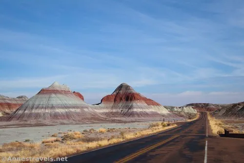
The route begins near the Teepees. The pulloff can accommodate 4-5 cars if you squeeze them in, but there are a couple of other pulloffs in the area – and given that the hike isn’t all that popular, chances are that you’ll be able to park quite easily. I visited on a weekday in November and had the entire trail to myself.
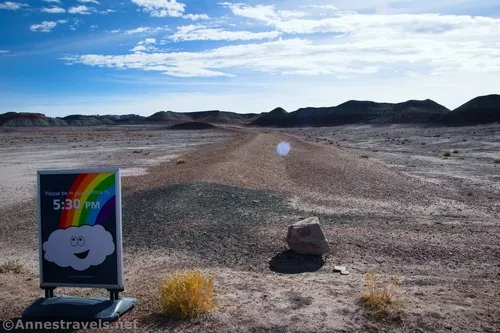
Park in the pulloff near the Teepees with an obvious (but closed) old dirt road heading straight for the distant badland hills (the opposite direction of the Teepees) – when I visited, a sign was positioned at the beginning of the road asking you to be back in your car at 5pm. I found out later that what they really want is for you to be out of the park when it closes at 5pm. I was so busy enjoying the lovely evening at the Crystal Forest that I overstayed by about 10 minutes – and the ranger wasn’t exactly thrilled to have to follow me to make sure I actually did exit the park. (Oops!) So it’s an exit thing, not a car thing!
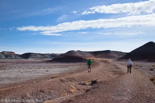
Follow the old road toward the badlands. The surface is gravelly and easy to walk on. After about 0.4 miles, cross over a very old culvert and then enter the turn-around at the end of the road. Walk over to the far side to pick up the obvious trail that ascends the badlands.
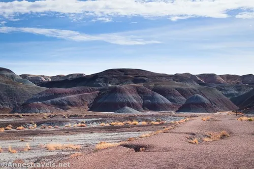
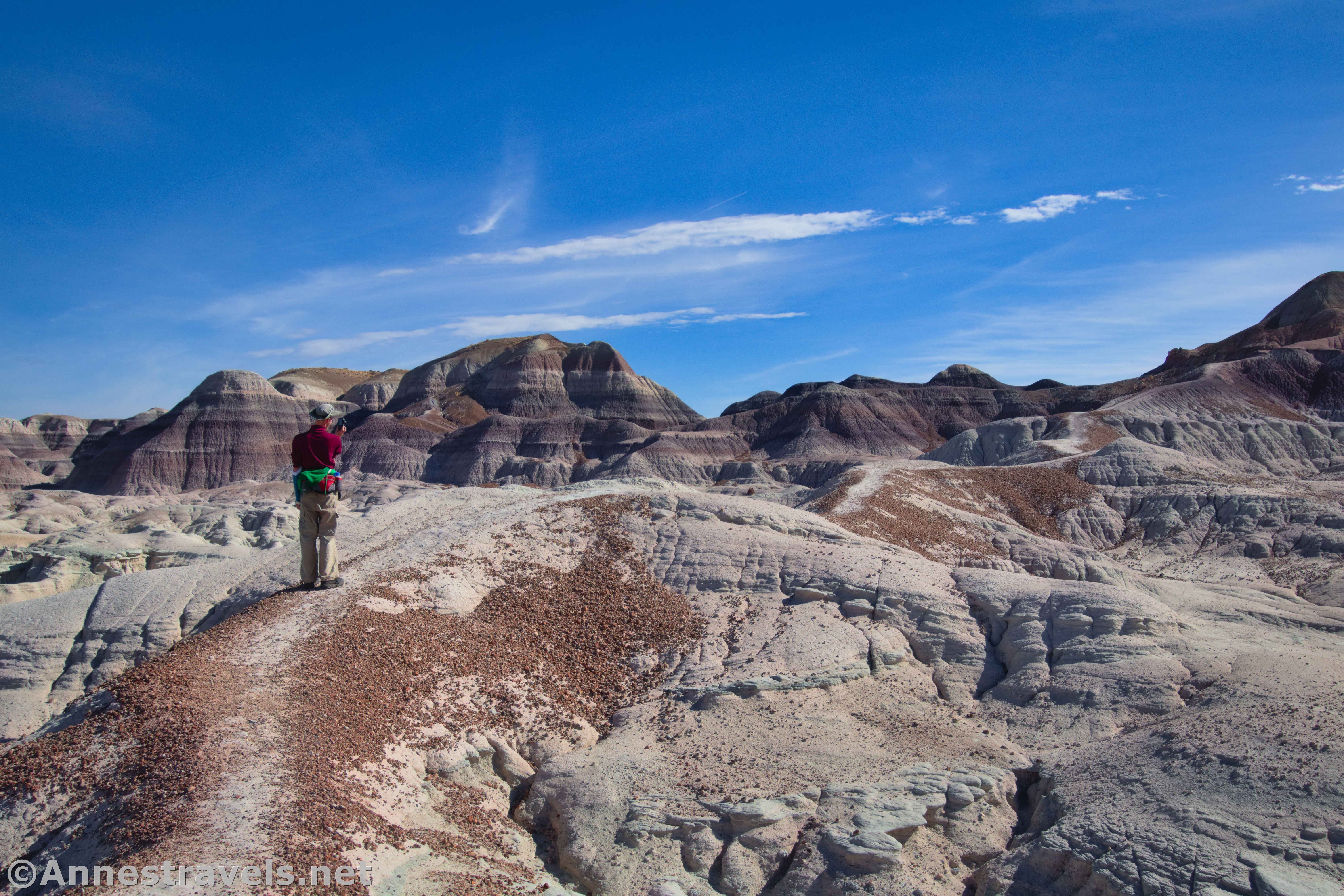
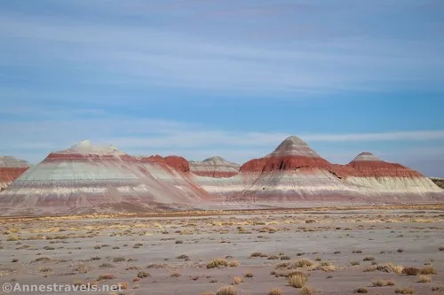
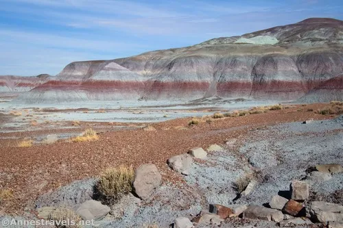
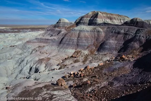
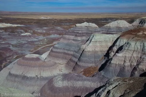
The views along the old road were good, especially of the Teepees. But as you climb higher, the views improve. I was delighted with these vistas; they seemed to get better and better the further we hiked.
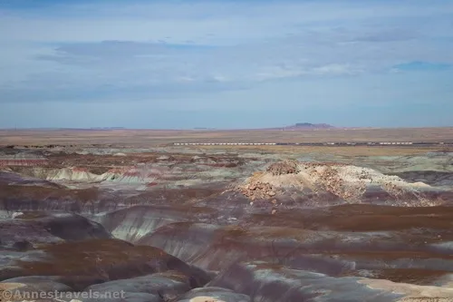
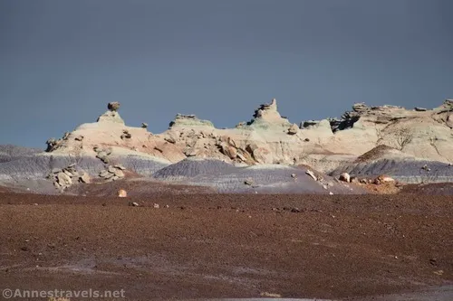
The trail is fairly obvious up to the top of the badlands; beyond this, it takes a little bit of intuition in a few places. In general, though, it wasn’t too hard to follow – thankfully! At 0.6 miles, the top of a small badland hill gives an especially good view (marked “viewpoint” on my map).
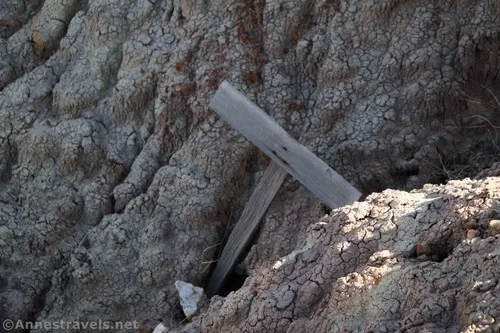
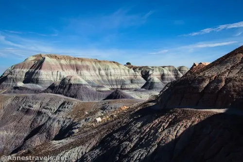
Keep walking along the top of the badlands on the faint if visible trail toward a larger ridge of badlands. It ascends more steeply before reaching a junction in the trail just before the 1.0 mile mark. An old and unreadable sign had been dropped into a hole nearby.
The official route goes left here. However, being the curious sort and thinking I could get a great view from the ridgeline (have I ever mentioned that I can’t turn down a good view?), I turned right. The trail becomes increasingly steep and slippery, so use caution.
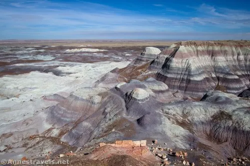
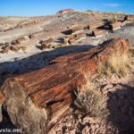
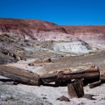
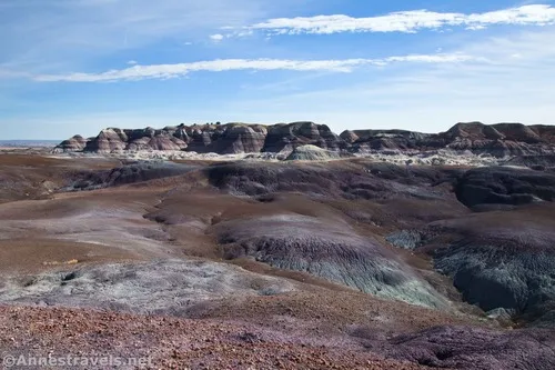
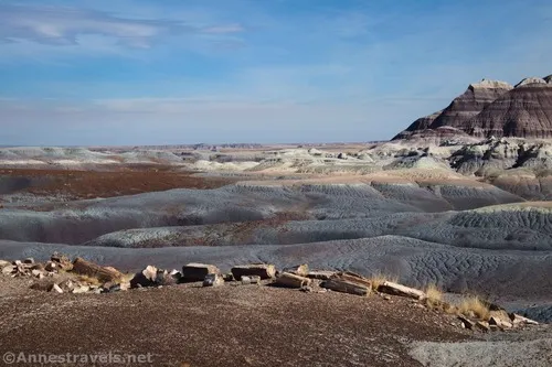
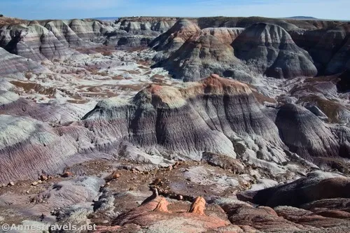
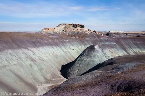
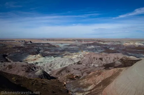
At the top of the ridgeline, you’re rewarded with fabulous views. Not only do you get to look back at where you’ve come from, but you also get to look over the other side of the ridge into a valley filled with rock formations and petrified wood. Amazing!
I hiked all of the way out to the end of the ridgeline (to a metal stake in the ground), but the views are better near where you reach the ridgeline.
Scramble back down to the trail junction and turn up the official route. This is much easier to hike and less slippery as it works its way along the side of the ridge and then up and along another ridge. The views are good if not quite as spectacular as from the unofficial trail to the ridgeline.
At about mile 1.5, you’ll come to five juniper trees. If you’re in this for a casual hike, you should turn around here. I continued a short distance further to where the trail begins a steep descent into a wash which will bring you down to the Blue Mesa Trail – a paved loop hike that passes pretty badlands and petrified wood.

However, I didn’t go down to the paved trail. The park staff had asked me not to, due to the slippery nature of the route. Therefore, professional ethics kept me from completing the descent. (It didn’t stop me from figuring out where the route entered the Blue Mesa Trail a few hours later, though!) I turned around an hiked back to the pulloffs near the Teepees, enjoying the view along the way!
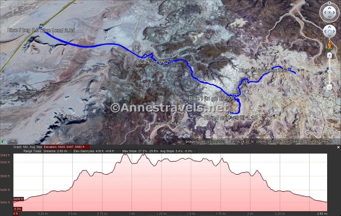
Round Trip Route Length: I went 2.8 miles; you could cut some of that off by not ascending to the ridgeline
Elevation Gain: 418ft. (5,404ft. to 5,583ft.)
Facilities: None
Fees: $25/vehicle, valid 7 days. America the Beautiful National Parks & Federal Lands Passes and Petrified Forest Annual Passes are accepted.
Trail Notes: This hike does not have an official trail or trail markings, so you’ll need to be very comfortable with off-trail travel. Summer is too hot to try it, so do it in the early morning, late afternoon, or cooler winter months. Be very careful of slippery gravel, steep grades, and potentially losing the trail at times. Remember to leave no trace – which would include not trying to hike the badland portion of the path when it’s muddy.
Trail 
![]()
![]()
![]()
Road ![]()
Signs ![]()
![]()
![]()
![]()
Scenery
Would I go 100 miles out of my way for this? ![]()
Overall Rating: ![]()
![]()
GPS Coordinates for the Blue Forest Route
TH: 34.9430030°, -109.7777550° (34°56.58018′, -109°46.66530′ / 34°56’34.8108″, -109°46’39.9180″) (5,409ft.) (0.0)
Viewpoint: 34.9405810°, -109.7690820° (34°56.43486′, -109°46.14492′ / 34°56’26.0916″, -109°46’08.6952″) (5,509ft.) (0.62)
Junction; go left: 34.9385780°, -109.7655060° (34°56.31468′, -109°45.93036′ / 34°56’18.8808″, -109°45’55.8216″) (5,565ft.) (0.97)
End of viewpoint trail: 34.9377390°, -109.7657650° (34°56.26434′, -109°45.94590′ / 34°56’15.8604″, -109°45’56.7540″) (5,575ft.) (1.10)
5 juniper trees: 34.9400280°, -109.7620480° (34°56.40168′, -109°45.72288′ / 34°56’24.1008″, -109°45’43.3728″) (5,602ft.) (1.53)
End: 34.9429790°, -109.7777780° (34°56.57874′, -109°46.66668′ / 34°56’34.7244″, -109°46’40.0008″) (5,409ft.) (2.85)
The gpx file for the Blue Forest Route can be downloaded – please note that this and the GPS Coordinates are for reference only and should not be used as a sole resource when hiking this trail.
Download GPX File size: 44.1 KB Downloaded 311 times
(Note: I do my best to ensure that all downloads, the webpage, etc. are virus-free and accurate; however, I cannot be held responsible for any damage that might result, including but not limited to loss of data, damages to hardware, harm to users, from use of files, information, etc. from this website. Thanks!)
Getting to the Blue Forest Route Trailhead
From I-40, take Exit 285 for Petrified Forest National Park. At the end of the exit ramp, turn right, following the signs for 180 East, 77 South, and more. Only 1.5 miles later, turn right onto Navajo Blvd which almost immediately becomes Apache Ave. After 0.7 miles, turn left onto US-180 E. A sign will point left toward Petrified Forest National Park. Drive 17.5 miles before turning left into Petrified Forest National Park. Continue 14.3 miles; take the first pulloff in the area of Teepees (this is likely the first pulloff after the Blue Mesa Scenic Drive).
From the northern part of Petrified Forest National Park, drive north from the visitor center. The road will loop around past the Painted Desert Inn (historic – there is no lodging in the park) before turning south to pass over I-40. Continue south to the Teepees area – you want to park in the last of the pulloffs in this area (very shortly before a badlands almost touches the road on the left). The pulloff is about 14 miles from the visitor center.
More Hikes in Arizona!
There are so many amazing sites to see in Arizona. This guidebook takes you to 50 of the best things to see in the state. Buy your copy here!