Sometimes you go to a place because you really want to go there. And sometimes you go because there are circumstances beyond your control that cause you make choices you wouldn’t have made otherwise. That happened with us the last time we visited Colorado. The weather simply wasn’t cooperating, so we couldn’t go to the Mount Elbert area when we wanted to. The only place it didn’t seem to be raining was in the area around Black Canyon of the Gunnison, so guess where we drove to? Black Canyon, of course! We actually had a great time hiking a couple trails with stunning views of the canyon. Today I’d like to talk about the Chasm View Nature Trail, a very short trail (0.5 mile (0.8 km) loop) with some very nice views. Usually, I try to avoid nature trails (just because I don’t find them very interesting), but this one has such nice views of the canyon that it’s well worth walking!
Quick Stats
The Chasm View Nature Trail leaves from the campground on the North Rim of Black Canyon of the Gunnison. I much prefer the North Rim to the South Rim of the canyon; part of this is just because it’s less crowded (there aren’t even any paved roads, let alone flush toilets), but the real reason is because the views are much better. Instead of about one overlook that shows the bottom of the canyon and the Gunnison River (like on the South Rim), just about every overlook you can see these features. The views are also just more spectacular, especially at Exclamation Point although the North Rim Drive also offers some very nice scenery.
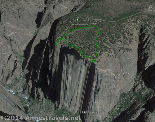
But back to the Chasm View Nature Trail: The trail begins near the post-and-rail fences. Because it’s a loop, you can go either direction. It’s also a nature trail, so if you want to learn about the natural environment / history of the canyon, pamphlets should be available at the trailhead. I decided to go right; I think this is a good way to go because you get the forest / campground views over first, but it really doesn’t matter. Going right (counter-clockwise), the sandy trail travels behind some of the campground sites for a short distance as it proceeds through a pinion pine / juniper forest.
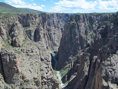
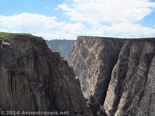
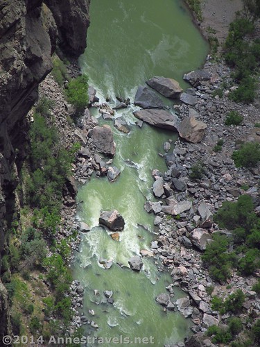
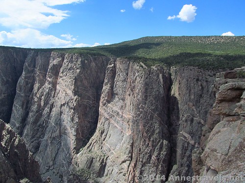
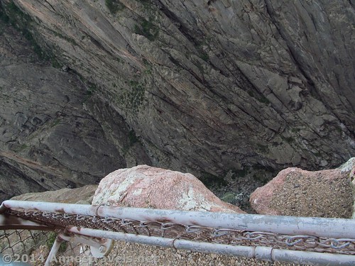
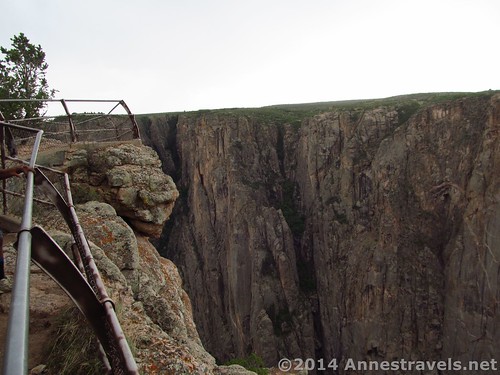
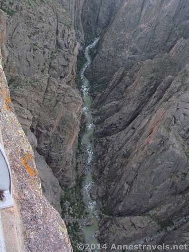
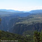
After 0.15 miles (0.25 km), a short side trail on the right descends a series of steps to a viewpoint. The views here are spectacular of the canyon. The Gunnison River is very visible, and the canyon walls loom upward grandly and ruggedly (you can even see the famed “Painted Wall” on the right). You can also see people and vehicles on the South Rim – which shows you just how far away that other rim isn’t! There are guardrails, but since you are directly on the edge of the canyon – and a very, very long drop off – it doesn’t make you feel very safe. Let’s just say that this may not be the best option for those who are afraid of heights or for small children!
Go back to the main trail (turning right as you come back up to the top of the stairs) and continue walking. The trail traverses rock and dirt, often passing close to the canyon edge (with guardrails) before arriving at the second viewpoint at mile 0.3 (0.5 km). This is another great view, similar, yet different, from the other. The trail is located at a bend in the canyon, so the first viewpoint shows downstream, while the second viewpoint has a better view of upstream. Several of the viewpoints along the Rim Drive are visible from this viewpoint.
Turn away from the canyon and follow the trail 0.2 miles (0.3 km) back to the trailhead via a sandy path. It may be a short trail, but the views make the hike well worth the stop!
If you’d like to trek down into the canyon, you can read about my adventures in Long Draw here.
Round Trip Trail Length: 0.5 miles (0.8 km)
Trailhead Elevation: 7,720 ft. (2,353 m)
Lowest Elevation: 7,680 ft. (2,340 m)
Net Elevation Change: 40 ft. (12 m)
Facilities: Picnic area, camping, and primitive restrooms at the trailhead
Fees: $15 to enter Black Canyon of the Gunnison National Park, valid 7 days. America the Beautiful (Interagency), Senior (Golden Age), Access (Golden Access), Volunteer, Military, and Black Canyon Annual Passes also accepted.
Trail 


Road 


Signs 


Scenery 


Would I go 100 miles out of my way for this? 


Overall Rating: 


Key GPS Coordinates:
Chasm View Parking Area (limited parking): 38.584987°N / -107.708923°W (38° 35’ 5.9526”N / -107° 42’ 32.1222”W)
Chasm View Nature Trailhead: 38.58491°N / -107.70900°W (38° 35’ 5.6760”N / -107° 42’ 32.4000”W)
Viewpoint 1: 38.58395°N / -107.71118°W (38° 35’ 2.2200”N / -107° 42’ 40.2474”W)
Viewpoint 2: 38.58241°N / -107.70909°W (38° 34’ 56.6760”N / -107° 42’ 32.7240”W)
The gpx file for the Chasm View Trail can be downloaded – please note that this and the GPS Coordinates are for reference only and should not be used as a sole resource when hiking this trail.
Download GPX File size: 16.3 KB Downloaded 146 times
(Note: I do my best to ensure that all downloads, the webpage, etc. are virus-free and accurate; however, I cannot be held responsible for any damage that might result, including but not limited to loss of data, damages to hardware, harm to users, from use of files, information, etc. from this website. Thanks!)
Getting to the Chasm View Nature Trailhead:
From I-70, take Exit 37 in Grand Junction onto I-70 BUS W / US-6 W; drive 1.8 miles and turn left onto CO-141S. After 5.5 miles, turn left onto US-50 E and drive 32.4 miles. In the town of Delta, turn left onto CO-92 E / Hwy 92 and drive an additional 20.7 miles. Take a slight right to continue on CO-92 and drive 10.6 miles. In the town of Crawford, instead of continuing on CO-92, turn right on Dogwood Ave, then left on 1st Street / Badger Ave, which will change names to Fruitland Mesa Road. Drive 3.3 miles. When Fruitland Mesa Road turns right, continue straight on 7745 Road and drive another 1.2 miles. Turn right onto A Road / Black Canyon Road; take the first right to stay on A Road / Black Canyon Road.
Alternatively, from Gunnison, CO, take US-50 W for 26 miles. Turn right onto CO-92 W to cross the Blue Mesa Dam; drive 38.5 miles. (This entire drive is gorgeous, even if the roads after the dam are a bit hair-raising!) Turn left off of CO-92 W onto Black Canyon Road for 4 miles, then turn right onto A Road / Black Canyon Road.
If coming from either direction: After 0.8 miles, take the first left onto Black Canyon Road. Almost 7 miles later, the road will change names to G74 Road. Continue another 0.5 miles past the visitor center to the campground. Continue around the one-way campground loop to a parking area near the primitive restrooms. (This is also the parking area for the picnic area.) The trail begins a few yards (meters) further along the road, on right. There is also a very limited parking area next to the trailhead.
Zoom map out to browse nearby hikes & places of interest
This Week’s Featured Product!
This book will help you plan your trip to Black Canyon, from hiking trails to other activities.
[forecast location=”Montrose, CO” caption=”Weather for the Chasm View Trail” measurement=’F’ todaylabel=”Today” datelabel=”date(‘D M d’)” highlow=’%%high%%°/%%low%%°’ numdays=”5″ iconset=”Default”]

Pingback: 11 Amazing Trails of the West that are 1 Mile (or Less) in Length
Pingback: The 12 Most Popular Pictures on Anne's Travels