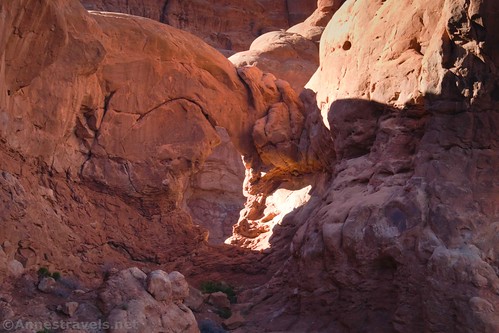
Arches National Park has over 2,000 documented arches, but most people don’t see a quarter of them. There are the famous ones along the popular park trails, but otherwise, there are many very nice arches that are rarely or never seen – or at least, if people do see them, they don’t know what they’re looking at. On a recent visit to Arches, I decided to try and see a few of the lesser-known arches – specifically, The Tunnel, Ring Arch, and Christmas Tree Arch. The first two are along Upper Courthouse Wash, but Christmas Tree Arch – the topic of today’s post – is a short distance off of the Windows Primitive Loop.
Quick Stats
I had read about Christmas Tree Arch online, and while the directions were simple, they almost seemed too simple. “Go through the gap and you’ll see it,” was the word of the day. It can’t be that easy, I thought, and I set out to find out if it was, indeed, quite that easy to get to an impressive arch that people rarely visit.
One very important note before we go on: There is no trail to Christmas Tree Arch. You’ll need to do some easy wayfinding and have a pretty good sense of direction, plus there is some light scrambling involved. It’s unlikely that you’ll get lost, but you should be fairly familiar with finding your way around slickrock fins before trying this. No trail also means that you’ll need to be super careful about staying on rock and not trampling the soil – I didn’t have much trouble staying on the slickrock/rocks, but you will need to skirt some dirt areas.
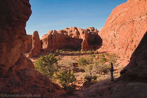
The route begins at the end of the Windows Primitive Loop (the end that doesn’t immediately take you to the Windows – go to the most obvious trailhead and work your way left until you come to the very obvious trail marked as the Primitive Loop).
Walk along the Primitive Loop for 0.2 miles (be sure to look over on your right to see Seagull Arch). Just before the trail veers to the right to climb up some boulders and pass through a gap, turn left, off-trail, staying on the rocks and slickrock and avoiding the dirt areas.
Head generally as north as you can while staying to the west of the rock wall. You’re trying to stay fairly close to the rock wall on the right and shooting for the very obvious gap in the slickrock walls. While it may look impossible from here, it’s actually not a bad scramble up into the gap – Class 2 bordering on Class 3 if you don’t find the easier way up.

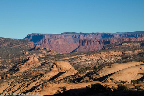
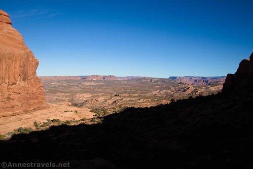
Once in the gap, enjoy the views down into this hidden valley away from the crowds of Arches. You can see to the cliffs over the Colorado River, though the views will be better in a minute.
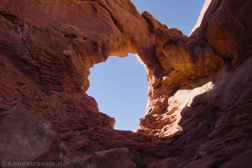
From the gap, you can also get your first glimpse of Christmas Tree Arch over on the left just before the rock wall on the left turns at a near-right angle. Unless the sun is shining through it (as it is in the afternoon), it may be difficult to spot, as there are rock fins behind it, but if you look carefully it should be visible. From here, it’s a “simple” matter of scrambling down the rocks and then up the watercourse below the arch. Staying as high as possible on the hillside is probably the easiest course of action, though I still had some light Class 3 moves. Some of my group members found other ways up that looked closer to Class 4.
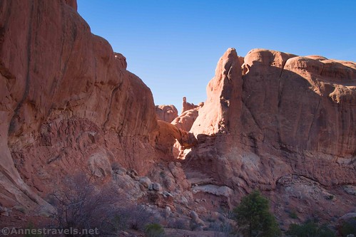
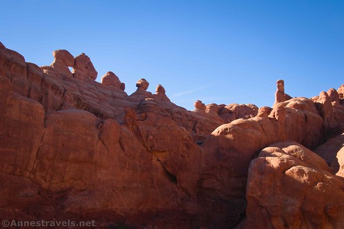
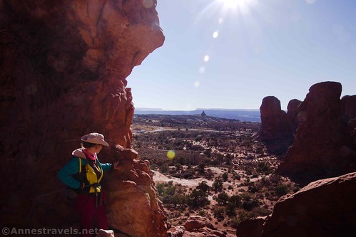
You can climb all of the way into the arch once you’re finally standing below it. I highly recommend climbing into it if you’ve come all this way, not because it looks better from the inside, but because the views from it and through it are quite good up to some rock spires and also out over the Windows parking area. The views are toward Double Arch, but you can’t see the arches due to a slickrock fin.
The views from here are probably best in the morning. I did the hike in the afternoon, and while the views toward the cliffs over the Colorado River were great, most of the other views would have been better with the sun at a different angle.
On your return to the parking area, I highly recommend finishing off the Primitive Loop – though you might see a few more people once you get around to the Windows than at Christmas Tree Arch!
Round Trip Trail Length: 1.2 miles out & back just to Christmas Tree Arch; I did 2.1 miles total by hiking to Christmas Tree Arch and the Windows
Elevation Gain: They say it’s about 838ft. (5,174ft. to 5,342ft.), but I’d guess it’s a bit less than that since we didn’t scale sheer walls like the elevation plot shows.
Facilities: Water and primitive restrooms at the trailhead
Fees: $30/vehicle, valid 7 days. America the Beautiful passes and Southeast Utah Park Passes also accepted.
Trail Notes: As I said above, there is no trail to Christmas Tree Arch and the route requires mild wayfinding and some scrambling. The Windows tend to be quite crowded so parking is often an issue – you may want to arrive early or go in the off-season. Entry tickets are now required to enter Arches National Park during the busier seasons, though exactly how they work is yet to be determined.
Trail 


Road 


Signs 


Scenery 


Would I go 100 miles out of my way for this? [rating:]
Overall Rating: 


GPS Coordinates for Christmas Tree Arch
Arches Primitive Loop TH: 38.6875000°, -109.5364667° (N38° 41.250′ W109° 32.188′ / 38°41’15.0000″, -109°32’11.2800″) (5,131ft.) (0.0) (would end at 2.21)
Leave trail: 38.6887500°, -109.5336000° (N38° 41.325′ W109° 32.016′ / 38°41’19.5000″, -109°32’00.9600″) (5,175ft.) (0.20)
Gap: 38.6911500°, -109.5359333° (N38° 41.469′ W109° 32.156′ / 38°41’28.1400″, -109°32’09.3600″) (5,206ft.) (0.48)
Christmas Tree Arch: 38.6918000°, -109.5371833° (N38° 41.508′ W109° 32.231′ / 38°41’30.4800″, -109°32’13.8600″) (5,208ft.) (0.61)
Regain Trail: 38.6887333°, -109.5336500° (N38° 41.324′ W109° 32.019′ / 38°41’19.4400″, -109°32’01.1400″) (5,130ft.) (1.01)
The gpx file for Christmas Tree Arch and the Windows Loop can be downloaded – please note that this and the GPS Coordinates are for reference only and should not be used as a sole resource when hiking this trail.
Download GPX File size: 43.7 KB Downloaded 116 times
(Note: I do my best to ensure that all downloads, the webpage, etc. are virus-free and accurate; however, I cannot be held responsible for any damage that might result, including but not limited to loss of data, damages to hardware, harm to users, from use of files, information, etc. from this website. Thanks!)
Getting to The Windows Parking Area
From the visitor center, continue into the park for 9.1 miles. Turn right, following signs for Windows. Park at the end of the road about 2 miles later. Note that the parking area can be very full; I recommend hiking here in the early morning or evening or, preferably, from November-March.

This Week’s Featured Product!
Check out this “opinionated” guide to the best hikes in Arches National Park. With 25 hikes, the book covers many great hikes, from rock art and history to arches and rock formations.

