Turn left at the stream that looks like a trail. Then, turn right at the trail that looks like a stream.
-One of my group members remembering the Clouds Rest Trail
If there was one hike in Yosemite that is absolutely the most epic, I’d say it was the Clouds Rest Trail. Or at least, the views from the top are so epic, and the first and last half miles of the trail are so memorable, that I would call it the best of the best of Yosemite. The good (or bad) news is that it is 1) along the Tioga Pass Road, and 2) 14+ miles RT, so between those two, while you probably won’t have the trail to yourself, you also won’t find it completely overrun like trails in the valley or on the Glacier Point Road – but it might also be snowy into the summer months.
Quick Stats
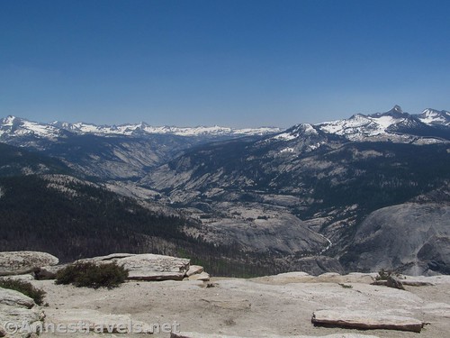
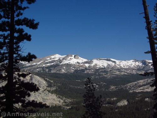
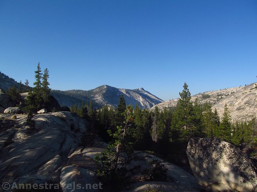
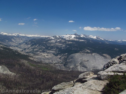
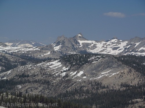
The Merced River flows between granite domes below Mount Clark (right) and the peaks of the High Sierras
We started out the trail to Clouds Rest very (very!) early one morning in early July, almost exactly one week after the Tioga Road opened for the season. We had scoped out the situation a few days earlier, so we knew what to expect – at least for the first half mile.
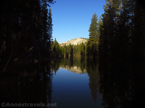
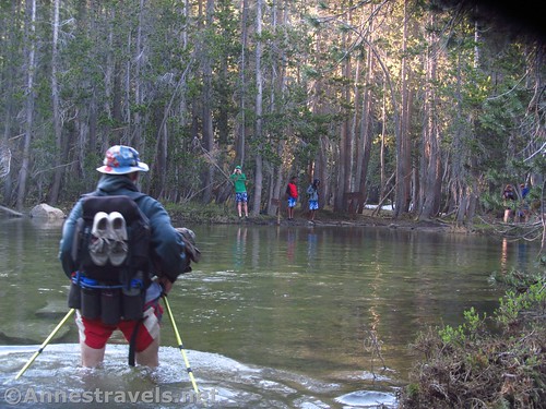
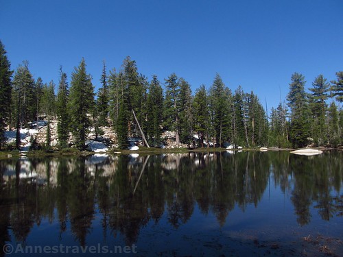
The first set of excitement comes at only 0.1 miles from the Sunrise Lakes Trailhead. The first 0.1 miles are a boardwalk or well-maintained gravely path. Very nice. Very wide. No excitement. Then the trail crosses the Teyena Lake Outlet. It’s quite safe; the water is so slow-moving that it might as well be part of the lake. By the end of the summer, the strategically-placed stepping stones (huge, flat rocks on the bottom of the riverbed) are visible, and you can rock-hop across with dry (or nearly dry) feet. Early in the season, though, it’s a 30-ft. expanse of waist-deep, cold water – and that’s on top of the stepping stones.
At 5:30am, cold is even colder, I’m convinced.
We had dressed in bathing suits and water shoes (from hiking the Zion Narrows earlier on the trip) and carried our packs (and hiking shoes) high enough so they wouldn’t get wet. It was an undertaking, but not too bad, except that it was cold. On the far side, turn right following the sign for Clouds Rest.
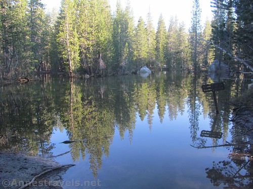
Looking back from the far side of the crossing. You’ve come from the break in the trees on the lefts side of the photo
We strapped on our packs and hiked in our wet bathing suits and shoes 1 mile between a tumble of rock and forest to the next stream crossing. The trail is fairly flat and easy enough to follow. This stream crossing was nothing like the first; just a quick-moving mountain stream, easily crossed in a pool that spans the trail. But if we thought the Teyena Lake Outlet was cold, this must have been half a degree above freezing!
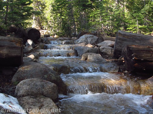
We changed back into shoes and clothes and continued along the trail, which rolls slightly 0.6 miles to another stream crossing (very shallow; we crossed on logs) with a lot of pretty waterfalls on the left. At least, there we waterfalls early in the season.
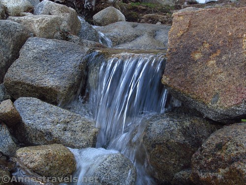
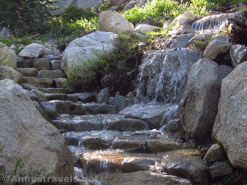
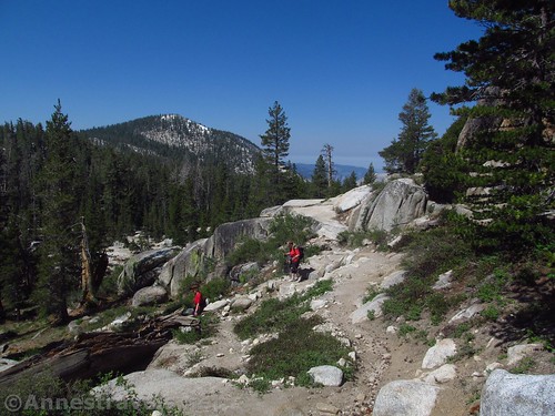
Not long after this, the trail begins to ascend steeply with occasional views into the valley. The trail is good; just keep an eye out for it. Early in the season, this part of the trail is a set of perpetual waterfalls. The trail was a stream, in places, and where it wasn’t a stream, the stream crossed the trail to drop to the trail below. My group started joking that if they saw a stream, they knew where the trail went.
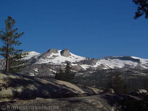
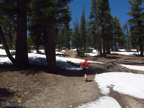
As the trail climbed higher into the forest, there began to be some significant snowcover. Finally we lost the trail altogether and simply headed upward. If you find yourself in this situation, just go up – you’re heading for a kind of pass just to the left of the end of the ridgeline.
We finally summited the saddle at the top of the hill at mile 3.1. Later in the day, some of my group unearthed (or really, unsnowed) the trail sign under a five foot pile of snow. But for now, the saddle top and the trail on the other side of the hill were snow-free, hurray!
The trail goes straight over the pass and down the other side, quite dusty. But we were just happy to have a snow-free trail without a stream running down the middle of it. Of course, it didn’t last long. Besides the streams and snow, there was a marshy area; early in the season, we just jumped hummock to hummock and mostly kept our feet dry. The trail rolls over several hills, but generally goes upward after dropping into the valley.
Then my hiking boots started to come apart. I’d had a little trouble with it the trip before, and had upgraded to another pair of boots. But I had glued these and they seemed to be fine, and they were more suited to wet trails than my new boots, so I had worn the old ones on this particular hike. Great. I’ve got another 3 miles up and 7 miles down, and I hope my boots last that long!
At 5.6 miles, come to another trail junction in a dusty section of the forest. Turn right toward Clouds Rest.
Here we met our last snowfield. Still, it wasn’t hard to figure out where the trail went – we just had to keep going upward along the narrowing fin of the ridgeline through the trees.
Break out of the trees about mile 7; shortly afterward, encounter the last trail junction. Keep going upward, up the rocks.
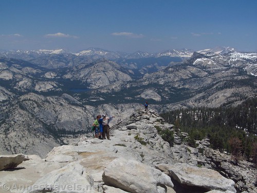
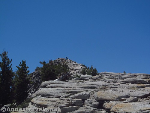
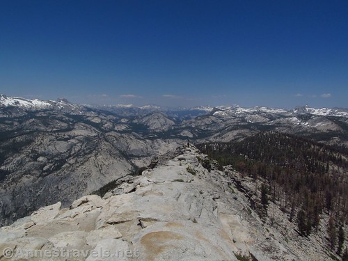
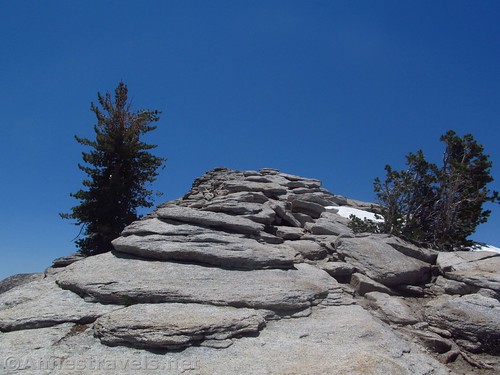
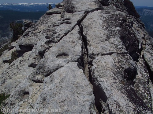
Now comes the last quarter mile, which is by far the most exciting part of the hike, and it’s a good thing the views are so incredible, because you might not go for it if you didn’t have the draw of the views to keep going upward. The trail – well, there isn’t a trail anymore, but there are cairns, and you’d know which way to go, anyway – travels up a narrow granite fin, about 10ft. wide, narrower or wider in places. It’s not for those with vertigo, but it’s also not quite as bad as the Causeway in Colorado (per me – though the drop is much, much further) because it’s wider.
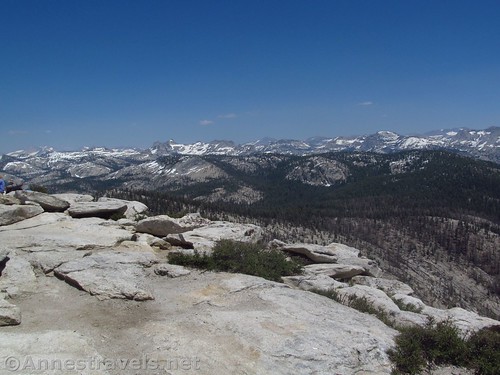
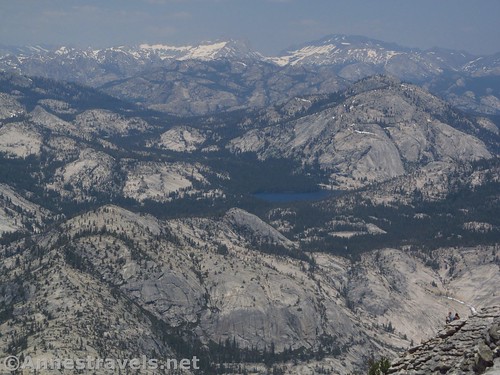
About halfway up, I met one of my usually reserved and quiet group members leaping back down to help the more vertigo-prone members of my group up. About as soon as he was within earshot, he was exclaiming and glowing and enthusing over the views and how incredible they were, and how worth the hike this was. And deservedly so. Behind me, the granite domes and basins of eastern Yosemite stretched away in jaw-dropping beauty, all greys and greens and whites with blue lakes and the blue sky and puffy clouds over it all. The view just got better and better the higher I climbed.
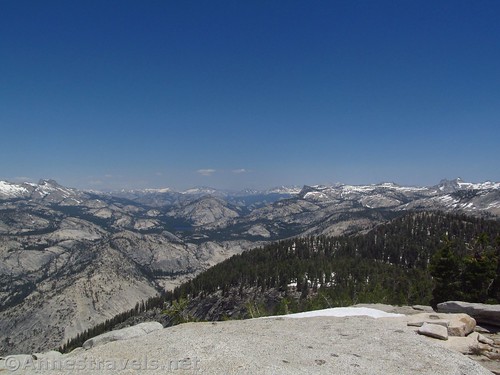
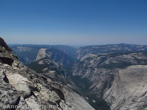
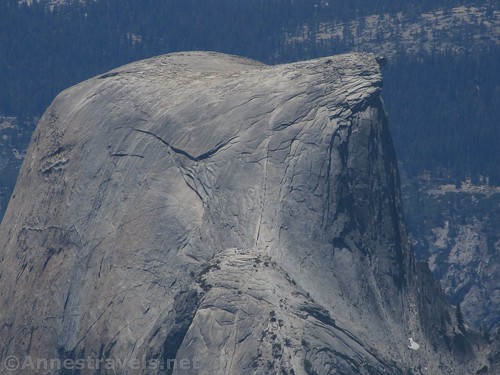
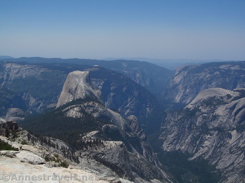
Finally, 7.3 miles from the trailhead, we reached the top of Clouds Rest. And the views. Oh, the views! I have so much trouble believing that the views from other domes in Yosemite, even Half Dome, could be better than this (and you don’t need a special permit to day hike Clouds Rest). Besides the domes and lakes, now there were also views to the High Sierras to the north and south, and to the southeast, the Merced River (?) flowed down a granite valley, so incredibly formed. Over to the west was Yosemite Valley and Half Dome. It’s not particularly shapely from this viewpoint – you’d be better off with North Dome for shapely views of Half Dome – but you can see the cables and all the people trying to get to the top.
We sat at the top for a bit and simply gawked, like tourists. But that was what the park ranger on her day off was doing, so I don’t feel bad about it. When we tired of one view, we just moved to another spot to get a different view. It was so spectacular, jaw-dropping, vertigo-inducing, amazing, incredible, awe-inspiring… you get the idea.
I took off my hiking boots and let them dry out a bit, walking about the granite dome in my hiking socks. The fewer miles in the boots, the better, until we got back to the van!
Far too soon, we knew we had to go back down into the snow and forest and waterfalls. It’s a long hike, and we wanted to get back before dark (we only barely made it on that count). And one of my group members wanted to go swimming in the Teneya Lake Outlet on the way back.
Overall? If you can make the hike –and it’s not an easy one – it’s worth every step and you will, at least in my opinion, see one of the best views Yosemite has to offer. And considering some of Yosemite’s views, that’s saying a lot.
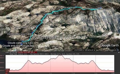
Round Trip Trail Length: 14.6 miles (out & back)
Net Elevation Change: 1,721ft. but it feels like a lot more because there are many ups and downs (8,182ft. at the first stream crossing to 9,903ft. on Clouds Rest) – my GPS said the total elevation gain was in the neighborhood of 3,355ft.
Facilities: Primitive restroom at the trailhead along with bear boxes (required to be used if you’re overnighting it)
Fees: $30/vehicle, valid 7 days. Federal Lands & Recreation Passes and Yosemite Annual Pass also accepted.
Trail Notes: Start early in the day so you can get a parking spot. This is not an easy hike; make sure you’re in top-notch shape and also acclimated to the elevation before hiking. Use extreme care on the snow, and be wary of the parts where the trail is a stream – we lost our way more than once and then had to get back on the trail, one way or another. Also, the last quarter mile is quite dangerous, so use caution. Do not climb if lightening is in the forecast or if it will be cloudy – this is called Clouds Rest for a reason!
Trail 


Road 


Signs 


Scenery 


Would I go 100 miles out of my way for this? 


Overall Rating: 


GPS Coordinates for Clouds Rest
Trailhead: 37.8258139°N, -119.4700222°W (37°49’32.93″N, -119°28’12.08″W / 37°49.54883’N, -119°28.20133’W) (8,197ft.) (0.0; ended 14.6)
Teyena Lake Outlet: 37.8256083°N, -119.4685111°W (37°49’32.19″N, -119°28’6.64″W / 37°49.53650’N, -119°28.11067’W) (8,193ft.) (0.12)
Trail Junction #1: 37.8243944°N, -119.4679667°W (37°49’27.82″N, -119°28’4.68″W / 37°49.46367’N, -119°28.07800’W) (8,186ft.) (0.3)
Stream Crossing #1: 37.8164500°N, -119.4660361°W (37°48’59.22″N, -119°27’57.73″W / 37°48.98700’N, -119°27.96217’W) (8,182ft.) (1.08)
Stream Crossing #2 (waterfalls): 37.8106722°N, -119.4625611°W (37°48’38.42″N, 119°27’45.22″W / 37°48.64033’N, -119°27.75367’W) (8,227ft.) (1.6)
Trail Junction #2: 37.8006861°N, -119.4584667°W (37°48’2.47″N, -119°27’30.48″W / 37°48.04117’N, -119°27.50800’W) (9,201ft.) (3.1)
Trail Junction #3 (Nevada Falls): 37.7772361°N, -119.4692278°W (37°46’38.05″N, -119°28’9.22″W / 37°46.63417’N, -119°28.15367’W) (9,160ft.) (5.6)
Trail Junction #4 (Forsyth): 37.7697389°N, -119.4879889°W (37°46’11.06″N, -119°29’16.76″W / 37°46.18433’N, -119°29.27933’W) (9,759ft.) (7.1)
Clouds Rest: 37.7678583°N, -119.4892389°W (37°46’4.29″N, -119°29’21.26″W / 37°46.07150’N, -119°29.35433’W) (9,903ft.) (7.3)
The gpx file for Clouds Rest can be downloaded – please note that this and the GPS Coordinates are for reference only and should not be used as a sole resource when hiking this trail. Also note that because of snow and water, I didn’t always stick to the trail, and even lost the trail at various points. When in doubt, follow the trail, not the GPX.
Download GPX File size: 332.3 KB Downloaded 309 times
(Note: I do my best to ensure that all downloads, the webpage, etc. are virus-free and accurate; however, I cannot be held responsible for any damage that might result, including but not limited to loss of data, damages to hardware, harm to users, from use of files, information, etc. from this website. Thanks!)
Getting to Clouds Rest
From Lee Vining and US-395, turn onto the Tioga Pass Road (CA-120W). After 26.8 miles, turn left into the trailhead, signed for “Sunrise” (aka, the Sunrise Lakes Trailhead).
From Crane Flat (head out of the valley toward the Tioga Road; Crane Flat is where CA-120 toward San Francisco turns left), take the Tioga Road 30.8 miles toward Lee Vining. Turn right into the parking area, signed for “Sunrise” (aka, the Sunrise Lakes Trailhead).
Zoom map out to browse nearby hikes & places of interest
This Week’s Featured Product!
My favorite book for planning hikes in Yosemite, there are so many trail options in this guide! From short strolls to multi-week backpacking routes, there is something for everyone in this book.
[forecast location=”Lee Vining, CA” caption=”Weather for Clouds Rest” measurement=’F’ todaylabel=”Today” datelabel=”date(‘D M d’)” highlow=’%%high%%°/%%low%%°’ numdays=”5″ iconset=”Default”]

