One of the more view-saturated hikes we took in the Cabinet Mountain Wilderness actually has almost no trail. There is a trail – at least as far as Cliff Lake – but if you want to see everything in the area (namely, Chicago Peak, Copper Lake, Milwaukee Pass, Cliff Lake, and St. Paul Peak) you’ll have to hone your off-trail scrambling skills before you come. You’ll also want to hone your 4×4 driving skills because, while there is a road to the trailhead, we couldn’t make it up the road in our high clearance van. But if you can do all that, you’re in for a real treat in the way of views, wildlife, wildflowers, and a true wilderness experience.
Quick Stats

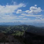
Views from a clear area around the upper part of the road. The views are better in the afternoon, but these are still pretty good!
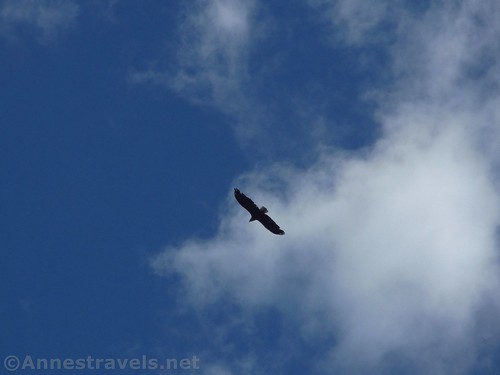
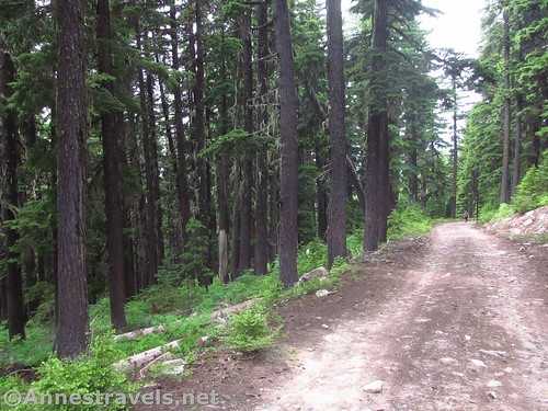
We parked about 2.4 miles down the road from the trailhead, at the entrance to an old unused road and just before a nasty section of uphill. A jeep would be fine on it, and probably a pickup would be as well (I saw SUVs up there). But our van wasn’t up to it. So we walked up the road. I wish I’d taken more pictures while the sun was out – specifically, in the afternoon. But I did get a photo of a bald eagle that was soaring overhead.
The actual trailhead has a sign (yes!) and a signboard (wow!) and room for half a dozen or so vehicles to park. You’re also supposed to register. We did so and headed up the path. The trail immediately begins trekking uphill through the pines.
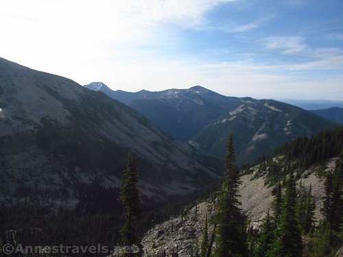
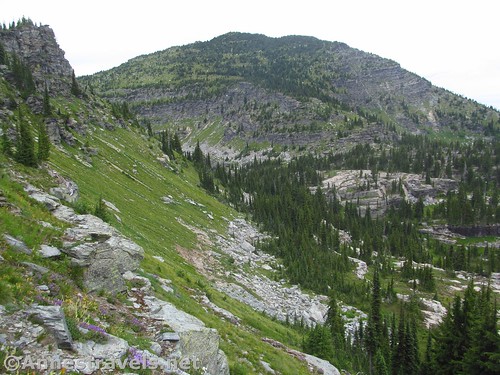
The trail enters the Cabinet Mountain Wilderness just before 0.25 miles and there is a viewpoint on the right just after 0.25 miles. This is one great view; I made the mistake of thinking, “Oh, the light will be better in the afternoon; I won’t take many pictures until our way back!” It was raining on the way back, so the photos would have been much worse if I had taken any. Sigh. I did get a few, but they’re not very good. But you can see what an incredible view it would be if the light was right and the sun was out.

Views toward Rock Peak from the viewpoint. On a clear day in the afternoon, this would be pretty spectacular.
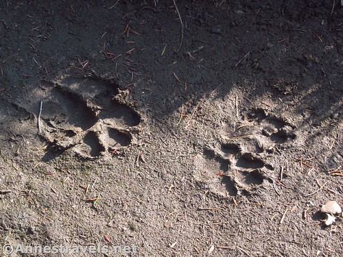
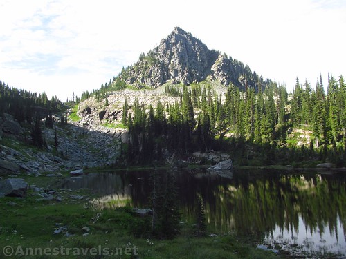
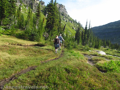
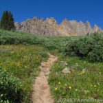
The trail continues on from the viewpoint, fairly flat, along the base of Chicago Peak. The views in this section are quite good of the craggy peak and the meadow below its slopes. We also saw some prints in the muddy trail; I’d guess they belonged to a dog, but we can pretend it was wolf, right?
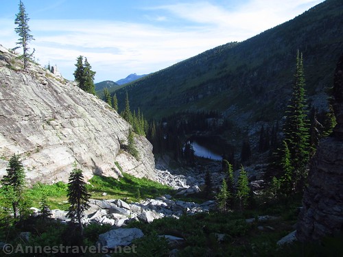
About 0.7 miles from the trailhead, just below Milwaukee Pass, the trail suddenly turns to the right into the pass. Before the pass, and several group members and I turned left to descend the rocky drainage (it’s a real rock scramble!) down to Copper Lake, about 0.25 miles below the trail.
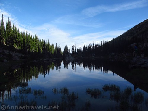
You won’t read about Copper Lake in most hiking guides; and really, it’s not the nicest lake in the Cabinets. But early on a summer morning, with the trees reflected in the still water, it was picturesque, if infested with mosquitos. (My group said it should have been called Mosquito Lake!)
We walked around the lake (in part because you didn’t want to stop to look at the view because of the mosquitos). It’s easy enough to get half to ¾ of the way around, but the west side of the lake is a bit more rugged. With a bit of scrambling, we made it, and we even saw some elk prints in the soft mud.
We scrambled back up to Milwaukee Pass (RT distance of side trip: about 0.9 miles), and from there we all crossed the pass to Cliff Lake. However, I’m going to talk about Cliff Lake and climbing St. Paul Peak in a different post (just so this one doesn’t get to be an epic instead of a blog post), so I’ll skip to the point where several of us decided to climb Chicago Peak on our way back. By then, the sun had disappeared completely and a storm was threatening. But we headed up anyway while the slower members of our group continued down the trail and back toward the van.
We walked to the place where we had descended to Copper Lake, then continued 0.05-0.1 miles along the trail to a place that looked promising for scrambling up the steep grassy slopes. The slopes are deceiving; they’re anything but easy to climb and they’re insanely steep. The ground under the grass is mostly loose gravel, so you have the fun of unstable footing on top of the steepness. It’s totally doable if you’re in good shape, but it’s no stroll in the park. The scramble borders on Class 3 at times.
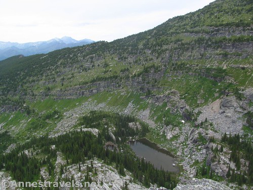
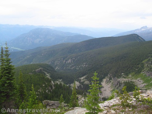
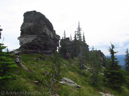
We headed for a break in the cliffs at the far right end of the peak and finally scrambled up through the break in the rocks, then around the back of the rocks so we could scramble up them to look down over the surrounding area. This route to the top of Chicago Peak was about 0.25 miles.
It really is a great view, and it would have been even better on a clear day. But even with the clouds, the views ranged a good distance across the forested hills, down on Milwaukee Pass, and across a number of lakes.
We figured that the way up wasn’t going to be fun to descend, so we would follow the deer or social trail along the back (west) side of Chicago Peak. After scrambling for some distance, passing what was probably a bear den (I was very nervous around that den!), and ending in a slide where we couldn’t go any further, we turned around and walked back to a break in the cliff where we could come back out on the east side and descend. It wasn’t much less steep, so we probably would have been better off just going back down the way we had come up.
We finally regained the trail about 0.75 miles after leaving it. From there, it was an easy hike back to the trailhead and then back down the road to our van.
And be on the lookout for the (easier, in many ways) hike to Cliff Lake and St. Paul Peak next week!
Round Trip Trail Length: Chicago Peak and Copper Lake had us at about 3.8 miles out & back from the trailhead. To also hike to Cliff Lake adds 0.6 miles; total distance for both lakes and both peaks is 5.5 miles.
Elevation Gain: 1,200ft. (6,346ft. to 6,900ft.)
Facilities: None
Fees: None
Trail Notes: Be prepared for off-trail travel, way-finding, and self-rescue if necessary. We saw 0 people on the trail all day long (though there were boot tracks in the soft mud, so someone had been on the trail recently). There were a few SUVs and trucks on the upper reaches of the road, but not many. Be prepared for a fully wilderness experience and to meet all kinds of wilderness animals – from bears and wolverines to mountain goats and mosquitos.
Trail 


Road 


Signs 


Scenery 


Would I go 100 miles out of my way for this? 


Overall Rating: 


GPS Coordinates
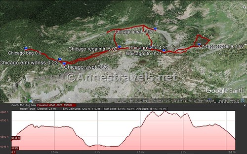
Where I parked: 48.0619500°, -115.7016500° (N48° 03.717′ W115° 42.099′ / 48°03’43.0200″, -115°42’05.9400″) (5,466ft.)
Trailhead: 48.0666500°, -115.6921667° (N48° 03.999′ W115° 41.530′ / 48°03’59.9400″, -115°41’31.8000″) (6,445ft.) (0.0) (end 5.51)
Enter Wilderness: 48.0680167°, -115.6878833° (N48° 04.081′ W115° 41.273′ / 48°04’04.8600″, -115°41’16.3800″) (6,673ft.) (0.23)
Viewpoint: 48.0681333°, -115.6874167° (N48° 04.088′ W115° 41.245′ / 48°04’05.2800″, -115°41’14.7000″) (6,680ft.) (0.26)
Trail Junction: 48.0733500°, -115.6848667° (N48° 04.401′ W115° 41.092′ / 48°04’24.0600″, -115°41’05.5200″) (6,618ft.) (0.71) (returned 1.58 & 4.15)
Copper Lake: 48.0763500°, -115.6849000° (N48° 04.581′ W115° 41.094′ / 48°04’34.8600″, -115°41’05.6400″) (6,352ft.) (1.00)
Leave the Trail for Chicago Peak: 48.0727833°, -115.6857167° (N48° 04.367′ W115° 41.143′ / 48°04.36700′, -115°41.14300′) (6,652ft.) (4.21)
Chicago Peak: 48.0737667°, -115.6870167° (N48° 04.426′ W115° 41.221′ / 48°04’25.5600″, -115°41’13.2600″) (6,988ft.) (4.52)
Regain Trail: 48.0713167°, -115.6871000° (N48° 04.279′ W115° 41.226′ / 48°04’16.7400″, -115°41’13.5600″) (6,646ft.) (5.02)
The gpx file for my hike to Copper Lake, Cliff Lake, St. Paul Peak, and Chicago Peak can be downloaded – please note that this and the GPS Coordinates are for reference only and should not be used as a sole resource when hiking this trail.
Download GPX File size: 149.6 KB Downloaded 156 times
The gpx file for Copper Lake and Chicago Peak only can also be downloaded
Download GPX File size: 111.6 KB Downloaded 115 times
(Note: I do my best to ensure that all downloads, the webpage, etc. are virus-free and accurate; however, I cannot be held responsible for any damage that might result, including but not limited to loss of data, damages to hardware, harm to users, from use of files, information, etc. from this website. Thanks!)
Getting to the Copper Lake/Chicago Peak Trailhead
From Libby, Montana, drive west on US-2 for about 15 miles. Turn left onto MT-56S for 34.6 miles, then turn left on MT-200E for 6.7 miles. Next to the wood factory, turn left on Government Mountain Road (dirt) and take the first right onto NF-150. Drive about 5.3 miles and turn left to stay on NF-150. After 2.5 miles, turn right on the road that (sort of) follows West Fork Rock Creek (at least for the first switchback). The road becomes increasingly narrow and bumpy, always climbing steeply uphill via many switchbacks. Our high clearance van made it up 4.3 miles (about 10 switchbacks); the section of road just beyond this point is very rocky and requires 4×4 and high clearance. Continue upward another 2.4 miles (and another 6 switchbacks) – a few open areas offer excellent views across the Cabinet Mountains. There is one downhill just before the trailhead at the end of the road. (Some maps may show the road continuing, but it doesn’t go past the parking area.)
From Sandpoint, Idaho, take US-2 to the point where US-2 joins US-95. Instead of turning onto US-95, continue straight on ID-200 for 33.2 miles. Enter Montana (the road becomes MT-200) and continue another 17.1 miles. At the wood factory, turn left on Government Mountain Road and follow the directions (above) to the trailhead.
From Kalispell, Montana, take US-93 South for 35 miles. Turn right onto MT-28W for 46.6 miles, then turn right onto MT-200W. After 59.4 miles, turn right next to the wood factory onto Government Mountain Road and follow the directions (above) to the trailhead.
Zoom map out to browse nearby hikes & places of interest
This Week’s Featured Product!
This book is considered the cream of the crop for books about hiking in the Cabinet Mountain Wilderness – in fact, it’s one of the only books about the region. The guide includes more than 100 trails in the wilderness area, including some specifically for mountain bikes.









Pingback: Sneak Peak: The Beauty of Western Montana! - Anne's Travels
Pingback: Cliff Lake and Climbing St. Paul Peak - Anne's Travels