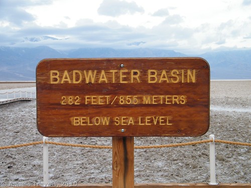
Badwater Basin is the lowest elevation in the USA at 282ft. (86m.) below sea level. Located in Death Valley National Park, CA, it is easily accessible from the park road. However, there’s more to Badwater than getting out of your RV and taking a few pictures in front of the ‘Lowest Place in the Western Hemisphere’ sign. You can actually walk all the way across Death Valley, and the views are worth it, not to mention that you can tell all of your friends how adventurous you are. For GPS coordinates, a map, and more, visit my updated report about crossing Death Valley.
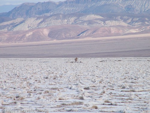
The Badwater parking lot is located about 17 miles (26km.) south of the Furnace Creek Visitor Center along Badwater Road There is a boardwalk that goes a small distance out onto the salt flats, and when you reach the end, you can either choose to turn around or take the ramp down onto the salt flats themselves. A trampled path stretches out across the flat at the bottom of the ramp for a good ways, and introduces those who don’t mind getting salt on their shoes to the wonders of Badwater. You can also walk out across the salt flats as far as you want as long as they aren’t wet. Behind you on the cliff wall across the road you can see a sign 282ft. (86m.) up showing you where sea level is—it’s interesting to think that if the mountains weren’t in the way you’d be underwater.
We have hiked across the flats twice (one way, it’s about 5 miles across), once from the West Side Road to Badwater and once from Badwater to the West Side Road. The West Side Road is a good dirt road as dirt roads go; however high clearance is recommended. Although you can walk across and then go back, we had part of our group drop us off on one side of the salt flats and then pick us up on the other side.
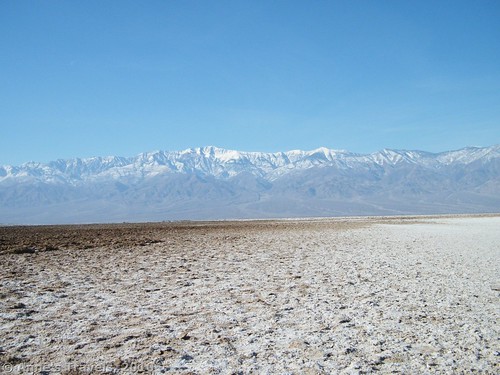
You can start at either side of the flats, and both sides have their advantages. Starting at the West Side Road makes it easier to find your way to your vehicle at the Badwater parking lot because you can see the parking lot for a long time before you get there; however, going this way you have your back to the best scenery. Going the other direction you can see Telescope Peak and the other mountains (including Rogers Peak and Bennett Peak) the whole way. Of course, you will have a harder time finding the rest of your group on the West Side Road since there are no real good landmarks to go by, but we didn’t have too much trouble because we brought walkie-talkies, but could see the sun glinting off our vehicle before we were in range. Even so, particularly if you are going west toward the mountains, using a compass and making a plan where and how you are going to meet the rest of your group would be a good idea. Planning your route on a map would also make going from Badwater to the West Side Road easier. If you do not have someone who can pick you up on the other side or you want a longer hike, you can always hike to the other side and then turn around and come back.
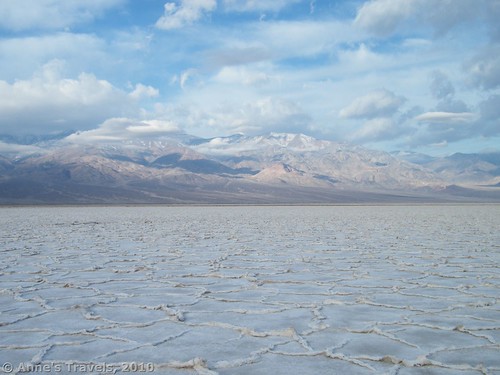
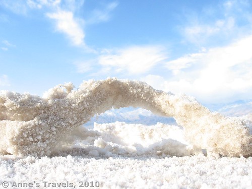
Since there is no real trail, walking on the flats can get rough in some sections. The salt creations are unique and beautiful, though, and well worth walking out on the flats to see. They are also very different in different parts of the flats, so if you enjoy salt creations you may want to hike around to different areas of the flats just to see these.
We’ve chosen to do this hike in the morning before it gets too hot. There is no shade out on the flats and the sun bouncing off all that white salt can be very bright (bring sunglasses and you’ll be smarter than us!). As always, whenever you are hiking in the desert, bring plenty of water, food, and use sun screen.
Round Trip Trail Length: 10 miles without a shuttle vehicle, 5 miles with a vehicle on each side of the valley
Facilities: None on the west side; primitive restrooms and a boardwalk on the east side
Fees: $20 to enter Death Valley National Park, valid 7 days. Interagency, Golden Age (Senior), Golden Access (Access), and Death Valley Annual Passes are also accepted
Trail 


Road 


Signs 


Scenery 


Overall Rating: 


This Week’s Featured Product!
Enjoy nearly 60 trails and routes in Death Valley with this guide!



Good day! This post could not be written any better! Reading this post reminds me of my previous room mate! He always kept talking about this. I will forward this write-up to him. Fairly certain he will have a good read. Thank you for sharing!
Thanks Anne for sharing your Badwater Basin hiking experience.
I want to hike across it this October to West Side Road, but my wife Karen and I are trying to figure out where on the West Side Road I might come out at. Or, maybe I should hike to east to the boardwalk are to avoid any confusion?
Sincerely,
Art Huseonica,
Crofton, Maryland
443-254-5730
Art,
Walking across the flats from the boardwalk is certainly the prettier way to walk; I’ve always wished I’d done it that way. However, as you said, it’s a lot easier to meet up if you walk from the West Side Road to the boardwalk. There’s no easy place you can walk toward and be sure of meeting up with your ride, although with a GPS you could probably head for Tule Spring (visible on Google Maps but just a circle and a squiggle on the park map). Approximate coordinates are 36.243462N / -116.881616W. You could also have walkie-talkies or cell phones.
Hope that helps.
Anne
Yes, Anne that is very helpful. I’m ordering walkie-talkies as a back-up. Cheers, Art H
Great! Have fun – it’s one of my favorite hikes in the park!
Anne
Pingback: 8 Epic Hikes in the Western US, Pt. 1 - Anne's Travels