The Southern Oregon Coastline isn’t all rocks and sea stacks. In fact, Floras Lake Beach is very much as sandy as the east coast. It’s also nearly empty of people, unlike the more northerly sand beaches. Still, it offers sights not usually seen in the eastern US – sheer, almost chalk-like cliffs, headlands, and an incredible sea arch (natural bridge, really) that make a beach well worth visiting!
Quick Stats
Actually, Floras Lake Beach is quite well-known, locally – a great number of people come there to wind surf on Floras Lake. And an over-grown stretch of the Coastal Trail traverses the nearby dunes. But few come down to the beach, itself, especially as far as the headlands that separate Floras Lake Beach from Blackrock Point, which are impossible to walk around except at low tide (and even then you may get your feet wet).
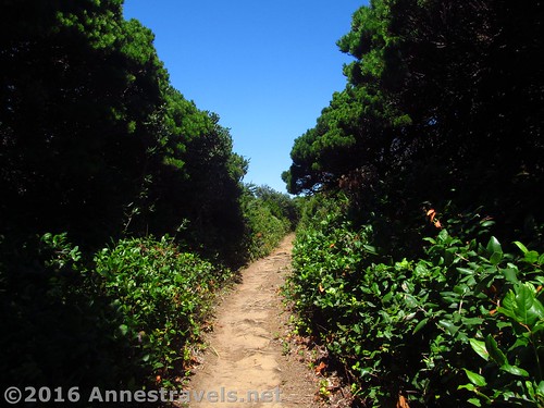
The trail begins from an unassuming parking area in Boice-Cope Park by crossing the bridge over the Floras Lake outlet. It then wanders through a low scrub forest and onto the grassy dunes for a tenth of a mile. Turn right at the sign indicating the way to the beach. From here, the trail crosses the dunes and drops to the very sandy beach at mile 0.3.
When we visited in late July, the beach to the right (north) was closed because of nesting birds. No fear – we wanted to go left, anyway.
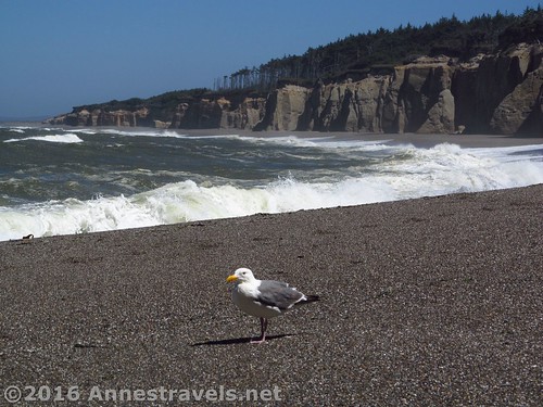
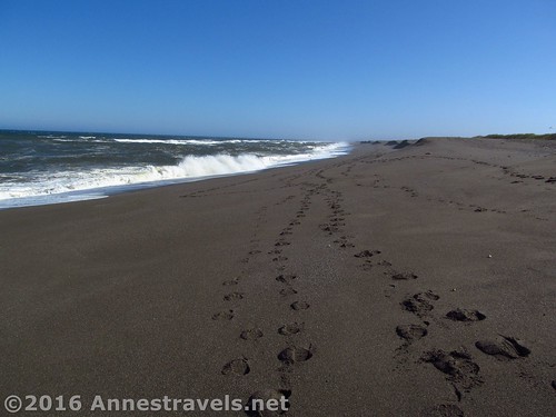
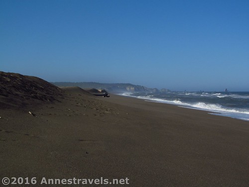
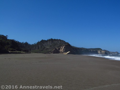
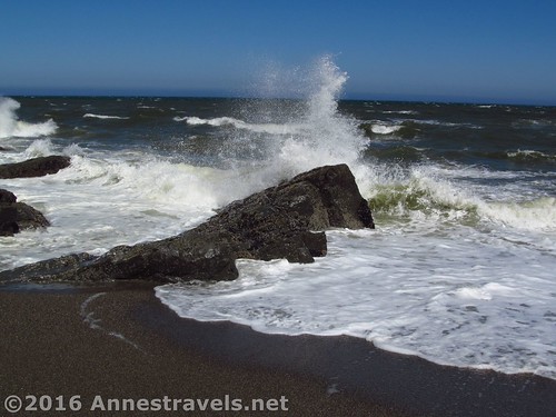
So we dropped down near the ocean (the sand is easier to walk in down there!) and began our trek to the south, with low, grassy sandhills on our left and the cold, green ocean on our right. The wind was intense – we were very thankful for our double-jackets – but the waves weren’t too bad and we were in no danger of the rising tide (not always the case during stormy weather and higher tides!)
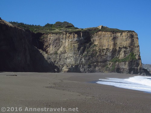
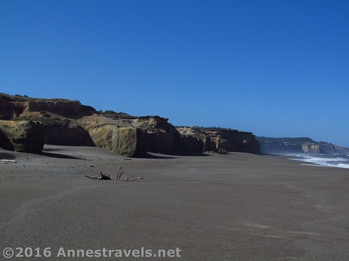
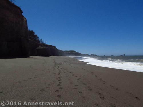
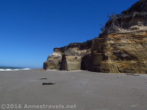
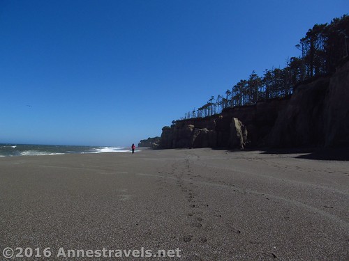
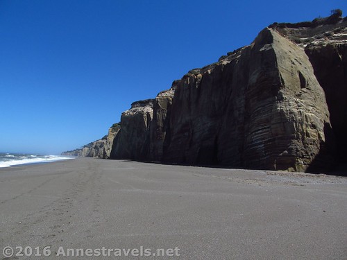
After a bit, the sandhills began to rise, eventually becoming imposing sandstone cliffs. This is what really sets Floras Lake Beach apart from other Oregon beaches – these sheer, 80 to 100 foot cliffs that remind me of the chalk cliffs of the English coast. Atop the cliffs, pines and coastal scrubbery are a nice touch.
At 2 miles from the parking area, we came to a place where the cliffs gave way to a narrow valley heading inland. We had seen on a sign that there should be a trail in this general area up the headland, then to the trail that would take us to Blackrock Point and its black beach with sea stacks.
We ended up scrambling around for more than 30 minutes, but we never found the trail, and what we did find was that it’s nearly impossible to get through the scrubby bushes – they look to be no more than knee-height, but they’re really chest-high in places. Not fun to try and push through. So we ended up just continuing down the beach. (Looking at a map more recently, we were totally the wrong place – the trail / road comes in much further south.)
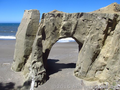
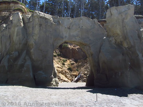
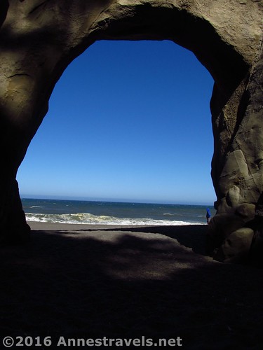
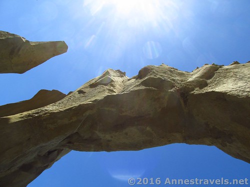
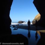
It ended up being a great thing to do. The cliffs become higher after this and more striking. At 2.3 miles, we spotted a most magnificent sea arch on our left. It’s hard to get a good picture of, and it’s easy to miss because it doesn’t stand too far away from the cliffs, but it’s really impressive.
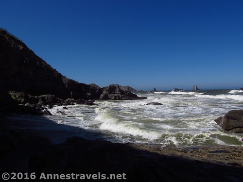
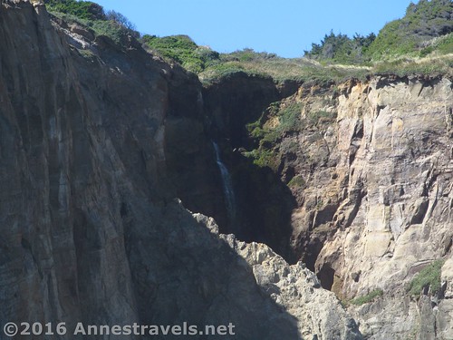
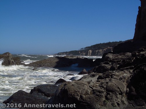
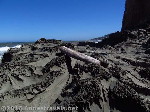
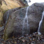
At 3.0 miles, a headland stands across the beach, barring further exploration south (unless it’s close enough to low tide that you can scramble over the rocks and around the point – even so, you might get your feet wet. A couple of us tried and found some interesting rocks (as well as a lot of sea junk, like ropes and things). A waterfall cascades down the cliff face just to the left of the headland, which is a nice touch.
The end of Floras Lake Beach (the waterfall is in shadow, but you can still see it about a quarter of the way from the left side)
We ate lunch in the shade of the headland, then headed back. We decided to strike inland sooner, and take the Coastal Trail back to the parking area. So once the cliffs leveled off, we headed up through the sandhills, following a trail. From there, we followed trails as best we could to get to what looked like a main trail – I’d guess it was the Coastal Trail, but even so, it was pretty grown in – turned left, and headed back toward the trail to the parking area.
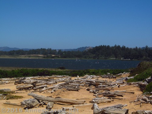
Going this way, we ended up walking around Floras Lake, which really is pretty (stay left on the trail that goes along the west (ocean) side of the lake). We also had a marvelous time watching the many wind surfers perfecting their craft on the lake (the wind was crazy strong!)
Overall, Floras Beach isn’t a difficult hike, but it is scenic – especially if you’ve always wanted to visit English cliffs 🙂
Round Trip Trail Length: About 6 miles
Net Elevation Change: 31ft. (-2ft. to 29ft.)
Facilities: A couple picnic tables, a boat ramp, and portable primitive restroom at the trailhead
Fees: None
Trail Notes: Do not attempt this hike during storms, or at high tide! There are virtually no escape routes when the tide comes up!
Trail 


Road 


Signs 


Scenery 


Would I go 100 miles out of my way for this? 


Overall Rating: 


Key GPS Coordinates for Floras Lake Beach
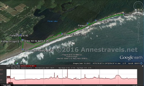
Floras Beach Parking (Boise-Cope State Park): 42.90276N / -124.50201W (42° 54′ 9.936″ / -124° 30′ 7.2354″)
Trail Beginning: 42.90309N / -124.50199W (42° 54′ 11.1234″ / -124° 30′ 7.164″) (17ft.) (ended 6.40)
Trail Split #1: 42.90354N / -124.50428W (42° 54′ 12.7434″ / -124° 30′ 15.4074″) (3ft.) (0.1; returned to split 6.26)
Trail Meets Beach: 42.90536N / -124.50735W (42° 54′ 19.296″ / -124° 30′ 26.46″) (21ft.) (0.34)
Trail up (where we spent 30 minutes walking around in circles): 42.88931N / -124.51807W (42° 53′ 21.516″ / -124° 31′ 5.0514″) (13ft.) (2.01)
Sea Arch: 42.88706N / -124.51985W (42° 53′ 13.4154″ / -124° 31′ 11.46″) (10ft.) (2.3)
Waterfall: 42.87960N / -124.52711W (42° 52′ 46.56″ / -124° 31′ 37.5954″) (-2ft.) (arrived 3.0; left 3.8)
Trail back: 42.89638N / -124.51343W (42° 53′ 46.968″ / -124° 30′ 48.3474″) (29ft.) (3.89)
The gpx file for Floras Lake Beach can be downloaded – please note that this and the GPS Coordinates are for reference only and should not be used as a sole resource when hiking this trail.
Download GPX File size: 145.3 KB Downloaded 193 times
(Note: I do my best to ensure that all downloads, the webpage, etc. are virus-free and accurate; however, I cannot be held responsible for any damage that might result, including but not limited to loss of data, damages to hardware, harm to users, from use of files, information, etc. from this website. Thanks!)
Getting to Floras Lake Beach
From the South in Gold Beach, OR, head north on US-101N 39.0 miles. Turn left onto Floras Lake Loop (OR-130) for 0.9 miles, then turn left onto Floras Lake Road (OR-136) for 1.4 miles. Continue left to stay on Floras Lake Road 450ft., then take a quick right onto Boice Cope Lane for 0.3 miles. Continue straight to descend to the parking area near the bridge and boat ramp.
From the North in Coos Bay, OR, drive south on US-101S 37.8 miles. Turn right onto Floras Lake Loop for 1.1 miles, then turn right onto Floras Lake Road. After 1.4 miles, continue left to stay on Floras Lake Road 450ft., then take a quick right onto Boice Cope Lane for 0.3 miles. Continue straight to descend to the parking area near the bridge and boat ramp.
Zoom map out to browse nearby hikes & places of interest
This Week’s Featured Product!
Looking for more hikes on the Oregon Coast? Check out this book, with detailed maps, GPS coordinates, and options for thru-hiking or section hiking, as well as shorter trails.



Pingback: Sneak Peak: A Land of Volcanos and Oceans - Anne's Travels