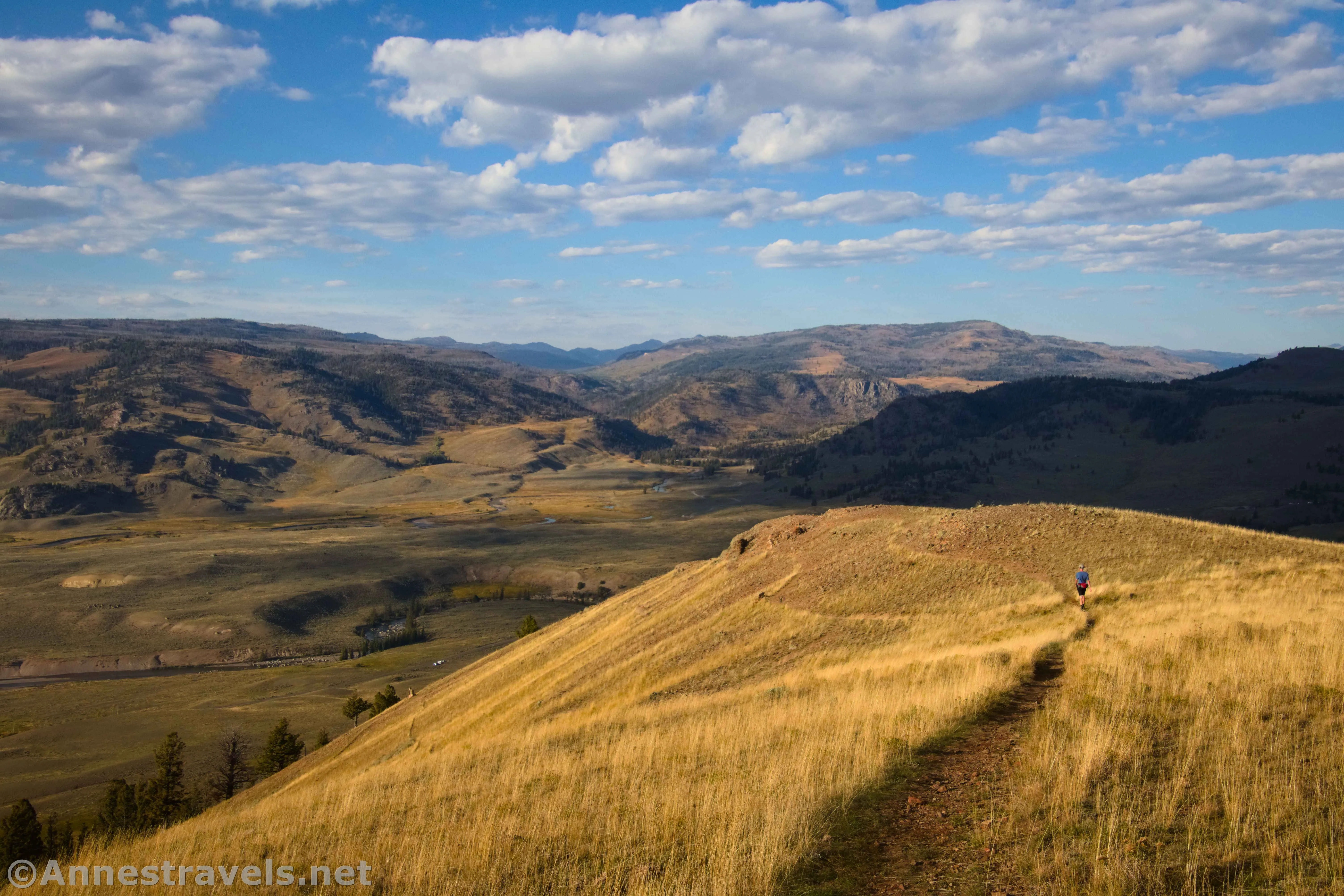
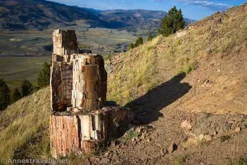
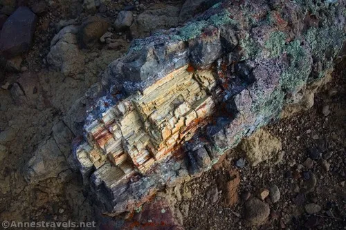
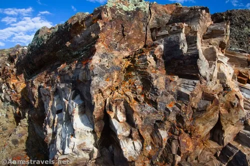
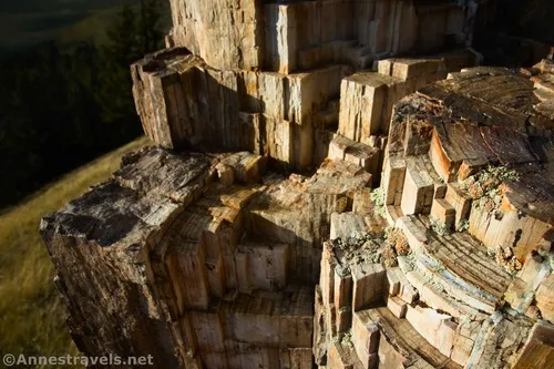
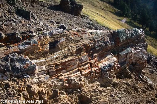
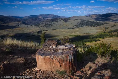
The Fossil Forest is a hidden gem of Yellowstone National Park. Located in the Lamar Valley, it’s not marked, nor is it especially official. But I was able to follow a trail all of the way up, so I can’t be the only person who enjoys the spectacular views that the mountain has to offer. More than halfway up, you just might find a secret stash of amazing things, too, but I’m not going to talk about that; you’ll just have to visit for yourself (or look at my photos in this post, or just look at the name of the trail to get a clue).
Quick Stats
The cost for visiting the Fossil Forest Trail is an exceedingly steep path; so steep, in fact, that one of my group members decided it was just too dangerous, turned around, and hiked back down. I can’t say as I blamed her; coming back down was a slide on gravel down a super steep slope as much as a hike. But those views – wow! I’d totally go back!
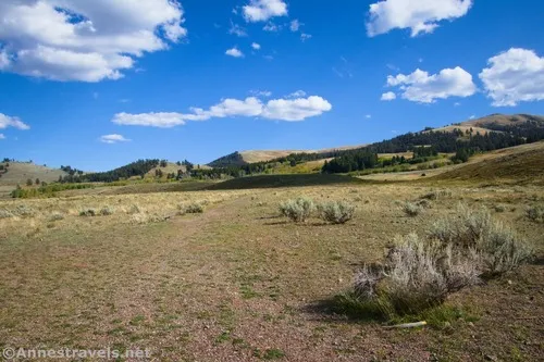
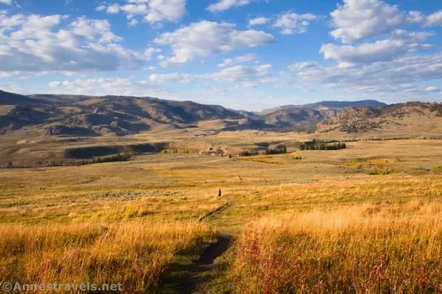
I visited the Fossil Forest late one afternoon in September after hiking the Lamar River Trail to Cache Creek and then Trout Lake. This was a “quick” stop and an adventure to finish off our day. The trailhead begins at an unmarked pulloff 0.3 miles southwest of where the US-212 crosses the Lamar River (5.0 miles northeast of Tower Junction when heading toward the Lamar Valley). There is no trailhead sign, but a beaten-down grass path goes south across the meadow. It will eventually become a more defined trail.
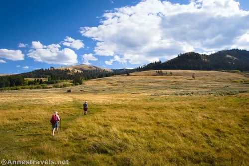
Cross the meadow and follow the path as it begins to ascend the side of the hill. The path becomes steeper and steeper and steeper until you know that you’re definitely on a social trail – no trailbuilder in their right mind would a trail like this intentionally!
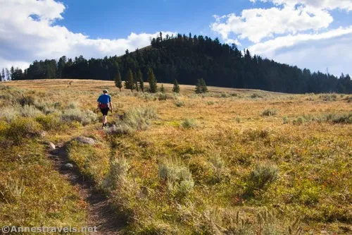
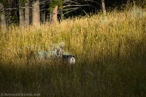
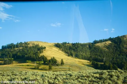
The route goes through stands of forest as well as grasslands. I saw a deer along the way.
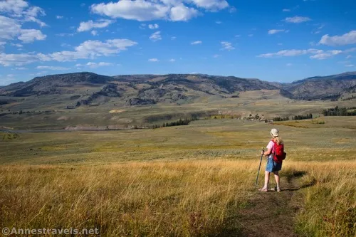
As you climb higher, the view gets better. The peaks around Beartooth Pass rise over the hills to the northeast, plus the views down on the Lamar River Valley are stunning.
A little after mile 1.1, the grade finally begins to abate a bit. I ended up turning around about mile 1.5 – it seemed like we’d seen most of the outstanding views (though I’m sure there would be more from the top!), we’d reached the end of the secret fossil bit, and we wanted to make sure we were back to the van well before dark. There a couple of social trails that branch off of the main trail – definitely follow them; you never know what you might find!
It appears that the trail continues up to the summit of the hill, then goes along the ridgeline to the Specimen Ridge Trail as well as down to the Crystal Creek Trail. That would have to be an adventure for another day!
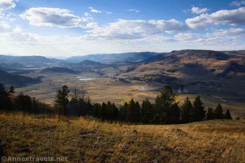
Hiking back, the views down on the Lamar Valley in the evening light were well worth all of the steepness.
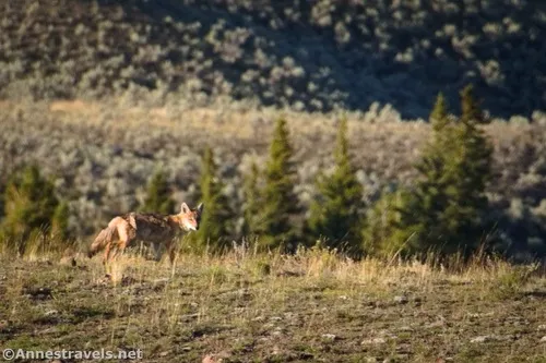
And we even saw a coyote when we were almost back to the parking area!
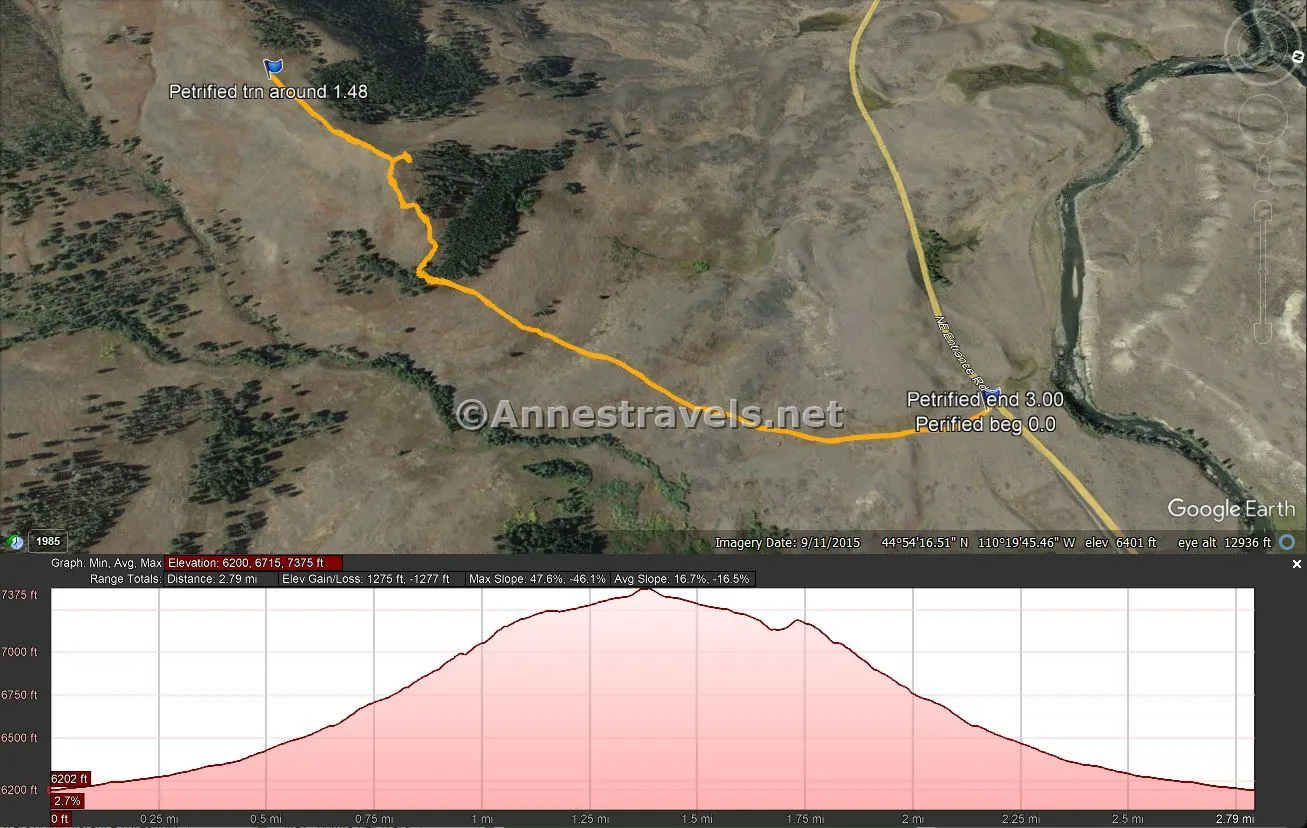
Round Trip Trail Length: I went a total of 3.0 miles, including a little bit of exploring near where I turned around. Going up to the top of the hill seems to add about half a mile each way, and traversing the ridgeline to the Specimen Ridge Trail seemed to be about 0.75 miles beyond the peak.
Elevation Gain: 1,277ft. (6,200ft. to 7,375ft.)
Facilities: None
Fees: $35/vehicle, valid 7 days. America the Beautiful National Parks & Federal Lands Passes and Yellowstone Annual Passes are accepted.
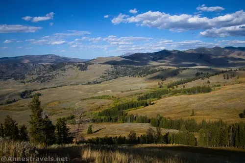
Trail Notes: This is not a trail for those who like a sanitized, easy experience. The hill is seriously steep! Plus the trail is social, so it’s pretty slippery in places. If you see trail junctions, just keep going up (there is one in the middle of a copse of trees; as I recall, you want to go right here, although both trails would eventually take you to the same place so it’s not a big deal). I highly recommend fall for this hike, when the Lamar Valley is golden and the sun is further south than north, and also afternoon, though I expect morning could also have some great views. Remember to leave no trace and take nothing – I mean absolutely nothing – with you that you found up there (except trash, of course!)
Trail 


Road 


Signs 


Scenery 


Would I go 100 miles out of my way for this? 


Overall Rating: 


GPS Coordinates for the Fossil Forest Trail
TH: 44.9118060°, -110.3277490° (44°54.70836′, -110°19.66494′ / 44°54’42.5016″, -110°19’39.8964″) (6,188ft.) (0.0)
Turn around: 44.8959330°, -110.3306930° (44°53.75598′, -110°19.84158′ / 44°53’45.3588″, -110°19’50.4948″) (7,360ft.) (1.48)
End at TH: 44.9118000°, -110.3278010° (44°54.70800′, -110°19.66806′ / 44°54’42.4800″, -110°19’40.0836″) (6,188ft.) (3.00)
The gpx file for the Fossil Forest can be downloaded – please note that this and the GPS Coordinates are for reference only and should not be used as a sole resource when hiking this trail.
Download GPX File size: 61.8 KB Downloaded 194 times
(Note: I do my best to ensure that all downloads, the webpage, etc. are virus-free and accurate; however, I cannot be held responsible for any damage that might result, including but not limited to loss of data, damages to hardware, harm to users, from use of files, information, etc. from this website. Thanks!)
GPS Coordinates for the Fossil Forest Trail
From Tower Junction, drive northeast on US-212, heading for the Lamar Valley. After 5.0 miles, the unmarked pulloff will be on the right (south). This is also 3.0 miles east of the much more official Specimen Ridge Trailhead.
From the Northeast Entrance, travel south and west on US-212 for 23.1 miles. The unmarked pulloff will be on the left. This is also 5.5 miles west of passing the Lamar Ranger station and 0.3 miles after crossing the Lamar River.
More Hikes in Yellowstone
Explore the lesser-known side of Yellowstone with this guide. It lists all 300+ of the park’s trails, along with quite a lot of other useful information.


Pingback: How I Hiked 100 Miles in Yellowstone National Park in 11 Days – Anne's Travels