I’ve heard about Ricketts Glen for many years. But somehow, I’ve never gotten around to visiting. I always assumed we’d get there someday since I had relatives who lived a few hours away. But they lived and died and we still hadn’t visited. So when I began to contemplate a not-too-far-away trip last fall with a waterfall-loving group member, I jumped at the idea of seeing 21+ waterfalls – in one hike!
Quick Stats
There are two main parking areas for Ricketts Glen. The most popular is the Lake Rose Trailhead near the park office, since it’s the shortest option and very convenient for the loop of Ganoga Glen and Glen Leigh, with Midway Crevasse as a fun little diversion along the way. The more traditional parking area is the Evergreen Parking/Glens Lot Trailhead Parking to the south. The good thing about this longer route is that you get to see an additional three waterfalls that aren’t on the loop. You can also park at Beach Lot #2 if both of the other lots are full. Click on “Falls Trail System Guide (PDF)” for a good map of the area at this link.
I decided to park at Lake Rose and then do a quick out-and-back to catch the additional three waterfalls that aren’t on the loop. It turned out to be a great option. However, since there is so much to see, and I know you want to see the pictures (so beautiful!), I’ve decided to split my hike between two different posts: This week, I’ll talk about descending Ganoga Glen (the western side of the loop) and the three additional waterfalls, then I’ll post about Glen Leigh (eastern side) and its waterfalls (plus Midway Crevasse) at a later date.
There’s some debate about which way you should hike the loop. I opted to descend Ganoga Glen and ascend Glen Leigh, catching Midway Crevasse on my way back to the parking area. It doesn’t really matter which way you do it; some prefer to get to the falls quickly (me) and then take the forest part (through Midway Crevasse) when they’re tired. Others like to do the boring part of the hike first and then have waterfalls beckoning them when they’re tired. It’s really up to you, but I’ll be describing the Lake Rose Trailhead down to and through Ganoga Glen to Waters Meet (where the two glens flow into the same stream) and then downstream to Murray Reynolds Falls – the furthest south waterfall in this part of Ricketts Glen.
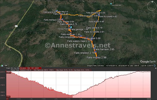
Without further ado, here’s a quick chart of the waterfalls. I’ll detail my hike below this.
| Cumulative mileage | Distance (approx.) | Waterfall name | Height |
| 0.48 | 0.0 | Mohawk Falls | 37ft. |
| 0.64 | 0.25 | Oneida Falls | 13ft. |
| 0.75 | 0.1 | Cayuga Falls | 11ft. |
| 0.87 | 0.1 | Ganoga Falls (top) | 94ft. |
| 1.09 | 0.2 | Ganoga Falls (bottom) | 94ft. |
| 1.37 | 0.3 | Delaware Falls | 37ft. |
| 1.50 | 0.1 | Mohican Falls | 39ft. |
| 1.61 | 0.1 | Conestoga Falls | 17ft. |
| 1.74 | 0.15 | Tuscarora Falls | 47ft. |
| 2.03 | 0.3 | Erie Falls | 47ft. |
| 2.31 | 0.3 | Waters Meet | – |
| 2.65 | 0.35 | Harrison Wright Falls | 27ft. |
| 2.79 | 0.15 | Sheldon Reynolds Falls | 36ft. |
| 2.98 | 0.2 | Murray Reynolds Falls | 16ft. |
We started out very early one Thursday morning in September. I was only partially aware at that point how blessed we were that there had been three days of rain just prior to our visit. Usually, in the summer and late fall, the waterfalls are only a trickle. You’re better off visiting either after a rain or in the spring, when snowmelt turns the streams into torrents.
From the Lake Rose Trailhead, take the steps by the sign down to forest level. After just over a tenth of a mile, turn right at the junction, following the sign for Ganoga Glen – the left trail is your return route. The trail descends through the trees and along the stream to cross a bridge. Two tenths of a mile from the first junction, go left for the Falls Trail (it’s signed) not right for Old Beaver Dam Rd. Tr.
The trail follows the river for another tenth of a mile to the first waterfall – Mohawk Falls (37ft.). It was one of the most disappointing falls for me. It’s hard to get a good view of it through the trees, though it’s a scenic enough waterfall.
Continue on down a set of stone steps to pass by an unnamed waterfall across the river from the trail – it only flows after rain, though it seems to trickle most of the year.
Oneida Falls is a quarter mile downstream from Mohawk Falls. It’s not terribly exciting; just a straight, 13ft. drop.
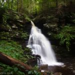
I loved photographing Cayuga Falls, a tenth of a mile later. It’s only 11ft. high, but it’s pretty!
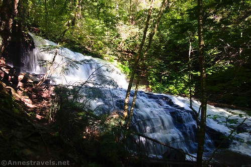
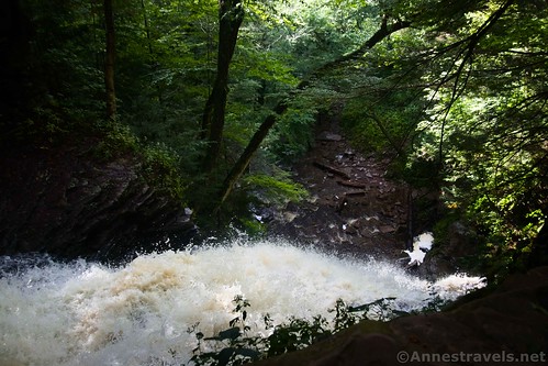
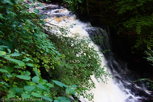
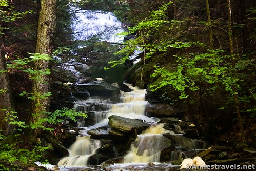
As we kept walking, we could hear the roar of another waterfall. The top of Ganoga Falls is a tenth of a mile below Cayuga Falls. At 94ft., Ganoga Falls is the tallest waterfall in Ricketts Glen. It’s gorgeous, too, though from here you can only see the water catapulting itself over the lip of the drop. It’s one of the few places where the park staff has installed railings!
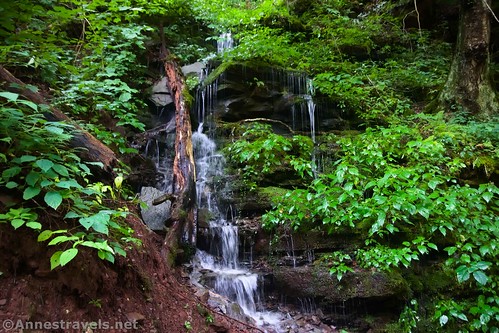
From the top of the falls, the trail turns right, away from the stream, and seemingly away from the waterfall. What it’s really doing is passing by the Old Beaver Dam Road Trail on the right less than a tenth of a mile later, then descending – steeply – another tenth of a mile to the bottom of Ganoga Falls (note that you’ll need to turn left on a social-type trail to drop down to the base of the falls). Along the way, we had the treat of a little waterfall among the ferns.
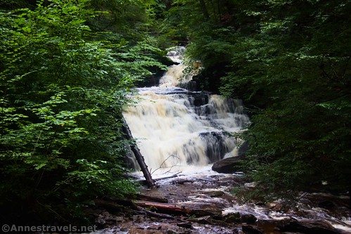
The power of the water is amazing at the bottom of Ganoga Falls (94ft.). The water roars down the cliff face. It’s spectacular!
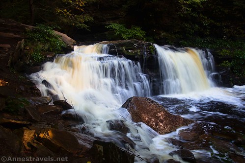
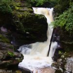
Continuing down the main Falls Trail, some stone steps pass by the relatively unimpressive Seneca Falls (12ft.). And then, 0.3 miles below Ganoga Falls, you’ll come to Delaware Falls (37ft.). This one was another favorite to photograph; it’s not terribly tall, but it’s simply lovely!
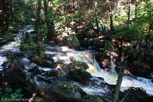
You’ll pass at least two more cascades over the next quarter mile as you descend to Mohican Falls (39ft.) (have you noticed that almost all of the falls in this section have been named for local American Indian tribes?)
Right about this point, a small creek enters from the right (west). Except for a small bridge that crosses it, it’s not all that exciting. Keep walking down to Conestoga Falls (17ft.) a tenth of a mile later…
…and then to Tuscarora Falls (47ft.) after another tenth of a mile.
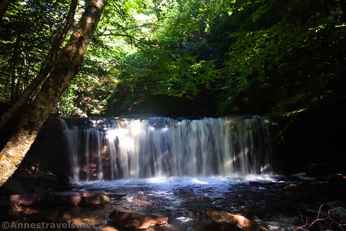
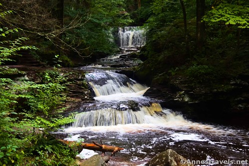
Then came another of my favorite waterfalls, a quarter of a mile downstream. Erie Falls is only 47ft. tall, but its form is beautiful!
Keep walking another 0.3 miles to a definite bridge over the creek (Kitchen Creek, as it happens). This is Waters Meet, so called because the two branches of Kitchen Creek come together here. Be sure to look across the branch of the creek you’ve been following to see Wyandot Falls (15ft.).
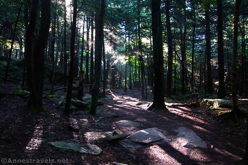
You’ve just exited Ganoga Glen, and the Falls Trail crosses the bridge here to wend its way up Glen Leigh. However, you want to stay on the same side of the creek, turn right, and work your way downstream on the path. For the most part, it’s a quiet trail beside gurgling Kitchen Creek.
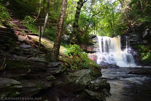
The first waterfall is after 0.3 miles. Harrison Wright Falls is only 27ft. tall, but its straight shot is a lovely one.
Sheldon Reynolds Falls (36ft.) was one of my favorite falls I saw all day. I couldn’t photograph it very well, but its form makes it one I can watch for a long time.
A quarter mile below Sheldon Reynolds Falls, the trail splits. So sayeth the sign, the upper (right) trail is moderate, while the lower trail (left) is difficult. I only wanted to get to Murray Reynolds Falls (16ft.) so I turned left for a short distance to the waterfall, which isn’t very impressive, but that’s mostly because it’s hard to see.
From there, we retraced our steps up to Waters Meet and then up Glen Leigh… but that’s a topic for another post!
Round Trip Trail Length: I did 6.6 miles around the entire loop and to the three other waterfalls. Out and back for Ganoga Glen down to Murray Reynolds Falls would be 6 miles RT.
Elevation Gain: 2,559ft. (2,228ft. to 1,390ft.) (note that the elevation gain may be a little bit overestimated due to low GPS service in the area.)
Facilities: Restrooms at the trailhead
Fees: None
Trail Notes: Try to go after a rain for the best the waterfalls have to offer. The park can be insanely busy on weekends, especially when the falls are flowing well. One or both glens may be closed in the winter due to hazardous conditions, rockfalls, and the like. While the Lake Rose Trailhead is called “small,” it has room for at least 50-100 cars – it’s just too small for the number of people who want to park there! It did not fill up on the Thursday that I hiked, but weekends could be an issue. Swimming is not allowed.
Trail 


Road 


Signs 


Scenery 


Would I go 100 miles out of my way for this? 


Overall Rating: 


GPS Coordinates for Falls Trail (Ganoga Glen & Glen Leigh)
Trailhead: 41.329782000, -76.290593000 (41°19.78692′, -076°17.43558′ / 41°19’47.2152″, -076°17’26.1348″) (2,217ft.) (0.0)
Begin loop: 41.328548000, -76.288344000 (41°19.71288′, -076°17.30064′ / 41°19’42.7728″, -076°17’18.0384″) (2,214ft.) (0.16)
Beaver Junction: 41.326444000, -76.288400000 (41°19.58664′, -076°17.30400′ / 41°19’35.1984″, -076°17’18.2400″) (2,166ft.) (0.34)
Mohawk Falls: 41.326556000, -76.287266000 (41°19.59336′, -076°17.23596′ / 41°19’35.6016″, -076°17’14.1576″) (2,117ft.) (0.48)
Unnamed Falls: 41.326247000, -76.286621000 (41°19.57482′, -076°17.19726′ / 41°19’34.4892″, -076°17’11.8356″) (2,091ft.) (0.54)
Oneida Falls: 41.325765000, -76.285515000 (41°19.54590′, -076°17.13090′ / 41°19’32.7540″, -076°17’07.8540″) (2,067ft.) (0.64)
Cayuga Falls: 41.324952000, -76.284223000 (41°19.49712′, -076°17.05338′ / 41°19’29.8272″, -076°17’03.2028″) (2,030ft.) (0.75)
Top of Genoga Falls: 41.323868000, -76.283650000 (41°19.43208′, -076°17.01900′ / 41°19’25.9248″, -076°17’01.1400″) (2,011ft.) (0.87)
Old Beaver Trail Junction: 41.323186000, -76.283958000 (41°19.39116′, -076°17.03748′ / 41°19’23.4696″, -076°17’02.2488″) (2,017ft.) (0.94)
Bottom of Genoga Falls: 41.323599000, -76.283418000 (41°19.41594′, -076°17.00508′ / 41°19’24.9564″, -076°17’00.3048″) (1,930ft.) (1.09)
Delaware Falls: 41.322274000, -76.282939000 (41°19.33644′, -076°16.97634′ / 41°19’20.1864″, -076°16’58.5804″) (1,910ft.) (1.37)
Mohican Falls: 41.321791000, -76.282724000 (41°19.30746′, -076°16.96344′ / 41°19’18.4476″, -076°16’57.8064″) (1,868ft.) (1.50)
Conestoga Falls: 41.3213880°, -076.2811450° (41°19.28328′, -076°16.86870′ / 41°19’16.9968″, -076°16’52.1220″) (1,760ft.) (1.61)
Tuscarora Falls: 41.321796000, -76.279165000 (41°19.30776′, -076°16.74990′ / 41°19’18.4656″, -076°16’44.9940″) (1,773ft.) (1.74)
Erie Falls: 41.321772000, -76.277010000 (41°19.30632′, -076°16.62060′ / 41°19’18.3792″, -076°16’37.2360″) (1,652ft.) (2.03)
Waters Meet: 41.321278000, -76.275380000 (41°19.27668′, -076°16.52280′ / 41°19’16.6008″, -076°16’31.3680″) (1,579ft.) (2.31)
Harrison Falls: 41.318735000, -76.274143000 (41°19.12410′, -076°16.44858′ / 41°19’07.4460″, -076°16’26.9148″) (1,516ft.) (2.65)
Sheldon Falls: 41.317783000, -76.273660000 (41°19.06698′, -076°16.41960′ / 41°19’04.0188″, -076°16’25.1760″) (1,466ft.) (2.79)
Upper/Lower Trail Junction: 41.316326000, -76.273142000 (41°18.97956′, -076°16.38852′ / 41°18’58.7736″, -076°16’23.3112″) (1,472ft.) (2.94)
Murray Falls: 41.316326000, -76.273142000 (41°18.97956′, -076°16.38852′ / 41°18’58.7736″, -076°16’23.3112″) (1,451ft.) (2.98)
Wyanot Falls: 41.321838000, -76.275268000 (41°19.31028′, -076°16.51608′ / 41°19’18.6168″, -076°16’30.9648″) (1,648ft.) (3.59)
B. Reynolds Falls: 41.330237000, -76.273468000 (41°19.81422′, -076°16.40808′ / 41°19’48.8532″, -076°16’24.4848″) (1.665ft.) (3.64)
R.B. Ricketts Falls: 41.324014000, -76.274494000 (41°19.44084′, -076°16.46964′ / 41°19’26.4504″, -076°16’28.1784″) (1,804ft.) (3.91)
Ozone Falls: 41.325364000, -76.274675000 (41°19.52184′, -076°16.48050′ / 41°19’31.3104″, -076°16’28.8300″) (1,875ft.) (4.19)
Huron Falls: 41.327733000, -76.274154000 (41°19.66398′, -076°16.44924′ / 41°19’39.8388″, -076°16’26.9544″) (1,947ft.) (4.48)
Shawnee Falls: 41.328179000, -76.273997000 (41°19.69074′, -076°16.43982′ / 41°19’41.4444″, -076°16’26.3892″) (2,002ft.) (4.58)
F.S. Ricketts: 41.330237000, -76.273468000 (41°19.81422′, -076°16.40808′ / 41°19’48.8532″, -076°16’24.4848″) (2,047ft.) (4.82)
Shortcut Junction: 41.330507000, -76.273720000 (41°19.83042′, -076°16.42320′ / 41°19’49.8252″, -076°16’25.3920″) (2,127ft.) (5.00)
Onondaga Falls: 41.331156000, -76.273440000 (41°19.86936′, -076°16.40640′ / 41°19’52.1616″, -076°16’24.3840″) (2,112ft.) (5.11)
Shortcut Junction: 41.331084000, -76.274778000 (41°19.86504′, -076°16.48668′ / 41°19’51.9024″, -076°16’29.2008″) (2,163ft.) (5.55)
Midway Crevasse: 41.329122000 -76.281825000 (41°19.74732′, -076°16.90950′ / 41°19’44.8392″, -076°16’54.5700″) (2,266ft.) (6.05)
Return to loop junction: 41.328572000, -76.288358000 (41°19.71432′, -076°17.30148′ / 41°19’42.8592″, -076°17’18.0888″) (2,251ft.) (6.48)
End: 41.329764000, -76.290631000 (41°19.78584′, -076°17.43786′ / 41°19’47.1504″, -076°17’26.2716″) (2,263ft.) (6.63)
The gpx file for the Falls Trail in Ricketts Glen can be downloaded – please note that this and the GPS Coordinates are for reference only and should not be used as a sole resource when hiking this trail.
Download GPX File size: 117.3 KB Downloaded 302 times
(Note: I do my best to ensure that all downloads, the webpage, etc. are virus-free and accurate; however, I cannot be held responsible for any damage that might result, including but not limited to loss of data, damages to hardware, harm to users, from use of files, information, etc. from this website. Thanks!)
Getting to the Lake Rose Trailhead (Ricketts Glen)
From I-180 (say, Williamsport), take Exit 15 toward US-220. Turn east on US-220N for 4.9 miles; turn right onto N Main Street for 0.3 miles. Turn left onto PA-118E (E Water Street). Drive 24.3 miles. Turn left onto PA-487N (a sign does point toward Ricketts Glen State Park, but it may be hard to see) for 3.7 miles. Take the road on the right into Ricketts Glen State Park; after 0.4 miles, you’ll need to turn right to continue another 0.6 miles down to the Lake Rose Trailhead at the end of the road.
From I-81 (say, Wilkes-Barre), take Exit 170 toward PA-309N (be sure it’s north, not south!). After 7.1 miles, turn left onto Hillside Road (signs point toward Penn State WB) for 3.2 miles. Then take a slight right onto Old Rte 115 for 0.9 miles, turn left to stay on Old Rte 115 for another mile, and then keep left again to stay on Old Rte 115 for another 1.5 miles. Turn left onto PA-118W. After 14.5 miles, turn right onto PA-487N (a sign does point toward Ricketts Glen State Park, but it may be hard to see) for 3.7 miles. Take the road on the right into Ricketts Glen State Park; after 0.4 miles, you’ll need to turn right to continue another 0.6 miles down to the Lake Rose Trailhead at the end of the road.
This Week’s Featured Product!
Fill up your waterfall-loving heart with this book to more than 180 waterfalls in Pennsylvania! Filled with color, pictures, directions, helpful hints, and much more, it’s a great resource. Buy your copy here!














Pingback: Trip Report: Ricketts Glen, World’s End, and More! – Anne's Travels
Pingback: The Falls Trail through Glen Leigh in Ricketts Glen State Park – Anne's Travels