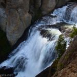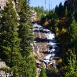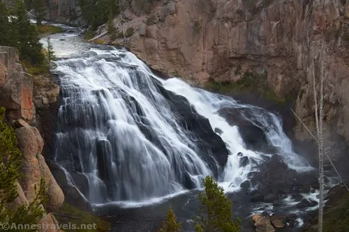
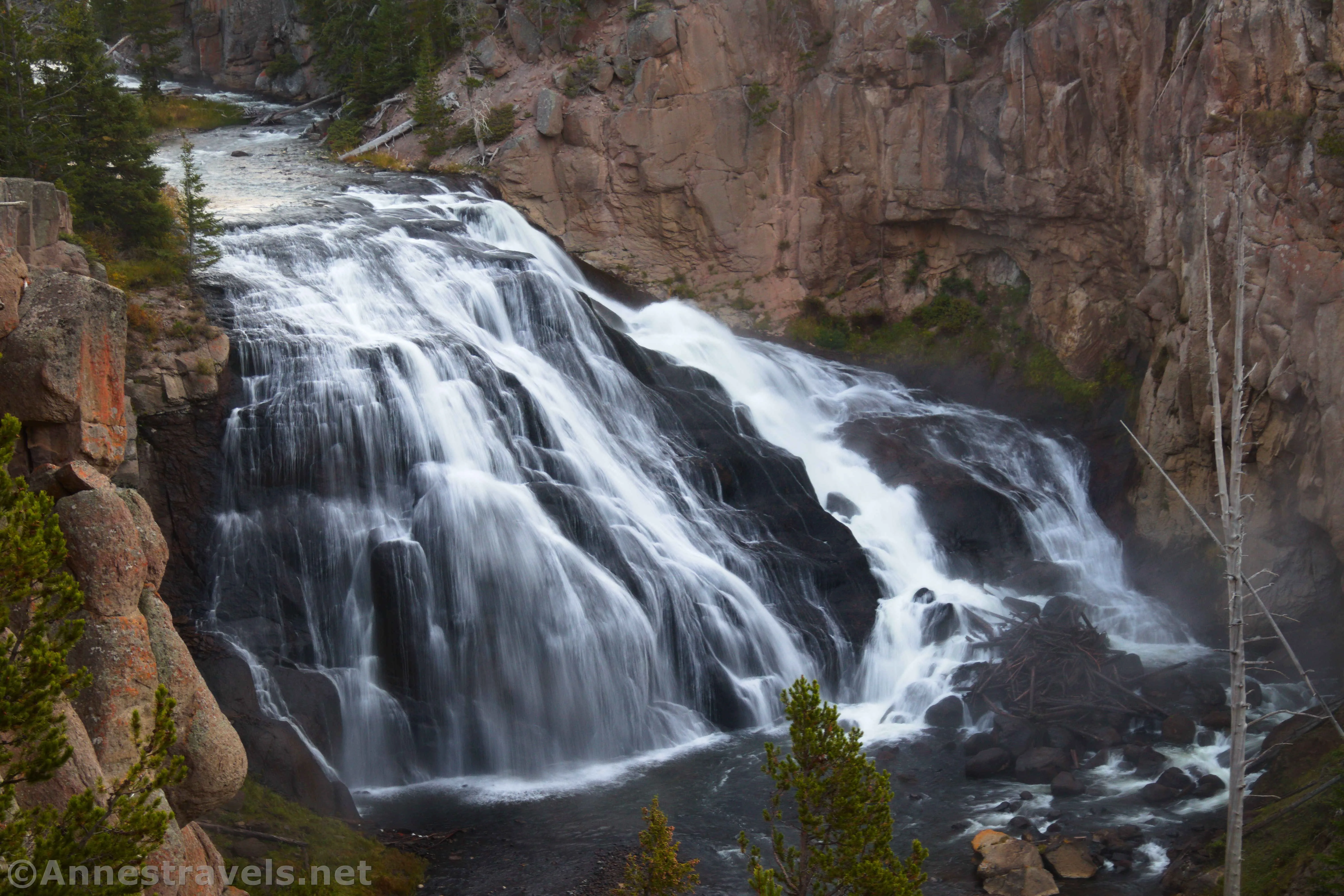
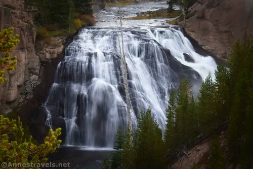
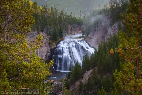
Gibbon Falls isn’t exactly a famous destination in Yellowstone National Park. Most people drive right by it while traveling between Madison and Norris. Plenty of people do stop – it’s unlikely you’ll have the viewpoint to yourself. But if you have an extra 10 (or better, 15) minutes, Gibbon Falls is a beautiful and interesting pulloff with a short walk to various viewpoints – and it’s even wheelchair accessible.
Quick Stats
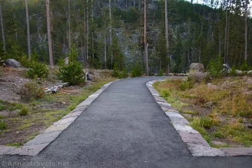
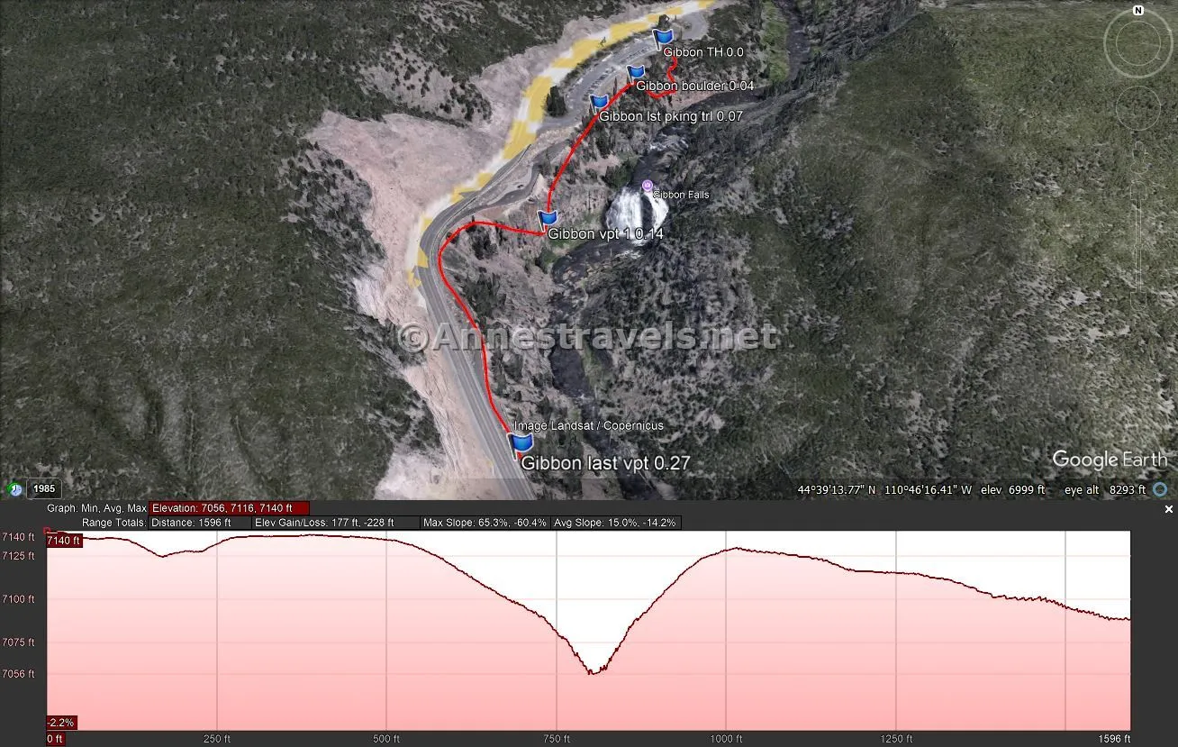
If you want the shortest walk possible, begin at the south (right) end of the parking area. Follow the paved path, and you’ll have a good view of the falls within about 400ft.
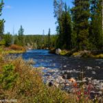
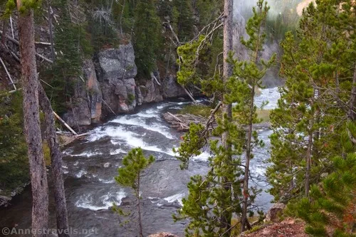
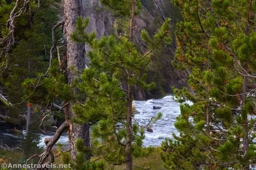
For the full experience, begin walking at the far north (left) end of the parking area. A paved path will take you down to peek through the trees over the Gibbon River. Supposedly, this shows you the top of the falls, but it’s hard to see through the fir trees.
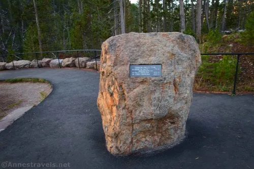
After losing elevation and then gaining it again over 250ft., the trail will meet up with the trail from the middle of the parking area next to a boulder with a sign on it – the sign is super confusing, so just continue on the paved path (don’t turn right toward the parking area), following the arrow for the falls.
About 150ft. later, the path from the southern end of the parking area joins your trail from the right. Continue left as the trail travels downhill. The first viewpoint is about 350ft. beyond this junction – you’ll have walked a total of about 0.15 miles at this point.
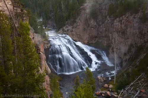
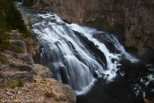
These are some of the best (or at least obstructed) views I found of Gibbon Falls. A sign kiosk is nearby if you want to check that out; there are also a few signs around about the history surrounding the falls.
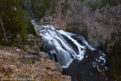
The trail continues down from here to a couple more viewpoints. While there are more head-on views along the trail, a tree or two (plus the cliff on the opposite side of the river) get in the way of being able to see the whole falls. This trail is actually the old road; sometime between September 2007 and August 2011 (thank you, GoogleMaps!), the NPS dug into the hillside to make the road wider. (Before this, Gibbon Falls was nothing more than a small pulloff where the sign kiosk is now, with more pulloff parking and a narrow sidewalk where parking area is today.) They also added the current barrier between the trail and the road – the barrier on the other side of the trail is the original guardrail along the old road – which may explain why it looks so beefy! It’s about 0.15 miles down to the far southern viewpoint.
When you’re finished enjoying views of the falls, retrace your steps to the southernmost trailhead and then back to your vehicle!
Round Trip Trail Length: Up to about 0.5 miles (as little as 0.15 miles)
Elevation Gain: My software says 295ft., but I don’t think I believe that – the trail is mostly flat. It’s probably closer to 30ft. (7140ft. to 7,088ft.)
Facilities: Vault toilets at the trailhead
Fees: $35/vehicle, valid 7 days. America the Beautiful National Parks & Federal Lands Passes and Yellowstone Annual Passes are accepted.
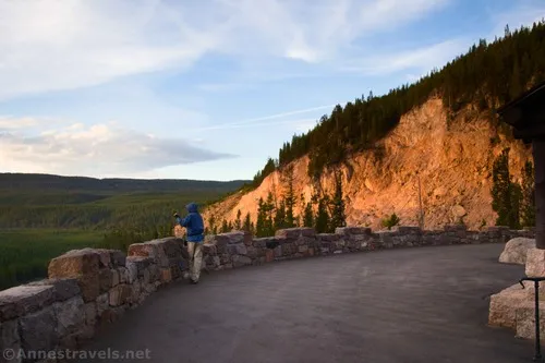
Trail Notes: The entire trail is wheelchair accessible; however, steep grades (about 10%) north of the middle trailhead keep most wheelchairs off of the northern part of the trail. I visited in the early morning (just the way it worked out), and while we didn’t have it to ourselves, it was pretty close. Sunshine on Gibbon Falls is beautiful, but I also appreciated the darker atmosphere for taking slow shutter speed shots.
Trail 
Road ![]()
Signs ![]()
Scenery ![]()
![]()
Would I go 100 miles out of my way for this? ![]()
![]()
![]()
Overall Rating: 
![]()
GPS Coordinates for Gibbon Falls
TH (north end): 44.6553840°, -110.7705600° (44°39.32304′, -110°46.23360′ / 44°39’19.3824″, -110°46’14.0160″) (7138ft.) (0.0)
Boulder with the confusing sign: 44.6549816°, -110.7708239° (44°39.29889′, -110°46.24943′ / 44°39’17.9336″, -110°46’14.9659″) (7,135ft.) (250ft. or 0.04)
Trail from south end of parking lot: 44.6546350°, -110.7711420° (44°39.27810′, -110°46.26852′ / 44°39’16.6860″, -110°46’16.1112″) (7,137ft.) (400ft. or 0.07)
First viewpoint: 44.6538800°, -110.7715380° (44°39.23280′, -110°46.29228′ / 44°39’13.9680″, -110°46’17.5368″) (7,080ft.) (0.14)
Lower viewpoint: 44.6522720°, -110.7716250° (44°39.13632′, -110°46.29750′ / 44°39’08.1792″, -110°46’17.8500″) (7,095ft.) (0.27)
Middle TH: 44.6551120°, -110.7709230° (44°39.30672′, -110°46.25538′ / 44°39’18.4032″, -110°46’15.3228″) (7,138ft.)
South TH: 44.6547380°, -110.7711880° (44°39.28428′, -110°46.27128′ / 44°39’17.0568″, -110°46’16.2768″) (7,140ft.)
The gpx file for Gibbons Falls can be downloaded – please note that this and the GPS Coordinates are for reference only and should not be used as a sole resource when hiking this trail.
Download GPX File size: 7.4 KB Downloaded 310 times
(Note: I do my best to ensure that all downloads, the webpage, etc. are virus-free and accurate; however, I cannot be held responsible for any damage that might result, including but not limited to loss of data, damages to hardware, harm to users, from use of files, information, etc. from this website. Thanks!)
Getting to Gibbon Falls
From Madison Junction, drive 4.8 miles north on US-89 (Grand Loop Road). Gibbon Falls will be on the right.
From Norris Junction (where the road south from Mammoth and the road to Canyon meet), drive 8.4 miles south on US-89 (Grand Loop Road). Gibbon Falls will be on the left.
Today’s Featured Product!
Explore Yellowstone and beyond with this guide to some of the state’s best views. It covers both well-known and lesser-visited destinations, from short strolls to hikes that could be overnight trips. Buy your copy here.