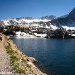
The day before I hiked up to the famous Kearsarge Pass, I happened to have a few hours to burn. I didn’t feel like sitting around the parking area, and I really, really didn’t feel like hanging out in the valley (where it was at least 20 if not 30 degrees hotter, as in about 101F). I saw on the map and signs and whatnot that it was only about 5 miles RT to the Golden Trout Lakes. That seemed like a great length, given the amount of time I had. Now, that didn’t count on the nearly 2,500ft. of elevation gain and a trail that didn’t exist in places (we’re talking rock scrambles on loose scree), nor did I realize until we got home that I didn’t get to Golden Trout Lakes but instead went to some other lakes. But still, it was a truly spectacular hike with a massive waterfall, a lovely meadow, two alpine lakes, and views galore – so there is that!
Quick Stats
The trailhead is the same as for Kearsarge Pass in Onion Valley. Follow the Kearsarge Pass Trail for 0.4 miles (you’ll pass where the horse trail comes in on the left) to a rickety but very official sign for the Golden Trout Lakes Trail (which goes right while the Kearsarge Pass Trail goes left). You’ll also see a sign that the national park boundary is 5 miles up the Kearsarge Pass Trail, and Kings Canyon National Park has special regulations (including no pets, weapons, and wheeled vehicles, and a permit is required for overnight use).
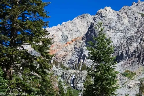
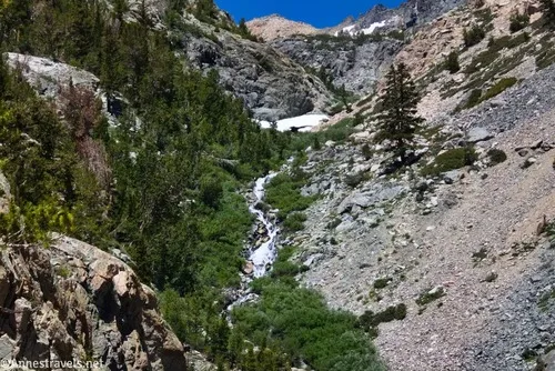
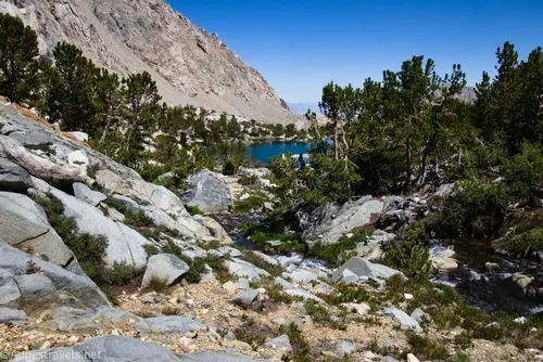
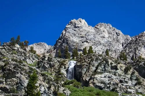
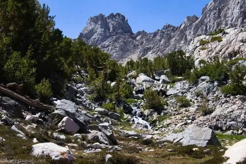
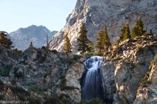
Meanwhile, while you’ve been climbing, you’ve begun to catch sight of Onion Valley Falls – you’ll be much more familiar with it before you get up to the Golden Trout Lakes.
Once off of the Kearsarge Pass Trail, the Golden Trout Lakes Trail is narrower but still quite defined. You’re hiking closer to Onion Valley Falls with fantastic views of the surrounding mountains.
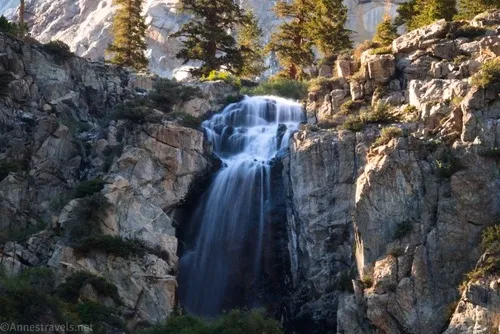
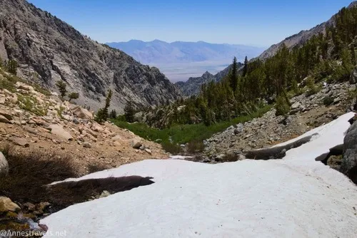
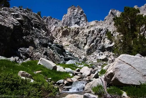
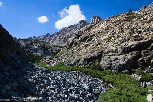
Cross over what appears to be an unnamed creek about 0.2 miles later; near here are the best views of Onion Valley Falls. The crossing wasn’t bad in early July after an average snowfall year, and we didn’t get our feet wet. After this, the trail vanishes into a scree slope – this is the most difficult part of the trail, though I can’t say it’s altogether easy after this. Do your best to make your way upward and reconnect with the trail as it once again crosses over the unnamed creek above Onion Valley Falls.
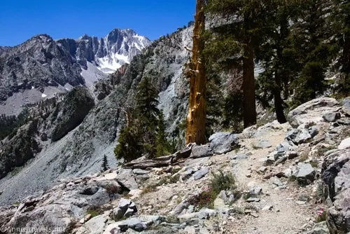
The trail picks up for a while, turning right-ish and becoming fainter as the canyon narrows and the tread becomes more (mostly stable) rocks. This is not as difficult as the scree section, but it’s still a beast of a climb. Thankfully, it’s also a pretty hike, with the stream below you and views out into the valley. There is more than one trail to follow in this section, but at least there is usually a vague path – and it’s hard to get too terribly lost.
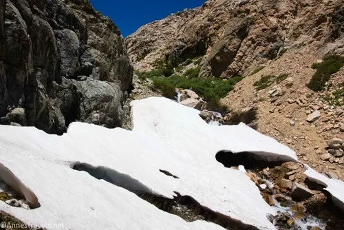
The rocky section had probably the most excitement for me of any part of the hike, and I’d be just as happy if you didn’t have to repeat my adventures verbatim. There was one section of snow still hugging the cliff, and the trail went right beneath it. Thankfully, we were able to skirt it fairly easily and (in one place) squeeze between the snow on one side and the canyon cliff face on the other – that was a fun experience (mostly!)
The second part of the excitement was when one of my group members lost his hiking pole (a vital part of our gear) while crossing the creek. We spent probably 20 minutes searching (a real group effort; everyone added support, from poking with sticks to stopping the water (with my feet) to try and figure out where it wasn’t/lower the water level, to wading in some of the shallower places, to documenting the efforts on digital film) but we found it!! Talk about a small-time hero saving the day!

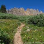
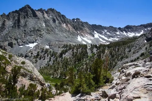
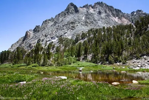
About mile 1.7, the grade abates a bit as you begin to enter a meadow. The path will take you around the left side, but it pretty much vanishes in a camping area a tenth of a mile or so later.
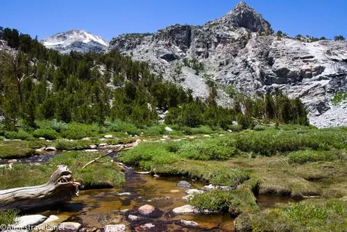
This is where we went wrong. If we had wanted to go up to the official Golden Trout Lake, we should have turned left. Near the turn, the Golden Trout lake North Spur Trail would turn right to cross over the stream (very swampy, but it is doable… more or less). We didn’t see a sign or a trail, and given the lay of the land, we continued to skirt around the north end of the meadow on stable scree (getting around the small pond was interesting but not impossible). It was beautiful and incredibly peaceful.
At the north end of the meadow, a rocky chute heads northeast up to toward two lakes (which on my maps don’t have names, and because I thought we were still on the trail, I called them Upper and Lower Golden Trout Lake – so let’s just say that they’re Lower North Golden Trout Lake and Upper North Golden Trout Lake, which is long and possibly confusing but also fairly accurate).
Two of my group decided that they were done for the day, and they wanted to keep their energy for hiking back down (a very worthy consideration!) I wanted to see the views up the chute, lakes or no lakes, so I shot off up to the lower one with a couple of my other group members in hot pursuit (or maybe they just wanted to see what was up there, too).
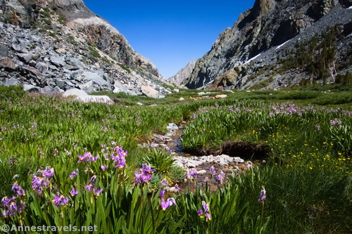
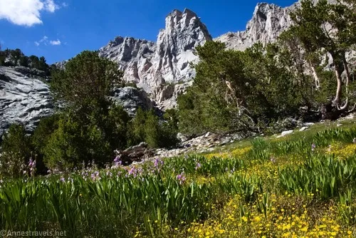
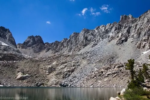
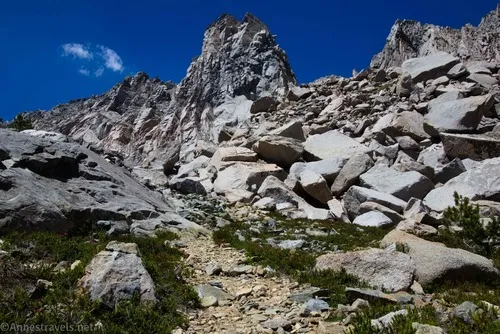
I followed the creek upward, finally taking to the scree when I found a vague trail. Apparently, it’s official, but you wouldn’t know that from looking at it. Views back down on the valley, across to the slopes of Mount Gould, and the basin that holds the real Golden Trout Lake were excellent.
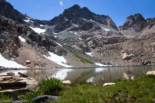
The path zigzags up and up and up a rugged almost 400ft. over 0.4 miles to Lower North Golden Trout Lake.
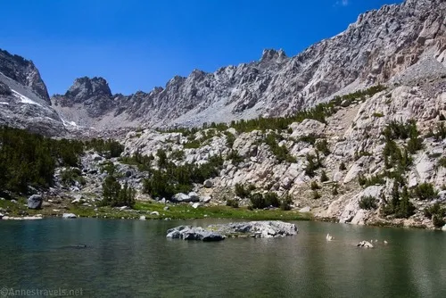
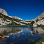
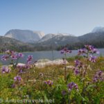
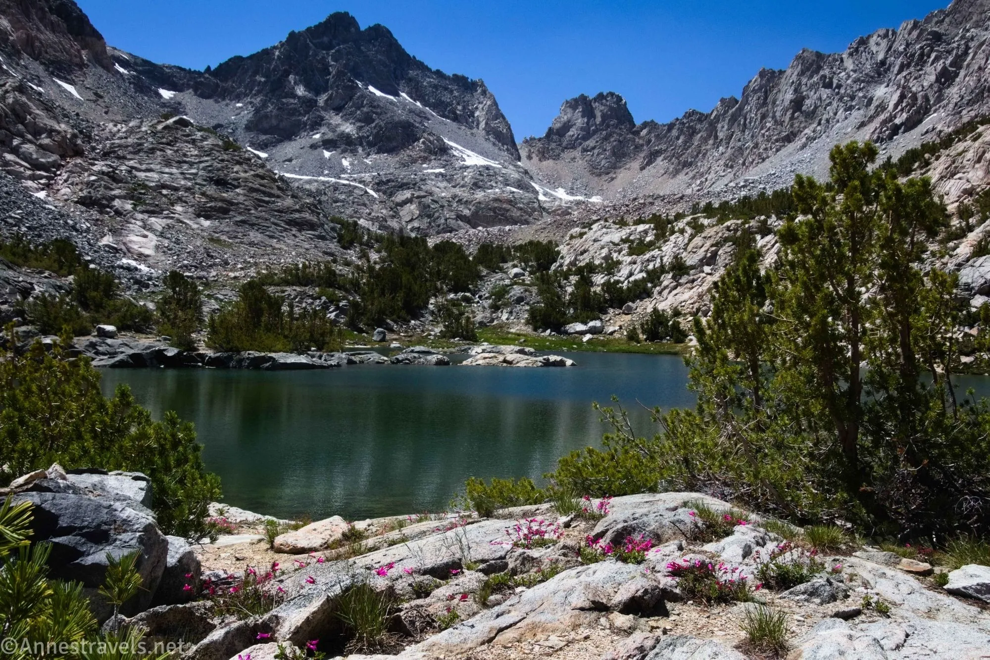
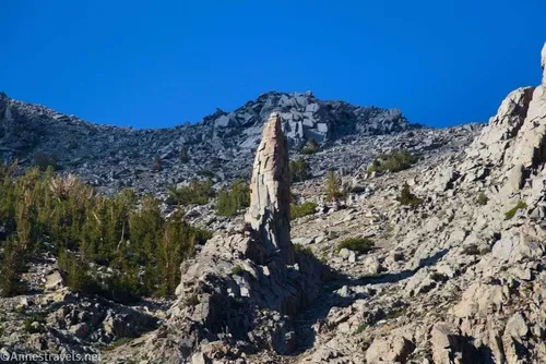
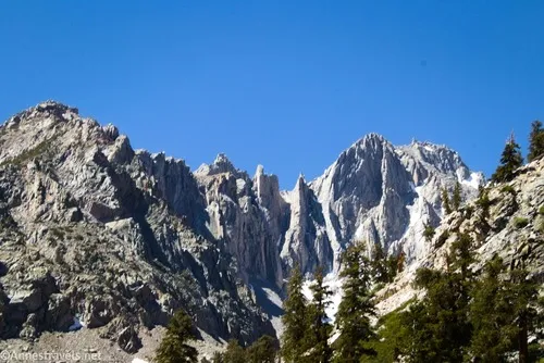
The lake has a great setting below Dragon Peak and Dragon Tooth. It’s also tucked between the rugged and rocky (almost sheer) cliffs of the canyon, which adds to the perspective.
I opted to go along the left (southwestern) shore, which is where the official trail goes. It wasn’t great, so on the way back down, I went along the northeastern shore. That was much worse and included some sketchy scrambling (I thought it was going to be Class 4 or that I was cliffed out, but it ended up being nothing more than Class 3), so stick to the official trail.
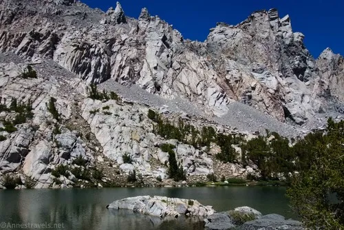
Supposedly, there is an official trail almost 0.2 miles to Upper North Golden Trout Lake, and it stays more southwest than northeast. However, I had difficulty finding it, and so I ended up more northeast. But with a nice little Class 2 scramble up 130ft., I made it to the upper lake, 4.25 miles after leaving the parking lot!
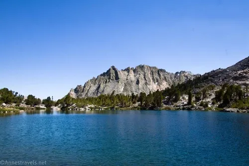
Upper North Golden Trout Lake is its own gorgeous setting. It’s almost directly below Dragon Peak and Dragon Tooth, and what it lacks in vegetation, it makes up for with rugged, classic Sierra-style rocks.
I was already pushing daylight (it was still nice and sunny, but it wouldn’t be a hop, skip, and a jump to get back down, and with grades this steep, it can take as long to descend as it took to ascend when you had to stop and catch your breath every 20 steps), so I only went as far as the mouth of the outlet of Upper North Golden Trout Lake. I’m sure you could have some fun exploring in this area, especially if you headed up toward one of the passes between the peaks that ring the ridgeline around the lake.
Back in the meadow, we did a better job of following the Golden Trout Lake North Spur Trail and crossing in the right place – at least generally – and we did make it back to the parking area before dark without too many uncomfortable adventures!
Round Trip Trail Length: I went 6.25 miles
Elevation Gain: 2,438ft. (9,181ft. to 11,404ft.)
Facilities: Campground near the trailhead (usually full); primitive restroom
Trail Notes: If you haven’t heard me say this yet, I’ll put it here: This is an incredibly steep, difficult climb. We were in pretty good shape and it still knocked us out a bit (or maybe that was just that we’d hiked 12 miles and 2.8k ft. of elevation gain the day before up to Piute Pass). It’s also incredibly beautiful. If I had to pick between this and Kearsarge Pass, there’s no question that Kearsarge would win. But this has some great features to it, including fewer people and the freedom to camp without a permit (I think – at least, the Golden Trout Lake Wilderness (which does require a permit) seems to be quite a distance south of here). Be ready to scramble, wayfind, and self-rescue up in here, and if you’re really adventurous, there are plenty of ways to extend the hike into the surrounding mountains.
Road 
![]()
Signs ![]()
![]()
Scenery
Would I go 100 miles out of my way for this?
GPS Coordinates for the Golden Trout Lakes
Kearsarge Pass TH: 36.7725330°, -118.3411380° (36°46.35198′, -118°20.46828′ / 36°46’21.1188″, -118°20’28.0968″) (9,200ft.) (0.0)
Golden Trout Lakes Junction: 36.7753610°, -118.3432130° (36°46.52166′, -118°20.59278′ / 36°46’31.2996″, -118°20’35.5668″) (9,416ft.) (0.40)
Stream crossing: 36.7770510°, -118.3462910° (36°46.62306′, -118°20.77746′ / 36°46’37.3836″, -118°20’46.6476″) (9,613ft.) (0.64)
Lower Golden Trout Lake: 36.7865530°, -118.3612490° (36°47.19318′, -118°21.67494′ / 36°47’11.5908″, -118°21’40.4964″) (11,273ft.) (2.81)
Upper Golden Trout Lake: 36.7881850°, -118.3654620° (36°47.29110′, -118°21.92772′ / 36°47’17.4660″, -118°21’55.6632″) (11,402ft.) (3.26)
End of the meadow: 36.7834410°, -118.3591260° (36°47.00646′, -118°21.54756′ / 36°47’00.3876″, -118°21’32.8536″) (10,946ft.) (4.12)
End: 36.7726090°, -118.3411390° (36°46.35654′, -118°20.46834′ / 36°46’21.3924″, -118°20’28.1004″) (9,206ft.) (6.24)

The gpx file for the North Golden Trout Lakes can be downloaded – please note that this and the GPS Coordinates are for reference only and should not be used as a sole resource when hiking this trail.
Download GPX File size: 81.6 KB Downloaded 268 times
(Note: I do my best to ensure that all downloads, the webpage, etc. are virus-free and accurate; however, I cannot be held responsible for any damage that might result, including but not limited to loss of data, damages to hardware, harm to users, from use of files, information, etc. from this website. Thanks!)
Getting to the Onion Valley Trailhead (Kearsarge Pass Trailhead/Golden Trout Lakes Trailhead)
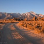
From the town of Independence on US-395, turn toward the mountains onto W Market Street (the post office is on the SW corner of this turn). After 0.2 miles, the road changes names to Onion Valley Road. Almost immediately, the road begins a slow rise across the plains, but when it hits the mountains, it gets serious about elevation gain.
I have driven cars that wouldn’t have made it up those incredibly steep switchbacks! As it was, my van full of people crept up and up and up and didn’t overheat – a testament to its quality, I guess. This was an old mining road (you can see other variations of the route along the way), and at one time, it was supposed to cross Kearsarge Pass and descend through Kings Canyon National Park. The road was never realized, and so it ends at the Onion Valley Trailhead, 13 miles after leaving US-395. The parking lot is large, but it’s also popular. I had no issue parking there on a holiday week in July, but it was fairly full by the time I came back from Kearsarge Pass the next day.

More Hikes in the High Sierras
Over 100 trails are featured within the covers of this book. Mountain peaks, lakes, waterfalls, day hikes, and backpacking trips are all covered with the quality you can expect from a Falcon Guide. Buy your copy here.