The Grand View area of New River Gorge National Park is best known for its two spectacular views of the gorge – the Main Overlook and the Turkey Spur Overlook. It also boasts five hiking trails. When I visited, the Turkey Spur area was being resurfaced, so it was closed. But I ended up walking out to the Main Overlook, hiking the Castle Rock Trail to North Overlook, taking the Grandview Trail back to the Main Overlook, and then finishing off my exploration with the Tunnel Trail. In all, I only hiked 2.6 miles with some great forest scenery (oh, and some fantastic views and rocky cliffs, etc., too – which is how I can recommend these if you happen to be visiting the area!)
Quick Stats
From the main parking lot, walk up the sidewalk with your back to the visitor center toward the Grandview Overlook (Main Overlook). The Grandview Trail (marked as the “Rim Trail”) heads left after about 200ft.; about 150ft. later, the Castle Rock Trail goes left as a dirt path; just beyond this, the Tunnel Trail goes right. Stay on the main sidewalk; you’ll be able to see the Grandview Overlook straight ahead of you at this point (about 150ft. away).
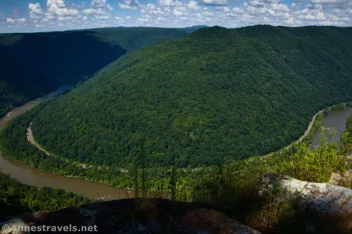
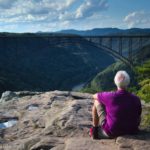
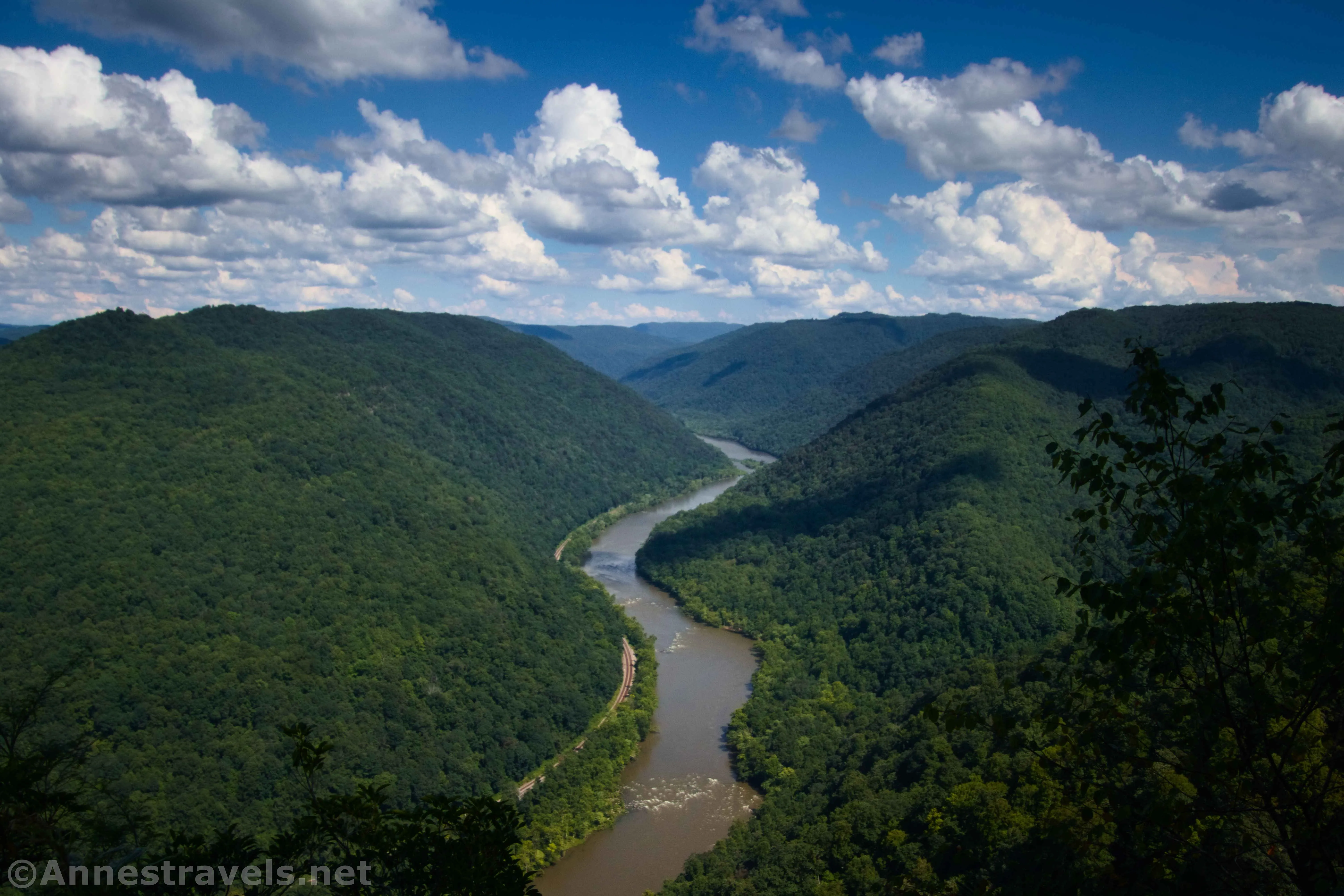
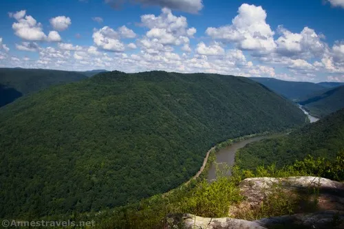
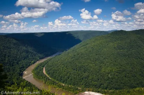
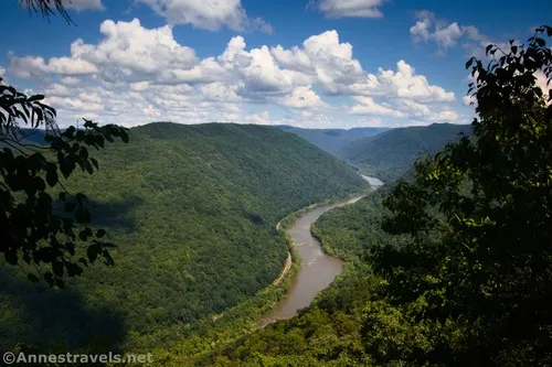
The Grandview Overlook really does have a great view. The New River makes a wide bend here, so you can see quite a distance in both directions. The slopes are forested with very little in the way of I started taking photos, but a really weird guy was soaking in the sunshine nearby. I stayed as long as there were other visitors also taking pictures, then decided I could come back later if he was gone and made a hasty departure to return to the Castle Trail.
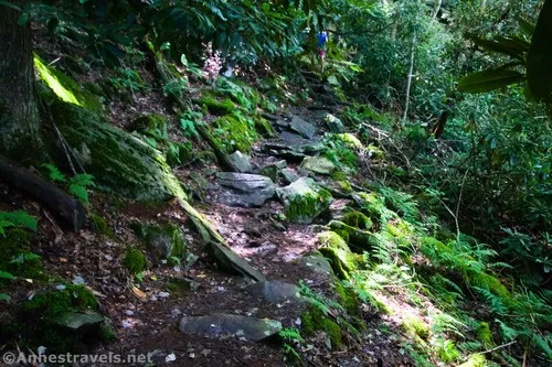
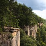
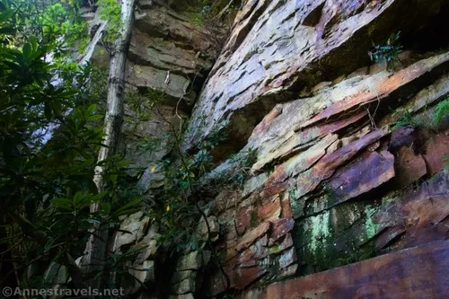
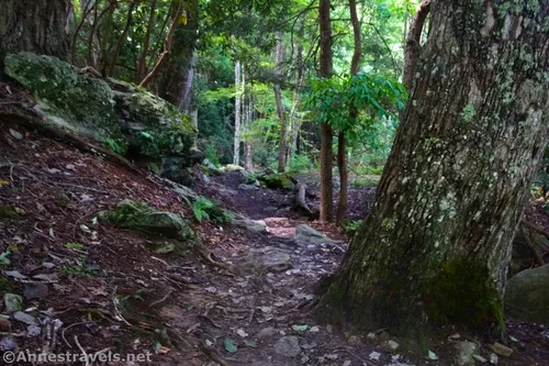
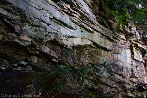
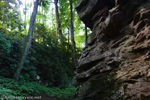
I highly recommend the Castle Trail. It’s not the easiest hiking (we’re talking rocks, roots, steps, more rocks, and a few very small trees across the trail), but it would rank as generally moderate in my world. Most of the time, it passes through the forest. But you also get some great views of cliffs on the left over its 0.7 mile length.
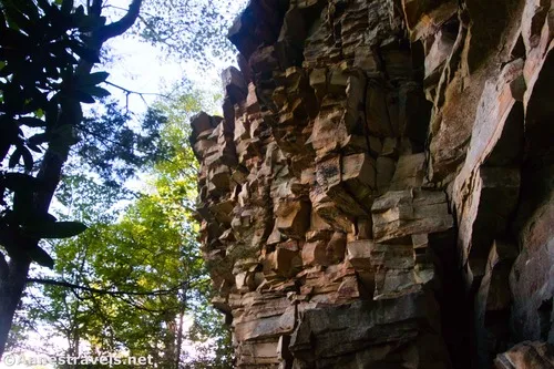
Unfortunately, my camera (or more accurately, my lens) was struggling that day. So most of my photos turned out blurry. I’ll still post a few.
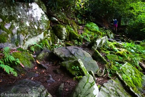
There is one especially good section that’s about a tenth of a mile or so long, right along the cliffs. So cool!
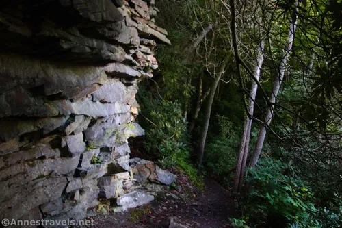
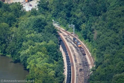
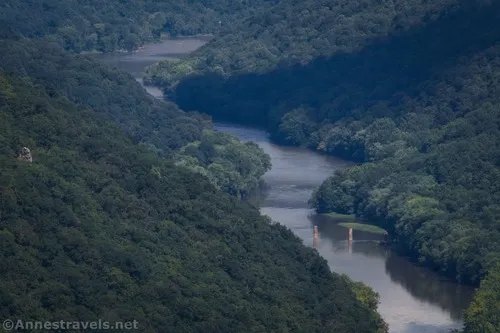
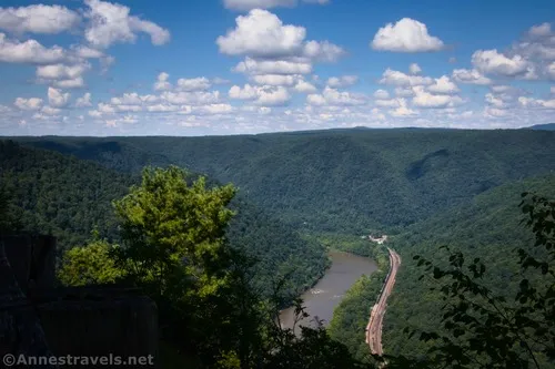
When I arrived back up at the Grandview Trail, I turned left for a tenth of a mile to the trail to North Overlook (marked simply as “overlook” on the junction sign). (Note that if I’d turned right at the Grandview Trail, I could have hiked out to Turkey Spur if it hadn’t been closed.) The view was excellent from North Overlook; not as good as the Main Overlook, but also very different. Most fascinating to me were the views down on a rail yard and a small town (I think, if I have this right, that the town’s name is Quinnimont; coal was first transported out of the gorge in 1873 from this town).
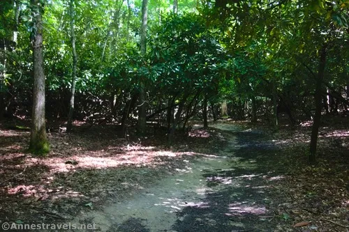
Return to the Grandview Trail, turn left, and hike back toward the sidewalk. In general, it’s a very boring trail; flat, sandy, and treed without views. However, I did find one overlook with an ok view on the left along the way.
I returned to the sidewalk about mile 2.0. The Main Overlook was empty, so I did a quick side-trip to get a few pictures before heading down the Tunnel Trail.
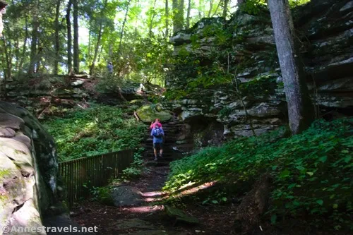
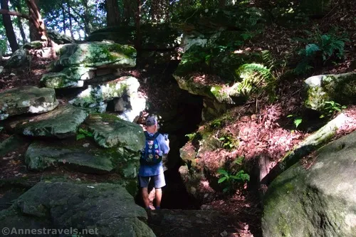
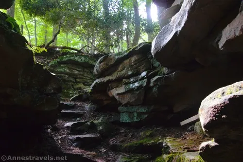
The Tunnel Trail is an interesting specimen. The path descends (relatively steeply), then a spur strikes off on the right between huge boulders about a tenth of a mile from the sidewalk. This takes you over to the Tunnel – which, due to safety concerns, has been closed off for many years. I tried to get a few photos, but it was hard going. And honestly, that boulder section was the best part of the Tunnel IMO.
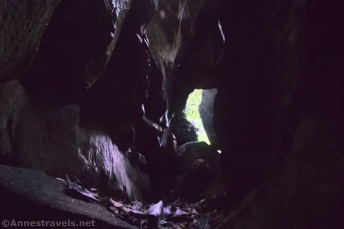
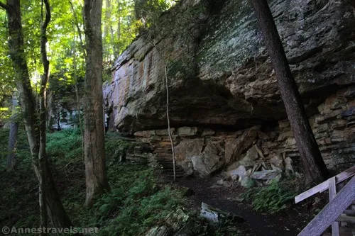
If you want to cut the trail short, climb the steps to the right of the Tunnel, then turn right to walk across the field and through the forest back to the parking area. I decided to finish off the trail, so I hiked back through the huge boulders and turned right on the main trail once again. This is a much easier (and shorter) version of the Castle Rock Trail, with similar huge cliffs on your right.
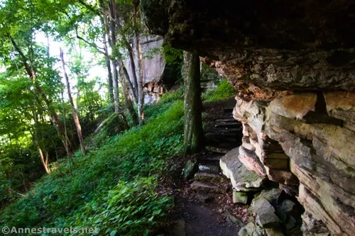
The trail finally climbs via a boardwalk back up to the rim of the gorge. When the trail spits you out of the forest, turn right to cross the field, walk through another forest, and return to the parking area. (If you’re not comfortable trying to find your way back to the parking lot – it’s not marked – turn right to hike along the edge of the forest until you see the stairs going down to the Tunnel on your right. Descend the stairs and follow the Tunnel Trail back up to the sidewalk near the Main Overlook – this will add considerable elevation gain but is a sure way of knowing where you are at any given moment.
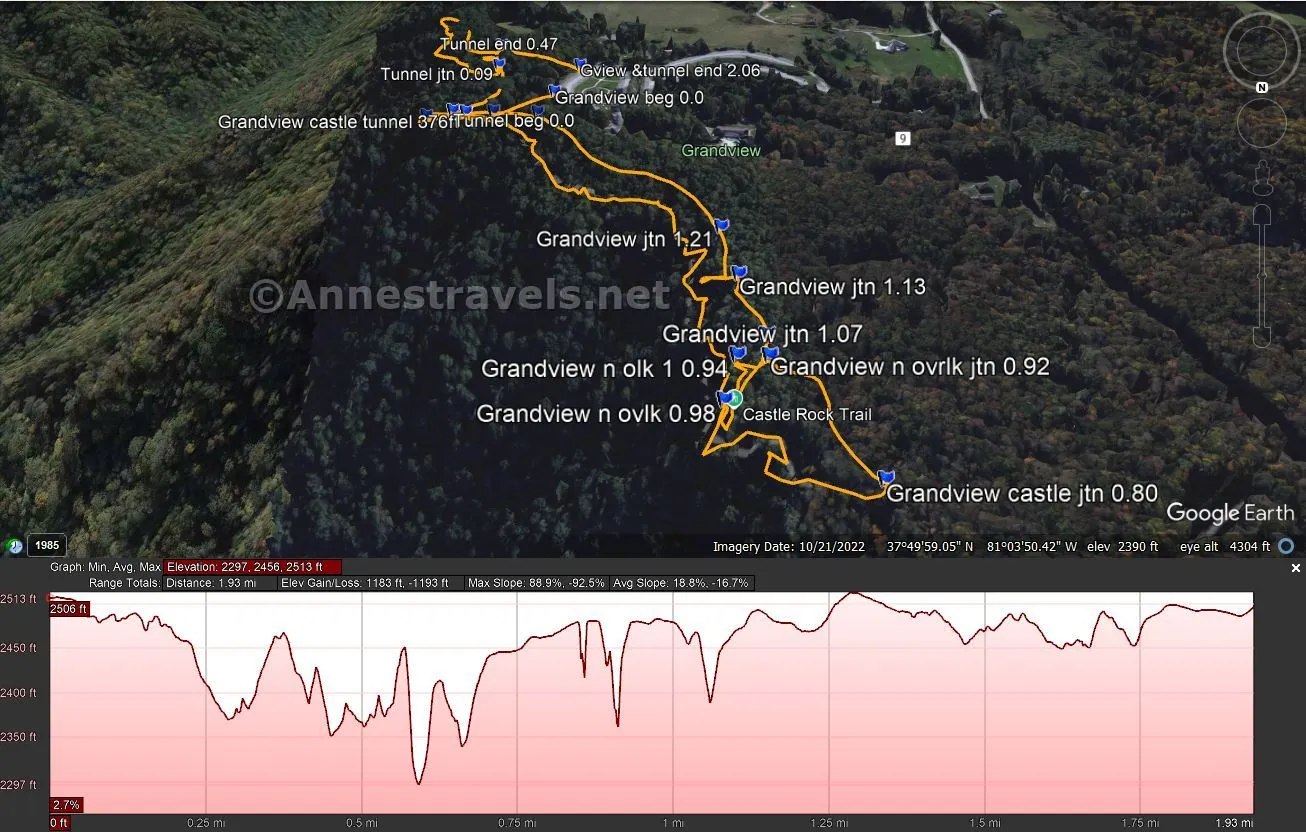
Round Trip Trail Length: To the Main Overlook and back is 0.2 miles. The Castle Rock Trail and Grandview Trail Loop (along with the Main Overlook and North Overlook) is 2.1 miles. The Tunnel Trail is about 0.5 miles.
Elevation Gain: Around 400ft. (2,297ft. to 2,513ft.)
Facilities: Restrooms at the trailhead along with picnic facilities and (occasionally) visitor center services.
Fees: None
Trail Notes: If you want to take the Castle Trail but don’t want to hike over the tangle of rocks and roots, take the Tunnel Trail instead. You’ll get a similar view without the difficult hiking. The Grandview Trail is generally flat and easy to hike, so doing an out-and-back to North Overlook is also an option. In general, the Grandview Area of the park is much quieter and much lower-key than, say, the area up by Fayetteville. There are pavilions and picnic areas scattered around the parking area, so that could be localized crowding, especially on weekends. There are many old and very historic structures, including the amphitheater, and many structures built by the CCCs. The state of West Virginia purchased the land in 1939 to make a day-use park; it was transferred to the National Park Service in 1990 and became part of New River Gorge National Park in 2020.
Trail 


Road 


Signs 


Scenery 


Would I go 100 miles out of my way for this? 


Overall Rating: 


GPS Coordinates for the Castle Rock and Grandview Trails
Trailhead: 37.830600,-81.062853 (37°49.83600′, -081°03.77118′ / 37°49’50.1600″, -081°03’46.2708″) (2,503ft.) (0.0)
Grandview Trail Junction: 37.830908,-81.062161 (37°49.85448′, -081°03.72966′ / 37°49’51.2688″, -081°03’43.7796″) (2,489ft.) (239ft.)
Castle Rock Trail & Tunnel Trail Junction: 37.830903,-81.061837 (37°49.85418′, -081°03.71022′ / 37°49’51.2508″, -081°03’42.6132″) (2,474ft.) (376ft.)
Main Overlook: 37.830899,-81.061370 (37°49.85394′, -081°03.68220′ / 37°49’51.2364″, -081°03’40.9320″) (2,422ft.) (523ft.)
Castle Rock/Grandview Trail Junction: 37.835529,-81.065760 (37°50.13174′, -081°03.94560′ / 37°50’07.9044″, -081°03’56.7360″) (2,432ft.) (0.80)
North Overlook Junction: 37.834382,-81.065012 (37°50.06292′, -081°03.90072′ / 37°50’03.7752″, -081°03’54.0432″) (2,474ft.) (0.92)
North Overlook: 37.834808,-81.064596 (37°50.08848′, -081°03.87576′ / 37°50’05.3088″, -081°03’52.5456″)( (2,442ft.) (0.98)
Trail junction: 37.834157,-81.065013 (37°50.04942′, -081°03.90078′ / 37°50’02.9652″, -081°03’54.0468″) (2,477ft.) (1.07)
Trail junction: 37.833404,-81.064828 (37°50.00424′, -081°03.88968′ / 37°50’00.2544″, -081°03’53.3808″) (2,466ft.) (1.13)
Trail junction: 37.832809,-81.064699 (37°49.96854′, -081°03.88194′ / 37°49’58.1124″, -081°03’52.9164″) (2,474ft.) (1.21)
Trail junction: 37.830967,-81.062685 (37°49.85802′, -081°03.76110′ / 37°49’51.4812″, -081°03’45.6660″) (2,511ft.) (1.39)
End (with Tunnel Trail): 37.829962,-81.063116 (37°49.79772′, -081°03.78696′ / 37°49’47.8632″, -081°03’47.2176″) (2,494ft.) (2.06)
GPS Coordinates for the Tunnel Trail
Beginning: 37.8308550°, -081.0616760° (37°49.85130′, -081°03.70056′ / 37°49’51.0780″, -081°03’42.0336″) (2,467ft.) (0.0)
Trail Junction: 37.8299010°, -081.0620890° (37°49.79406′, -081°03.72534′ / 37°49’47.6436″, -081°03’43.5204″) (2,457ft.) (0.09)
Tunnel End: 37.8294020°, -081.0620590° (37°49.76412′, -081°03.72354′ / 37°49’45.8472″, -081°03’43.4124″) (2,492ft.) (0.47)
End: 37.8299620°, -081.0631160° (37°49.79772′, -081°03.78696′ / 37°49’47.8632″, -081°03’47.2176″) (2,494ft.) (2.06)
The gpx file for the Grandview/Castle Trails Loop and the Tunnel Trail can be downloaded – please note that this and the GPS Coordinates are for reference only and should not be used as a sole resource when hiking this trail.
Download GPX File size: 36.1 KB Downloaded 151 times
(Note: I do my best to ensure that all downloads, the webpage, etc. are virus-free and accurate; however, I cannot be held responsible for any damage that might result, including but not limited to loss of data, damages to hardware, harm to users, from use of files, information, etc. from this website. Thanks!)
Getting to the Grandview area of New River Gorge National Park
If coming from I-64E, take Exit 129B and merge onto Grandview Road. If coming from I-64W, take Exit 129; stay in the right lane to merge onto Grandview Road. Drive 5 miles; when the road out to Turkey Spur turns left, you want to go right toward the visitor center. Drive about 0.2 miles to the multiple parking areas mostly centralized around the restroom. Park near the visitor center.
Today’s Featured Product
Enjoy 20 of the best hikes in New River Gorge National Park with this guide to the easier trails in the park. Besides New River Gorge, it also covers Hawks Nest State Park, Babcock State Park, and Bluestone State Park. Buy your copy here!


