Located just outside of Moab, Utah, it’s surprising that more people don’t know about Hidden Valley. If this scenic desert meadow was inside of one of the national parks in that area—Arches National Park, Canyonlands National Park, or even Canyon Rims National Recreation Area—it would probably be a popular destination for day hikers and backpackers. But, its position sandwiched between Hwy 191 and a network of 4×4 roads keeps this pristine vista from being discovered, except by locals and those who investigate BLM brochures on area destinations.
To get to the parking area for Hidden Valley, take Hwy 191 3 miles south of Moab. To Angel Rock Road. Turn right; after 2 blocks turn right again onto Rimrock Road. This road will take you the to parking area, a large, dirt lot where you can park your vehicle. There is a trail register where you can sign in. The trail starts at the south end of the parking lot.
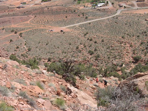
The trail, which is about 2 miles long (one way) and has a 680 ft. elevation gain, starts out from the parking area fairly flat, but soon begins to climb steeply uphill. Don’t underestimate this part of the trail: in the morning and middle of the day, it is directly in the sun and can be quite grueling, owing to the heat, the steepness and rockiness of the trail, and the sun’s intensity. The trail switchbacks its way up past huge boulders and smaller rocks. It just keeps going up, and up, and up!
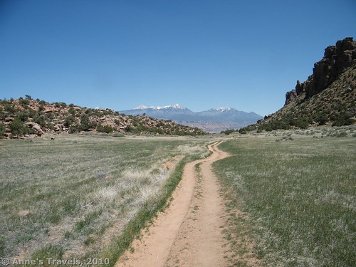
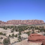
Then suddenly you reach the top of the hill and enter a totally different world. Instead of the rocky hillside and desert scrub vegetation, you are in a valley that is filled with, of all things, grass! It’s dry, sort of yellow/brown grass, but it is grass. The valley floor itself is flat, and the canyon walls are made of classic Utah red sandstone. The walls themselves tower above you in fantastic formations, but the valley is quite wide enough to allow the sun to come it. It’s pretty still here without much breeze, so I wouldn’t recommend this hike in the summer. Even in May it was warmer than we appreciated.
And the view! Not only do you have the desert meadow all around you and the fantastic canyon walls; you also have the La Sal Mountains behind you. In May, these still had snow on them, which made for stunning scenery. Think: dry grass in the foreground, red rocks to really make you think “desert”, and then the snow-capped La Sals in the background. I don’t think I’ve ever seen anything quite like it in all of my travels.
The valley itself is probably about a ½ mile long. Then you reach a wall of rock, and, although the trail continues, you are definitely out of the meadow and into the rocky, dry desert again.
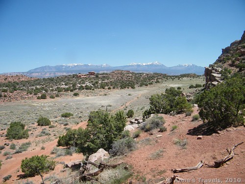
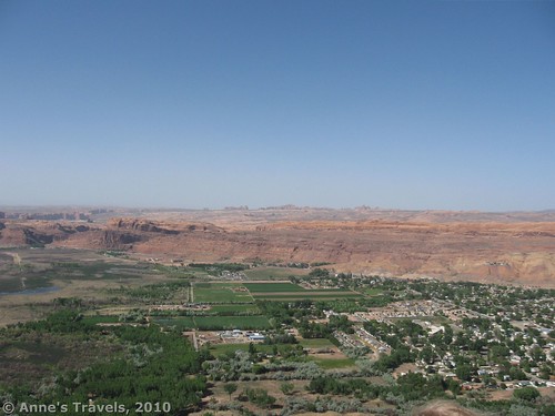
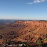
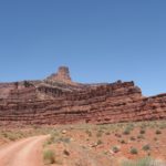
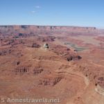
You can stop here, or you can keep going down another canyon (which, if I remember correctly, had pictographs on the walls) another 1/3 of a mile to the network of 4×4 roads I mentioned earlier. This is known as the Moab Rim Trail. With a good sense of direction, we did this, following a trail down the canyon and then on to the dirt road. (It would be much better to have a map and a compass—we’d seen the map and knew what we were doing, but I don’t want to be held responsible for someone trying this…!) We hiked down the road for at least 3 more miles and came out at the Moab Rim Trail parking area on Kane Creek Boulevard, 2.6 miles northwest of its intersection with Hwy 191 in Moab. The good thing about hiking the Moab Rim Trail is that you can look back the way you came and see the La Sal Mountains peaking up from behind the red rock formations. It is also just a nice hike through formations and Utah desert scenery. About halfway to Kane Creek Blvd there was a very nice overlook of Moab. Amazingly, there were fences, and maybe even an outhouse. I wonder what it used to be?
Half of our group had opted to go back down the Hidden Valley Trail, so they brought our vehicle around to the Moab Rim Parking area (which, by the way, is 0.1 miles after the first cattle guard). This was really nice, as we didn’t have to hike back the entire way we came. If you don’t have this opportunity and you want a shorter hike, I would suggest turning around after the Moab viewpoint, as the scenery, in my opinion, wasn’t as good after that. However, by going to the place where the 4×4 road descends to Kane Creek Blvd, you can see the Colorado River from about 100 feet above it.
Two words of caution: First, bring plenty of food and water with you. We’ve found when hiking that people hike on their stomach; in other words, if they’re hungry, they won’t hike well. Water is essential for anyone hiking in the desert, but this trail and road offer virtually no shade, which makes it especially important for hikers to drink plenty of water. (I’ve since read that the Hidden Valley Trail is in the shade in the afternoon, but I don’t think the road is in shade at any time of the day.) Second, the 4×4 roads are made for off-road vehicles, and I’m not sure 4×4 alone would be enough to get you across slick rock, through sand, and over the potholes that we saw as we walked along (bikers would probably have a blast). Check with local experts to find out current conditions.
Trail 


Road 


Signs 


Scenery 


Overall Rating: 


This Week’s Featured Product!
Look beyond the famous national parks with this guide. While it does suggest some in the parks (Arches, specifically), it also covers quite a few trails in wilderness areas around Moab.


Thank you a lot for giving everyone remarkably splendid opportunity to check tips from this website. It is usually very great and jam-packed with fun for me personally and my office co-workers to search your site. Not to mention, we’re usually fascinated with the information.
This website has some very helpful info on it! Cheers for helping me.
Maintain the excellent job mate. This web blog shows how well you comprehend and know this subject.
I’m new to your blog and i really appreciate the nice posts and great layout.:.;,’
The color of your blog is quite great. i would love to have those colors too on my blog.
Pingback: Celebrating 20 Years of Family Vacation - Anne's Travels