Growing up within 30 minutes or so of the Erie Canal, I’m surprised we didn’t walk on the canal path more often. We have done at least two bike rides on the canal path (one from Rochester to Fairport and once from Fairport to Newark) in recent years. But when we got kayaks, I wanted to try them out on the Erie Canal. I was a little worried about the motorboats and other crafts I’d seen while biking the canal path – being charged by a motor cruiser isn’t exactly my idea of fun. It turns out that the Erie Canal is a great place to kayak and you can even go through the locks – which is totally cool!
We put our kayaks in at the Pittsford Rowing Club boat ramp. There is space for about 3-4 vehicles next to the ramp and several more by the road coming in (including vehicles with trailers). Be sure not to park in the parking area for the Rowing Club.
There is a dock you can use to launch the kayaks. I’m still not used to getting into the kayaks from a dock, but I didn’t fall in. (Actually it’s not that hard, I just need a little more practice!)
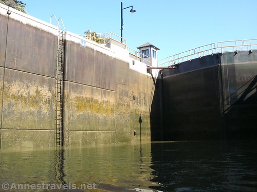
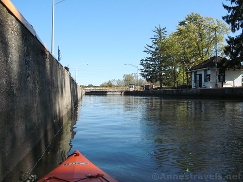
We turned left and almost immediately encountered Lock 32. I had read that we should call the person running the lock, and so I called on our cell phone (phone numbers for the locks are available on the Erie Canalway website). The man who answered told us to wait on this side of the bridge until the gates were fully open and then to enter the lock.
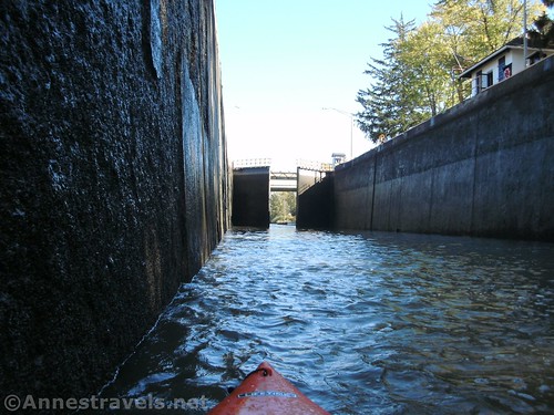
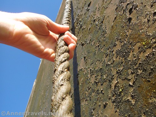
We did so and then the man shouted instructions down to us (sometimes they call instead of shouting). In this case, he wanted us to hold onto the ropes on the sides of the lock closest to the gates on the up-canal side. The rope was a little slimy but not too bad. I had brought plastic gloves with me, but I didn’t use them.
The lock filled with water (it’s not a bad motion; it’s actually quite pleasant) and then the man opened the locks and told us he’d let the guy at the next lock (Lock 33) know that we were coming. (Yes, they will run the lock for a single canoe or kayak if needed – they would rather have several boats, obviously, since it takes time, but if you’re the only one there, no problem!)
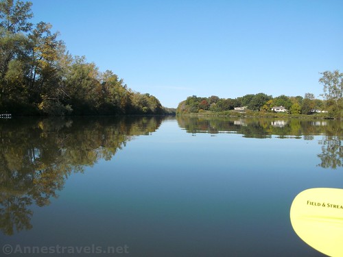
The area just above Lock 32 is peaceful and quiet. I saw a few water birds (including a heron that flew away before I could get a photo) and jumping fish. We paddled lazily for less than a mile up to Lock 33 and again I called the lock operator. He had the gates open and told us to come on in.
Again we held onto the ropes (not too slimy; this guy didn’t care where in the lock we were as long as we were holding onto the ropes). Again the lock gates closed (gulp!) and the water rose. It’s hard to get good photos of it because the locks are so deep and it was early morning.
The Erie Canal goes back to being pretty normal above Lock 33. The Canal Path is on the bank on the north side (there’s also a more primitive path on the south bank) and the scenery is peaceful but not especially exciting. The leaves were turning, which was pretty. We paddled up to I-390, where a dock is between the two highways.
If we had continued, we would have fairly quickly come to REI and Costco. I would have liked to paddle up to the guard locks or even the Genesee River, but we had told my sister (who works nearby) that we might meet her in Meridian Center Park for lunch, so we wanted to get back in time to meet her.
We had a nice brown-bag lunch (actually Rubbermaid containers – they seal so I knew if I accidentally dropped one in the canal the food would stay clean) and then began back downstream.
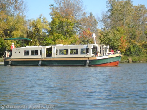
We met more people in the locks in the early afternoon. Lock 33 was pretty much the same except that we were going down instead of up. In Lock 32 we went down with a packet boat that is now used for tours. Because of the number of boats in the lock, the lockmaster asked one of us to hold onto a rope and the other to hold onto the ladder that descends into the lock. I decided I’d hold onto the ladder.
Just before we started going down, the captain of the Packet Boat suggested I might want gloves. “It can get pretty slimy,” he said nonchalantly. I pulled out my gloves just in time to hold tight as the water started to go down. All I can say is that “pretty slimy” was a very kind way to say what that ladder felt like. Through the gloves I could feel the 3D oozing, slimy, smelly gunk all over the rungs of the ladder. Three cheers for gloves… I don’t think I could have done it with bare hands!
We paddled out of the lock just in time for a larger boat to come up from below. We passed in the canal below the bridge and both the people on the boat and us took photos of the other.
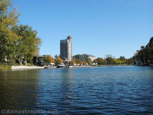
We had a little extra time, so I decided we should go down to Pittsford. I knew there was an old rail bridge just before the charming town, so I figured that would be a great place to turn around. Shortly after passing the boat ramp, we passed “Kings Bend” where the Erie Canal once turned northward to go through Rochester. At this point, it’s just a swampy stream.
The trek to Pittsford was a bit longer than I had planned (oops!) but we had fun. Along the way, we passed one of the maintenance sheds for the canal. Pittsford itself is a great place to be if you like charming old towns. There was an ice cream place and restaurant down by the canal, but we turned around and went back (I knew we were having homemade Ruben’s for supper so I didn’t want to ruin my appetite!)
On our way, we met some of the youth rowing crews. Some of the kids looked like they were having fun, and others looked bored. Oh well.
We pulled back up to the dock just as another boat was being pulled up on the boat ramp. Because we couldn’t use the ramp, it was a little more exciting to get the kayaks up on the dock (much easier with two people, for sure!) But we did it and loaded the kayaks back in the van.
Over all we kayaked 9 miles – you can easily shorten or lengthen the distance. But overall it was a great fall day on the canal and I can’t wait until they open the canal again in the spring!
Round Trip Paddle Length: I went from the boat launch below Lock 32 to I-390, then down to Pittsford, then back to the boat launch for a total of 9 miles. Just up to I-390 and back would be about 6 miles; just to Pittsford and back would be about 3 miles (with no locks).
Facilities: There are restrooms and picnic tables in Meridian Center Park and at the parks by the locks (most locks have a launch for small crafts like kayaks). You can use the restrooms at the Pittsford Public Library and there are restaurants and charming shops near the library.
Fees: None at this point – the locks are paid for by New York State via Thruway Tolls and tax dollars. At some future point, larger boats may need to pay; look it up before you go.
Paddle Notes: Be sure you’re through the locks before they close for the evening – it would be a long and possibly arduous portage around the locks. When you go into a lock, follow the lock operator’s instructions, whatever they happen to tell you. I felt very safe leaving my van in the parking area – Pittsford isn’t exactly a sketchy area. Note that life vests are required. You’re also supposed to have a flashlight, whistle, and phone. Any questions, look up https://eriecanalway.org/explore and they’ll probably have the answer. Find the “Download the Guidebook” on https://eriecanalway.org/explore/watertrail for great maps.
Signs 


Parking 


Scenery 


Interest 


Fun Factor 


Personnel 


Ease of access 


Would I go 100 miles out of my way for this? 


Overall Rating: 


Key Mileages for Kayaking the Pittsford to I-390 Section of the Erie Canal
Dock under I-390 – mile 253.5
Lock 32 – mile 255.1
Lock 33 – mile 256.4
Kings Bend – mile 254.75
Pittsford – mile 258.0
Getting to the Erie Canal Boat Launch by the Pittsford Rowing Club
Pittsford Rowing Club Boat Launch: 43.090552, -77.541587 (43°05.43312′, -077°32.49522′ / 43°05’25.9872″, -077°32’29.7132″)
From the north, take I-590 South. Take Exit 2B onto NY-31E/Monroe Avenue. After 0.6 miles, turn right onto NY-65S/Clover Street. Continue 1.5 miles; just after crossing the canal, turn left in the non-auspicious driveway for the Pittsford Rowing Club. Turn left before entering the Rowing Club parking lot; there is parking for trailers near the road in; smaller vehicles can park along the road to the boat launch.
From the south, take I-490 to Exit 26 to NY-31 and Pittsford. Turn right to take NY-31W almost a mile, then turn left onto Mitchell Road for another 0.4 miles. Turn right onto NY-96N/E Jefferson Road. After 1.9 miles, turn right onto NY-65N. Only 0.2 miles later, just before crossing the canal, take a very sharp right into the non-auspicious driveway for the Pittsford Rowing Club. Turn left before entering the Rowing Club parking lot; there is parking for trailers near the road in; smaller vehicles can park along the road to the boat launch.
The I-390 Kayak Launch is at 43.105521, -77.599440 (43°06.33126′, -077°35.96640′ / 43°06’19.8756″, -077°35’57.9840″)
Zoom map out to browse nearby hikes & places of interest
This Week’s Featured Product!
You may think it strange to be promoting a book on cycling in a post about paddling, but the good thing about this book is its content. Maps, mileages, features, and more are useful to anyone recreating on the Erie Canal or Erie Canal path.


