Most people who drive to the Keane Wonder Trailhead do so to walk up to the ruins of the Keane Wonder Mill. Many also climb the steep trail up to the old workings of the Keane Wonder Mine and the top of the aerial tramway. To be fair, that’s the most impressive of the hikes from the trailhead. But for a very different experience – and a change of scenery – I also recommend hiking to the Keane Spring and John Cyty’s Cabin.
Quick Stats
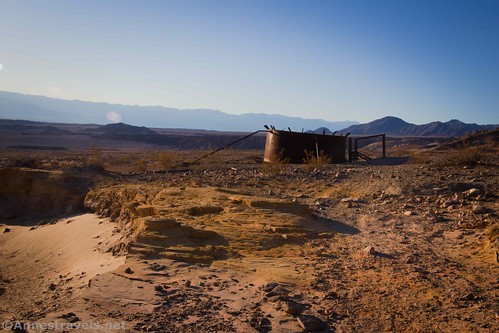
The trail is mostly flat and it’s typically easy to find. However, the trail at the trailhead is anything but easy to follow. I’d hiked to the spring once before about 20 years ago, and I still got lost trying to find the trail from the parking area. Your best bet is to strike out north along the base of the hills – keep your eyes open for trails that head north as well as the old, rusty pipeline. You’ll be following the pipeline most of the way, so it makes a great landmark. After walking for a short distance, you should find one (or both) trails that lead generally north along the pipeline.
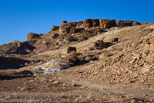
Instead of following this advice, we hiked up to the Keane Wonder Mill Site and then turned left on an established trail. This was interesting in its own right, as it passes several old ruins and finally ends at an old outhouse about 0.3 miles from the parking area. From there, we dropped down a steep, not very stable hillside and picked up the trail along the pipeline.
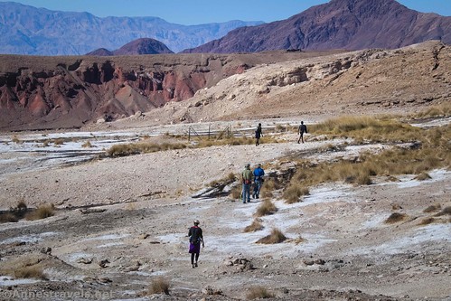
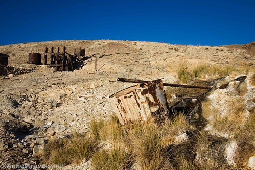
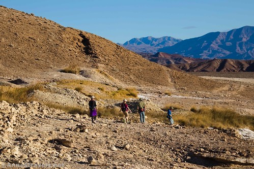
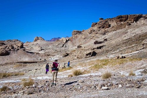
The trail to Keane Spring heads generally north along the base of the hills. Views are reasonably good along the way, although they get better as you walk further. Keep your eyes open for relics from the significant mining that took place in this area.
Keane Spring was an important part of the mining history of the area near the Keane Wonder Mine and the entire Bullfrog District. Water is a precious commodity in Death Valley, and the spring allowed the workers to survive and the mines to purify the ore to some extent before it was shipped to better refineries. However, the spring could only produce enough water to keep the Keane Wonder Mine purification processes at a low volume. The mine owner drilled another well near the mine site – but instead of striking water, he found another gold vein. So the new well was moved elsewhere.
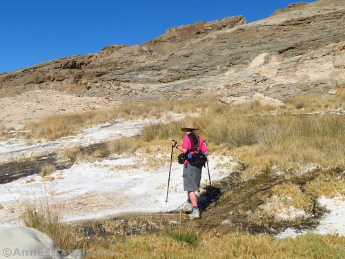
About 1.2 miles from the parking area, the trail comes to the outlet of the Keane Spring. In November, it was a trickle of water running down over dry ground. The water channels were incredibly disgusting, but I suppose they could be called pretty with the different colors of algae.
Nearby is an old collection tank. The water in that was even grosser than the flowing water. Those miners must have been pretty thirsty to drink that stuff!
I scrambled up to the source of Keane Spring. It’s just a lot of rushes with more desert beyond. Actually, just above the spring is a closed-off mine shaft. There is also a wildlife camera at the spring. And since I’ve now told you everything that’s there, you aren’t obligated to walk up to the source of the spring. It’s not really all that exciting.
On my first visit to Keane Spring, we had found a small arch near the spring. Unfortunately, I didn’t locate it this time. Maybe that was because I was distracted by the thought of hiking up to John Cyty’s cabin and stamp mill about a half a mile beyond Keane Spring.
“Old Johnnie” Cyty was a bit of a scoundrel, but he also played a role in the later years of the Keane Wonder Mine. He wasn’t very popular around Rhyolite – possibly because of his tendency to pull a gun to settle disputes – so when both he and another man (who was quite popular with the townspeople) both claimed to have staked gold mines on the same property, it’s not surprising that sympathies lay with the other party.
Exactly what happened is up for debate, but suffice to say that Johnnie Cyty won the dispute with his pistol. He was charged with murder – though it was unclear who had pulled a gun first – and sentenced to jail. Rhyolite residents thought he’d gotten off too easy, but within a few years, Old Johnnie was back at his claim, prospecting for gold. He built the cabin that still stands and the stamp mill behind it, transporting ore down from mines and prospects higher in the mountains.
As the years moved on, Old Johnnie became the caretaker of the buildings around the Keane Wonder Mine. He would entertain early travelers to Death Valley with stories of prospectors and explorers around campfires, but woe to you if you as much as took a handful of hay from the Keane Wonder property!
Old Johnnie Cyty never made big money on his mine, but his cabin and mill are still worth visiting, in part because they’re still in fairly good condition. The scenery improves between the Keane Spring and John Cyty’s cabin; you’ll pass by a couple of other small springs/water holding tanks along the way.
We didn’t go into the cabin (it didn’t look strong enough for that), but we did take pictures and walked around the outside. We also took a good look at the stamp mill, which was mostly intact. There’s even ore or rocks in the ore loader.
From here, you have a choice: You can return to the parking area for a 3.6 mile out & back hike, or else you can continue up the very steep trail toward the Big Bell Extension. Given the views from the longer hike, I can highly recommend it if you have time… but that’s a topic for another post!
Round Trip Length: 3.6 miles to John Cyty’s cabin; only 2.6 miles if you just go to Keane Spring
Elevation Gain: 668ft. (1,182ft. to 1,423ft.)
Facilities: None
Fees: $30/vehicle/7 days to enter Death Valley National Park. America the Beautiful National Park & Federal Lands Passes and Death Valley Annual Passes are also accepted.
Trail Notes: This is a very dry trail. Bring plenty of water and don’t attempt the hike it in the middle of the day in the spring, summer, or fall. The trail is also somewhat vague; you should be ready for self-rescue if necessary. Swimming is not allowed in the spring or tanks along the way (eeeewww!) Do not deface or in any way disturb the historical relics along the trail, including the cabin and mill.
Trail 


Road 


Signs 


Scenery 


Would I go 100 miles out of my way for this? 


Overall Rating: 


GPS Coordinates for the Keane Spring and John Cyty’s Cabin
TH (for the Keane Wonder Mine): 36.6681000°, -116.9104167° (N36° 40.086′ W116° 54.625′ / 36°40’05.1600″, -116°54’37.5000″) (1,267ft.) (0.0)
Junction: 36.6692333°, -116.9095667° (N36° 40.154′ W116° 54.574′ / 36°40’09.2400″, -116°54’34.4400″) (1,406ft.) (0.11)
Out House: 36.6699000°, -116.9111333° (N36° 40.194′ W116° 54.668′ / 36°40’11.6400″, -116°54’40.0800″) (1,411ft.) (0.29)
End (aka the real trailhead): 36.6678000°, -116.9107333° (N36° 40.068′ W116° 54.644′ / 36°40’04.0800″, -116°54’38.6400″) (1,301ft.) (7.07)
Keane Spring: 36.6734667°, -116.9209167° (N36° 40.408′ W116° 55.255′ / 36°40’24.4800″, -116°55’15.3000″) (1,296ft.) (1.36)
John Cyty’s Cabin & Mill: 36.6761667°, -116.9268167° (N36° 40.570′ W116° 55.609′ / 36°40’34.2000″, -116°55’36.5400″) (1,252ft.) (1.85)
The gpx file for the Keane Wonder Spring and John Cyty’s Cabin can be downloaded – please note that this and the GPS Coordinates are for reference only and should not be used as a sole resource when hiking this trail.
Download GPX File size: 83.6 KB Downloaded 300 times
(Note: I do my best to ensure that all downloads, the webpage, etc. are virus-free and accurate; however, I cannot be held responsible for any damage that might result, including but not limited to loss of data, damages to hardware, harm to users, from use of files, information, etc. from this website. Thanks!)
Getting to the Keane Spring Trailhead
From the Furnace Creek Visitor Center, turn left onto CA-190W. After 10.6 miles, turn right onto the road marked for Beatty. Drive 5.7 miles and turn right onto the well-graded dirt road to Keane Wonder. Park at the end of the road, 2.8 miles later.
The turnoff on the dirt road is 4.3 miles south of Daylight Pass Junction, where the Beatty Road meets the Daylight Pass Road at an information station with a kiosk and restrooms.
Note that the road to the Keane Spring Trailhead is gravel. While it is usually accessible to low-clearance vehicles, floods may temporarily close the road or make it high clearance only.
This Week’s Featured Product!
With more than just trails, this guide to Death Valley delves deeply into the history that made the region what it is today. It also covers trails and mines to visit and the flora, fauna, and geography of the park.


