In August, we “just happened” to be driving through Colorado on Colorado Day, when the state parks in the state offer free admission. I’d always wanted to check out State Forest State Park (who wouldn’t, with a memorable name like that?), so we ended up spending about half a day hiking up to Lake Agnes and back. The lake itself was pretty, but the really exciting thing was exploring an old dam and mine entrance on an offshoot trail about halfway to the lake. I’d say most of the other people on the trail were anglers, but with such a short (if steep) trail (it’s only 0.8 miles (1.2 km) OW with almost 500ft. (150 m) elevation gain), it makes for a nice hike on a day when you want to take it easy or have young children. After all, I’ve never known a child who doesn’t like throwing stones into a lake!
We finally arrived at the parking area about 10am, a couple hours later than we really wanted due to State Forest State Park not publicizing free admission (though the staff cheerfully honored it when requested) and having to drive in from Wyoming where we’d slept the night before. However, we ate a hasty lunch (remember, that’s noon Eastern Time), checked out the remarkable bathrooms, and headed up the trail. The trail begins behind the building to the right of the bathrooms. At first, it is fairly flat in a desert meadow. However, it soon begins to climb, switchbacking its way upward at an alarming rate. Don’t worry if you have to stop and catch your breath fairly often – you’re over 10,000 ft. (3,000 m) above sea level!
At 0.3 miles (0.5 km), the Lake Agnes Trail connects with the Michigan Ditch Trail; the trail looked nice, though we didn’t have the time to check it out. This is the way you’d go to get to the dam and mine; but more on that later.
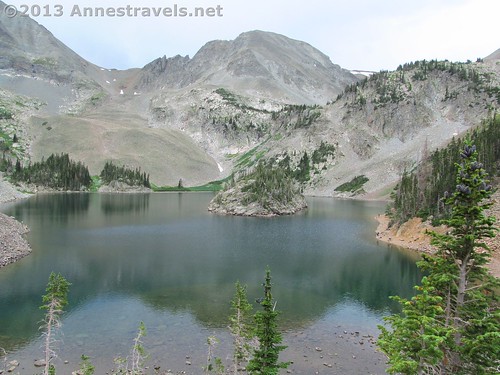
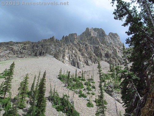
After the trail junction, the Lake Agnes Trail continues its relentless switchbacks. Then – finally – after another 0.4 miles (0.6 km), the trail splits near a sign that tells you there’s only 0.1 more mile (0.2 km) to the lake. It doesn’t matter which way you go because both will end up in the same place eventually. I went right up the rocky path, which finally levels out in a grove of pine trees. Take a few steps more, and, voila! There is Lake Agnes!
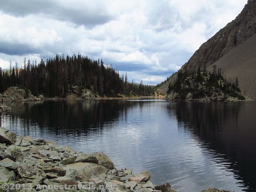
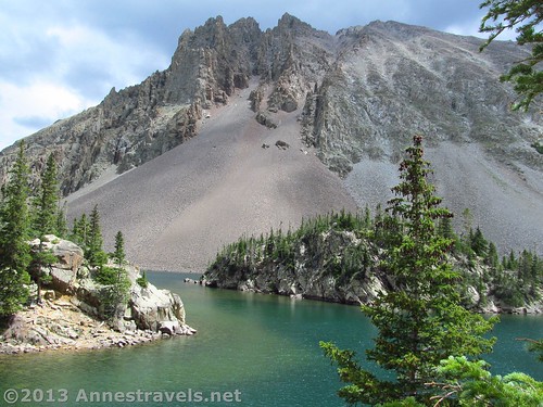
Looking back at the outlet from the north side of the lake (the small bay is just out of sight on the left)
From here, the trail goes right and left; take the left trail for now (it appears that most people take the right fork). The steep trail goes down to the lakeshore, then begins to circle the lake. This trail is often recommend by the park staff; however, it is more of a route than a trail and is no easy feat. We decided to forgo it, taking a left near the lake’s outlet to scramble up on the rocks for a beautiful view of the lake. Wow! This outlet is considered to be the headwaters of one of the major tributaries of the Upper North Platte River.
By this time, the clouds had rolled in, and we even got some drops of rain and heard some thunder. This didn’t make us too keen on staying, but nor did it make us want to walk through a pine forest back to the parking lot. So, we stayed put until the storm passed over and we could walk around without getting rained on.
From here, we walked back along the lakeshore to where the right trail comes down. We kept walking until a large rock outcropping protruding into the water blocked our way. This is obviously where most people stop. However, if you don’t mind scrambling and finding your own trails, you can scale the rock, scramble across the top and down the other side, and then take the trail as it continues to circle Lake Agnes.
Being us, of course we scrambled over the rock, located the trail on the other side, and kept walking. There are at least half dozen social trails over the rock, so take whichever one looks best for your abilities. The trail on the other side isn’t too difficult to find, although you may have to keep walking around the small bay to find it. By the time I reached the other side of the bay, it was easy to locate and stay on the trail.
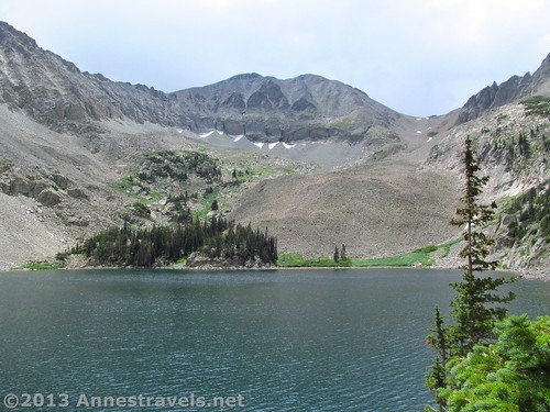
Not long after the trail leaves the bay behind, a large rock outcropping will jut out into the lake. This can be fun to sit on and enjoy the scenery. A couple of us did this; then the rest of the group joined us so we kept walking another couple hundred feet (60 m or so) on the trail, which grew more and more vague the further we went. We finally decided that neither the view nor the trail was getting any better (aka, the view was still very nice), so we settled down to let the children throw rocks and generally enjoy Lake Agnes. There weren’t any anglers nearby, but we saw plenty of fish swimming in the water. You can continue as far as you want around the lake. We watched a woman with a child in her backpack walk around the lake, and she looked like she was having quite a bit of trouble on the far end of the lake.
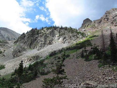
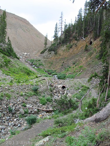
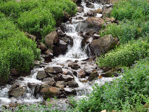
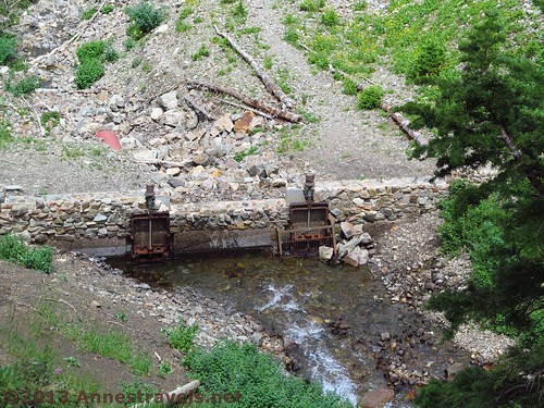
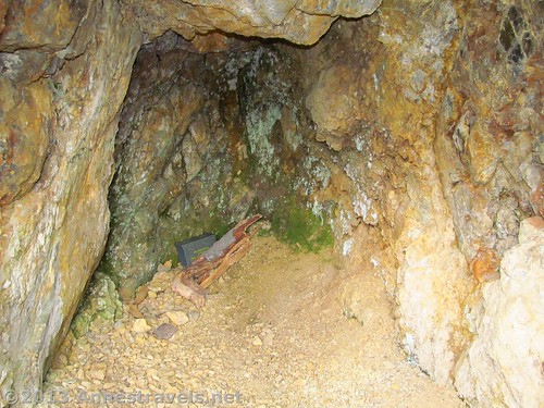
Return by the way you came. On our return trek, we decided to check out the first 0.1 miles (0.2 km)or so of the Michigan Ditch Trail. There were definitely some nice views to be had, but what was most exciting was that the trail crossed an old dam. The stream before the dam was a lovely waterfall, and up above was what appeared to be an old mine. Curious, several us scrambled up the ball-bearing-like gravely social trail to the entrance – only to discover that it isn’t more than about 8 feet (2 m) deep. A geocache box is located in the back of the cave.
Although this isn’t an all-day excursion by any means, it made for a fun little hike on an otherwise down-day. It would also be a great place to hike to with small children or a group that wants a challenging hike but isn’t used to hiking.
Round Trip Trail Length: Per the signs, as low as 1.6 miles (2.5 km); my GPS read 2.9 miles (4.6 km) at the end of the trail
Elevation Gain/Loss: Per the signs, 480 feet (146 m); my GPS read closer to 465 feet (141 m)
Facilities: Primitive restrooms at the trailhead; the restroom building is worth checking out even if you don’t use the facilities!
Fees: $7 per day; Colorado State Park Annual Passes also accepted (Interagency Passes not accepted)
Trail 


Road 


Signs 


Scenery 


Would I go 100 miles out of my way for this? 


Overall Rating: 


Key GPS Coordinates for the Agnes Lake Trail
Lake Agnes Parking Area: 40.49017N / 105.90332W (10,239ft.; 3,120 m)
Beginning of Lake Agnes Trail: 40.48989N / 105.90328W (10,244ft.; 3,122 m)
Agnes Lake Trail/Michigan Ditch Trail Junction: 40.48763N / 105.90240W (10,376ft.; 3,162 m)
Dam near Lake Agnes: 40.48709N / 105.90212W (10,438ft.; 3,181 m)
“Mine” above the dam: 40.48684N / 105.90224W (10,485ft.; 3,195 m)
Trail split 0.1 mile from Lake Agnes: 40.48485N / 105.90252W (10,621ft.; 3.237 m)
Trail split at the lake: 40.48426N / 105.90257W (10,634ft.; 3,241 m)
Lakeshore where we turned up to sit on the rocks and wait out the storm: 40.48409N / 105.90215W (10,632ft.; 3,240 m)
Viewpoint where we sat on the rocks to wait out the storm: 40.48420N / 105.90228W (10,654ft.; 3,247 m)
Rock outcropping beyond the small bay: 40.48227N / 105.90463W (10,662ft.; 3,249 m)
The gpx file for the Lake Anges Trail can be downloaded – please note that this is for reference only and should not be used as a sole resource when hiking this trail.
Download GPS File File size: 82.3 KB Downloaded 505 times
(Note: I do my best to ensure that all downloads, the webpage, etc. are virus-free and accurate; however, I cannot be held responsible for any damage that might result, including but not limited to loss of data, damages to hardware, harm to users, from use of files, information, etc. from this website. Thanks!)
Getting to the Agnes Lake Trail
From the North/West: From the tiny town of Walden, CO, take CO-14 E for almost 28 miles (45 km) to a dirt road on your right. A sign should mark this junction. Take this road, stopping (if necessary) to pay the entrance fee. Keep driving to the valley bottom, being on the sharp lookout for vehicles coming toward you; this is definitely a one-lane road with virtually no place to turn around. When you reach the bottom of the valley, turn right to cross the bridge; then take the road as it begins to steeply go uphill. Follow this road to its end at the Lake Agnes Trailhead.
From the East: From I-25 in Fort Collins, take Exit 269 onto CO-14 W. Almost 4 miles later (6.5 km), CO-14 will turn right and merge with US-187 N; turn right to follow CO-14. Continue 10.3 miles (16.5 km); turn left to stay on CO-14 W. After another 60 miles (96 km), look for a dirt road on the left. (Warning: CO-14 is a bit of a crazy mountain road; I wouldn’t recommend traveling it at night or in cold, wet weather.) Take the dirt road, stopping (if necessary) to pay the entrance fee. Keep driving to the valley bottom, being on the sharp lookout for vehicles coming toward you; this is definitely as one-lane road with virtually no place to turn around. When you reach the bottom of the valley, turn right to cross the bridge; then take the road as it begins to steeply go uphill. Follow this road to its end at the Lake Agnes Trailhead.
From the South: From I-70, take US-40 at Exit 232 north for 48 miles (77 km); turn right on CO-125 after the town of Granby. (This will be just after the turnoff for Rocky Mountain National Park.) Drive another 53 miles (85 km); turn onto CO-14 E in Walden and follow the directions for “From the North/West”.
This Week’s Featured Product!
Enjoy fly fishing and Colorado? This is the reference book for you! The book covers the major rivers where fish can be caught, as well as many streams. Maps help you find the best place to go on each river to catch yourself some prize-winning fish…or just where to spend a quiet day in the wilderness.

