Little Wildhorse Canyon may be the most famous slot canyon in Utah. It’s certainly up there, along with Buckskin Gulch, Peek-a-boo and Spooky Slots, Kanarra Creek, and the Zion Narrows (which are unarguably the most famous and also not really a slot canyon IMO). Little Wildhorse is a great introduction to slot canyons, as it features narrow passages, cool stripes and rock formations, and a few scrambles without any rope-worthy technical sections. Even if you’ve done slot canyons before (I have!), it’s still a worthwhile destination – it’s just that pretty!
Quick Stats
Most people who hike the entirety of Little Wildhorse Canyon (you don’t need to do the entire thing to see cool stuff) tack on Bell Canyon as a lollipop loop. I did this, too; just realize that Little Wildhorse is much more interesting and more difficult than Bell (which is mostly just a stroll through a narrow but rarely slotty canyon). I’d still recommend the loop to avoid having to pass quite so many people while scrambling back down Little Wildhorse. Also, the hike between the two canyons has some good views. However, due to the length of the hike and the number of photos, I’m going to write about descending Bell Canyon in a separate post.
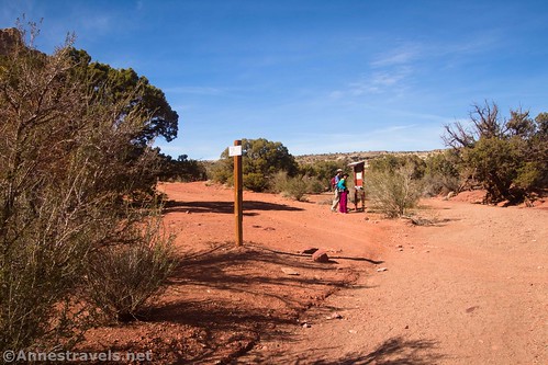
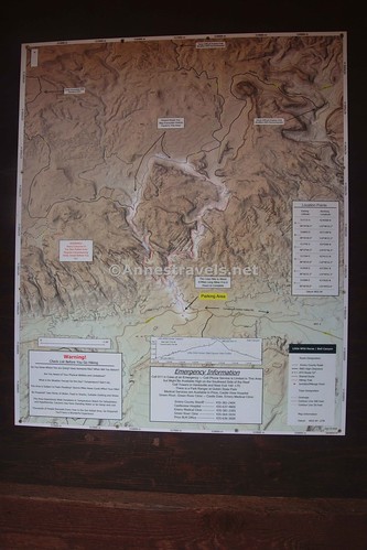
I started up the Little Wildhorse Canyon Trail on a moody morning in early November. (Note that I don’t necessarily recommend slot canyons in November due to the chill of the rock making the hike much colder than the surrounding desert – but thankfully, this day was warm enough to be pleasant both inside and outside of the canyon, even if I did see a skim of ice on some of the puddles in Little Wildhorse Canyon). The path begins as a real trail for about 0.1 miles before dropping into the wash. Turn left to hike up the sandy wash with occasional cottonwoods.
About half a mile from the parking area, you’ll come to the first obstacle: A dryfall that (when I visited) had a large puddle beneath it. Backtrack a short distance so you can bypass the dryfall via a stone shelf on the left (while walking upcanyon).
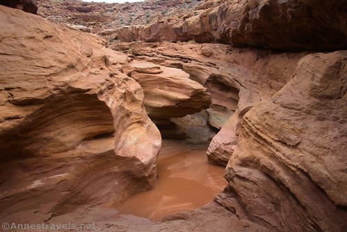
The route goes up the stone shelf, then along about halfway up the cliff above the canyon for a short distance. It then descends back into the canyon via sketchy social trails. I didn’t see a single good route down, though some are definitely better than others – and there are plenty to choose from!
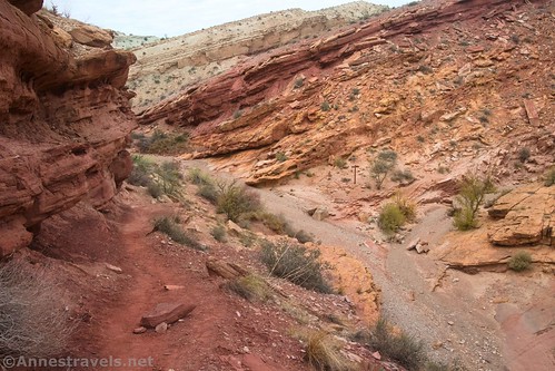
Once safely down in the wash again, turn left to almost immediately arrive at the junction with Bell Canyon about mile 0.6. The sign is small, but it’s not hard to see if you’re looking for it (you can also see it while up on the bypass trail). Turn right up Little Wildhorse Canyon.
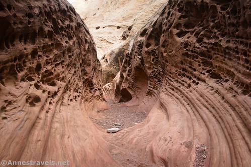
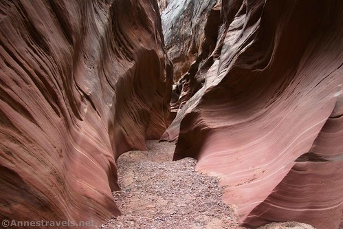
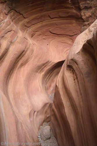
This is where the real excitement begins, though the first set of narrows doesn’t truly begin for another 0.4 miles. Keep your eyes open for small arches, rock formations, sculpted walls, and stripes in the rock.
I’m afraid I don’t recall the exact order of events in the canyon, and my photos, while helpful, don’t tell me where they were taken relative to my GPS coordinates. So I’m going to tell you what you’ll see, and while I’ll try to get them in order, just realize that, for example, you might see the rock art before the final set of narrows, etc.
The first set of narrows is about 0.2 miles long; a tenth of a mile later, begin a 0.3 mile second set of narrows. A third set of narrows is 0.9 miles further upcanyon.
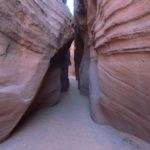
The narrows are fun. They’re typically wide enough to continue walking straight ahead (yay!), but they’re pretty sculpted. And there are enough small dryfall scrambles to make sure you stay on your toes!
There are also a few more major obstacles along the way – mostly Class 3 scrambles up dryfalls and over/around chokestones. This is made more exciting if it’s rained recently and puddles have formed below the dryfalls. These can cause excitement, but if you’re good at scrambling/chimneying, they shouldn’t stop you for very long. On the other hand, you’ll lose more people at every major obstacle and might even have the canyon to yourself by the time you reach the top!
Because I was 1) so late in the season, 2) so early in the morning, and 3) on a weekday, I had the canyon almost completely to myself (I believe I saw two couples in Little Wildhorse Canyon and no one in Bell Canyon – though I did meet several people in the canyon below the split, especially on my way back). This is not typical – usually, there are quite a few people enjoying Little Wildhorse Canyon, to the point that many people describe it as “crowded” (if not quite up to national park crowd standards).
About 4 miles from the trailhead, I marked an especially interesting dryfall on my GPS. Is it really the most difficult, or did I just think that I could get a decent waypoint because the canyon was open enough not to obstruct my signal? Who knows!
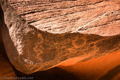
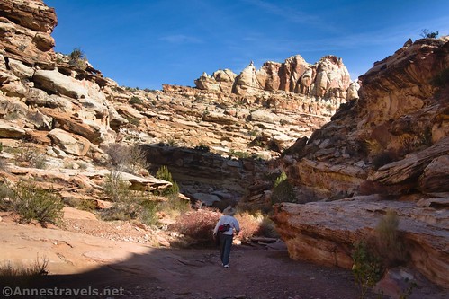
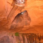
What I do know is that the canyon opens up to some dramatic cliff wall views. If you have sharp eyes, you might even spot some rock art on a boulder along the way.
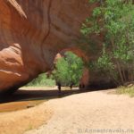
Beyond the wide-and-cliffs part of the canyon, pass through an arch created by a dryfall and a chockstone. It’s pretty dramatic!
Some creative chimneying and scrambling up three more dryfalls (some with puddles!) brought me up into the upper part of the canyon. This was not as scenic as what we’d already seen, but it’s still interesting. Keep walking upcanyon.
About mile 4.9, the wash splits. A couple of signs tell you to take the left fork (one says “Trail” and the other points toward Bell Canyon). If you’re not planning to do the Little Wildhorse-Bell Canyons Loop, this is a good place to turn around for a 9.8 mile hike.
The sandy wash continues another 0.6 miles to where the Behind the Reef Road crosses the wash – this is a pretty obvious junction with a sign kiosk as well as another sign pointing left toward Bell Canyon. But this post is getting pretty long, so I’ll talk about looping down through Bell Canyon in another post!
Round Trip Trail Length: Up to 11.0 miles as an out & back; with the loop, I did 10.0 miles
Elevation Gain: 557ft. (4,956ft. to 5,513ft.) (the GPX file shows a little more than this (ok, a lot more than this) due to losing reception in the canyon multiple times.)
Facilities: Primitive restrooms at the Little Wildhorse Trailhead
Fees: None at this point. However, they seem to be instituting fees and shifting land ownership between federal/state in various places in the immediate area; I’m hopeful that this will stay free for the foreseeable future.
Trail Notes: Be ready to share this hike with quite a few other people, including families. Only go up the canyon as far as you’re comfortable – some of the dryfalls are definitely Class 3 or a little more. The rocks tend to radiate chill; this is great in the summer and not so awesome when it’s freezing outside! Remember to never, ever enter a slot canyon if there is rain in the forecast anywhere in the vicinity.
Trail 


Road 


Signs 


Scenery 


Would I go 100 miles out of my way for this? 


Overall Rating: 


GPS Coordinates for Little Wildhorse Canyon
TH: 38.5830480°, -110.8028690° (38°34.98288′, -110°48.17214′ / 38°34’58.9728″, -110°48’10.3284″) (4,964ft.)
Enter wash: 38.5845580°, -110.8037910° (38°35.07348′, -110°48.22746′ / 38°35’04.4088″, -110°48’13.6476″) (4,964ft.) (0.12)
Puddle/scramble: 38.5886890°, -110.8058030° (38°35.32134′, -110°48.34818′ / 38°35’19.2804″, -110°48’20.8908″) (5,002ft.) (0.49)
Bell Canyon Junction: 38.5889430°, -110.8065730° (38°35.33658′, -110°48.39438′ / 38°35’20.1948″, -110°48’23.6628″) (5,044ft.) (0.62)
Narrows: 38.5929090°, -110.8071390° (38°35.57454′, -110°48.42834′ / 38°35’34.4724″, -110°48’25.7004″) (5,066ft.) (1.09)
Exit Narrows: 38.5942730°, -110.8074200° (38°35.65638′, -110°48.44520′ / 38°35’39.3828″, -110°48’26.7120″) (5,076ft.) (1.29)
Narrows: 38.5947110°, -110.8073040° (38°35.68266′, -110°48.43824′ / 38°35’40.9596″, -110°48’26.2944″) (5,075ft.) (1.36)
Exit Narrows: 38.5973760°, -110.8007060° (38°35.84256′, -110°48.04236′ / 38°35’50.5536″, -110°48’02.5416″) (5,287ft.) (2.51)
Narrows: 38.6028090°, -110.7986760° (38°36.16854′, -110°47.92056′ / 38°36’10.1124″, -110°47’55.2336″) (5,237ft.) (3.4)
Dryfall: 38.6060750°, -110.7957200° (38°36.36450′, -110°47.74320′ / 38°36’21.8700″, -110°47’44.5920″) (5,349ft.) (3.99)
Wash Junction: 38.6116050°, -110.7950340° (38°36.69630′, -110°47.70204′ / 38°36’41.7780″, -110°47’42.1224″) (5,431ft.) (4.87)
Behind the Reef Road: 38.6154130°, -110.8027650° (38°36.92478′, -110°48.16590′ / 38°36’55.4868″, -110°48’09.9540″) (5,503ft.) (5.48)
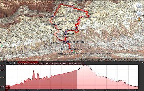
The gpx file for Little Wildhorse Canyon/Bell Canyon Loop can be downloaded – please note that this and the GPS Coordinates are for reference only and should not be used as a sole resource when hiking this trail.
Download GPX File size: 145.7 KB Downloaded 325 times
(Note: I do my best to ensure that all downloads, the webpage, etc. are virus-free and accurate; however, I cannot be held responsible for any damage that might result, including but not limited to loss of data, damages to hardware, harm to users, from use of files, information, etc. from this website. Thanks!)
Getting to Little Wildhorse Canyon Trailhead
From I-70, take Exit 149 west of Green River to UT-24. Head south on UT-24. After 24.1 miles, turn right onto Temple Mountain Road (signed for Goblin Valley State Park). About 5.2 miles later, turn left to continue on the paved road, following the sign for Goblin Valley State Park (there will probably be a sign near here welcoming you to Goblin Valley State Park at some point in the future – land shifts after my visit made this part of the road in the state park). Drive 6.1 miles and turn right onto Wild Horse Road for 5.4 miles (note that many blogs will tell you this is an unpaved road; as of November 2021, the road was freshly paved). Just after crossing the wash, turn right into the parking area for Little Wildhorse Canyon.
From Hanksville, UT, drive north on UT-24. After 19.6 miles, turn left onto Temple Mountain Road (there should be a sign for Goblin Valley State Park, but it may only show the other direction… there is a fair-sized gravel parking area at this junction). About 5.2 miles later, turn left to continue on the paved road, following the sign for Goblin Valley State Park (there will probably be a sign near here welcoming you to Goblin Valley State Park at some point in the future – land shifts after my visit made this part of the road in the state park). Drive 6.1 miles and turn right onto Wild Horse Road for 5.4 miles (note that many blogs will tell you this is an unpaved road; as of November 2021, the road was freshly paved). Just after crossing the wash, turn right into the parking area for Little Wildhorse Canyon.
Today’s Featured Product!
Explore the San Rafael Swell (including plenty of slot canyons) with one of my favorite hiking guide authors to this region of the country! David Day covers more than 30 hikes and destinations to discover. Get your copy here!












Pingback: Bell Canyon & Finishing the Little Wildhorse Canyon Loop – Anne's Travels
Pingback: Sneak Peek: A Trip to Utah’s Arches & Canyons! – Anne's Travels