On the 4th of July, I had a special treat: I went up to the Blue Ridge Parkway with my aunt and uncle. They’ve lived in the area for years, but somehow we never have time to get up there when I visit. So it was totally exciting to drive up there on a beautiful summer day to enjoy the views. One of my favorite stops along the way was the Mabry Mill, located at milepost 176.2.
Quick Stats
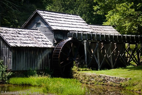
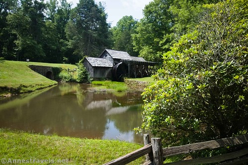
The Mabry Mill is known as one of the most-photographed areas of the Blue Ridge Parkway; some would also call it the most-photographed mill in the US (I’m not sure on that one, but it’s up there). The famous photography viewpoint is steps from the parking area; walking a little further will bring you to other historic buildings, including a blacksmith’s shop.
The quick history is that Edwin Boston Mabry began construction of the mill in 1903. During the building phase, E.B. Mabry supported himself and his wife, Lizzie, via a blacksmith shop and wheelwright shop. The mill was also used early on as a sawmill. Within two years, the mill was also used as a gristmill, and within seven years, the completed mill had a lathe, a tongue and groove lathe, a planer, and a jigsaw. Most of Mabry’s furniture and other items in their house were hand-made by E.B. or Lizzie.
From the Mabry Mill parking lot, head left (if you’re facing the gift shop/restaurant) by the signs and down the hill. (This paved path is also known as the “Mountain Industry Trail.”) The mill will come into view. This is a favorite place for photographers, especially when the trees nearby are in spring and early summer bloom.
We decided we might as well prove that the area is popular with photographers.
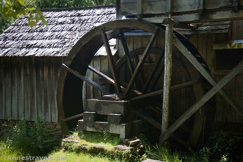
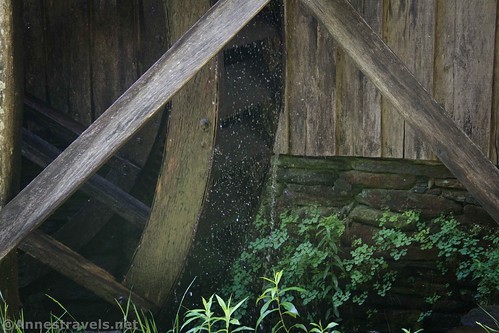
From there, the trail slopes downhill to a trail junction. Some of my group went right later on (sadly, I missed it, so you’ll just have to believe them that whatever it was that they saw up there was exciting enough to take the side trip). But at this point, we turned left, then left again to get a closer view of the water wheel in action.
We returned to the main path and turned left to continue up to a long bridge over and beside the flume that carried water to the mill. The excess water made a beautiful waterfall.
At the other end of the bridge is a display of old farm equipment. It’s not large, but you can look at it for 30 seconds – well, longer if you read the signs.
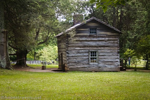
Then we turned left and walked over to the blacksmith’s shop. Nothing too much was happening there, so we wandered over to Matthew’s cabin (where a park ranger was talking about handcrafts that she had made or would be making) and then along the path to the old moonshine still in the woods. There were more old pieces of farm equipment along the way.

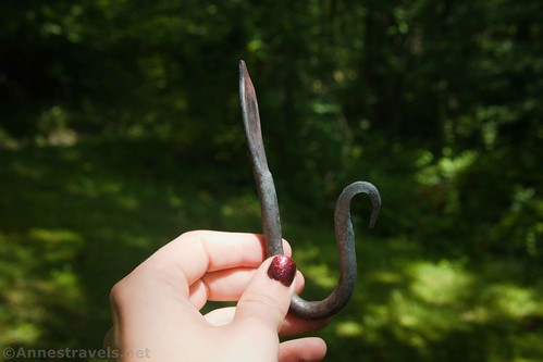
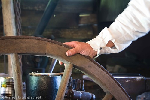
We wandered back down the path to Matthew’s Cabin and around to the front of the Mabry Mill. About that time, we realized that the blacksmith had returned from lunch and was doing a demonstration of making a hook. So we hurried back up the hill and spent probably 20 minutes talking with the blacksmith. He was fascinating.
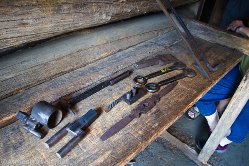
I missed a lot of the making of the hook, but I still got a few photos. He showed us some of his tools and patiently explained what each one was for. I gather he’s been volunteering here for some time and loves his job.
We thanked the blacksmith and walked back toward the parking area. I expect that there would be more going on in terms of historical interpreters on a busier (read: non-holiday) day. But even the blacksmith and the woman in Matthew’s Cabin were interesting. On the way back to the parking lot, I had to stop and take a few more photos of the Mabry Mill.
Overall, we spent probably an hour wandering around. (We tend to take our time at historic sites, and so this was a quick stop.) But it was great! On the 4th of July, it wasn’t very crowded, but it was summer, so the interpreters were there to explain what was going on. If you happen to be driving on the Blue Ridge Parkway, I recommend a stop, no matter how short! And while you’re in the area, be sure to check out the viewpoints near Rocky Knob… but that’s a topic for another post!
Round-trip Trail Length: I walked 0.6 miles, and that was with a fair bit of walking around the blacksmith’s shop. The length will vary based on where exactly you walk.
Elevation gain: About 86ft. (2,848ft. to 2,865ft.)
Facilities: Restrooms in the gift shop and up at the second parking area. There is also a gift shop and restaurant in the parking area where I parked.
Fees: None
Trail Notes: The path is paved, so it’s pretty much ADA- and family-friendly. There is a second parking lot closer to the blacksmith shop if you’d rather drive than walk up and across the bridge. If you can, go on a day when the mill will be open – it wasn’t the day we visited, but I’m sure it would be fascinating on the inside. Also note that while leashed pets are allowed on the trail, pets are not allowed in the restaurant or gift shop.
Trail 


Road 


Signs 


Interest 


Fun Factor 


Exhibits 


Personnel 


Cleanliness 


Ease of access / walking 


Would I go 100 miles out of my way for this? 


Overall Rating: 


GPS Coordinates for the Mabry Mill
Mabry Mill Restaurant & Gift Shop: 36.7498359°, -080.4050946° (36°44.99015′, -080°24.30568′ / 36°44’59.4092″, -080°24’18.3407″)
Trailhead: 36.7502679°, -080.4055137° (36°45.01607′, -080°24.33082′ / 36°45’00.9643″, -080°24’19.8492″)
Blacksmith Shop: 36.7514161°, -080.4058708° (36°45.08497′, -080°24.35225′ / 36°45’05.0980″, -080°24’21.1350″)
Matthew’s Cabin: 36.7513459°, -080.4062280° (36°45.08075′, -080°24.37368′ / 36°45’04.8452″, -080°24’22.4209″)
Moonshine Still Overlook: 36.7516760°, -080.4063529° (36°45.10056′, -080°24.38118′ / 36°45’06.0335″, -080°24’22.8705″)
The gpx file for my walk on the Mountain Industry Trail at the Mabry Mill can be downloaded – please note that this and the GPS Coordinates are for reference only and should not be used as a sole resource when hiking this trail.
Download GPX File size: 19.0 KB Downloaded 119 times
(Note: I do my best to ensure that all downloads, the webpage, etc. are virus-free and accurate; however, I cannot be held responsible for any damage that might result, including but not limited to loss of data, damages to hardware, harm to users, from use of files, information, etc. from this website. Thanks!)
Getting to the Mabry Mill
The Mabry Mill is located on the Blue Ridge Parkway at Mile 176.2.
From I-81, take Exit 114 toward Floyd. Turn onto VA-8S (aka W Main Street) (left if coming from I-81S, right if coming from I-81N). Drive 25.4 miles south on VA-8S. Take the exit on the left onto the Blue Ridge Parkway; once at the parkway, turn right. After 11 miles, the mill will be on your left.
From Greensboro, follow I-73N. Continue straight when the road becomes US-220N. Seventeen miles from here, turn left onto Martinsville loop, then 0.8 miles later, turn left onto Spencer Road. You will enter Virginia within the 0.4 miles before you continue straight on Horsepasture Price Road. After 6.8 miles, turn left onto US-58W for 33.8 miles. Turn right onto State Rt. 795 for 0.4 miles, then continue straight on State Rt. 603 for 0.5 miles. Turn left toward the Blue Ridge Parkway; once on the parkway, turn right. The mill will be on your right after 0.2 miles.
This Week’s Featured Product!
To really do the Blue Ridge Parkway justice, check out this book! It mostly covers trails, but it also speaks to the overlooks and attractions along the way.

