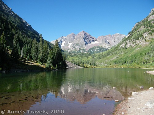
So I’m told, one of the most photographed vistas in the US is of the Maroon Bells Mountains in western Colorado. Especially in early summer, when the mountains still snow-covered, the view of the Maroon Bells on a sunny day is stunning: perfectly shaped mountains flecked with snow reflecting in a picturesque, crystal clear mountain lake. Trails take hikers up to other views of the mountains, and to spectacular views of the mountains surrounding the Maroon Bells.
Directions:
To get to the Maroon Bells from the north, take CO-82 E toward Aspen, Colorado. Just after the airport as you are going into the town of Aspen you will enter a traffic circle. About a quarter of the way around the circle (to your right) is Maroon Creek Road (CO Rd. 13). Take this road up to the entrance station for Maroon Bells Wilderness Area. The parking area is about 9 miles up this road, but you won’t be able to miss the parking area because it’s also the end of the road. If you’re coming from the south, take CO-82 W to the traffic circle just before the airport, and take Maroon Creek Road (most of the way around the traffic circle) up to the parking lot.
Because of the park’s popularity, the park administration has to limit the number of people who can go into the park on a given day. Otherwise, it would be completely overrun with tourists. (As it is, there are more people around than many “wilderness” parks.) In general, no private vehicles are allowed up the road into the park between 9 am and 5 pm on a given day between mid-June and Labor Day, unless the vehicle has infants in car seats, someone who is disabled, or over 11 passengers. I believe that you can also get in if you are staying in the campground. As there were only 10 of us in our vehicle, we decided to arrive at the park well before 9 am so that we could park in the parking lot and not have to take the bus. For more information, please see the national forest website at http://www.fs.fed.us/r2/whiteriver/rangerdistricts/aspen_sopris/mb_scenic_site/index.shtml
The place where most of the photographers hang out is Maroon Lake, which is at one end of the parking lot. This is absolutely stunning scenery, with the Maroon Bells reflected in the lake. I can’t describe how beautiful it is; words just don’t have the ability to describe it. So, if you want to know what it looks like, you’ll either have to find a picture, or go and see it yourself (my recommendation). From here a trail goes off along the lake to take you to several other destinations in the park.
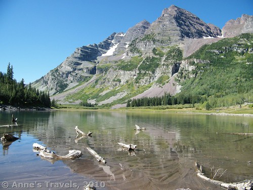
A popular place to hike to is Crater Lake (not to be confused with the one in Oregon). The lake allows you to get closer to the mountains, but it’s full of dead logs, so the view could be better. For photographs, the view is probably better from Maroon Lake if you want the reflection of the mountains, but you can see the mountains themselves better from Crater Lake. If you’re going on to one of the passes, I highly recommend you taking the side trip to see the lake, but don’t think that you’ll get remarkably better views than you do from Maroon Lake.
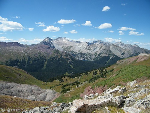
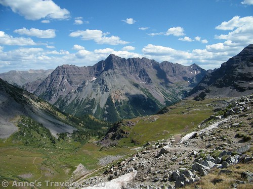
We hiked to from Crater Lake (a 1.8 mile hike from the parking lot) up to Buckskin Pass (4.8 miles from the parking lot). Before I tell you about the trail, let me tell you two things: first, we’d been hiking in the Cascade Mountains for 2 weeks just before doing this trial, with no altitude sickness problems, but up at the pass the air was so thin, several of us had headaches and other altitude related ailments. It wasn’t terrible, but do be aware that this is not a hike for those with breathing problems. Secondly, the view was absolutely spectacular: totally different from the Maroon bells, but still, utterly beautiful. From Buckskin Pass you can see into the Snowmass Wilderness, including Snowmass Mountain (the only major peak in Colorado that can’t be seen from a major roadway) and Snowmass Lake.
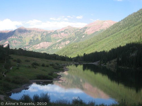
To get to Buckskin Pass, from the parking lot take the trail around Maroon Lake to the National Forest bulletin board and follow the signs for the Maroon-Snowmass Trail. You will be climbing a rocky path through an aspen/fir forest, then descending a very rocky trail to Crater Lake. When you reach the Crater Lake bulletin board, you can either take the side trip to the Lake (maybe ¼ or ½ a mile to the lake), or turn right and follow the trail up into Minnehaha Gulch. This is a really pretty part of the trial, with a stream that bisects Gulch. Really, it’s more of a meadow than a gulch, with pretty flowers, grass, and shrubs. The scenery above you keeps changing, from grey mountains to red-ish rocks. Eventually, you will come to a fork in the trial, with one trail going to Maroon-Snowmass (and Buckskin Pass) and the other going to Willow Lake/Willow Pass. Take the left fork. At this point, the trail becomes steeper and switchbacks its way up the face of the mountain to the pass. The air is very thin here, and this was where we started having altitude problem (headaches, etc.). We also rested a lot, because we were used to more oxygen in the air when scaling mountains.
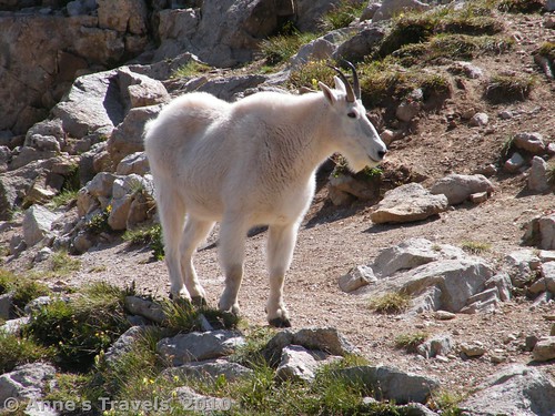
And then—finally!—we reached the pass. The view, as I said above, was stunning. You can continue beyond this to backcountry campsites, or return the way you came. We ate lunch at the pass, and a family of mountain goats (there had to be at least half a dozen of them) walked within a few feet of us. We got some great pictures, but we weren’t crazy about mountain goats getting that close to our lunch! Another interesting thing was that even though it was late August, there was still some snow clinging to the pass, and the trail was covered with snow just before the top of the pass (though it was easy to get around).
The bottom line on this trail is that you probably won’t find scenery like this elsewhere. You might, but this is still well worth the hike. So my recommendation: if you’re up to an 9.6 mile (round trip) hike through high elevations, do it! If not, just visit the park—you won’t regret it.
Round Trip Trail Length: 9.6 miles
Facilities: Restrooms and picnic tables at the parking area
Fees: $10 per vehicle, or cost of bus to get into the park. America the Beautiful, Golden Age, Golden Access, and Maroon Bell Season Passes are also accepted, but don’t apply to the bus fee 🙁
Trail 


Road 


Signs 


Scenery 


Would I go 100 miles out of my way for this? 


Overall Rating: 


This Week’s Featured Product!
Track down the best views in Colorado with this guide!


Hey how’s it going doing? I just now needed to point out that its been a pleasure reading your website. Concerning bookmarked your internet-site to ensure that I could keep coming back & find out more in the future too. plz do keep up to date the product quality writing
Wow, this is in every repscet what I needed to know.
My spouse and I stumbled over here coming from a different web address and thought I might check things out. I like what I see so now i am following you. Look forward to checking out your web page repeatedly.
Pingback: Anne's Travels » Electric Pass: The Highest Named Pass in Colorado